Ask a hundred people who have never been to Africa what they picture when they hear “African mountain,” and nearly all of them will describe Kilimanjaro: a solitary volcanic cone rising out of dry savannah, dotted with day-trippers in matching fleece jackets. Almost none of them will picture what actually waits in the far west of Uganda, an entire mountain range, not a single peak but six distinct, glaciated massifs, buried under a permanent shroud of cloud, wrapped in forest so dense it swallows sound, and rising so abruptly from the Albertine Rift floor that early European explorers spent decades arguing over whether it even existed. I have spent years of my working life inside this range, and I still find that most trekkers arrive at the gate holding a picture of the Rwenzori that is roughly a decade out of date and about a third as strange as the reality. This guide exists to correct that. If you are seriously researching a trek here, and not simply skimming for a headline fact, what follows is the most complete single account of Rwenzori Mountains National Park you will find anywhere: what it is, where its boundaries run, why it exists as a protected area at all, and what that designation actually means for the person standing at the trailhead lacing up their boots.
Rwenzori Mountains National Park is the Ugandan protected area that covers the eastern flank of the Rwenzori mountain range, a UNESCO World Heritage Site, a Ramsar Wetland of International Importance, and the home of Africa’s third-highest summit. It is not a single mountain in the way Kilimanjaro or Mount Kenya are single mountains; it is a compact, extraordinarily rugged massif system straddling the border between Uganda and the Democratic Republic of Congo, protecting one of the last completely intact ecological transects on the African continent, from lowland tropical forest to permanent equatorial glacier, within the space of a single multi-day walk. Everything else in this guide unpacks what that means in practice, and by the end of it you will understand this park better than the vast majority of people who have actually trekked through it.
Where Rwenzori Mountains National Park Is, and What It Protects
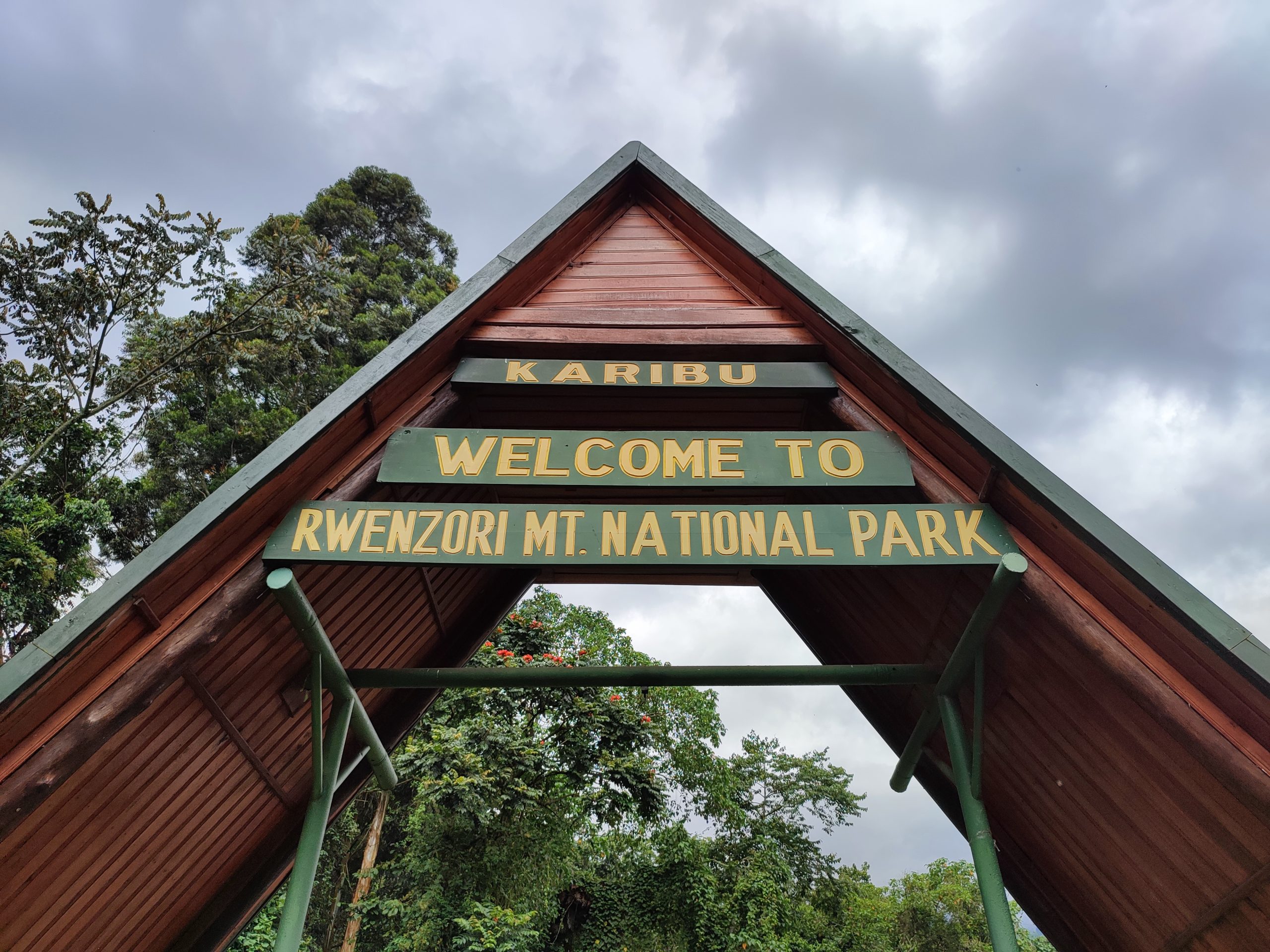
Rwenzori Mountains National Park sits in far western Uganda, straddling Kasese, Kabarole, and Bundibugyo districts, and running directly along the international border with the Democratic Republic of Congo. It lies almost exactly on the equator, a fact that surprises most first-time visitors more than any other single piece of Rwenzori trivia, because equatorial mountains are not supposed to carry permanent snow and ice, and yet this one does. The park protects approximately 996 square kilometers of the range’s eastern slopes, encompassing the full altitudinal sweep from around 1,600 metres at the Nyakalengija and Kilembe trailheads up to 5,109 metres at the summit of Margherita Peak on Mount Stanley, Uganda’s highest point and Africa’s third-highest summit after Kilimanjaro and Mount Kenya.
The park was gazetted in 1991 by the Ugandan government and is managed today by the Uganda Wildlife Authority (UWA), the same body responsible for permits, ranger patrols, hut infrastructure, and conservation across all of Uganda’s national parks. Three years after gazettement, in 1994, UNESCO inscribed Rwenzori Mountains National Park as a World Heritage Site, one of only two natural World Heritage Sites in Uganda alongside Bwindi Impenetrable Forest, home to roughly half the world’s remaining mountain gorillas. In 2008, the range received a second, separate international designation as a Ramsar Wetland of International Importance, recognising its critical hydrological function as a water tower for both the Nile and Congo river systems. Very few protected areas on the planet carry all three of these designations simultaneously, and understanding why the Rwenzori earned them is the key to understanding what makes this park genuinely unlike anywhere else you could choose to trek.
| Quick Facts: Rwenzori Mountains National Park
Location: Western Uganda, border with DR Congo (Kasese, Kabarole & Bundibugyo districts) Gazetted as a national park: 1991 UNESCO World Heritage Site since: 1994 Ramsar Wetland designation: 2008 Size: Approximately 996 square kilometres Highest point: Margherita Peak, Mount Stanley, 5,109 metres Managing authority: Uganda Wildlife Authority (UWA) |
Why the Rwenzori Is Called the “Mountains of the Moon”
Long before any European set foot in this range, it already had a name and a reputation. The Greek geographer Ptolemy, writing around 150 AD, described a range of snow-capped mountains deep in equatorial Africa that fed the headwaters of the Nile, and he called them Lunae Montes, the Mountains of the Moon. Arab geographers carried the name forward as Jabal al-Qamar for centuries before Henry Morton Stanley became the first European to sight the range on 24 May 1888, confirming that Ptolemy’s ancient description had a real mountain behind it all along. The name most likely reflects the way glaciated summits gleam under moonlight when viewed from the surrounding plains, though the etymology carries deeper, older resonances too. Locally, the Bakonzo people who have lived in the mountain’s foothills for centuries call the range Rwenzururu, a name that translates roughly to “rainmaker” or “lord of the clouds,” a description that, if you have ever stood in the Bigo Bog under a low, grey Rwenzori sky, needs no further explanation. If you want the full account of the explorers, the 1906 first ascent, and how the trekking infrastructure we use today came into being, our complete history of the Rwenzori Mountains traces the entire story from Ptolemy to the present day.
The Geology: A Mountain Range That Isn’t a Volcano
Nearly every other major high mountain in East Africa, Kilimanjaro, Mount Kenya, the Virunga volcanoes, exists because of volcanic activity. The Rwenzori is the exception, and it is a significant one. This is a block mountain system, formed when tectonic forces along the western branch of the East African Rift System thrust an enormous slab of ancient Precambrian crystalline rock upward over the last several million years, rather than building a cone from erupted lava and ash. The rock exposed on the upper Rwenzori is among the oldest found anywhere on the continent, and the range’s jagged, faulted profile, sharp ridgelines, deep glacial valleys, and abrupt rock faces, reflects that violent tectonic origin rather than the smoother, symmetrical slopes typical of a volcanic cone. This geological distinction matters practically as well as academically: it is part of why Rwenzori terrain feels so different underfoot from Kilimanjaro’s long, graded volcanic scree slopes, and why our guides consistently describe this as a mountaineer’s range rather than a walker’s range.
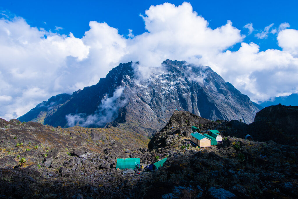
The park is not one mountain but six named massifs arranged along the spine of the range, each with its own subsidiary peaks. Mount Stanley is the highest and carries twin summits, Margherita at 5,109 metres and Alexandra at 5,091 metres, along with the heavily glaciated Stanley Plateau. Mount Speke reaches 4,890 metres at its Vittorio Emanuele summit, Mount Baker rises to 4,843 metres at Edward Peak, and the remaining three, Mount Emin (4,798m), Mount Gessi (4,715m), and Mount Luigi di Savoia (4,627m), complete what our guides simply call the full crown of the Rwenzori. Every one of these massifs was first summited during a single extraordinary Italian expedition in 1906, led by Luigi Amedeo di Savoia, the Duke of Abruzzi, whose team climbed all six in a matter of weeks, an achievement that remains one of the more remarkable feats in the early history of world mountaineering.
Why UNESCO Designated the Rwenzori a World Heritage Site
If you take away one fact from this entire guide, make it this one: the Rwenzori’s UNESCO status was earned overwhelmingly because of its vegetation, not its glaciers, its altitude, or its geology, remarkable as all three of those are in their own right. The park protects an intact, unbroken vertical sequence of five distinct ecological zones stretching from tropical rainforest at the valley floor to permanent glacial ice at the summit, and no other mountain in Africa preserves this complete transect in comparable quality. Kilimanjaro passes through analogous bands, but its volcanic cone shape produces thinner, drier zones, and its proximity to semi-arid savannah gives it a fundamentally different ecological baseline. The Rwenzori’s version of this sequence is thicker, wetter, and stranger at every level, and it is worth walking through what each zone actually contains, because this is what you will be moving through, day by day, on any Rwenzori trek.
The Afro-Montane Forest Zone (roughly 1,450–2,600 metres)
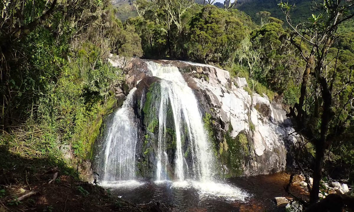
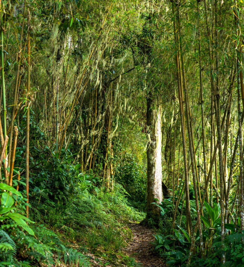
This is the lush, humid lower forest that greets every trekker at the Nyakalengija or Kilembe trailheads, dominated by ancient Podocarpus and Symphonia trees, tree ferns, wild bananas, and the red-flowered Mimulopsis that bursts into colour after rain.
It is also, by a wide margin, the Rwenzori’s richest zone for wildlife encounters, home to black-and-white colobus monkeys, the secretive L’Hoest’s monkey, blue monkeys, the endemic Rwenzori turaco, and eastern chimpanzees, more often heard than seen. Our full Rwenzori wildlife guide goes into far greater depth on what lives in this and every other zone.
The Bamboo-Mimulopsis Zone (roughly 2,500–3,000 metres)
Dense stands of mountain bamboo take over as the forest thins with altitude, an important watershed zone that traps and stores rainfall, and a habitat that still occasionally hosts blue monkeys and the odd chimpanzee, alongside a range of forest birds.
I am text block. Click edit button to change this text. Lorem ipsum dolor sit amet, consectetur adipiscing elit. Ut elit tellus, luctus nec ullamcorper mattis, pulvinar dapibus leo.
The Giant Heather-Rapanea Zone (roughly 3,000–3,500 metres)
This is one of the most atmospheric sections of any Rwenzori trek: giant heather trees, Erica arborea, growing six metres tall or more and draped in curtains of old-man’s-beard lichen, filtering the light green and silver and muffling every sound. It is also where the infamous Rwenzori bogs begin in earnest, ground that stays saturated for the entire year, a detail covered in full in our guide to the Central Circuit’s day-by-day experience.
The Afroalpine Moorland Zone (roughly 3,500–4,500 metres)
The zone that makes the Rwenzori’s UNESCO citation genuinely unimpeachable.
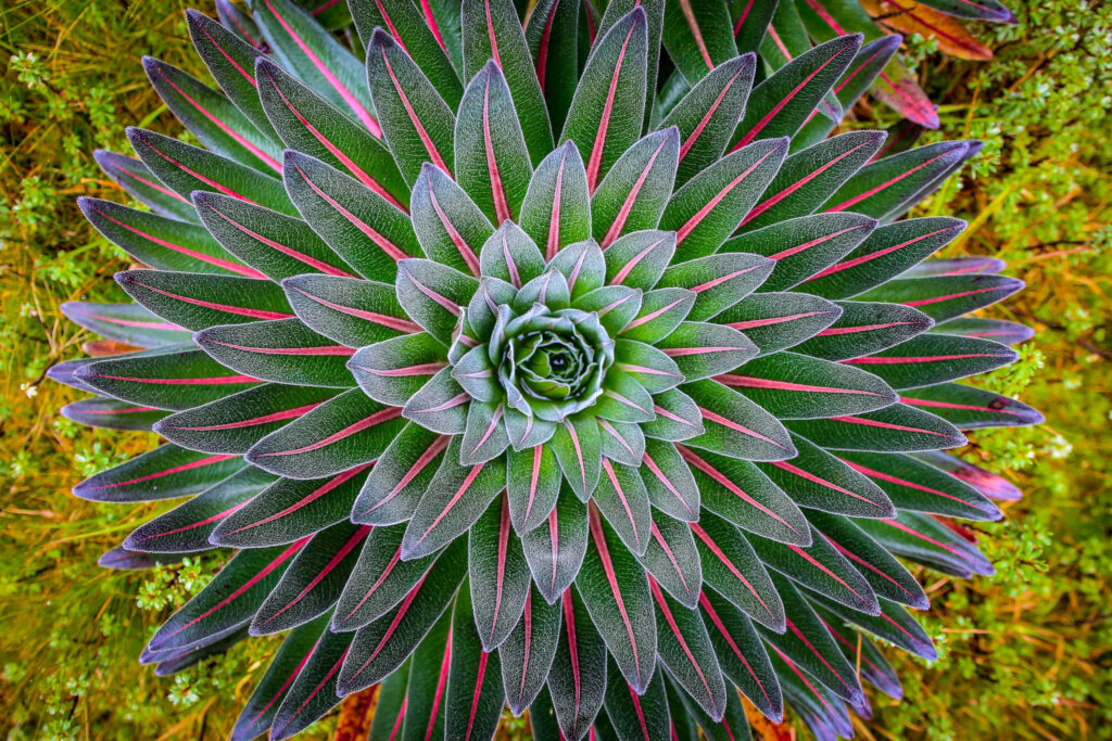
This is the realm of giant lobelias reaching three to five metres and giant groundsels rising to similar heights, plants that exist almost nowhere else on Earth outside a handful of other Albertine Rift peaks, growing in a landscape that trekkers routinely describe as the most surreal environment they have ever walked through. Our detailed vegetation zones guide covers the botany of this zone in far more depth than we can give it here.
The Nival, or Glacial Summit, Zone (above roughly 4,500 metres)
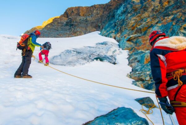
The final zone: bare rock, permanent snowfields, and the Rwenzori’s shrinking equatorial glaciers, most visibly on the Stanley Plateau and the upper flanks of Mount Speke.
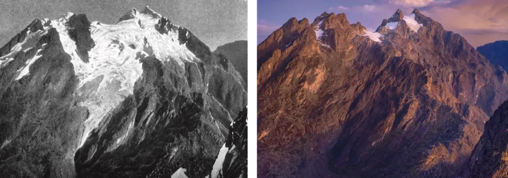
These glaciers have retreated by more than 80% since the Duke of Abruzzi’s 1906 survey, and current scientific projections suggest they may vanish entirely within the coming decades, making a Rwenzori glacier crossing, described step by step in our glacier crossing guide, a genuinely time-limited experience.
Biodiversity and the Albertine Rift Endemism Hotspot
The Rwenzori sits within the Albertine Rift, the western branch of the East African Rift System, which holds the highest concentration of endemic vertebrate species found anywhere on the continent. The park’s extraordinary altitudinal range, more than 3,500 vertical metres within a compact footprint, creates a stacked sequence of distinct habitats that few other single protected areas can match, and its history as an Ice Age forest refugium has produced unusually deep genetic diversity over time. Rwenzori Mountains National Park has recorded more than fifty bird species that are endemic or near-endemic to the Albertine Rift, and its list of resident and near-endemic mammals, from the Rwenzori red duiker to the elusive Rwenzori leopard of the high moorland, reads like a checklist found nowhere else on a single mountain.
It is worth being direct about one common misconception here: the Rwenzori has no mountain gorillas. Trekkers hoping to combine the two should look instead to nearby Bwindi Impenetrable Forest or Mgahinga Gorilla National Park, both readily combinable with a Rwenzori itinerary. What the Rwenzori does offer, in genuine abundance, is primate life in its lower forest, chimpanzees, colobus monkeys, and L’Hoest’s monkeys among them, along with wildlife safety considerations that are honestly addressed in our guide to leopards and other dangerous animals in the Rwenzori, which puts the real risk hierarchy of altitude, cold, and terrain ahead of wildlife encounters, exactly as it should be.
The Trails and Routes Inside the Park
Rwenzori Mountains National Park is not accessed through a single trailhead or a single route; it contains a small family of distinct trekking systems, each managed differently and each suited to a different kind of trekker. Understanding the difference between them before you book is one of the most consequential planning decisions you will make.
The Central Circuit Trail
The original and most historically significant Rwenzori route, beginning at the Nyakalengija trailhead in Ibanda and looping through the heart of the range via the Bujuku Valley, the Scott Elliot Pass, and the Freshfield Pass, staying at the wooden UWA huts of Nyabitaba, John Matte, Bujuku, Elena, Kitandara, and Guy Yeoman along the way. It is managed by Rwenzori Mountaineering Services and remains the classic choice for a 7-day Margherita Peak summit attempt. Our Central Circuit day-by-day guide walks through exactly what each stage of this route feels like underfoot.
The Kilembe Trail
Launched in 2011 and managed independently by Rwenzori Trekking Services, this southern route begins near the old copper-mining town of Kilembe and climbs through the dramatic Nyamwamba Valley, generally regarded as the more scenically varied and more demanding of the two main routes, with newer, better-maintained camp infrastructure at Kalalama, Mutinda, Bugata, Hunwick’s, and Margherita Camp.
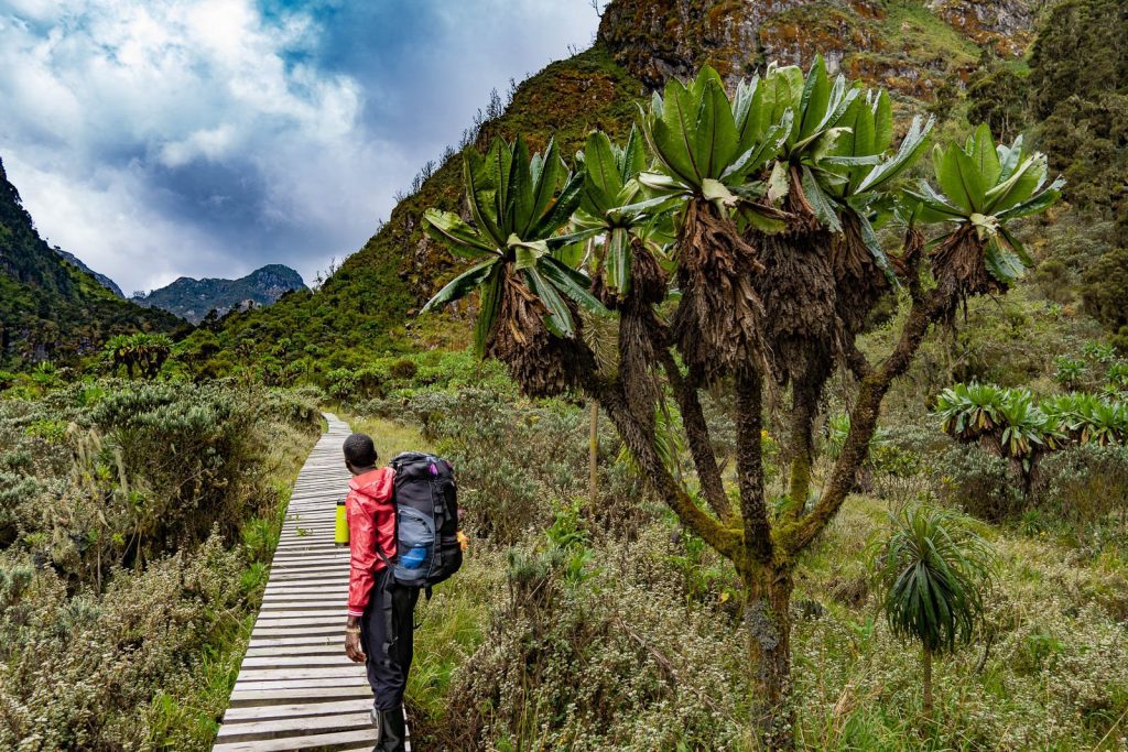
If you are weighing the two against each other, our detailed Central Circuit versus Kilembe Trail comparison covers every practical difference: cost, difficulty, huts, and which trekker suits which trail.
The Bukurungu Wilderness Trail
Developed jointly by the Uganda Wildlife Authority and WWF in 2018, this is the park’s true frontier route: no huts, no permanent infrastructure, and only a handful of visitors a year, passing four spectacular high-altitude lakes, Irene, Mughuli, Bukurungu, and Bujuku, on a trail that genuinely feels undiscovered even by Rwenzori standards.
The Mahoma Loop and Shorter Forest Routes
For trekkers who want a genuine Rwenzori experience without committing to a multi-day summit expedition, shorter routes like the 2-Day Lake Mahoma hike and the Mutinda Lookout route stay within the lower and middle forest zones, offering outstanding birdwatching and immersion in the montane forest without altitude or glacier risk. These are also the routes we most often recommend to families, first-time trekkers testing their interest, and older visitors who want the Rwenzori experience without a Margherita summit attempt.
For a full breakdown of every option, from one-day forest walks to the 18-day expedition covering all six major summits, our complete Rwenzori Mountains guide lays out the entire portfolio in one place, and our page on what makes the Rwenzori special explains why serious trekkers consistently rate it above far more famous African mountains.
Park Management, Fees, and the Uganda Wildlife Authority
Every trekker entering Rwenzori Mountains National Park does so under the authority of the Uganda Wildlife Authority, which manages conservation, ranger deployment, hut infrastructure, and the fee structure that funds all of it. Unlike gorilla trekking permits in Bwindi, which are limited, dated, and frequently sold out months in advance, the Rwenzori operates on a straightforward daily park entrance fee rather than a bookable permit lottery, which means you are extremely unlikely to arrive in Uganda and discover your preferred dates are unavailable. What you do need to budget for, in detail, is covered in our Rwenzori park entrance fees and permits guide and our full cost of climbing breakdown, both of which set out exactly what UWA charges per day, per route, and per residency category.
A certified guide is a legal requirement for every trekker inside the park, without exception, and solo trekking is explicitly prohibited under UWA regulation. This is not bureaucratic caution for its own sake; it reflects the genuine complexity of Rwenzori terrain, where route-finding through bog, cloud, and unmarked upper mountain sections requires the kind of accumulated local knowledge that only Bakonzo guides, most of whom have grown up in the mountain’s foothills, can reliably provide. Every trek we operate returns 10% of proceeds directly to Bakonzo community programs, schools, orphan support, and family welfare in the Kasese region, a detail we consider as important as any summit statistic.
The Best Time to Visit Rwenzori Mountains National Park
The Rwenzori sits at the meeting point of Congo Basin moisture and the East African anticyclone, and the honest answer is that it receives some rainfall in every month of the year, more of it, in fact, than any other major mountain range in Africa. That said, two windows are meaningfully drier and more favourable for trekking: December through February, and June through August. Outside these windows, March through May and October through November bring heavier, more sustained rain, muddier trails, and reduced summit visibility, though a smaller but growing number of experienced trekkers deliberately choose the wet season for its intensified, cloud-wrapped atmosphere and near-total absence of other parties on the trail. Our dedicated best time to visit the Rwenzori guide breaks this down month by month with specific rainfall patterns, and our companion piece on how much it actually rains in the Rwenzori is essential reading regardless of which season you choose, because waterproof gear is never optional here, dry season or not.
How to Get to Rwenzori Mountains National Park
The park’s two trailheads sit near the town of Kasese in far western Uganda: Nyakalengija, in Ibanda village roughly 22 kilometres north of Kasese, serves the Central Circuit, while the Kilembe trailhead lies about 13 kilometres from Kasese town, serving the Kilembe Trail. Most international trekkers travel overland from Kampala or Entebbe, a journey of roughly six to seven hours through Fort Portal that passes the Kibale Forest corridor and the dramatic Albertine Rift escarpment, though domestic flights to Kasese are also available for those short on time. We strongly recommend arriving in Kasese at least a day before your trek begins, allowing time to rest, sort final gear, and meet your guide team in person before setting out.
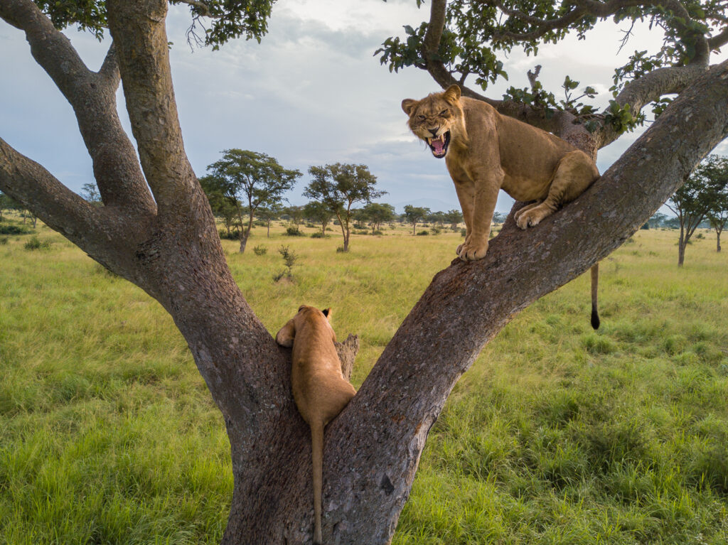
The Rwenzori’s position in Uganda’s western wildlife corridor also makes it an outstanding anchor for a broader itinerary, with Queen Elizabeth National Park immediately to the south for tree-climbing lions and Kazinga Channel boat safaris, and Bwindi’s mountain gorillas within reach for those extending their trip further southwest.
Who Rwenzori Mountains National Park Is Right For
It is worth being candid, in the voice of someone who has watched hundreds of trekkers arrive at this park with wildly different expectations: the Rwenzori is not a beginner’s mountain in the way that a guided Kilimanjaro walk-up can be. There is no technical climbing required below the glacier on the standard Central Circuit or Kilembe itineraries, but the terrain, saturated bog, root systems, steep wet rock, is relentless in a way few other treks anywhere in the world can match, and reaching Margherita Peak itself involves genuine glacier travel with crampons, ropes, and an early-hours ascent under headlamp. It is, however, entirely achievable for well-prepared, reasonably fit trekkers of a wide range of ages and backgrounds who commit to real preparation beforehand. If that describes you, our 16-week training plan for a Rwenzori trek is the single most useful resource we publish for getting your body ready, and our honest guides for first-time and beginner trekkers and for older trekkers considering the Rwenzori will tell you plainly whether this park, and which route within it, is the right match for your current fitness and experience.
Why Trek Rwenzori Mountains National Park With Us
We are specialists in exactly one mountain range. We do not sell Kilimanjaro, we do not sell generic East African safaris as our core business, and that focus means our guides, almost all of them Bakonzo men and women who grew up within sight of these peaks, have spent their entire working lives learning this park’s moods: which section of the Bigo Bog is safe to cross after three days of rain, how the Stanley Plateau’s ice behaves differently at 5am than at 9am, and exactly how to pace a nervous first-time trekker through their first exposed scramble above Elena Hut. Whether your ambition is a straightforward 7-day Central Circuit summit of Margherita Peak, the more remote and demanding Kilembe Trail, an ambitious multi-peak expedition across Stanley, Speke, and Baker, or simply a 2-day forest walk to Lake Mahoma to experience the UNESCO-listed vegetation zones without a summit attempt, we have built and refined every one of these itineraries from the inside, over years of continuous operation in this exact park.
Frequently Asked Questions About Rwenzori Mountains National Park
Is Rwenzori Mountains National Park the same as Rwenzori Mountains?
Not quite. “The Rwenzori Mountains” refers to the entire 120-kilometre mountain range straddling the border between Uganda and the Democratic Republic of Congo, while Rwenzori Mountains National Park is specifically the protected area covering the eastern, Ugandan side of that range, roughly 996 square kilometres, gazetted in 1991 and managed by the Uganda Wildlife Authority. The Congolese side of the same range falls within Virunga National Park, which is currently not accessible for trekking because of ongoing armed conflict in eastern DRC. Every established Rwenzori trekking route, the Central Circuit, the Kilembe Trail, the Bukurungu Trail, and the shorter forest routes, is located entirely within the Ugandan national park.
Why was Rwenzori Mountains National Park made a UNESCO World Heritage Site?
UNESCO inscribed the park in 1994 primarily because of its vegetation: an intact, unbroken vertical sequence of five ecological zones running from tropical rainforest at around 1,450 metres to permanent glacial ice at 5,109 metres, a transect of this completeness and quality found nowhere else in Africa. The designation also recognised the park’s exceptional biodiversity and the unusually high concentration of species endemic to the Albertine Rift found within its boundaries, alongside its outstanding natural beauty and its significance as a site of ongoing ecological and evolutionary processes.
How big is Rwenzori Mountains National Park and where exactly is it?
The park covers approximately 996 square kilometres in far western Uganda, spanning parts of Kasese, Kabarole, and Bundibugyo districts, and running directly along the international border with the Democratic Republic of Congo. It sits almost exactly on the equator, roughly 33 kilometres north of the line, with its two main trailheads near the town of Kasese: Nyakalengija for the Central Circuit and Kilembe village for the Kilembe Trail.
What is the highest point in Rwenzori Mountains National Park?
Margherita Peak, on Mount Stanley, is the highest point in the park at 5,109 metres above sea level. It is both Uganda’s highest point and Africa’s third-highest summit, behind only Kilimanjaro and Mount Kenya. Mount Stanley also carries a secondary summit, Alexandra Peak, at 5,091 metres, and sits above the heavily glaciated Stanley Plateau, the final section crossed on any Margherita summit attempt.
Do I need a permit to enter Rwenzori Mountains National Park?
Yes, but the system works differently from Uganda’s gorilla trekking permits. Rather than a limited, bookable permit that can sell out months ahead, the Rwenzori operates on a daily park entrance fee charged by the Uganda Wildlife Authority for each day spent inside the park boundary, alongside mandatory guide, hut, and rescue fund fees. This means permit availability is rarely a limiting factor in planning your trip, though booking your guide team and itinerary well in advance is still strongly advisable, particularly during the June-to-August and December-to-February peak windows.
Can I trek in Rwenzori Mountains National Park without a guide?
No. The Uganda Wildlife Authority requires every trekker inside the park to be accompanied by a certified guide at all times, and solo, unguided trekking is explicitly prohibited. This regulation reflects the genuine difficulty of Rwenzori route-finding through bog, cloud, and technical upper-mountain terrain, and it is enforced at every trailhead and checkpoint throughout the park.
What animals live in Rwenzori Mountains National Park?
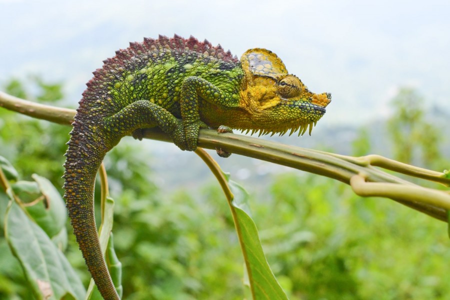
The park does not have mountain gorillas, but it supports a genuinely rich, highly endemic wildlife community distributed across its five vegetation zones: eastern chimpanzees, black-and-white colobus monkeys, and L’Hoest’s monkeys in the lower forest; the endemic Rwenzori turaco and dozens of Albertine Rift endemic bird species throughout the mid-altitude zones; the three-horned chameleon and Rwenzori red duiker; and, in the high Afroalpine moorland, the rarely seen Rwenzori leopard. More than fifty recorded bird species are endemic or near-endemic to the Albertine Rift region.
What is the best time to visit Rwenzori Mountains National Park?
The two driest and most favourable windows are December through February and June through August, when trails are firmer and summit weather windows are more frequent. The Rwenzori receives some rainfall in every month of the year regardless of season, so waterproof gear is essential no matter when you travel. The wetter months, March through May and October through November, bring heavier rain and muddier trails but significantly fewer other trekkers and a distinctly wild, atmospheric character that some experienced visitors specifically seek out.
How difficult is trekking in Rwenzori Mountains National Park?
Trekking here is widely regarded by experienced mountain guides, ourselves included, as more physically demanding underfoot than Kilimanjaro, not because of altitude alone but because of relentless bog, saturated ground, and root-tangled terrain that persists for days at a time. The standard Central Circuit and Kilembe itineraries require no technical climbing skill below the glacier, but reaching Margherita Peak itself involves genuine glacier travel with crampons and ropes. With proper preparation, a structured training plan, and the right gear, it is achievable for well-prepared trekkers across a wide range of ages and experience levels.
Ready to Experience Rwenzori Mountains National Park for Yourself?
Reading about the Rwenzori only gets you so far. The rest, the sound of the Bigo Bog boardwalks under your boots, the first sight of giant lobelias rising out of the mist, the specific, disbelieving quiet of standing on a glacier at the equator, only happens on the mountain itself. Our guides have spent their working lives inside this exact park, and we would rather have an honest conversation about which route, season, and itinerary genuinely fits your fitness and goals than sell you the wrong trek. Get in touch with our team to start planning your Rwenzori Mountains expedition, or message us directly on WhatsApp for honest, no-pressure advice from a real mountain guide. However you choose to experience it, whether a two-day forest walk to Lake Mahoma or an eighteen-day expedition across all six summits, Rwenzori Mountains National Park rewards exactly the kind of serious, well-prepared traveller who has read this far.