Can you fly a drone in the Rwenzori Mountains? This article offers an in-depth summary of Uganda’s drone laws, the process for obtaining a national park permit, the consequences of not having a permit, and more effective alternatives.
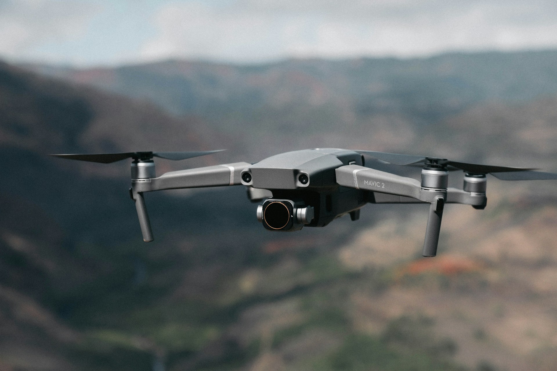
I have been asked this question more times than I can count, usually by someone standing at the Kilembe trailhead holding a DJI case alongside their trekking poles, equal parts excited and uncertain. The Rwenzori from the air must be extraordinary, with the Stanley Glacier, the lobelia forests, and the valley systems dropping away to the Kasese plain. The impulse is understandable. But the answer involves more layers than most trekkers expect, and getting it wrong can cost you your drone before your trek even starts.
Flying a drone in the Rwenzori Mountains is not simply a matter of unpacking your equipment at the trailhead and pressing take-off. The Rwenzori Mountains National Park is a protected area managed by the Uganda Wildlife Authority (UWA) under Uganda’s national parks legislation, and it is also a UNESCO World Heritage Site. Both designations carry specific restrictions on drone operations that operate independently of Uganda’s general aviation regulations. Before you can legally fly a drone anywhere within the national park boundaries, you are required to obtain clearances from multiple government authorities, including the Ministry of Tourism, Wildlife and Antiquities, the Office of the Chief of Defence Forces, the Uganda Civil Aviation Authority (CAA), and the Uganda Wildlife Authority itself.

⚠ If you arrive at Entebbe International Airport with a drone that has not been pre-authorised through Uganda’s formal permit process, the drone will be confiscated by customs officials. It won’t be returned until you leave, and there’s no guarantee it will be safe. This is not a theoretical risk; it is a documented, regularly enforced outcome for travellers who have not followed the correct procedure.
That said, the situation is nuanced rather than simply prohibitive. Ugandan nationals and companies registered in Uganda face a clearer path to drone operation permits than foreign visitors. Foreign nationals can legally bring and operate a drone in Uganda, including in the national park under specific conditions, but the process is multi-layered and time-consuming and requires starting the application sequence at least three to six months before your planned travel date. For most trekkers visiting the Rwenzori for seven to eight days of guided hiking, the permit process is disproportionate to the personal filming ambition. For professional filmmakers, documentary producers, and conservation researchers with genuine lead time and a clear project rationale, it is achievable.
This article gives you the complete, honest picture: what the regulations actually require, why they exist, what happens if you ignore them, how the permit process works if you choose to pursue it, and, critically, what the alternatives are that let you come home with extraordinary visual records of the Rwenzori without risking your equipment, your trip, or your legal standing in Uganda.
Why Are Uganda’s Drone Regulations As Strict As They Are?
To understand the Rwenzori’s drone policy, you first need to understand Uganda’s broader approach to drone governance, because the national park rules sit on top of a national regulatory framework that is, by East African standards, among the most restrictive for foreign visitors. Uganda classifies drones as Remotely Piloted Aircraft Systems (RPAS) under the Civil Aviation (Remotely Piloted Aircraft Systems) Regulations, 2020, which came into force on 20 May 2020 and are enforced by the Uganda Civil Aviation Authority. These regulations categorise drone operations by risk level: Category A (basic, low-risk), Category B (standard), and Category C (complex, commercial, or certified) and require authorisation from the CAA for all categories.
More significantly for foreign visitors, Uganda’s regulations treat any drone import as a potential security matter. The Office of the Chief of Defence Forces must approve the importation of any drone into the country, conduct a background check on the operator, and review the intended flight locations before clearance is granted. This reflects a genuine security concern in a country that shares borders with the DRC, a region with ongoing military and political complexity, and whose national parks and sensitive infrastructure require protection from surveillance risks. The military clearance requirement is not bureaucratic excess; it is a deliberate policy decision that reflects Uganda’s specific security context, and it applies uniformly to tourists and professionals alike.
Within the Rwenzori Mountains National Park, specifically, the Uganda Wildlife Authority adds its layer of restriction. The park is home to a UNESCO World Heritage Site designation (awarded in 1994) and a Ramsar Wetland of International Importance designation (2008), both of which carry conservation obligations that require the UWA to manage human activity within the park with conservation outcomes as the primary consideration. Research conducted across multiple African conservation areas has consistently shown that drone noise causes measurable disturbances in wildlife, elevates stress responses in primates, alters feeding behaviour in ungulates, and disrupts nesting patterns in birds. The Rwenzori’s unique bird species, like the Rwenzori turaco and Rwenzori batis, as well as its mammals, such as colobus monkeys and forest elephants, could be harmed by drone activities that are not properly managed in the park.
There is also the matter of the park’s unique atmospheric conditions. The Rwenzori is renowned for its weather; clouds build rapidly from the Congo basin, visibility changes within minutes, and at altitudes above 3,500 metres, the combination of clouds, mist, and temperature inversion can create conditions in which a drone operating beyond a visual line of sight becomes a genuine hazard. A drone lost in the Rwenzori is not retrievable. The density of the vegetation, the complexity of the terrain, and the absence of road access to the high mountains make a crash above 3,000 meters essentially permanent.
The Legal Framework: Uganda’s Drone Regulations Explained
The Uganda Civil Aviation Authority (CAA) and RPAS Regulations 2020
The Uganda Civil Aviation Authority is the primary regulatory body for all drone operations in Uganda’s airspace. Under the 2020 RPAS Regulations, no drone can be operated within Uganda unless it has been registered with the CAA and the operator holds a valid certificate or permit issued by the Authority. For foreign visitors, the rules are straightforward: they can’t fly drones in Uganda without special permission, and since there are no specific exceptions, they must get approval through a detailed process involving multiple agencies first. The CAA charges a permit fee of approximately UGX 200,000 to 250,000 (approximately USD 55 to 70 at current exchange rates) plus 18% VAT, payable at the CAA office at Entebbe International Airport.
Operational rules under the CAA framework apply once a permit is obtained. Drones must be flown within visual line of sight (VLOS) at all times; beyond-visual-line-of-sight operations require additional certification and are not available to tourist operators. Maximum altitude is 400 feet (approximately 122 metres) above ground level. Night flying is prohibited. Drones must not be flown over crowds, wildlife, private property, military installations, government buildings, or sensitive infrastructure. The 400-foot altitude cap, it is worth noting, is measured above ground level on a mountain where ground level is at 4,000 metres; the drone may still be flying at a significant elevation above sea level while complying with the cap. This requirement matters for understanding what aerial photography from within the national park can actually achieve.
The Ministry of Tourism, Wildlife and Antiquities: First Point of Contact
For any foreign national wishing to bring a drone to Uganda for filming or research purposes in a national park, the first formal step is to write a letter to the Ministry of Tourism, Wildlife, and Antiquities. This letter must introduce the applicant and their organization; explain the purpose of the drone operation in detail, specify the locations where flying is planned, and provide full technical specifications for the drone, including make, model, year of manufacture, serial number, and declared value. The Ministry issues a Letter of No Objection once satisfied with the application, and this letter becomes the foundation document for all subsequent clearance applications. Please allow four to six weeks for the ministry to process your application.
The Office of the Chief of Defence Forces: The Security Gate
Once the ministry letter is obtained, it must be forwarded with the same drone specifications and flight location details to the Office of the Chief of Defence Forces (CDF). This is the most unpredictable step in the process: the CDF conducts a background check on the applicant and assesses the security implications of the proposed drone operation, including the flight locations and the potential for aerial surveillance of sensitive areas. Processing time at this stage ranges from four to eight weeks, and approval is not guaranteed. If the CDF issues a Letter of No Objection, the applicant can then proceed to customs clearance at Entebbe and the CAA operational permit application. If the CDF declines to approve, the process ends there. This step is the reason the standard advice is to begin the permit application process at least three to six months before your intended travel date.
The Uganda Wildlife Authority: National Park Permission
Even with full CAA clearance, operating a drone within Rwenzori Mountains National Park requires a separate, specific permit from the Uganda Wildlife Authority. The UWA treats drone operations within its managed parks as a distinct activity requiring its own justification and conditions. Applicants must provide a valid reason for drone use (filming, research, or conservation purposes are the categories most likely to receive approval), a detailed scope of the planned filming, including locations within the park, dates and duration, and an agreement to ranger supervision during all flights. As of 2025, the UWA enforces a zero-tolerance policy for unauthorised commercial documentation within restricted areas, and filming without the correct permits can result in equipment confiscation and significant legal penalties. The UWA permit process typically takes two to four weeks once CAA clearance is in hand.
The Uganda Media Council: Required for Commercial Filming
If the drone footage is intended for commercial use, including YouTube channels with monetisation, paid stock footage, client commissions, documentary productions, or any other project where the footage will be licensed or sold, an additional media card from the Uganda Media Council is required for each crew member involved in filming. Media cards cost USD 175 for 30 days or USD 225 for 60 days and require completion of Form G along with a project brief letter from the filming company. Processing is typically completed within two to three working days, making the media card the fastest step in the process. However, it cannot be obtained without the other clearances already being in place.
The Complete Drone Permit Process for the Rwenzori Mountains.
The table below summarises the full permit pathway for a foreign national wishing to legally operate a drone at Rwenzori Mountains National Park in the correct sequence. Every step is mandatory; no step can be skipped or substituted.
| Step | Authority | What You Need | Timeline |
| 1 | Ministry of Tourism, Wildlife & Antiquities | Official letter of No Objection stating purpose, location, drone specifications (make, model, serial number, value) | 4–6 weeks |
| 2 | Office of the Chief of Defence Forces (CDF) | Forward Ministry No Objection; undergo security background check on operator and intended flight areas | 4–8 weeks |
| 3 | Uganda Revenue Authority (Customs) | An import permit must be presented at Entebbe International Airport or at the border crossing. The drone may be bonded until the permit is confirmed | On arrival |
| 4 | Uganda Civil Aviation Authority (CAA) | Full drone specs, operator credentials, flight plan, and all prior clearances. Fee: UGX 200,000–250,000 + 18% VAT | 2–4 weeks after CDF clearance |
| 5 | Uganda Wildlife Authority (UWA) | UWA filming permits for Rwenzori Mountains National Park. Valid reason, scope of filming, ranger escort required | 2–4 weeks |
| 6 | Uganda Media Council | Each crew member receives a media card if filming commercially. $175 (30 days) / $225 (60 days). Form G and the project letter required | 2–3 working days |
⚠ Total minimum lead time: 3 to 6 months before your travel date. Applications should be submitted in sequence; each step depends on documentation from the previous one. In most cases, starting this process after booking your Rwenzori trek is too late.
What Actually Happens If You Bring a Drone Without the Right Permits
This question is asked often enough, and the consequences are serious enough, that it deserves a direct, detailed answer rather than a general warning. The risk begins before you even reach the Rwenzori. Uganda’s customs authorities at Entebbe International Airport are aware of the drone permit requirements and actively look for drone equipment in scanned baggage. Experienced travellers have reported that DJI-branded cases, quadcopter propellers, and controller units are identifiable on airport X-rays even when packed inside other baggage. If customs authorities identify a drone without proper import documentation, they confiscate it immediately, tag it with the traveller’s name and departure information, and store it in customs storage until departure. It will not be available for use during your trip. Whether it will be in the same condition on return is not guaranteed.
If a drone somehow gets through customs and is discovered within the national park by a UWA ranger, by another guide team, or reported by another trekker, the consequences are more serious still. Unauthorised drone operation in a Ugandan national park is a criminal offence under Uganda’s wildlife laws, potentially resulting in a fine, the permanent confiscation of the drone, removal from the park, and a formal record with the Uganda Wildlife Authority that can affect future entry to Ugandan protected areas. For guides and trekking operators accompanying a trekker who is flying an unauthorised drone, the consequences can extend to permit suspension, which is why guides from responsible operators will not allow unauthorised drones to be operated on any trek they are leading. If you bring an unauthorised drone on a Rwenzori Trekking Safaris hike, your guide will ask you to put it away. This step is not optional.
The temptation to simply take the risk is understandable, particularly in the remote high zones of the Rwenzori where ranger presence is less frequent. But the consequences of discovery are real, the impact on local wildlife is genuine, and the safety risks of operating a drone in the Rwenzori’s complex, cloud-prone, high-altitude environment are not trivial. The mountain’s weather can change in fifteen minutes, and a drone lost in the heather zone above 3,500 metres is simply gone. The combination of regulatory risk, conservation impact, and practical safety hazard makes the present a situation where the honest advice is unambiguous: do not bring an unauthorised drone to the Rwenzori.
The Conservation Case: Why the Drone Restrictions Protect What Makes the Rwenzori Worth Visiting
It is worth stepping back from the regulatory framework and addressing the underlying conservation rationale, because understanding it tends to shift the perspective of trekkers who arrive frustrated by the permit requirements. The Rwenzori Mountains are a UNESCO World Heritage Site in large part because of their extraordinary biodiversity, specifically, the unparalleled vertical sequence of Afroalpine ecosystems and the concentration of Albertine Rift endemic species that they contain. The Rwenzori turaco, the handsome francolin, the Rwenzori batis, dozens of specialised forest birds, and the malachite sunbird that inhabits the giant lobelia stands above 3,500 metres are all species that science has documented as sensitive to acoustic disturbance.
Studies conducted in African primate habitats have measured significant physiological stress responses in colobus monkeys, L’Hoest’s monkeys, and chimpanzees exposed to drone noise, including elevated cortisol levels, flight responses, and disruptions in feeding and grooming behaviour. The Rwenzori’s bird species, many of which have restricted ranges and small populations, show nest-abandonment responses to unexpected aerial intrusions that bear the acoustic signature of a drone. In a forest ecosystem where the reproduction success of endemic species is central to the conservation value that earned the UNESCO designation, repeated drone exposure in nesting seasons carries measurable negative consequences.
The restriction is not arbitrary bureaucratic caution. It reflects a genuine and well-documented relationship between drone operations and wildlife welfare in sensitive mountain ecosystems. When you accept the permit requirements and the resulting constraints on your photography, you are participating in a conservation framework that keeps the Rwenzori the place it is, not just for the next visitor, but for the long-term ecological integrity of one of Africa’s most important protected areas.
What You Can Do Instead: Capturing the Rwenzori Without a Drone

The impulse behind wanting to fly a drone in the Rwenzori is completely reasonable: the mountain’s visual drama, the lobelia forests, the glacier seen from below, and the camp nestled between giant boulders at 4,485 metres are genuinely extraordinary and deserve to be captured. The good news is that the Rwenzori rewards ground-level photography in ways that drone footage, with its tendency toward scale-flattening aerial perspectives, cannot replicate. Some of the most powerful images ever captured in the Rwenzori were taken at eye level, in the rain, with a camera pressed against a waterfall, or in the thin grey light of a 2:00 AM summit departure.
| Alternative | What It Gives You | Our Advice |
| Mirrorless or DSLR camera | High-resolution stills and video at any altitude; no permits; no risk of confiscation | Best option for most trekkers. The Sony A7 series, Canon R5, and Nikon Z-series all produce extraordinary results in the Rwenzori environment. |
| Action camera (GoPro, Insta360) | Wide-angle POV footage, waterproof, light; ideal for trail and summit footage | Mount a helmet or trekking pole for hands-free recording. The Rwenzori’s mist and waterfalls make action cam footage compelling. |
| Telephoto lens | Brings distant peaks and wildlife into frame without disturbing them; far exceeds drone zoom in resolution | For Rwenzori wildlife (Malachite Sunbird, Colobus, and duiker), a 400mm+ telephoto lens is more effective than any drone. |
| Hire a licensed Ugandan videographer | Ugandan nationals and registered companies face simpler permit pathways than foreign tourists and can operate legally within the park. | Ask us to connect you with licensed Ugandan filmmakers who have existing UWA relationships. Adds a professional dimension to your footage. |
| Satellite imagery / Google Earth | Free, high-resolution aerial views of the entire Rwenzori range available for use in video productions | NASA and Google Earth imagery of the Rwenzori glacier is stunning and publicly licensed for many uses. |
Photography Tips Specific to the Rwenzori
The Rwenzori’s defining atmospheric condition is moisture: mist, rain, condensation on lenses, and the extraordinary quality of light that comes through cloud cover in the high heather zone. This environment rewards photographers who embrace it rather than waiting for clear-sky conditions that the Rwenzori rarely delivers for more than a few hours. A mirrorless camera in a weatherproof body, the Sony A7 IV, Nikon Z6 III, or OM System OM-1 all perform well in wet conditions; with a weather-sealed zoom lens covering 24 mm to 200 mm, they will handle 95% of photographic opportunities on the mountain. Pack silica gel sachets in your camera bag; the humidity at camp level condenses on cold glass overnight, and a few gel packets prevent the haze that ruins morning shots.
The best lighting on the Rwenzori happens at two times: the first thirty to sixty minutes after sunrise, before clouds form, when the forest gets soft light and the giant heathers glow from behind the moisture; and the short, striking moments after it rains in the dry season, when the peaks appear clearly against a bright blue sky. Neither window lasts long. Having a camera ready with the settings pre-set is more valuable than the most sophisticated equipment. On summit day, the pre-dawn glacier section offers some of the most distinctive photography on any East African mountain: headlamps on ice, the Stanley Plateau receding behind you in darkness, and the first grey light of dawn arriving as you approach the Margherita ridge.
What Professional Filmmakers Do: Legitimate Paths to Aerial Rwenzori Footage
For documentary filmmakers, conservation organisations, and professional content creators who genuinely need aerial footage from Rwenzori, there are legitimate pathways that the permit system is designed to accommodate. The key difference between a tourist trekker wanting drone footage and a professional production is the project structure: professional productions have a defined client, a distribution plan, a production company, and the institutional weight to navigate a multi-agency permit process that takes months.

The most effective approach for professional productions is to engage a Ugandan fixer, a local production company, or an individual with existing relationships with the UWA, the Ministry of Tourism, and the CAA to manage the permit process on behalf of the foreign production. Ugandan nationals and companies registered in Uganda face a simpler permit pathway than foreign tourists, and an experienced local fixer can compress the timeline significantly compared to a foreign production attempting to navigate the process independently from abroad. Some Ugandan production fixers have standing relationships with the UWA’s filming permit office and can advise on the specific documentation, fees, and conditions that apply to a Rwenzori filming project. Allow a minimum of three months, and ideally six months, even with a fixer involved.
Conservation organisations conducting research within the national park, including glacier monitoring projects, biodiversity surveys, and habitat mapping, have in some cases obtained drone permits as instruments for scientific work rather than commercial filming. These applications are typically routed through the UWA’s research permit system rather than the commercial filming permit pathway, and they require a formal institutional affiliation, a research protocol, and in some cases a UWA research partnership agreement. For academic and conservation institutions, this is a viable route. It’s not for lone hikers.
If You Are Serious About Pursuing a Drone Permit: A Practical Timeline
For those who have read the permit process and remain committed to pursuing it, professional filmmakers, serious commercial photographers, and conservation researchers, the following timeline is the minimum realistic framework. Six months before your travel date is the outer boundary of a comfortable process; three months is the theoretical minimum for a well-organised application with no delays, though delays at any stage are common.
In months five and six before travel, identify and contact your Ministry of Tourism letter contact, prepare your drone technical specifications, draft your project description, and send your initial application. In months three and four, please follow up on the Ministry’s progress and prepare the CDF application so it can be submitted immediately upon receiving the Ministry’s Letter of No Objection. Avoid submitting to the CDF before receiving the ministry letter; the sequence of documentation is crucial. In months two and three, please ensure you receive CDF clearance and submit your CAA operational permit application with all prior clearances attached, along with the UWA filming permit application. In the final month, please confirm the issuance of CAA and UWA permits, arrange the customs declaration at Entebbe, and if filming commercially, ensure that Uganda Media Council media cards are obtained for all crew members. Arrive at Entebbe with physical copies of all permits and a ranger-escorted flight plan agreed upon with UWA in advance.
The practical contact information for the relevant authorities is as follows. You can reach the Uganda Civil Aviation Authority at info@caa.co.ug or +256 41 352 000, with their offices located at Airport Road, Entebbe. You can reach the Uganda Wildlife Authority directly through ugandawildlife.org, which operates a tourism and filming permit desk. You can reach the Uganda Media Council, which handles media card applications, through official Ugandan government channels. You should address your written applications to the Permanent Secretary of the Ministry of Tourism, Wildlife, and Antiquities.
What the Camera Cannot Capture Anyway,
There is something worth saying to every trekker who comes to the Rwenzori with a camera of any kind: drone, mirrorless, or phone, which is this: the mountain’s most extraordinary quality is not visual. The giant lobelias at 3,800 metres in an evening mist are extraordinary to photograph, but the photograph does not convey the cold, the silence, the smell of wet rock and old men’s beard lichen, or the improbability of being here in a world that looks genuinely unlike anywhere else on Earth. On summit day, the glaciated slope above Elena Hut or Margherita Camp in darkness at 2:30 AM, with the headlamp beam on ice and nothing visible beyond it, produces no photograph at all. It produces a memory that your camera cannot access.

This conclusion is not an argument against photography. It argues against making photography the trek’s focus at the expense of the experience. The trekkers who return from the Rwenzori most satisfied are those who took careful and intentional photos, accepted the mountain’s weather and light conditions, and focused their remaining attention on simply being present in a landscape that has grown in isolation for millions of years. The question is, “Can I fly a drone?” is, in the end, a question about how to capture the Rwenzori Mountains. The answer is that Rwenzori rewards being in it more than being above it.
Frequently Asked Questions: Drones in the Rwenzori Mountains
Can I fly a drone in the Rwenzori Mountains?
Flying a drone in Rwenzori Mountains National Park is legally possible but requires advance permits from multiple Ugandan government authorities, including the Ministry of Tourism, Wildlife, and Antiquities, the Office of the Chief of Defence Forces, the Uganda Civil Aviation Authority (CAA), and the Uganda Wildlife Authority (UWA). The process takes a minimum of three to six months and is not available for tourists who arrive without prior authorisation. If you bring a drone to Uganda without proper import permits, it will be confiscated at Entebbe International Airport on arrival. Unauthorised drone operations within the national park are a criminal offence under Ugandan wildlife law. For most trekkers visiting the Rwenzori, a mirrorless camera with a quality zoom lens delivers superior photographic results without the regulatory complexity.
Are drones banned in Rwenzori Mountains National Park?
Drones are not categorically banned in Rwenzori Mountains National Park, but they are subject to strict permit requirements that effectively prohibit casual tourist use. The Uganda Wildlife Authority (UWA) does not allow drone operations within national park boundaries without a specific UWA filming permit, which must be obtained in addition to a Uganda Civil Aviation Authority operational permit and import clearance through the Chief of Defence Forces. In practice, the multi-agency permit process, which requires a minimum of three to six months of lead time and is primarily accessible to commercial filmmakers, conservation researchers, and documentary producers with institutional backing, means that recreational drone flying by individual tourists visiting the Rwenzori is not feasible. As of 2026, UWA will enforce a zero-tolerance policy for unauthorised commercial documentation in restricted areas.
What permits do I need to fly a drone in Uganda?
To legally fly a drone in Uganda as a foreign visitor, you need the following permits in sequence: a Letter of No Objection from the relevant ministry (for national park filming, the Ministry of Tourism, Wildlife, and Antiquities); a security clearance from the Office of the Chief of Defence Forces; an import permit from the Uganda Revenue Authority (customs clearance at Entebbe); an operational permit from the Uganda Civil Aviation Authority, which costs approximately UGX 200,000 to 250,000 plus 18% VAT; and, for Rwenzori Mountains National Park, specifically, a UWA filming permit from the Uganda Wildlife Authority. Commercial filmmakers additionally require a media card from the Uganda Media Council ($175 for 30 days). The entire process must be initiated at least three to six months before travel. Arriving without these clearances results in drone confiscation at the airport.
Will my drone be confiscated at Entebbe Airport?
Yes, if your drone has not been pre-authorised through Uganda’s formal import permit process, it is highly likely to be confiscated at Entebbe International Airport. Uganda’s customs authorities are aware of drone import regulations and actively identify drone equipment through baggage scanning. A drone confiscated at Entebbe is held in customs storage until your departure and is not available for use during your trip. To avoid confiscation, you must obtain an import permit from the Uganda Civil Aviation Authority before arrival, which itself requires prior clearances from the Ministry of Tourism and the Office of the Chief of Defence Forces. Allow three to six months for this process. The advice of experienced Uganda travel operators is unambiguous: if you have not completed the full permit process before departure, leave the drone at home.
What are the drone flying rules in Uganda national parks?
Uganda’s national parks, including Rwenzori Mountains National Park, are managed by the Uganda Wildlife Authority (UWA), which prohibits drone operations without specific UWA filming permits. Even with a CAA operational permit, you must have a separate UWA park permit to fly within national park boundaries. UWA requires a valid stated purpose (filming, research, or conservation), agreement to ranger supervision during all flights, and prior approval of flight locations within the park. General operational rules under the CAA framework apply within permits: drones must remain within a visual line of sight, must not exceed 400 feet (122 meters) above ground level, may only fly during daylight hours, must not fly over wildlife, and must not operate in weather conditions that reduce visibility. As of 2026, Uganda will have a zero-tolerance policy for unauthorised commercial documentation in restricted areas.
How do I get permission to film with a drone in the Rwenzori Mountains?
To obtain permission to film with a drone in the Rwenzori Mountains, you must complete a six-step permit process: write a formal letter to the Ministry of Tourism, Wildlife and Antiquities requesting a No Objection letter (include your project details and full drone specifications); forward the Ministry letter to the Office of the Chief of Defence Forces for security clearance; clear the drone through Uganda Revenue Authority customs at Entebbe with your CAA import permit; apply to the Uganda Civil Aviation Authority for an operational permit (fee approximately UGX 200,000–250,000 plus VAT); apply to the Uganda Wildlife Authority for a specific Rwenzori Mountains National Park filming permit; and, if filming commercially, obtain media cards from the Uganda Media Council ($175 per crew member for 30 days). Begin this process at least three to six months before your intended filming date. Professional Ugandan production fixers with UWA relationships can help compress the timeline.
What are the best camera alternatives to a drone for photographing the Rwenzori Mountains?
The Rwenzori Mountains reward ground-level photography in ways that drone footage cannot fully replicate. A full-frame mirrorless camera (Sony A7 series, Nikon Z series, or Canon R series) with a weather-sealed 24–200mm zoom lens covers the vast majority of photographic opportunities on the mountain, from forest wildlife in the lower zones to glacier shots on summit day. An action camera (GoPro or Insta360) mounted to a helmet or trekking pole provides excellent hands-free POV footage of trail sections, waterfalls, and summit approaches. A telephoto lens of 300–500 mm brings Rwenzori wildlife, particularly birds like the Rwenzori turaco and the Malachite Sunbird, into frame far more effectively than any drone. For serious visual storytellers, working with a licensed Ugandan videographer who already has UWA relationships is the most practical path to professional-quality aerial footage of the range.
Can a Ugandan citizen fly a drone in the Rwenzori Mountains more easily than a foreign tourist?
Ugandan nationals and companies registered in Uganda face a somewhat simpler regulatory pathway to drone permits than foreign tourists. While the same steps are needed for permits from various agencies, Ugandan citizens are usually trusted more than foreign tourists, making the security check process easier for them. Companies registered in Uganda with existing CAA certification and UWA filming relationships can in some cases obtain permits more quickly than a foreign production starting from scratch. This is why engaging a licensed Ugandan production company or fixer: one with existing government relationships, is the recommended approach for any foreign filmmaker seeking to capture aerial footage of the Rwenzori.
Planning Your Rwenzori Trek? We Are Here to Help.
Whether you are coming to photograph the mountain, to climb it, or simply to walk inside one of the most extraordinary ecosystems in Africa, the planning process benefits from talking to people who know every kilometre of the trail. At Rwenzori Trekking Safaris, we manage guided expeditions on the Kilembe Trail, the Central Circuit Trail, the Bukulungu Trail, and every non-summit and multi-peak itinerary the range offers. We can advise honestly on what photography equipment works best on the mountain, what conditions to expect in your travel window, and if you have a serious filming project in mind, how to approach the permit process and who the right contacts are on the Ugandan side.

Contact us to start planning your Rwenzori expedition. Tell us your travel dates, your trekking objectives, and your photography ambitions, and we will help you design an experience that makes the most of the mountain’s extraordinary visual environment with or without a drone.


