Hike the Kilembe Trail and discover 6+ thundering Rwenzori waterfalls in 4 days. Expert guides, porters & all gear are provided. Book your Uganda waterfall trek today.
4-Day Rwenzori Waterfalls Hike | Kilembe Trail Uganda
4-Day Rwenzori Waterfalls Hike: 6+ Stunning Kilembe Trail Waterfalls.
Kilembe Trail | 6+ Thundering Cascades | Rwenzori Mountains National Park, Uganda
Chase six spectacular waterfalls through Africa’s most extraordinary montane forest. No glacier experience is needed, just a hunger for one of Uganda’s last truly wild adventures.
Begin your 4-day Rwenzori Waterfalls Hike through the Rwenzori highlands’ exciting waterfalls at Samalira, then continue to Cathy’s Waterfall, the Nyamwamba Waterfalls, Plozza Falls, and Egwe Falls. While approaching Mount Rwenzori, you may see some of the seemingly endless waterfalls appear first; the result is something you may have overlooked.
During this 4-day Rwenzori hike, explore the stunning beauty of the Rwenzori mountain’s different vegetation zones on the Kilembe trail. The hike will leave you with permanent, indelible memories. Discover the park’s varied fauna, including the Rwenzori turaco, duikers, and the three-horned Rwenzori chameleon, which is unique to the Rwenzori Mountains.
During this 4-day waterfall tour along the Kilembe Trail, you will stay in cozy cabins from the first camp, Sine, to Samalira. Enjoy breathtaking views of the giant lobelias as you progress. Hikers of all skill levels and lengths will love this short but exciting trek across the Rwenzori Mountains. It is the best option for anyone who has limited time but still wants to see the region’s breathtaking natural splendor.
Since we at Rwenzori Trekking Safaris have had the opportunity to explore every path to the peak, we provide multi-day guided ascents of the Rwenzori Mountains, which are on many people’s bucket lists.
4-Day Rwenzori Waterfalls Trek at a Glance
| Duration | 4 Days / 3 Nights |
| Total Distance | Approx. 40 km (round trip via Kilembe Trail) |
| Maximum Elevation | ~3,100m (Bugata Camp) |
| Starting Elevation | 1,580m (Kilembe Trailhead, near Kasese) |
| Difficulty | Moderate, suitable for fit beginners with solid preparation |
| Start & End Point | Kilembe Trailhead, Kasese, western Uganda |
| Trail | Kilembe Trail, Rwenzori Mountains National Park |
| Waterfalls Visited | 6+ named and unnamed cascades |
| Best Seasons | June–August (long dry) & December–February (short dry) |
| Group Size | 1–12 trekkers (private or shared departure) |
| Accommodation | Rustic trail huts at Sine, Samalira, and Bugata camps |
| Meals | Full board breakfast, trail lunch, and a 3-course dinner daily |
| Price | From $615, varying by group size; UWA fees USD 270/person |
Why the 4-Day Rwenzori Waterfalls Hike Is Unmissable.
There is a particular kind of joy reserved for standing beneath a roaring equatorial waterfall soaked, awed, and entirely alone in the forest. On the Kilembe Trail, the wilder and less-travelled of the two main approaches into Rwenzori Mountains National Park, that experience does not happen once but six times over four extraordinary days. This is the 4-Day Rwenzori Waterfalls Hike, and it is genuinely unlike any other short trek in East Africa.
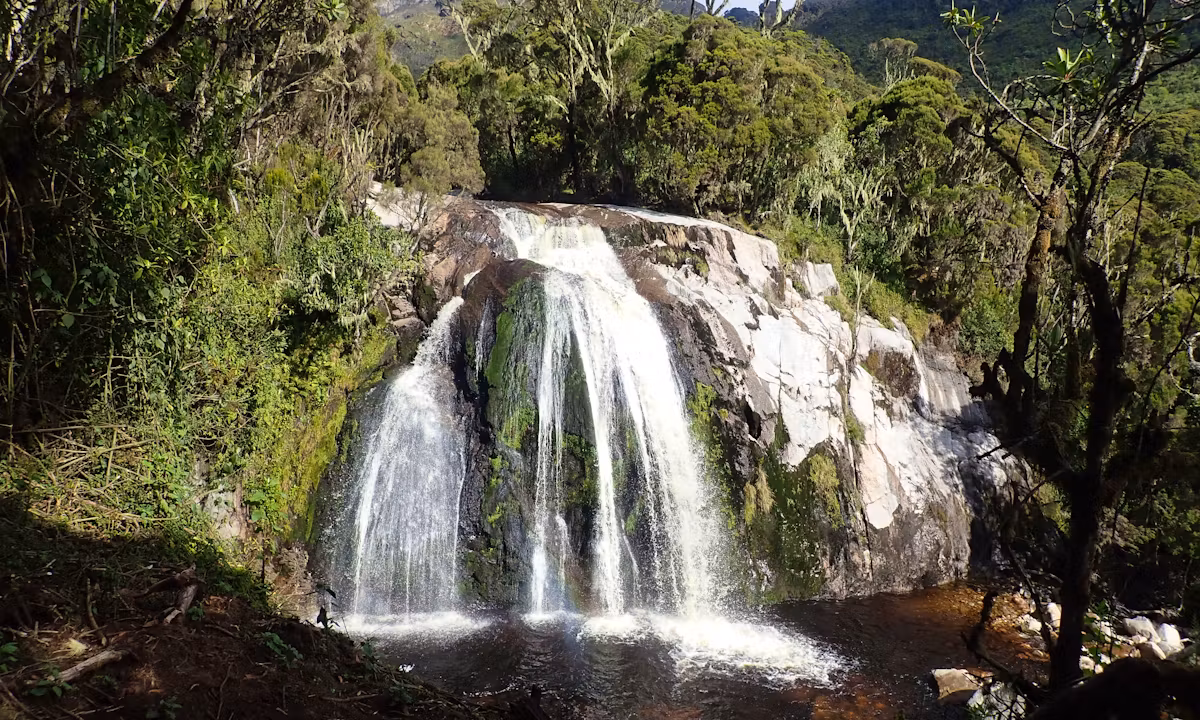
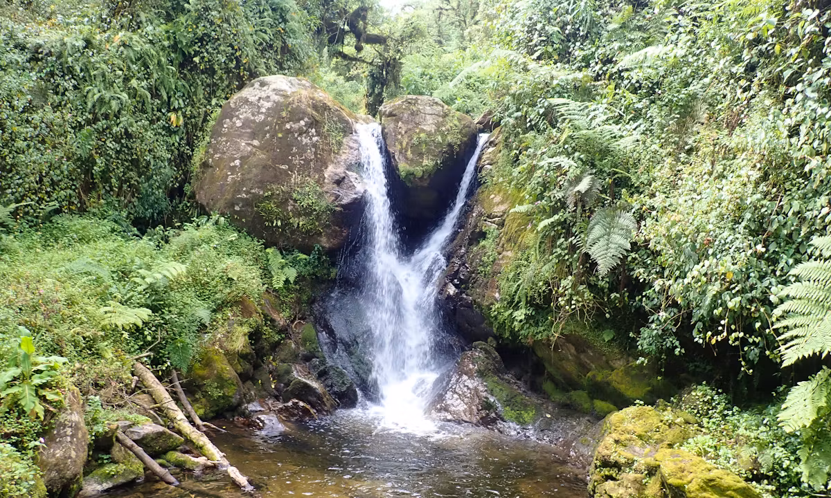
The Rwenzori Mountains receive some of the highest annual rainfall in Africa, 2,000–3,000 mm per year at mid-elevations. Every valley carved into these ancient crystalline block mountains channels water downhill with relentless force, creating a network of rivers, gorges, and cascades that most trekkers never see. While the majority of visitors chase high-altitude glaciers via the Central Circuit, the Kilembe Trail threads the southern flanks of the range through deep forested valleys where the waterfalls are at their most accessible and spectacular. On this 4-day itinerary you will pass Mwamba Falls, Kabamba Falls, the dramatic 40-meter double-tier Samalira Falls, Upper Samalira Cascade, Bugata Stream Falls, and a final set of valley cascades on the descent six distinct water features in all.
The beauty of this itinerary is its accessibility. You do not need glacier-climbing experience, technical gear, or weeks of altitude acclimatization. The trek maxes out at approximately 3,100 metres above sea level, high enough to feel the elevation but well below the threshold where serious altitude illness typically sets in. What you do need is cardiovascular fitness, a tolerance for the Rwenzori’s legendary mud, and curiosity about one of the world’s most botanically extraordinary mountain ecosystems. With fewer than 1,000 trekkers visiting the entire range per year (compared to 50,000+ on Kilimanjaro), you will share these waterfalls with almost no one. The silence, the mist, and the scale belong entirely to you.
For trekkers who complete this route and want to press deeper into the range, the Kilembe Trail extends all the way to Margherita Peak at 5,109m. Our 8-Day Kilembe Trail to Margherita Peak uses this exact trailhead and covers all the same lower camps before climbing into the Afroalpine zone and beyond. But on this 4-day waterfall iteration, the mountain rewards you generously before any of that is necessary.
Full Day-by-Day Itinerary: 4-Day Rwenzori Waterfalls Hike
Day 1: Kilembe Trailhead → Sine Camp
Elevation: 1,580m → 2,540m | Distance: ~10 km | Hiking Time: 5–6 hours
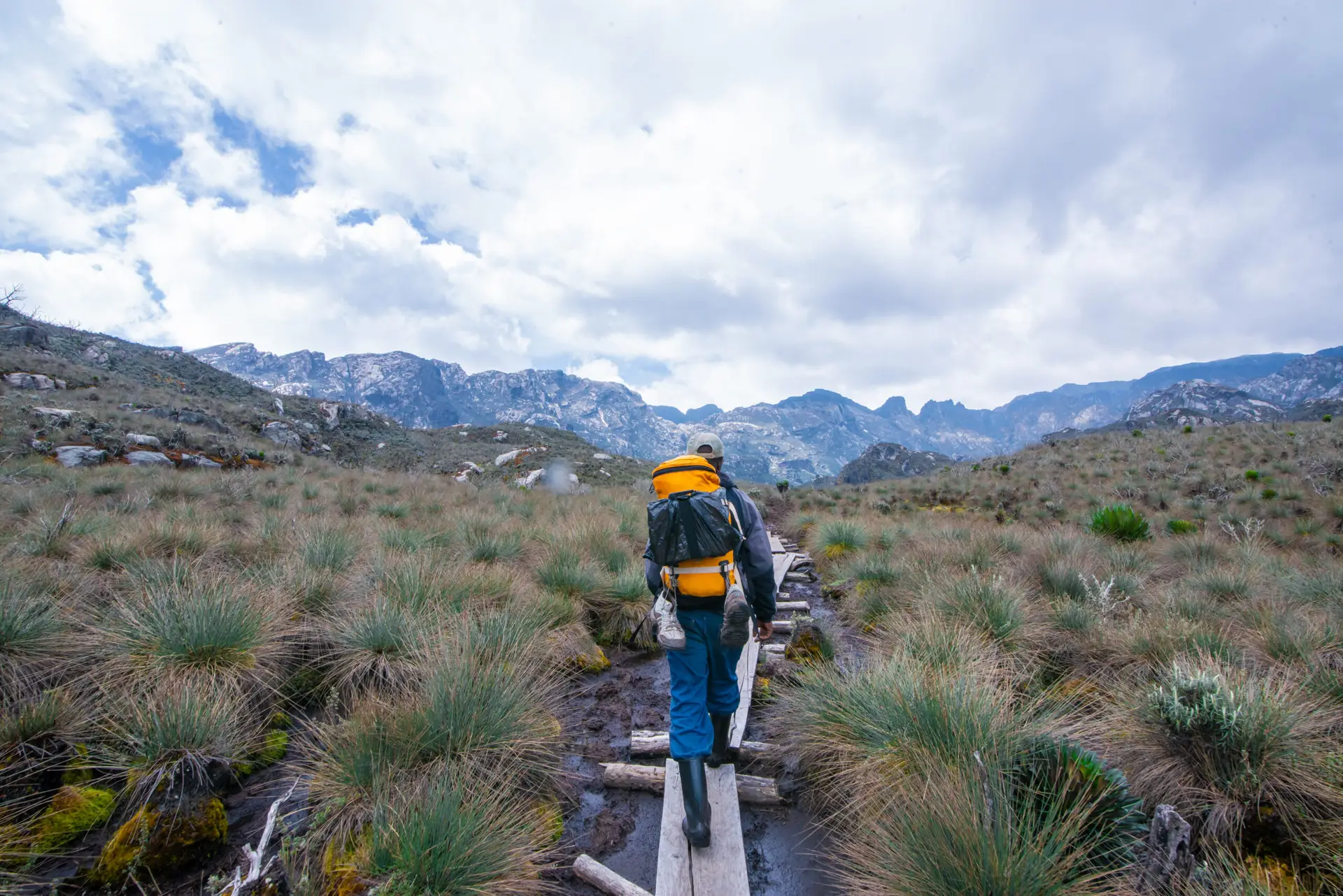
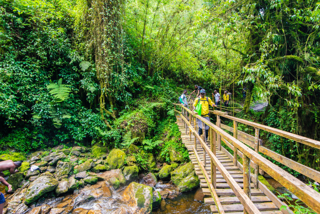
Your 4-Day Rwenzori Waterfalls Hike begins at the Kilembe Trailhead, a short drive from Kasese town. Kilembe is a former copper-mining village perched at the foot of the southern Rwenzori escarpment at 1,580m, where the mountains rise steeply from the Albertine Rift Valley floor. After a full pre-departure briefing, permits are processed at the park gate, and your porter team, Bakonzo mountain men who have grown up in the shadow of these peaks, assemble to carry your main luggage.
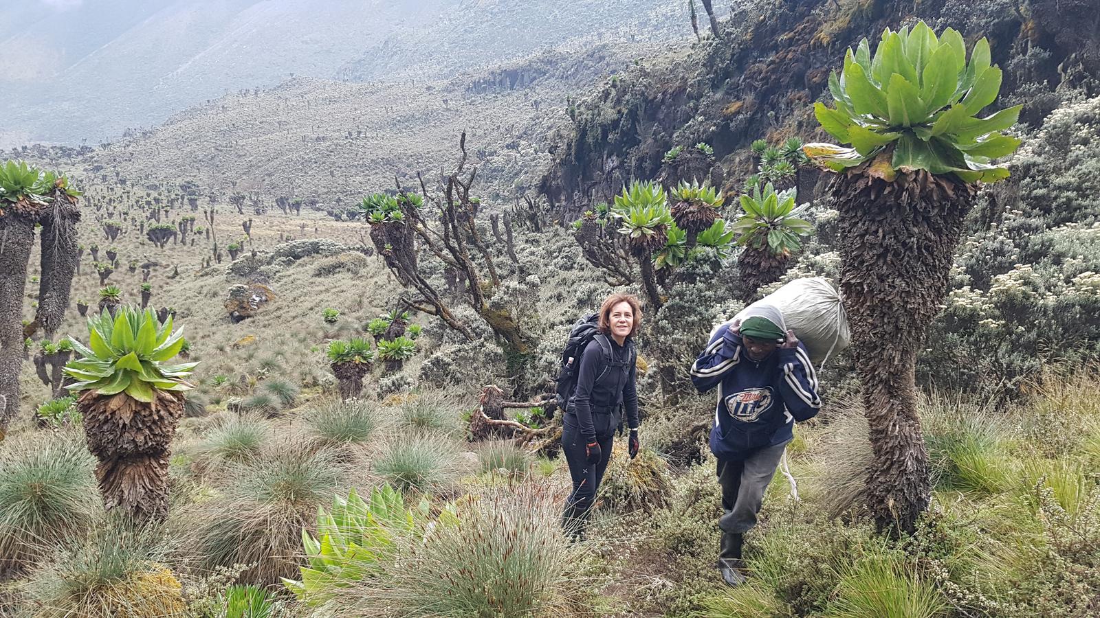
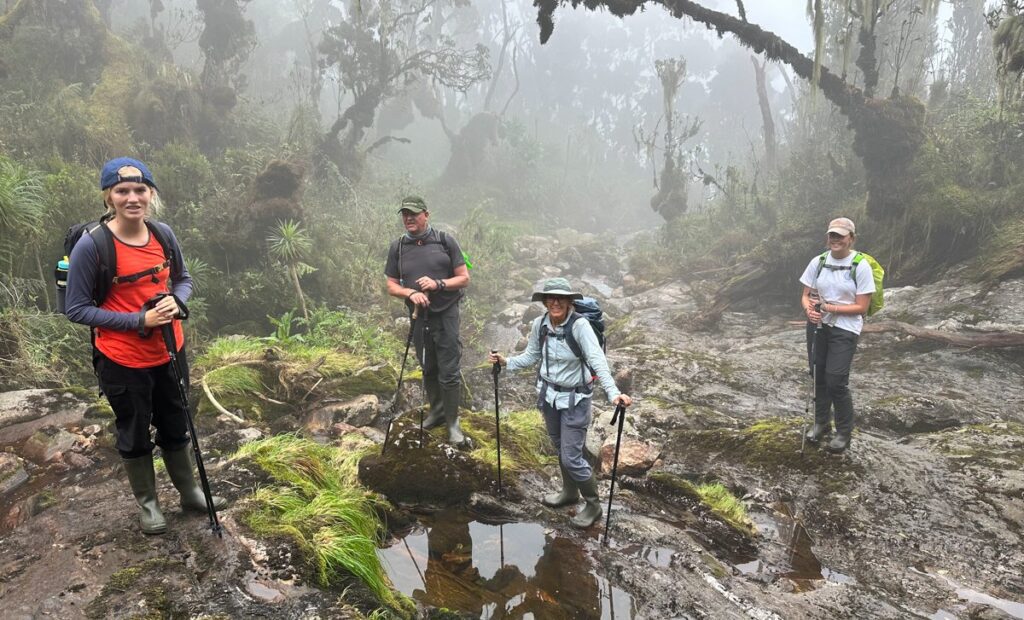
The trail enters the national park almost immediately, and the montane rainforest closes in around you within minutes. Day 1 is a sustained climb of nearly 1,000 vertical meters spread over 10 kilometers of well-maintained trail. The path follows the Mubuku River valley, climbing through dense Afromontane forest draped in old man’s beard lichen and towering Podocarpus trees. Colobus monkeys announce themselves from the high canopy; red-tailed monkeys ghost through the middle story; the three-horned chameleon grips low branches at eye level. The Rwenzori Wildlife Guide details every species you are likely to encounter.
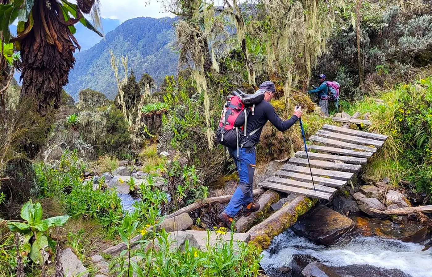
Approximately two hours from the trailhead, the path descends briefly to cross the Mubuku River on a log bridge, and here you encounter your first major waterfall: Mwamba Falls, where the river plunges through a narrow basalt gorge in a curtain of white. This is your first photography moment and your first glimpse of the scale of the Rwenzori’s water systems. After the crossing, the climb resumes through a bamboo forest before breaking into a more open landscape of giant heather and the first Senecio trees.
Sine Camp at 2,540 m arrives as a welcome sight: wooden huts in a clearing above the valley. Your cook will have a three-course meal underway as you unlace your boots. On clear evenings, the lights of Kasese are visible far below, the flatlands of the Albertine Rift stretching to the horizon.
Waterfall: Mwamba Falls | Highlight: First Mubuku River crossing, colobus monkeys, first Senecio trees
Sleep: Sine Camp huts (2,540m) shared bunk dormitory with foam mattresses, toilet block on site
Day 2: Sine Camp → Samalira Falls Camp
Elevation: 2,540m → 2,900m | Distance: ~8 km | Hiking Time: 4–5 hours
Day 2 is the waterfall centerpiece of the entire trek. From Sine Camp, the trail holds its elevation through open heathland before dropping into the Samalira Valley, a narrow, steep-sided gorge that channels an enormous volume of water. Within 90 minutes of departure, you reach Kabamba Falls, where a stream tumbles over exposed rock in a 12-meter plunge. A dry ledge just metres from the base makes this the trail’s most accessible photography viewpoint. In the rainy season, the roar is audible from half a kilometer away.

The trail then climbs the western wall of the Samalira Valley before dropping steeply to the river. The approach to Samalira Falls is theatrical: you hear it long before you see it, a deep, percussive thunder building as the trail bends around a buttress of exposed rock. Then it appears: a 40-meter double-tier cascade pouring over a mossy cliff face into a pool below, surrounded by giant ferns and hagenia trees draped in fog. This is arguably the most spectacular waterfall accessible on any short trek in Uganda. Samalira Falls receives a fraction of the visitors that Uganda’s more famous Sipi Falls draws, yet eclipses it in scale.
Samalira Camp is positioned just above the falls at 2,900m. The constant sound of falling water carries through the night an atmospheric soundtrack unlike anything a lower-altitude camp provides. At this elevation, temperatures drop to 8–12°C after dark, making a good sleeping bag essential. For a comparison of all short Kilembe Trail options, our hiking trails overview covers every available route.
Waterfalls: Kabamba Falls + Samalira Falls (40m double-tier centrepiece) | Highlight: Samalira gorge, giant fern understorey
Sleep: Samalira Camp huts (2,900m) shared bunks, cooking shelter, toilet block
Day 3: Samalira Camp → Bugata Camp: Upper Waterfalls Exploration.
Elevation: 2,900m → ~3,100m | Distance: ~8 km | Hiking Time: 5–6 hours
Day 3 takes you into the high montane and lower afro-alpine zones. From Samalira, the trail climbs through the transition zone where Podocarpus and Hagenia give way to giant heathers (Erica arborea and Erica trimera), and the first ground orchids appear at the trail’s edge. The vegetation zones guide provides a detailed botanical breakdown of every ecological layer you pass through.
Within an hour of Samalira, you cross the main stream a second time, where it runs over exposed granite shelves. Upper Samalira Cascade: a less dramatic but photogenic series of stepped pools and falls that rewards a careful scramble to the water’s edge. Here the water is crystal clear, fed by glacial melt and rainfall from above. Beyond the cascade, the trail presses into increasingly open country, the heather canopy thinning to reveal upper ridgelines through gaps in the cloud.

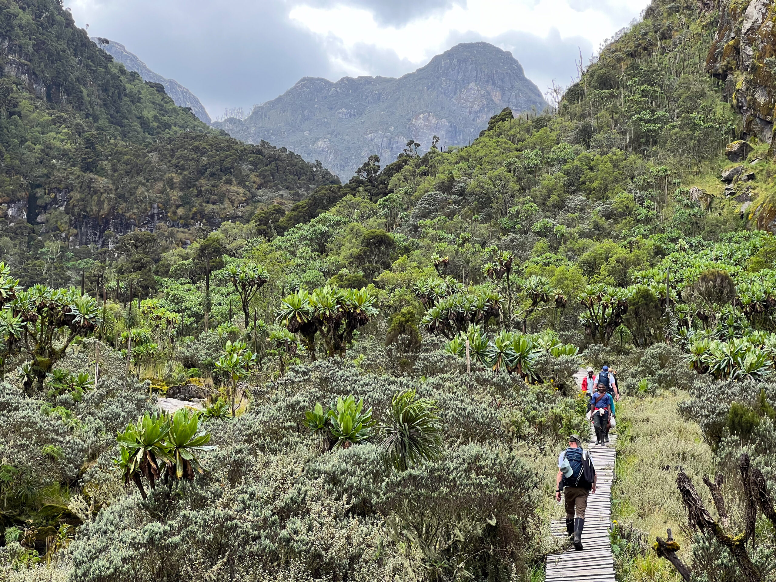
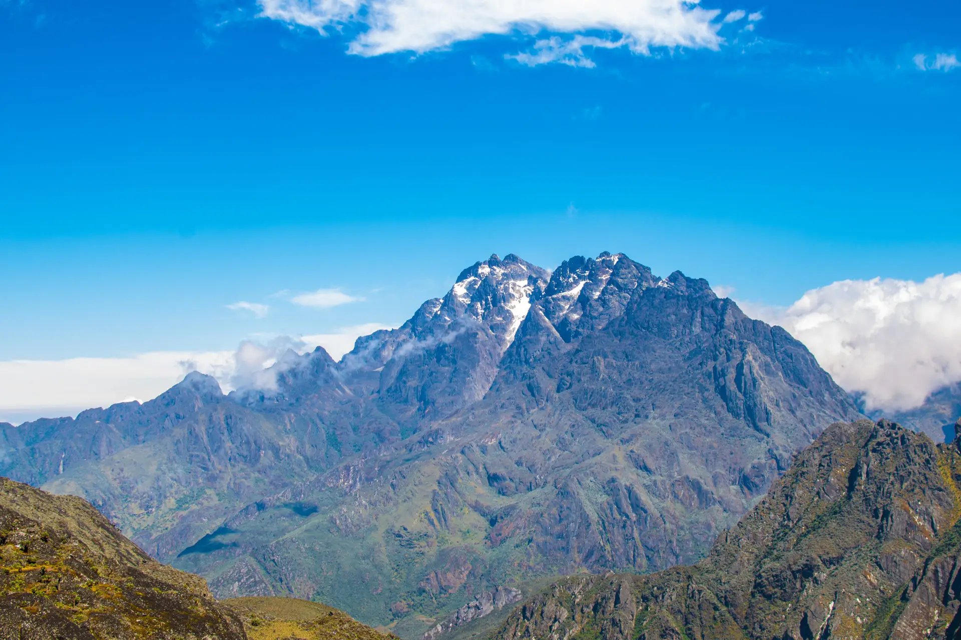
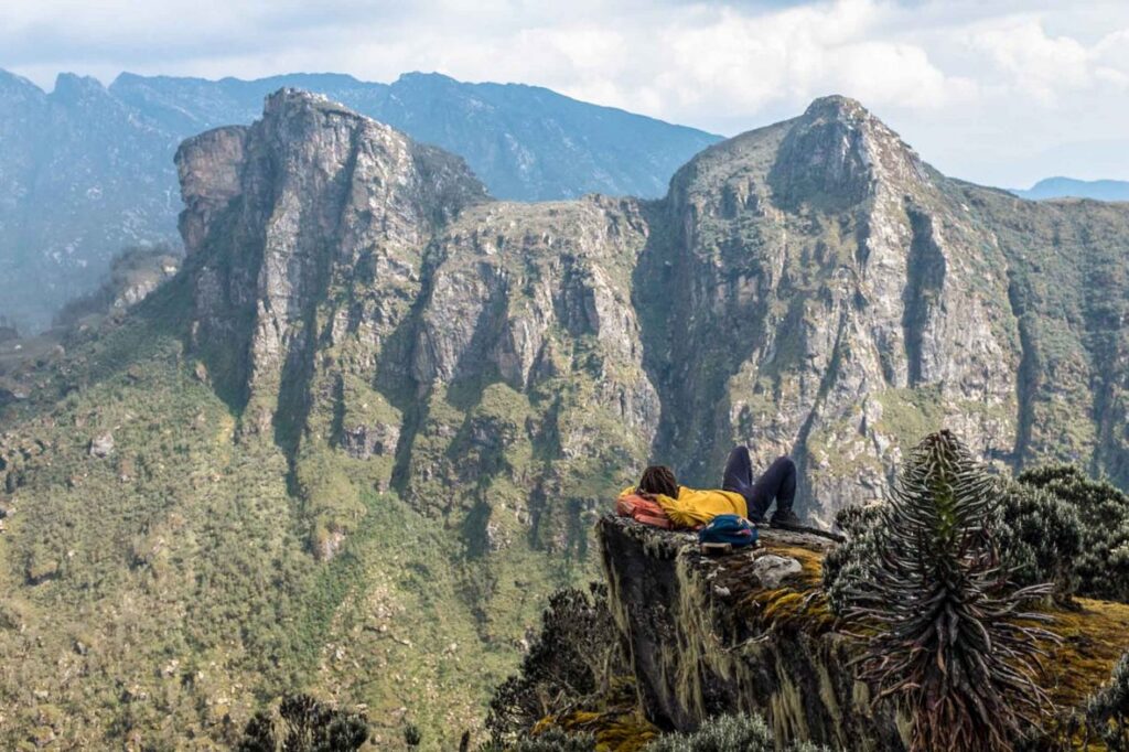
On clear mornings, the snow-capped ridges of Mount Stanley are visible to the north, a reminder of the vast alpine world this trek only grazes. Near Bugata, the Mubuku River’s headwaters cross the trail in a wide braided section, and Bugata Stream Falls, a compact but vigorous 15-meter cascade, marks the trek’s final named waterfall. By any tally, you have now seen six distinct water features in three days of walking.
Bugata Camp at ~3,100m is the trek’s highest sleeping point. Cold, wind-exposed, and magnificent. On clear evenings, Rwenzori peaks emerge from cloud in a spectacle of rock, ice, and fading equatorial light. Those who want sweeping panoramic views on a comparable four-day itinerary may also wish to consider our 4-Day Mutinda Lookout Trek, which departs from the same Kilembe Trailhead.
Waterfalls: Upper Samalira Cascade + Bugata Stream Falls | Highlights: Giant heather forest, first Afro-alpine plants, Mount Stanley snowline views
Sleep: Bugata Camp huts (~3,100m), basic sleeping huts, cook shelter, toilet
Day 4: Bugata Camp → Kilembe Trailhead (Full Descent)
Elevation: ~3,100m → 1,580m | Distance: ~14 km | Hiking Time: 6–7 hours
The descent from Bugata to Kilembe is a a long and knee-testing 1,520 vertical metres over 14 kilometers, but it rewards patience with one final sequence of cascades as the Mubuku River gathers volume below. Reversing the same trail offers entirely new perspectives: waterfalls you passed looking up now appear from above; forest bends invisible in the climbing effort now reveal themselves in the relaxed pace of descent.
You will pass Samalira Falls a second time now from the eastern approach, looking down into the gorge and Kabamba Stream from the opposite bank. By mid-morning the mist burns off to reveal the Rift Valley in full clarity: sugar plantations, wetlands, and the valley floor stretching to the horizon. The Mwamba crossing returns for a final farewell before the trail delivers you back to Kilembe, where cold drinks and a vehicle await.
Your 4-Day Rwenzori Waterfalls Hike ends with a completion certificate and a debrief with your lead guide. Those who the mountain has stirred should explore the full Kilembe Trail or consider the 3-Day Sine & Samalira Camp Trek as an introduction for future visitors.
Highlight: Final views of Samalira Falls from above, Rift Valley panoramas, completion certificate at Kilembe
End point: Kilembe Trailhead (1,580m) vehicle transfer to Kasese arranged by default
Elevation Profile Summary for the 4-Day Rwenzori Waterfall Hike.
The 4-Day Rwenzori Waterfalls Hike follows an out-and-back profile with a net ascent of 1,520 vertical metres from Kilembe Trailhead (1,580 m) to Bugata Camp (~3,100 m). Total cumulative elevation across all four days is approximately 1,800 m gain and 1,800 m loss.
Day 1: 1,580m → 2,540m | +960m net gain over 10km. Longest sustained climb; no significant descent until camp.
Day 2: 2,540m → 2,900m | +360m net gain over 8 km. The valley gorge descent and subsequent reascent add approximately 400 meters of additional vertical gain.
Day 3: 2,900m → 3,100m | +200m net gain over 8km. The most gradual elevation occurs during the day, with bog and wet heathland underfoot from Samalira upward.
Day 4: 3,100m → 1,580m | -1,520m net loss over 14km. Long and relentless descent; trekking poles critical for knee protection.
Camps & Accommodation Along the Kilembe Trail
Sine Camp (2,540 m)
Sine Camp is the first overnight stop on the Kilembe Trail, serving as the base for both our 2-day Sine Camp trek and this 4-day itinerary. Small wooden huts in a clearing above the Mubuku Valley offer foam-mattress bunks, a shared toilet block, and a cooking shelter. Dawn birdsong here is exceptional; Rwenzori turacos and crowned hornbills call from first light. Temperatures range from 10 to 18°C.
Samalira Falls Camp (2,900 m)
The most atmospherically positioned camp on the route, Samalira sits directly above the falls that bear its name. The sound of falling water is constant and oddly soporific once you adjust. On clear evenings, the western sky above the Rift Valley turns amber and deep red. The huts here are slightly more exposed than those at Sine, so bring a sleeping bag rated for a minimum comfort temperature of -5°C.
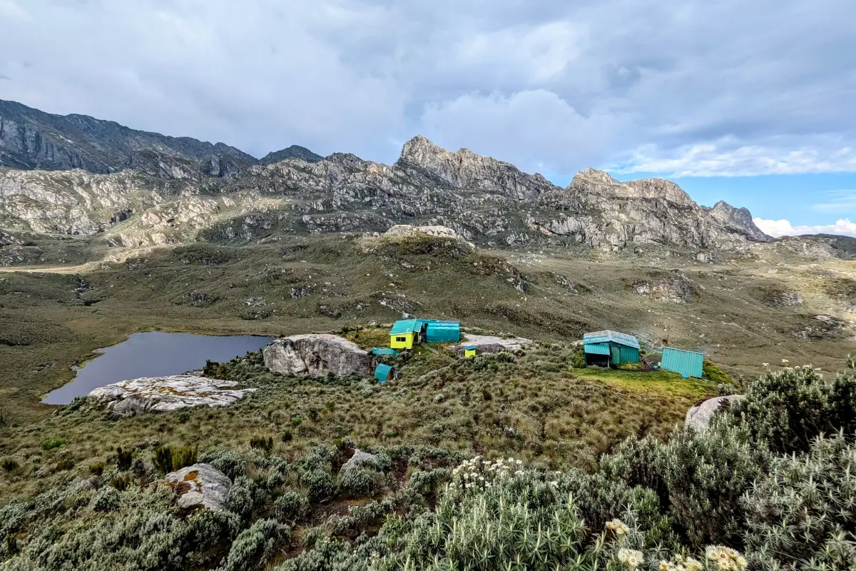
Bugata Camp (~3,100m)
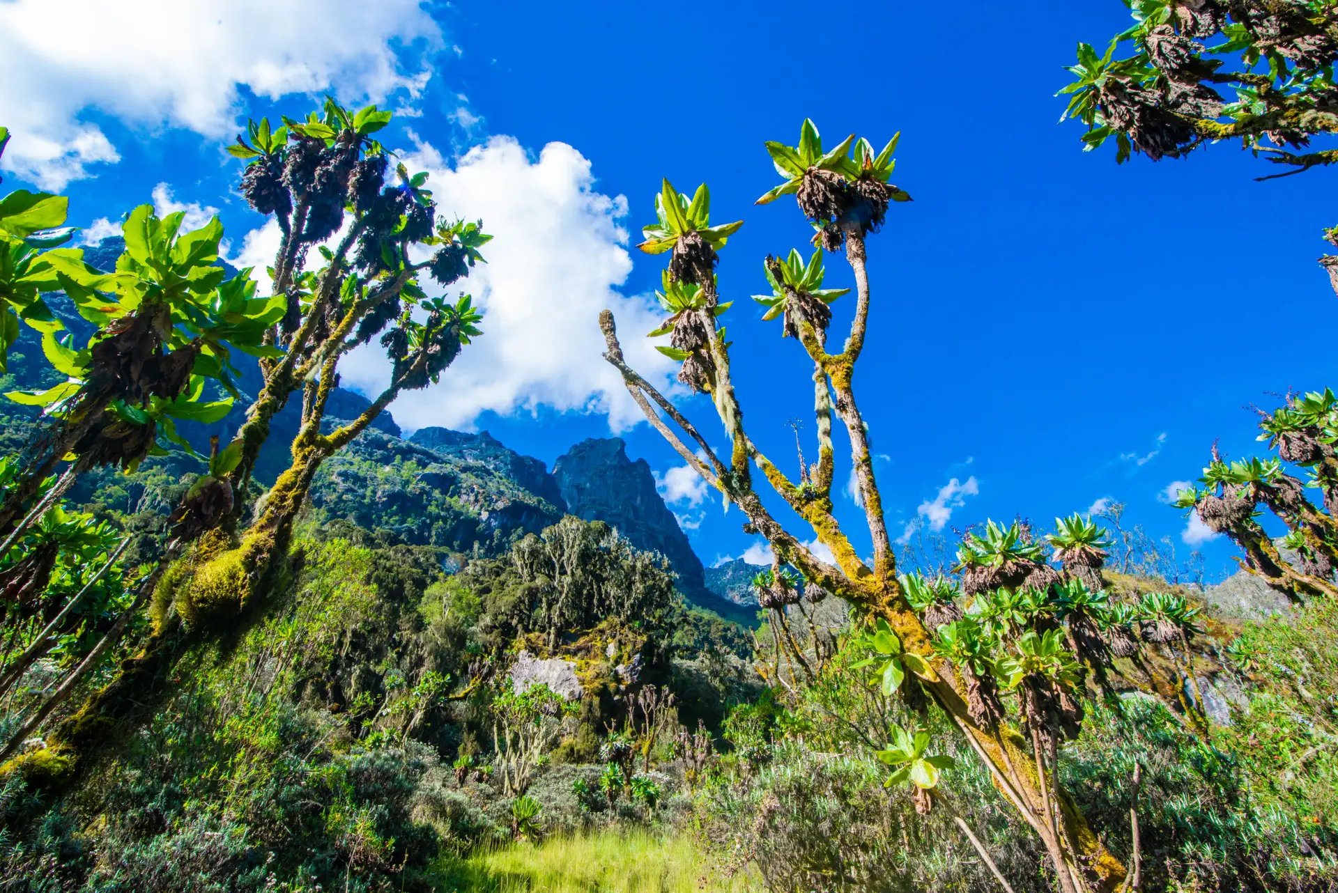
Bugata marks the threshold of the true Afro-alpine zone. Vegetation opens dramatically from dense heather transitioning to low sedge grassland interspersed with the first giant groundsels (Senecio adnivalis). It is wind-exposed and cool even during the dry season. Trekkers on the 8-Day Kilembe Trail to Margherita Peak continue upward from this point into the snowfields. For the 4-day waterfall trekker, Bugata represents the summit of achievement, and it feels every bit that significant.
Flora & Wildlife on the 4-Day Rwenzori Waterfalls Hike
The Kilembe Trail passes through three distinct ecological zones, making it one of the most botanically rewarding short treks in the region. Our guide to the vegetation zones of the Rwenzori is recommended pre-trek reading; the Rwenzori Wildlife Guide lists all species by zone.
Montane Forest Zone (1,580m–2,600m)
Dense Afromontane rainforest covers the lower trail, with Podocarpus milanjianus, Hagenia abyssinica, and Symphonia globulifera above and a rich understory of Mimulopsis, Impatiens, and Begonia species. Wildlife includes black-and-white colobus monkeys, red-tailed monkeys, blue monkeys, L’Hoest’s monkeys, and forest duiker. Birdlife is exceptional; look for the Rwenzori turaco, African green broadbill, Rwenzori batis, and multiple sunbird species. Three-horned Jackson’s chameleons are frequently spotted on lower vegetation.
Bamboo & Transition Zone (2,500m–2,800m)
A short bamboo section appears above the forest habitat associated with forest elephants and buffalo, though encounters are rare on the southern trail. This transitions to a mosaic of giant heather, Hypericum trees, and the first tree ferns: vegetation that feels increasingly prehistoric the higher you climb.
Giant Heather & Lower Afroalpine Zone (2,800 m–3,100 m)
Above Samalira, giant heathers (Erica arborea, reaching 6–8 metres) form cathedral-like tunnels over the trail, draped in old man’s beard lichen (Usnea). Ground orchids bloom in wetter sections. The first giant groundsels begin appearing as you approach Bugata the Rwenzori’s alien-looking signature plant, found nowhere else on Earth at this altitude.
Physical Difficulty & Fitness Requirements
The 4-Day Rwenzori Waterfalls Hike is rated Moderate. It is suitable for healthy adults with solid cardiovascular fitness but requires no prior mountaineering experience. The primary challenge is the Day 1 ascent of nearly 1,000 m in a single day and the consistently technical terrain: wet roots, rocky river crossings, and deep mud in the lower gorge sections. As a benchmark: if you can comfortably complete a 3-hour uphill hike with a 10kg daypack without frequent rest stops, you have the necessary base fitness.
Training in the six weeks before departure should include at least two uphill hike sessions per week, stair climbing, and cardiovascular training (running or cycling). Trekking poles are strongly recommended and significantly reduce knee strain on the 1,520m Day 4 descent. Altitude sickness at 3,100 m is unusual but possible; adequate hydration (3–4 liters per day), steady pacing, and avoiding alcohol are the most effective preventive measures.
For context on how the Rwenzori compares to other major African mountain treks, our Rwenzori vs. Kilimanjaro comparison provides an honest analysis. And for those wondering whether the investment is worth it, our guide to why the Rwenzori is worth climbing makes the case comprehensively.
Best Time to Do the 4-Day Rwenzori Waterfalls Hike
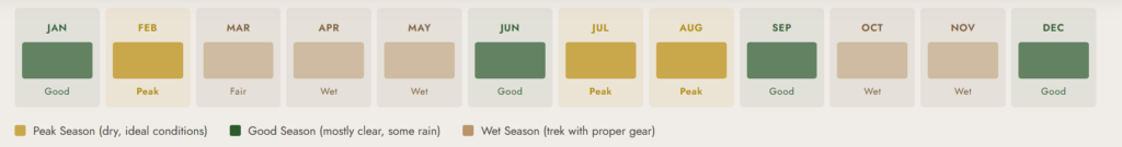
The Rwenzori creates its own microclimate, and rain can fall at any time of year. However, Uganda’s two dry seasons offer meaningfully better conditions, and planning around them significantly improves your experience.
June to August (Long Dry Season): The best overall window. Trails are drier and more stable; views from Bugata toward the upper peaks are most likely to clear; waterfalls remain impressive from residual runoff. Peak season books well in advance.
December to February (Short Dry Season): A solid second option. Waterfalls are often fuller due to the preceding short rains, creating more dramatic photography. December and January are particularly reliable.
March to May & September to November (Wet Seasons): Hikeable but more challenging. The camp is surrounded by deep mud, high river crossings, and frequent cloud cover that obscures the views. Waterfall volume is at its absolute maximum during these months, which is ideal if your specific goal is dramatic cascade photography at full flood and you have the experience to navigate slippery terrain. Rubber boots (available from us in Kasese) are essential in the wet season.
What’s Included in the Package
Included
- Uganda Wildlife Authority Entry Permit 4 days of park access fees
- Professional Lead Guide UWA-certified Kilembe Trail specialist
- Dedicated Porter Team: one porter per trekker for luggage up to 15kg
- Camp Cook & Full Board Meals: breakfast, trail lunch/snacks, and 3-course dinner daily
- 3 Nights Camp Hut Accommodation Sine, Samalira, and Bugata camps
- Pre-Departure Safety Briefing: full route and emergency protocol overview at Kilembe
- Completion Certificate issued at the Kilembe Trailhead upon return
- Emergency First Aid Kit pulse oximeter, altitude medications, wound care
- Transfer: Kasese Town ↔ Kilembe Trailhead included on Day 1 and Day 4
Not Included
- International/Domestic Flights & Long-Distance Transport to Kasese (we can arrange on request)
- Personal Trekking Gear: sleeping bag, boots, poles, clothing
- Travel Insurance with Emergency Evacuation Cover mandatory
- Gratuities for guides, porters, and cook (see FAQ for recommended amounts)
- Personal Snacks & Alcoholic Beverages
Packing & Gear List for the 4-Day Rwenzori Waterfalls Hike
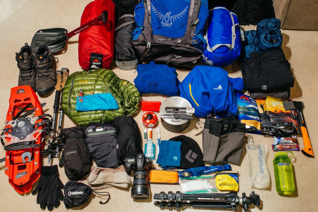
Footwear
- Waterproof hiking boots with ankle support treated with DWR spray before departure
- Short gaiters to keep mud and moisture out of boot tops
- Camp sandals: lightweight slip-ons for evenings in camp
- Rubber boots (gumboots) available for hire from our Kasese office recommended for wet-season trekking
Clothing System
- Moisture-wicking base layers merino wool preferred in the Rwenzori’s damp conditions
- Insulating mid-layer fleece or down jacket; essential at Samalira Camp (8°C nights) and above
- Waterproof shell jacket non-negotiable; your most important garment on this trail
- Waterproof, lightweight trousers; keep accessible in daypack at all times
- Two pairs of trekking trousers; expect both to get muddy
- Warm hat and gloves required from Samalira Camp upward
- Sun hat and UV sunglasses for open heathland and ridge sections
- 4+ pairs of merino or wool socks; wet cotton socks cause blisters on Day 4’s long descent
Sleep System
- Sleeping bag rated to -5°C comfort rating (not limit); liner adds 3–5°C at Bugata Camp
- Sleeping bag liner silk or fleece; protects camp bedding and adds warmth
Equipment
- Trekking poles (pair) strongly recommended; aluminium or carbon fibre, collapsible
- Daypack 25–35 L for water, snacks, rain gear, camera; main luggage carried by porter
- Water bottles or hydration bladders with a minimum 2L capacity; water filter or purification tablets as backup
- Headtorch with spare batteries (no electricity in camp huts); essential for early morning starts
Health & Hygiene
- Prescription medications, including personal altitude medication (consult doctor before departure)
- Blister kit: moleskin, compeed, small scissors; treat hot spots immediately
- Sunscreen SPF 50+: UV radiation increases ~10% per 1,000m of elevation gain
- DEET insect repellent for lower montane forest zone (mosquitoes and tsetse)
- Hand sanitiser + personal first aid ibuprofen, loperamide, rehydration salts, antiseptic wipes, plasters
Electronics
- A camera with waterproof case or dry bag mandatory on the Rwenzori; your electronics will face rain
- Portable charger (20,000 mAh): no charging facilities on trail; covers 3–4 nights of camera and phone use
- Passport/ID and park permit stored in a waterproof document wallet
Rwenzori Trekking Permits, Park Fees & Cost Breakdown
All UWA park fees and accommodation are included in the Rwenzori Trekking Safaris package price. For full transparency, the underlying fee structure per person is as follows:
| UWA Entry Permit | USD 45 per person per day × 4 days = USD 180 |
| UWA Hut Accommodation | USD 30 per person per night × 3 nights = USD 90 |
| Professional Guide | Included in package price |
| Porter Team (1 per trekker) | Included in package price |
| Camp Cook | Included in package price |
| All Meals (Full Board) | Included in package price |
| Kilembe Trailhead Transfer | Included in package price |
| Recommended Gratuities | Guide: USD 50–75 | Porter: USD 30–50 | Cook: USD 30–40 |
| Total UWA Fees (per person) | USD 270 is fully included in the package. |
Contact us directly for current package pricing by group size. Groups of 6+ benefit from the lowest per-person rates. Solo and duo trekkers are always welcome; pricing adjusts accordingly.
Getting There: Transport to Kilembe Trailhead
The Kilembe Trailhead is 12 km southwest of Kasese town in western Uganda. Our Kasese gateway guide for trekkers covers accommodation, restaurants, and logistics for your arrival day.
From Kampala
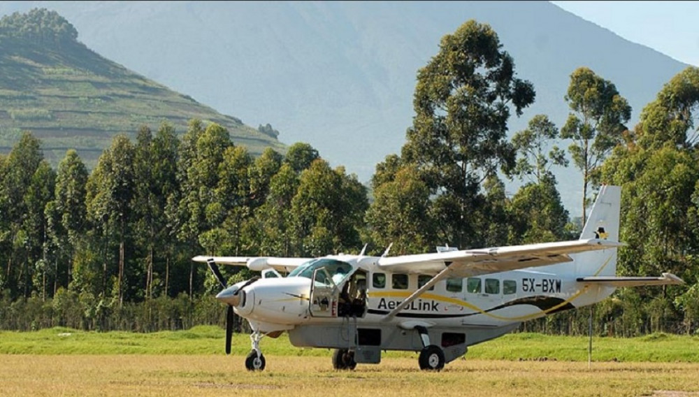
Kampala to Kasese is 385km, approximately 5–6 hours by private vehicle. Daily bus services (Gateway, Link) depart Kampala bus parks. We recommend arranging private 4WD transfers for groups with equipment, at approximately USD 120–150 one-way, through Rwenzori Trekking Safaris.
From Entebbe International Airport
Entebbe to Kasese is approximately 420km (5.5–7 hours). Plan an overnight stop in Kampala or Entebbe after your international arrival, before the westward transfer. Budget one full travel day between your international arrival and your trek start date.
Kasese Town to Kilembe Trailhead
The 12km transfer from Kasese to the park gate takes 25–30 minutes by vehicle. We include this transfer in all 4-day packages as part of your Day 1 departure logistics. Permit verification takes place at the Kilembe gate before the trail begins.
Book Your Trek
Respond within Minutes
From
$615
per person
- Duration 4 Days / 3 Nights
- Group Size 1–12 people
- Start Point Kilembe TrailHead
- Departures Year-round
- No Summits Bugata Camp
No booking fee. Free cancellation up to 30 days before departure. We respond within Minutes.
Our Popular Rwenzori Treks
Magheritah Peak (8 Days Kilembe Trail)
$1705 Per Person
Mutinda LookOut (4 Days)
$645 Per Person
Short Magherita Hike (5 Days Central Circuit)
$1200 Per Person
Rwenzori Hike (7 Days Central Circuit)
$1400 Per Person
Frequently Asked Questions: 4-Day Rwenzori Waterfalls Hike.
How difficult is the 4-Day Rwenzori Waterfalls Hike for a beginner trekker?
The 4-Day Rwenzori Waterfalls Hike is rated moderate and is genuinely accessible to fit beginners who have some experience on uneven terrain. The key challenge is the Day 1 ascent of nearly 1,000 vertical metres and the consistently wet, rooted trail surface throughout. If you can comfortably complete a 3-hour uphill hike carrying a light pack without needing frequent rest stops, you have the necessary baseline fitness. Six weeks of uphill training before departure is strongly recommended.
What waterfalls will I see on this trek, and how many are there?
On the 4-Day Rwenzori Waterfalls Hike via the Kilembe Trail, you encounter a minimum of six distinct waterfalls and cascades: Mwamba Falls (Day 1, Mubuku River crossing); Kabamba Falls (Day 2, 12-meter plunge); the 40-meter double-tier Samalira Falls (Day 2 centerpiece, the trek’s signature spectacle); Upper Samalira Cascade (Day 3, granite-stepped pools); Bugata Stream Falls (Day 3 near camp); and a final sequence of unnamed valley cascades on the Day 4 descent. Wet-season trekkers will see these falls at their most dramatic volume
Is altitude sickness a risk on the 4-Day Rwenzori Waterfalls Hike?
The maximum elevation on this trek is approximately 3,100m at Bugata Camp. Altitude sickness is possible but uncommon at this elevation for healthy adults. Mild symptoms such as headache and fatigue at Day 3 altitude are not unusual and typically resolve with rest and hydration. Our guides are trained in altitude illness recognition and carry basic medications, including Diamox. The most effective prevention is adequate hydration (3–4 liters per day), a steady ascending pace, and avoiding alcohol. Trekkers with pre-existing cardiac or respiratory conditions should consult their physician before booking.
Do I need technical mountaineering experience or special gear for this trek?
No technical mountaineering experience or glacier gear is required for the 4-Day Rwenzori Waterfalls Hike. The route stays well below the snowline and involves no technical climbing. Standard waterproof hiking boots, a -5°C sleeping bag, waterproof shell clothing, and trekking poles are the essential items. Rubber boots (gumboots) are available for hire from our Kasese office and are strongly recommended for wet-season trekkers. A full gear list is sent with your booking confirmation.
What is the best time of year to hike the Kilembe Trail Waterfalls route?
The best overall window is June to August (Uganda’s long dry season), when trails are most stable and views from Bugata toward the upper peaks are most likely to clear. December to January is a strong second choice, often offering fuller waterfall volumes from the preceding short rains. The trek can be completed year-round; the wet season (March-May, September-November) delivers the most dramatic cascades at maximum volume but requires greater tolerance for deep mud and slippery terrain.
How exclusive is the Kilembe Trail, and will I share it with many other groups?
The Rwenzori Mountains receive fewer than 1,000 trekkers per year across the entire range. On the Kilembe Trail specifically, it is entirely normal to complete the 4-day waterfall route without encountering another independent group. At Samalira Falls, one of Uganda’s most spectacular waterfalls, you may stand completely alone in the mist, hearing nothing but falling water and birdsong. This extreme exclusivity is one of the Rwenzori’s most compelling selling points and a direct contrast to more commercialized East African mountain experiences.
Can I extend this trek to climb Margherita Peak after the 4-day waterfalls hike?
Yes. The 4-Day Rwenzori Waterfalls Hike uses exactly the same entry point and lower trail as our longer Kilembe Trail expeditions. Our 8-Day Kilembe Trail to Margherita Peak extends the route through the upper Afroalpine zone, across the Elena Glacier, and to the 5,109m summit. The trek requires additional fitness preparation, crampons, and glacier travel experience, but the first four days of that itinerary are identical to this waterfall hike. Contact us to discuss combining the routes.
What food is provided on the trail?
All meals are prepared by your dedicated camp cook from Day 1 through Day 4. Breakfasts include porridge, eggs, toast, fruit, and tea or coffee. Trail lunches are packed boxes containing sandwiches, fruit, energy bars, and juice. Dinners are hot three-course meals: soup, a main course (rice, pasta, or posho with beans, vegetables, and protein), and fruit for dessert. Vegetarian, vegan, and gluten-free requirements can be accommodated with advance notice when booking.
Is the Kilembe Trail harder than the Central Circuit?
The Kilembe Trail is generally considered slightly more technically challenging and less well-maintained than the Central Circuit, as it sees fewer trekkers and less regular path upkeep. The trail is narrower and muddier in sections. However, for a waterfall-focused short trek, the Kilembe Trail is unambiguously the superior choice; it threads through deeper valleys with far more dramatic cascade encounters than the Central Circuit’s lower sections. Our hiking trails overview compares both routes in full detail.
What tipping is expected for guides and porters?
Tipping is customary in Uganda’s trekking industry and represents a meaningful part of your team’s income. Recommended gratuities for a 4-day trek: USD 50–75 for your lead guide; USD 30–50 for each porter; USD 30–40 for the camp cook. These are recommendations rather than requirements. Tips are best given in Ugandan shillings or USD at the Kilembe Trailhead on Day 4. A shared tip envelope for the whole team is perfectly acceptable if you prefer not to tip individually.
Is travel insurance mandatory for the 4-Day Rwenzori Waterfalls Hike?
Travel insurance with emergency medical evacuation cover is mandatory for all trekkers on Rwenzori Trekking Safaris itineraries. Although the 4-Day Waterfalls Hike does not involve glacier travel, the terrain is remote, and the nearest hospital is in Kasese. Serious injuries may require helicopter evacuation from the park. Medical evacuation to Kampala can cost USD 5,000–20,000 without cover. World Nomads, SafetyWing, and similar adventure travel insurance providers offer appropriate policies; verify that Uganda and altitudes up to 3,100 m are included.