What the Rwenzori Central Circuit really feels like day by day: terrain, food, huts, summit, and emotions. First-person expert guide.
Nobody who has walked the Rwenzori Central Circuit ever quite finds the right words for it on the first attempt. They talk about mud, and that is true. They talk about the altitude, and that matters. But what they usually mean and what no itinerary page ever quite captures is the feeling of being inside something alive. The mountain is not a backdrop. The character of the whole experience includes the weight of the air in the forest, the way the clouds slide off the glaciers in the early afternoon, and the sound of the Mubuku River three hundred meters below you when you are perched on a boulder in the heather zone, where it is very, very quiet.

This guide is not an itinerary. Itineraries tell you where you sleep. This document is a day-by-day account of what the 7-Day Central Circuit Trek to Margherita Peak actually feels like: what you walk through, what you eat, what the huts smell like at 3,962 metres when the cloud comes in, what your body is doing on summit morning, and what it means to stand on Africa’s third-highest point with the Stanley Glacier beneath your feet and the Congo Basin falling away to the west in an unbroken green horizon. I have guided this route more times than I can count. Let me tell you what it is actually like.
Before Day One begins, read our complete guide to what the Rwenzori really demands and the 16-week training plan that gets most trekkers to the trailhead in the condition this mountain deserves. Come prepared, and the experience described here will be extraordinary. If you arrive unprepared, the same terrain will just become an unpleasant test.
The Night Before: Kasese, Kit Checks, and the Particular Feeling of What Is Coming
Most trekkers spend the night before the trek in Kasese, the closest urban center to the Rwenzori Mountains National Park and the base from which your guide team and logistics will be finalized. Kasese is a small, warm, dusty town that sits at around 1,000 metres at the base of the Rwenzori foothills. In the late afternoon, if the weather is clear, you can see the mountain from here, or at least you can see the foothills, a wall of green rising steeply above the town’s edge, the upper massifs permanently shrouded in the cloud that never really lifts from the Rwenzori. It is the last night of flat ground, reliable electricity, and restaurants.
The kit check happens the evening before departure. Your guide reviews every item: boots, waterproofs, sleeping bag, base layers, crampons, and ice axe for the glacier section. This process is not bureaucracy; it is the experienced read of a mountain professional who knows that the item most likely to cause a problem is the one you thought you did not need. Trekkers who have read our complete packing guide arrive with everything; the few who have not occasionally have intriguing conversations about whether trail runners are an adequate substitute for mountain boots in the Bigo Bog. They are not.
Sleep comes slowly for most people the night before the Rwenzori. Not from anxiety, exactly, but from a kind of alert readiness the knowledge that tomorrow the mountain begins and that by the time you return to a room like this one, the person inside it will be measurably different from the one lying here now.
Day 1: Nyakalengija (1,646 m) → Nyabitaba Hut (2,651 m)
| From | To | Distance | Altitude Gain | Walking Time |
| Nyakalengija | Nyabitaba Hut | ~10 km | +1,005 m | 4–6 hours |
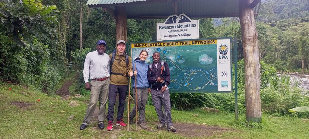
You arrive at Nyakalengija in the morning by vehicle from Kasese, a forty-minute drive through banana plantations and villages where the Bakonzo people, who have lived in these mountains’ shadow for centuries, go about their days without particular interest in the small convoy of international trekkers rattling past. The Rwenzori Mountaineering Services headquarters here is a modest cluster of buildings at the park gate where permits are checked, weights are verified, and the full expedition team assembles for the first time.

Meeting your porters on Day 1 is one of the quiet privileges of the Rwenzori experience. These are the people who will carry the expedition, in every meaningful sense. Their effortless competence, the way they assess loads, arrange packs, and move into conversation with each other in Rutooro, communicates something important: this mountain is their home. They are not awed by it. They are respectful of it. That relationship is what you want walking ahead of you for the next seven days. The porter system and what it means for the Bakonzo community are worth understanding before you arrive.
WHAT IT FEELS LIKEDay One is the most socially rich day of the trek. You are still at your most talkative, full of energy, full of questions, and still carrying a slight tension that the trail has not yet dissolved. The forest absorbs all of it within the first twenty minutes. |
The trail from the park gate drops briefly into a lush valley before climbing into genuine afro-montane rainforest. The vegetation change happens quickly enough that you notice it as a distinct event. One moment you are walking through farmland at the mountain’s edge, and the next you are inside a green chamber of enormous fig trees, their roots buttressing into the path in ways that require careful foot placement. The air changes simultaneously: it becomes heavier, damper, cooler, and rich with the smell of decomposing leaf litter and mossy stone.

The wildlife of the Rwenzori Mountains makes its first appearance here. Rwenzori turacos, brilliant green birds with red wing flashes that seem almost too vivid to be real, move through the canopy in loose, calling groups. Colobus monkeys sit in the high branches of forest giants, white-and-black against the green, watching the trail with no particular alarm. Three-horned chameleons grip the undergrowth with a slowness that seems deliberate, as if they understand they are difficult to spot and are in no hurry to confirm or deny your presence.
The path climbs steadily on a well-maintained trail of earth and root and occasional wooden bridging. The Mubuku River Valley opens on your left at intervals where the forest thins and the drop is significant; there are sections where a stumble off the narrow trail edge would have serious consequences, and your awareness of the altitude you are gaining grows with each such opening. After three to four hours, you reach the Kurt Schäfer Bridge, a narrow suspension bridge over the point where the Bujuku and Mubuku rivers meet. The sound of that confluence is loud enough to feel it.
Nyabitaba Hut sits at 2,651 metres on a ridge with views on clear evenings back down the Mubuku Valley toward the plains and, on the other side, ahead toward the dark green mass of the upper mountain. The hut is a modest structure: wooden sleeping platforms, foam mattresses, and blankets that smell of previous occupants and wood smoke. The cook has arrived before you porters always do, and there is hot tea waiting when you drop your pack onto the platform and your legs onto the bench outside the hut door. This is the first of the moments that define the Rwenzori. Hot tea, the smell of damp wood, the gradual arrival of evening on a mountain ridge, and the knowledge that the adventure is only Day One.
GUIDE INSIGHTAt Nyabitaba I always watch how people eat dinner and how they sleep. Not because I am suspicious, but because the body tells me things on Day One that it will not say again. Someone who eats very little and goes to sleep within twenty minutes of finishing is either exhausted or already mildly altitude-affected. The difference matters, and I start tracking it from the first night. |
Day 2: Nyabitaba Hut (2,651 m) → John Matte Hut (3,505 m)
| From | To | Distance | Altitude Gain | Walking Time |
| Nyabitaba Hut | John Matte Hut | ~9 km | +854 m | 5–7 hours |
Day Two is where the Rwenzori announces its intentions. You wake at Nyabitaba to find the mountain is often above the cloud base by morning, and the hut sits at the edge of a world that has reduced itself to grey and green and the sound of dripping. Breakfast is porridge or eggs with bread, prepared by the cook on a gas burner in the small cooking shelter attached to the hut. It is warm and filling, and you eat it in the doorway while watching the clouds shift. By the time you are ready to leave, the trail has already been walked by the porters who set off an hour before you.
The descent from Nyabitaba to the valley floor is steep and requires care. The path is rooted, narrow, and damp in a way that is pleasant in cool weather and demanding in rain. You cross the Bujuku River on a wooden bridge that bounces underfoot, and then the climb begins in earnest up a bamboo forest so dense that the trail becomes a green tunnel, the bamboo canes tapping against each other in the breeze above your head with a dry, percussive sound entirely unlike anything else in the forest below.
WHAT IT FEELS LIKETrekkers often mention the bamboo zone when describing the Rwenzori to those who haven’t been. There is something about the scale of it, each cane two to three times your height, the light filtering through in long bars, that makes it feel genuinely otherworldly. |
Above the bamboo, the character of the forest shifts again into giant heather and Hagenia woodland, enormous, moss-draped trees with trunks the color of rust, their bark thickly upholstered with layers of moss and lichen that make the forest floor look like something between a carpet and a coral reef. The Rwenzori’s extraordinary moisture is responsible for this abundance. Something growing colonizes every surface in the mountain’s mid-zone. Moss-covered rocks border the paths, erupting with small ferns at close intervals.

John Matte Hut arrives after a long final climb on a ridge with increasingly wide views. At 3,505 meters, you are definitely on the mountain. The plains below are not visible; you are above the forest canopy line in the lower sections, and the upper mountain rises unmistakably ahead of you. The hut at John Matte is weathered but solid, with a social area where the guide and porters often gather in the evening and where the fire, always lit on cold evenings, becomes the gravitational center of the camp’s social life for two hours before bed.
Dinner at John Matte is typically a proper cooked meal: rice or posho, a stew of beans or vegetables, sometimes a protein component, and more tea than you knew you wanted. The mountain cook produces these meals in conditions that would challenge a professional kitchen. Everything has been carried up from the trailhead in the porter loads. Given the circumstances, the meal is hot, carbohydrate-heavy, and surprisingly satisfying.
Sleep at John Matté is when many trekkers first notice the altitude. Not through any dramatic symptom, but through the quality of sleep itself, lighter, more fragmented, occasionally interrupted by a headache that resolves with hydration. This is normal acclimatization physiology at 3,505 metres, and our pre-acclimatization guide explains exactly what the body is doing during these early altitude nights.
Day 3: John Matte Hut (3,505 m) → Bujuku Hut (3,962 m)
| From | To | Distance | Altitude Gain | Walking Time |
| John Matte Hut | Bujuku Hut | ~7 km | +457 m | 4–6 hours |
Day Three is the day the Rwenzori reveals the botanical world that makes it unlike any other mountain on Earth. From John Matte, the trail climbs gradually through the transition zone between Hagenia woodland and the true Afro-alpine ecosystem, and what you enter is one of the most disorienting, visually overwhelming landscapes on the continent.
Giant groundsels, Senecio adnivalis, stand at the edges of the trail in groups of five and ten, their thick, grey-white trunks rising three and four metres to rosettes of silver-green leaves that catch the morning light. Giant lobelias, Lobelia wollastonii, erupt from the valley floors and hillsides in torch-like columns of flowers that reach two meters high. The landscape looks as though someone has been assembling a garden for several million years without ever consulting a design principle, which is essentially what has happened. The Rwenzori’s endemic flora evolved in isolation on these peaks, and the result is genuinely alien.
WHAT IT FEELS LIKEWalking through the giant groundsel forest on Day Three is the moment most trekkers go quiet. Not from exhaustion, but from the specific silence that descends when you realize you are somewhere genuinely extraordinary. Even trekkers who have visited the Himalayas, Patagonia, and the European Alps say they have never seen anything like the Bigo Bog. |
The Bigo Bog is the crossing that defines this section for most trekkers. The Bigo Bog is a wide, flat, glacier-carved valley that was once a lake and is now a wetland of spectacular proportions, an expanse of saturated ground, tussock sedge, and standing water through which the trail runs on elevated wooden boardwalks. On a grey morning, with cloud filling the valley from both sides, the Bigo Bog has a quality of absolute stillness broken only by the sound of your boots on the boards and the distant alarm call of something in the heather above.

The boards save you from the mud, but only almost. In places where the boards have sunk or shifted, the mud below them is the deep, sucking, irreversible kind. Gaiters are not optional here; they are the difference between dry boots for the rest of the day and a long, cold afternoon on wet feet. The best boots guide for the Rwenzori bogs is worth reading before you pack.
Bujuku Hut arrives at the edge of Lake Bujuku, a high-altitude tarn at 3,962 metres, dark and still, surrounded by the peaks of Mount Stanley, Mount Speke, and Mount Baker rising on three sides. This spot is the emotional center of the Central Circuit, the point where the mountain shows you its full scale and the summit suddenly becomes geometrically real rather than abstractly planned. On clear evenings, the Stanley Glacier is visible from the hut door, pale and permanent above the dark rock faces of the upper massif. Most trekkers spend a long time standing in that doorway.
The hut at Bujuku smells of wet rock and wood smoke and the accumulated dampness of a structure that lives inside a cloud. It is not unpleasant; it is mountain-specific, the way old climbing huts in the Alps have their own particular atmosphere. You hang your wet things on every available surface. You eat dinner quickly because the cold closes in fast at this altitude. And you spend the evening talking in the way that people talk when they are far enough from normal life to drop most of the habitual distance.
Day 4: Bujuku Hut (3,962 m) → Elena Hut (4,541 m)
| From | To | Distance | Altitude Gain | Walking Time |
| Bujuku Hut | Elena Hut | ~6 km | +579 m | 4–6 hours |
On Day Four, you feel that altitude is a physical fact rather than just a number. At nearly 4,000 metres before you even begin the morning’s ascent, your body is operating at a respiratory rate and heart rate that are measurably elevated above your sea-level baseline. The porridge at breakfast tastes the same as it did on Day Two, but the bowl feels heavier, the air feels thinner, and the temptation to sit quietly in the hut for another ten minutes is real. This is not weakness. It is acclimatization.

The route from Bujuku climbs toward the Scott Elliot Pass at approximately 4,372 metres on a trail that ascends through the most exposed and dramatic terrain of the lower circuit. The giant groundsels thin out here, replaced by low alpine cushion plants, rocks encrusted with lichen in yellow and orange, and sections of scree where careful footwork matters. The views widen with every 100 meters of gain. By the time you reach the Scott Elliot Pass, the full extent of the Bujuku Valley is visible below, and on a clear morning, Mount Speke’s Vittorio Emanuele Peak is directly ahead, its glacier visible as a pale stripe above the dark rock face.
WHAT IT FEELS LIKECrossing the Scott Elliot Pass for the first time always produces the same response: a pause. Not because you need to rest, though you might. But the view below and ahead is unlike anything you’ve seen on the mountain. You are above the cloud. You are in the alpine zone. The summit is close enough to feel personal. |
From the pass, the descent to Elena Hut traverses high alpine terrain with the glaciers of Mount Stanley directly above you. Elena Hut, at 4,541 meters, is the highest sleeping camp on the Central Circuit and the launch point for tomorrow’s summit bid. It is a solid, metal-roofed structure on a narrow ledge that feels exactly as exposed as it is. On three sides, the mountain drops away; on the fourth, the glacier approaches.
The cold at Elena is different from the cold at the lower camps. It is dry and absolute, not the damp chill of the forest zone but the compressed, thin-air cold of genuine high altitude. At night, temperatures can fall below -10°C. The full temperature guide for Margherita Peak prepares you for exactly such conditions: what to wear, how to layer, and what happens to your fingers at 4,500 metres if you make equipment errors. Read it before you pack.
Dinner at Elena is the most deliberately nutritious meal of the expedition. The cook knows what is coming tomorrow and what the body needs tonight: carbohydrates, warmth, and adequate fluid. There is often soup, followed by the main course, followed by the insistent encouragement from your guide to drink more than you think you need to. The guide’s evening briefing at Elena is also the most detailed of the trek, a precise account of what tomorrow requires: the 3:00 AM wake-up, the timing of the glacier approach, the crampon protocol, the rope sequence, and what the summit experience will look like if the weather holds.
GUIDE INSIGHTAt Elena, I always tell the group that tomorrow is not about fitness. By this point we know everyone’s fitness. Tomorrow is about pacing and about trusting the process. The summit bid is not a race. It is a methodical, guided piece of alpinism that most of the people in this hut have never done before. The guide sets the pace. Follow the guide. |
Day 5: Elena Hut (4,541 m) → Margherita Peak (5,109 m) → Kitandara Lakes (4,023 m)
| From | To | Distance | Altitude Gain | Walking Time |
| Elena Hut | Margherita → Kitandara | ~12 km | +568 m / −1,086 m | 10–14 hours |
The alarm at 3:00 AM sounds like something personal. The hut is cold in a way that is immediately and completely motivating; the fastest way to warm up is to move, and within twenty minutes of the alarm, the team is assembled outside Elena Hut in head torches and full cold-weather layers, crampons in hand, the glacier visible above as a pale mass against the dark blue of the pre-dawn sky. The stars at 4,500 meters are not the same as those you see below. They are denser and closer, and the Milky Way is a literal band of light across the sky that makes you stop even though you are cold.
The crampon fitting happens at the glacier edge. Your guide checks every buckle and strap; now is not the moment for an improvised adjustment, and then you rope up. The glacier crossing to Margherita Peak on Mount Stanley is the technical centerpiece of the entire expedition. The ice is steep in places, particularly on the upper approach, and the combination of altitude, darkness, and cold creates a specific quality of focus that is unlike anything else in normal mountain trekking. You are not hiking. You are climbing. The guide’s pace is methodical and constant, and your world reduces to the pool of light from your head torch, the sound of your crampons on the ice, and the next step.
Altitude on summit morning is a physical fact that feels qualitatively different from the altitude at camp. At 4,800 metres, breathing becomes effortful rather than merely elevated. The body is prioritizing survival-level oxygen distribution, and non-essential functions like warmth in the extremities and strength in the secondary muscle groups receive less. Every step costs more than the one before it. This response is normal. This level is the peak. The guide knows it and is watching for the difference between normal altitude effort and the early signs of altitude illness requiring a turn-back decision.
WHAT IT FEELS LIKEThe last section before the Margherita summit is what people mean when they say the Rwenzori takes something from you. This is not a negative statement. It demands something genuine: effort, concentration, trust in your guide, and a willingness to keep moving when everything would prefer to stop. And what it provides in return is a summit. |
The summit of Margherita Peak at 5,109 metres is a broad, glaciated plateau with a clear metal marker. To the west, the Congo Basin drops away into an ocean of rainforest so dense and so vast that you understand, for the first time, the full geographic scale of Central Africa. To the northeast, Mount Speke’s summit is visible across the Bujuku Valley. To the south, Mount Baker rises above the Kitandara Lakes basin. You are on the third-highest point in Africa, at the equator, standing on glacial ice, with the sun just rising. The experience is not adequately described in words, but most trekkers spend their summit time in a particular quiet, not the quiet of exhaustion, but the quiet of something completing.

The descent from Margherita to Kitandara is long. After the glacier, you descend via Freshfield Pass back into the heather zone, past the extraordinary Scott Elliot Pass perspectives again from the other side, and down to the Kitandara Lakes basin at 4,023 metres. Kitandara, two high alpine lakes in a sheltered valley surrounded by peaks, is one of the most beautiful places on the mountain. The evening light on the water, after a summit day, has a quality that experienced mountaineers consistently describe as among the best they have encountered anywhere. The accommodation at Kitandara Hut is simple and solid. Dinner has never tasted like anything except exactly what you needed.
Day 6 Kitandara (4,023 m) → Guy Yeoman Hut (3,261 m)
| From | To | Distance | Altitude Gain | Walking Time |
| Kitandara Hut | Guy Yeoman Hut | ~10 km | −762 m | 5–7 hours |
The morning after the summit has a specific quality that takes most people by surprise. There is no anticlimax; the descent day retains the fullness of everything accumulated on the mountain, and the trail from Kitandara traverses new terrain that the route has not yet shown you. This side of the Central Circuit, descending via the Mubuku Valley through the headwall above Guy Yeoman, passes through an Afro-alpine landscape that rivals anything seen earlier on the route, arguably more dramatic because you are descending into it from above rather than climbing through it from below.
The trail from Kitandara briefly climbs to Freshfield Pass, at approximately 4,282 meters, before beginning the long, sustained descent toward Guy Yeoman. The passage through this section in clear morning light with the Kitandara basin visible behind and the valley descending ahead, with Mount Luigi di Savoia’s Weismann Peak visible to the south and the enormous bulk of Mount Emin and Mount Gessi in the far distance, is the moment when the full geography of the Rwenzori range finally resolves into something comprehensible. You have been inside it for five days; now, briefly, you can see all of it.
The lower sections of the trail, where it steepens through the heather-to-forest transition, can be challenging on the knees. Trekking poles earn their place here. Guy Yeoman Hut sits in the moorland-heather zone at 3,261 meters, named for a former park warden whose conservation work was foundational to the Rwenzori’s protection. It has the quality of a place near the end of something significant. The mountain above is still enormous; the valley below promises the return to the world. You are seated outside the hut in the late afternoon, sipping tea, and there is little conversation.
WHAT IT FEELS LIKEReturning trekkers often describe Day Six as the most bittersweet day of the circuit. You have the summit behind you. The mountain is still overwhelming around you. But the world below has begun to reassert itself in the tired practicality of your legs, in the way the lower forest sounds more familiar, and in the small part of you that is thinking about a shower. |
Day 7: Guy Yeoman Hut (3,261 m) → Nyakalengija Trailhead (1,646 m)
| From | To | Distance | Altitude Gain | Walking Time |
| Guy Yeoman Hut | Nyakalengija | ~15 km | −1,615 m | 6–8 hours |
The last day of the Central Circuit is the longest descent, and it moves through the mountain’s history in reverse from moorland through heather woodland, back into the giant Hagenia zone, back into the bamboo tunnel, and finally back into the lush Afromontane forest of the lower mountain where the whole experience began seven days ago. The descent is long, and the legs know about it by the time Nyabitaba Hut appears again on its familiar ridge, but the trail is now a known thing; every crossing, every root, every view down the Mubuku Valley is recognized.

The forest on Day Seven looks different to how it looked on Day One, not because the forest has changed, but because you have. The enormous fig trees, colobus monkeys, and the calls of the Rwenzori turaco in the upper canopy remain the same. But you walk through it now with the knowledge of what is above it, what that forest is the beginning of, and what happens to the air and the temperature and the character of the world when you rise through it far enough. It has a different meaning.
The porter farewell at the trailhead is one of the more emotionally complex moments of any Rwenzori expedition. These are the people who carried your mountain for seven days. They know the trail better than their own streets, having walked it in darkness, rain, and the particular mud of the Bigo Bog on a wet morning when the boards have sunk to ankle level. The tipping protocol described in our complete guide to tipping your Rwenzori porter and guide team is also the moment to look the person who carried your expedition in the eye and acknowledge what they did.
The drive back to Kasese is forty minutes of watching the mountain recede in the vehicle’s rear window. By the time you arrive, you are already trying to explain it. Most people give up on the first attempt. The Rwenzori does not translate into brief descriptions. It is, in the end, something you have to go and find out for yourself.
The Practical Texture of Seven Days: Food, Sleep, and the Hut System
What You Eat on the Central Circuit
The expedition cook prepares all the mountain food on the Central Circuit, surpassing most trekkers’ expectations. Breakfasts are typically porridge or egg dishes with bread, accompanied by tea or coffee and sometimes fruit. Lunches are either a packed meal eaten on the trail or a hot meal at a camp midpoint, depending on the day’s structure. Dinners are the most substantial meals, with rice, pasta, or posho as the carbohydrate base with stews, soups, and proteins built on top. The cook uses a gas burner at every camp and produces three-course meals in conditions that a restaurant kitchen would consider challenging. Portions are large by design: the caloric expenditure at altitude in cold, wet conditions is substantial, and under-eating is one of the contributing factors in both altitude illness and general performance decline.
Trekkers with dietary requirements such as vegetarian, vegan, gluten-free, or allergen-specific can receive accommodations with advance notice. Our guide to vegetarian and vegan food on the Rwenzori Trek details exactly how the process works in practice.
The Huts: What They Are Actually Like
The six permanent huts on the Central Circuit, Nyabitaba, John Matte, Bujuku, Elena, Kitandara, and Guy Yeoman, are solid, weatherproof wooden structures with sleeping platforms and foam mattresses. They are not luxury accommodation. The mattresses are compressed with use; the walls retain the smell of previous expeditions in a way that is not unpleasant but is certainly distinctive; the gaps in the timber admit the wind at higher elevations. Each hut has a designated cooking area for the guide and porter team, separate from the trekker sleeping area. Our full Rwenzori accommodation guide covers the detailed character of each specific camp, including the view from each hut door and the typical social atmosphere around the fire.
Sleep, Altitude, and Managing Seven Nights
Sleep quality on the Central Circuit varies predictably with altitude. Below 3,000 meters, at Nyabitaba and Guy Yeoman, most trekkers sleep reasonably well given the physical exertion of the day. Between 3,000 and 4,000 meters at John Matte and Bujuku, sleep is lighter, sometimes fragmented by mild headaches or periodic breathing. Above 4,000 meters, at Elena and Kitandara, sleep is genuinely difficult for some people, and the 3:00 AM summit alarm at Elena arrives before most people feel properly rested. This phenomenon is normal and expected. The physiology behind it is explained in detail in our pre-acclimatization guide.
Frequently Asked Questions: Central Circuit Trail: Day-by-Day Experience
What is it really like to hike the Rwenzori Central Circuit?
The Rwenzori Central Circuit is a seven-day journey through five distinct ecological zones, from tropical Afromontane rainforest through bamboo, giant heather, Afro-alpine moorland, and glaciated summit terrain that is unlike any other trekking experience in Africa. The trail is consistently challenging: muddy, root-tangled, often wet, and steep in sections that demand careful footwork. But its character is defined by its extraordinary biodiversity and visual drama rather than its difficulty. Giant groundsels and lobelias create a landscape that feels genuinely alien; Lake Bujuku at 3,962 metres reflects the peaks of three of Uganda’s highest mountains simultaneously; Elena Camp at 4,541 metres sits at the edge of the Stanley Glacier in a cold, exposed stillness that concentrates the mind. The summit bid at 3:00 AM on Day Five involves roped glacier travel with a head torch. The descent via the Kitandara Lakes on the same day covers terrain of extraordinary beauty. This is not a walk. It is an expedition.
How hard is the Central Circuit physically?
The 7-Day Central Circuit is a serious physical undertaking that requires solid cardiovascular fitness, strong legs for sustained uphill and downhill movement on rough terrain, and the muscular endurance to operate at altitude with a day pack for six to eight hours per day across seven consecutive days. It is not technically demanding in the climbing sense for most sections; the exception is the Day Five glacier approach to Margherita Peak, which requires basic crampon and ice axe technique that your guides teach and supervise throughout. The Bigo Bog on Day Three is famously energy-intensive. The summit day on Day Five is the hardest single day, combining altitude, cold, and technical terrain. Our complete difficulty guide gives a detailed assessment of what physical preparation the circuit requires.
What do the huts smell like on the Rwenzori?
The huts on the Central Circuit smell of the mountain they are part of: damp timber, wood smoke from the cooking areas, the concentrated dampness of wet gear hanging on every available hook, and the particular organic richness of a high-altitude environment where everything is perpetually moist. It is not an unpleasant smell; it is specific and memorable and mountain-correct. Elena Hut, at 4,541 metres has the cleanest smell of all the camps because the cold and the elevation dry the air; Nyabitaba and John Matte, in the transition zone between forest and moorland, retain more of the forest’s organic depth in their walls. After two days you stop noticing, and it simply becomes the smell of the expedition.
What is the food like on the Central Circuit?
Food on the Central Circuit is prepared by the expedition cook and is substantially better than most trekkers expect. Breakfasts involve porridge or eggs with bread and tea. Lunches are either packed or hot depending on the day’s camp structure. Dinners are full-cooked meals of rice, pasta, or posho with stew, protein, and vegetables, followed by tea. The cook travels with all ingredients, carried in porter loads from the trailhead, and produces hot meals at every camp regardless of weather conditions. Portions are calibrated for the caloric demands of altitude trekking: large. Trekkers with specific dietary requirements (vegetarian, vegan, or allergen-related) should communicate these at booking, and they will be fully accommodated, as explained in our food guide for the Rwenzori.
What time do you start the Margherita Peak summit bid?
The summit bid on Day Five begins at approximately 3:00 AM from Elena Hut (4,541 m). This timing is deliberate: starting in darkness ensures arrival at the glacier crossing in the pre-dawn window when ice conditions are firmest, and it positions the summit arrival at around 07:00–09:00 AM, the period when Margherita Peak is most frequently clear of clouds and when the air is coldest and least turbulent. Starting later risks encountering the afternoon cloud and storm systems that build over the summit most days by 10:00–11:00 AM. The full summit day involves glacier travel with crampons and an ice axe under guide supervision, returning to Elena for a rest period before the long descent to Kitandara in the afternoon. The total Day Five movement is ten to fourteen hours of active trekking and climbing.
How cold does it get at Elena Hut and on the summit?
Elena Hut, at 4,541 metres regularly sees overnight temperatures between -5°C and -10°C, sometimes lower. On the glacier and summit at 5,109 metres, temperatures before sunrise on summit morning typically range from -8°C to -15°C, with wind chill lowering the effective temperature further. This is the primary gear management challenge of the trek: packing enough insulation for Elena and the summit bid while keeping day packs manageable on the lower trail days. Our guide to staying warm on the summit covers the layering strategy required for summit night in specific detail.
What is the Bigo Bog, and how hazardous is it really?
The Bigo Bog is a wide, flat valley on Day Three of the Central Circuit, a former glacial lake that has transformed over millennia into an extensive wetland of saturated peat, tussock sedge, and standing water. The trail crosses it on elevated wooden boardwalks, but sections of the boardwalk have sunk or shifted over time, and crossing the bog in heavy rain involves a degree of mud engagement that ranges from ankle-deep to thigh-deep depending on conditions. Gaiters are mandatory. Waterproof boots are not optional. The bog is physically tiring not because it is steep but because it requires constant attention and balance. The giant lobelias and groundsels that line the bog’s western edge are among Africa’s most stunning plants, making this part of the circuit one of the most visually striking. Most trekkers who have complained bitterly about the Bigo Bog while crossing it describe it with a kind of fond exasperation when they are safely past it.
Can beginners do the Central Circuit?
The Central Circuit is achievable for fit, determined trekkers without technical mountaineering experience, but ‘beginner’ needs to be understood carefully here. If ‘beginner’ means someone who has never hiked before, then the Central Circuit is not the right starting point. If ‘beginner’ means someone who hikes regularly, is physically fit, has some experience with multi-day trekking, and is prepared to accept instruction from guides on the glacier section, then yes, with the right preparation and the right operator, the Central Circuit and Margherita Peak summit are realistic objectives. Our complete guide for beginner climbers on the Rwenzori gives an honest assessment of the preparation required and the specific skills the glacier section demands.
Ready to Experience the Central Circuit for Yourself?
The Central Circuit is not a mountain you read about and tick off a list. It is a mountain you experience over seven days of increasing intensity, set in one of the most biologically extraordinary landscapes on Earth. We have guided hundreds of expeditions on this route. We know what Day Three feels like when the cloud comes in over the Bigo Bog and what it means to stand on Margherita at sunrise. Let us help you get there properly prepared and fully supported.
→ Contact Us to Start Planning Your Central Circuit Expedition


