Evacuation Routes · Timelines · Guide Protocols · Helicopter Access · Travel Insurance
What to do in a Rwenzori medical emergency. Evacuation routes, timelines, helicopter access, guide protocols, and travel insurance. Expert guide.
Every serious mountaineer carries two things into the backcountry: the equipment for the climb and the knowledge of what happens if something goes wrong. In the Rwenzori Mountains, one of Africa’s most remote, wet, and complex alpine environments, the second of those is not a comfort item. It is fundamental to safety. This guide exists because the question of what happens in a mountain emergency, addressed honestly and in full detail, is precisely the kind of information that separates a genuinely prepared trekker from one who is hoping nothing goes wrong.

The good news, stated plainly at the outset: serious emergencies on the Rwenzori are rare. The mountain receives between 1,000 and 1,500 trekkers per year, and the overwhelming majority complete their treks safely with nothing more serious than blisters, muscle fatigue, and the kind of mild altitude discomfort that rest and hydration resolve overnight. Expert guides, mandatory team compositions, a functioning hut system, and a well-established park management structure mean that the Rwenzori is, for the prepared and properly guided trekker, an entirely manageable mountain environment.
But the Rwenzori is also remote. Evacuation from Elena Camp at 4,541 meters can take ten to fourteen hours of movement in difficult terrain. Helicopter rescue is not a reliable first-line option. Mobile phone coverage does not exist above the first few kilometers of either major trail. Medical emergencies that occur on high-altitude tropical mountains, such as altitude sickness, hypothermia, serious falls, and acute illness, can escalate rapidly if the response is slow or poorly coordinated. Understanding the system before you need it is the most important emergency preparation you can do. This guide gives you that system, completely and honestly.
The Rwenzori’s Emergency Landscape: What Makes It Distinctive
To understand evacuation from the Rwenzori, you first need to understand the terrain. The Rwenzori Mountains National Park covers approximately 1,000 square kilometers of fault-block mountain terrain along the Uganda–DRC border. Unlike the conical profile of Kilimanjaro or the relatively accessible ridgelines of Mount Kenya, the Rwenzori is a dense labyrinth of ridges, gorges, bogs, cliff sections, river crossings, and heavily vegetated valleys. There are no roads inside the park boundary. There are no landing zones suitable for helicopters at the higher camps. Movement through the upper mountains is slow, even for fit, experienced trekkers, and significantly slower for an emergency carry.
The mountain receives very high rainfall; our complete weather guide covers these conditions in full, which means that trails that are challenging in dry conditions become genuinely treacherous in rain. River crossings that a healthy trekker navigates without difficulty can become serious obstacles when carrying an incapacitated person on a stretcher. Cloud cover at altitude is nearly constant, which severely limits aerial operations. These are not reasons to avoid the mountain; they are reasons to ensure that every expedition operating here is staffed, equipped, and managed to the standard these conditions demand.
The Central Circuit Trail operates from the Nyakalengija trailhead on the eastern flank of the mountain, with the nearest vehicle access at the park headquarters approximately 1.6 kilometers from the gate. The Kilembe Trail operates from the Kilembe Mine trailhead on the southern approach, with vehicle access directly at the trail entrance. All-weather roads connect both trailheads to Kasese town, the staging point for almost all Rwenzori expeditions. Kasese has a functional municipal hospital. The nearest high-level medical facility is International Hospital Kampala (IHK), approximately six to seven hours’ drive away.
GUIDE INSIGHTI have managed medical situations on this mountain; fortunately, nothing life-threatening, but always serious enough to test the response system. What I tell every trekking party before we set off is this: the safety net consists of the guide team, the communication system, and the evacuation plan. It is not the helicopter. Understanding that clearly from Day One is what keeps every trekker appropriately alert without being afraid. |
Evacuation Routes and Realistic Timelines from Every Camp
The single most important piece of practical knowledge about Rwenzori emergency management is this: descent is almost always the first and correct response to any serious high-altitude medical condition, and it must begin immediately rather than waiting for external rescue to arrive. Understanding the time it takes to descend from each camp gives both the guide team and the trekker a realistic framework for decision-making.
| Camp / Zone | Altitude | Est. Descent Time to Trailhead | Notes |
| Elena Hut (summit approach) | 4,541 m | 10–14 hours | Fastest route via John Matté; trail highly technical in rain |
| Bujuku Hut | 3,962 m | 8–11 hours | Via John Matte and Nyabitaba, river crossings may delay |
| John Matte Hut | 3,505 m | 5–7 hours | Most accessible mid-mountain camp; guide-radio contact reliable |
| Nyabitaba Hut | 2,651 m | 2–3 hours | Trailhead vehicle access from Nyakalengija |
| Kilembe — Margherita Camp | 4,540 m | 12–16 hours | Longest evacuation corridor, rescue porter essential |
| Kilembe — Mutinda Camp | 3,597 m | 7–10 hours | Two-night camp; descent via Bugata and Sine |
| Kilembe — Sine Camp | 2,546 m | 3–4 hours | Vehicle access at Kilembe trailhead |
Evacuation timeline estimates from each major Rwenzori camp. Times assume fit porters carrying an assisted or litter patient; a solo descent with support is faster.
Elena Hut (4,541 m): The Critical Zone
Elena Hut on the 7-Day Central Circuit is the highest permanent sleeping camp on the mountain and the base from which most summit bids to Margherita Peak (5,109 m) are launched. It is also the most demanding point from which to evacuate a seriously ill trekker. The descent from Elena to John Matte Hut is a four-to-six-hour commitment across steep, root-tangled, frequently wet terrain. From John Matte to Nyabitaba adds another three to four hours. Traveling from Nyabitaba to the Nyakalengija trailhead takes an additional two to three hours. The total evacuation corridor from Elena to vehicle access is ten to fourteen hours, and that is under reasonable conditions. In heavy rain or after dark, it extends further.

This timeline is the primary reason that the rescue porter, included in all summit expedition teams, is not an optional extra. A single guide cannot safely assist a seriously ill trekker down this terrain while simultaneously managing communication, making navigation decisions, and monitoring the patient’s condition. The porter team and rescue porter are the mechanism that makes a rapid, safe descent possible from this altitude.
Bujuku Hut (3,962 m)
Bujuku Hut sits at the edge of Lake Bujuku in one of the most dramatic settings on the Central Circuit. It is a critical acclimatization stop, and it is also by the standards of the upper mountain a comparatively better-positioned emergency point. A descent from Bujuku via John Matte to Nyabitaba and the trailhead is achievable in eight to eleven hours for an assisted carry under good conditions. More importantly, Bujuku is within reliable VHF radio communication range of the park headquarters, which means that a message sent from this camp can have support mobilized at the trailhead while the descent is still underway. Our complete accommodation guide provides a detailed description of the camp system.
John Matte Hut (3,505 m)
John Matte is the most practically accessible of the upper-mountain camps from an emergency management perspective. It sits at a reliable radio communication point; the descent to Nyabitaba (3–4 hours) is the most straightforward section of the Central Circuit evacuation corridor, and the terrain, while still challenging, is less technically complex than the upper mountain approaches. A trekker showing early signs of altitude sickness at John Matte has both the time and the altitude window to execute a controlled descent before the condition escalates.
Kilembe Trail: Margherita Camp (4,540 m)
The Kilembe Trail’s uppermost camp, Margherita Camp, at 4,540 metres, presents the longest evacuation corridor of any standard Rwenzori overnight position. From Margherita Camp to the Kilembe trailhead via Bugata, Mutinda, and Sine camps is a twelve-to-sixteen-hour assisted descent. The 8-Day Kilembe Trail itinerary deliberately includes a rescue porter as a fixed component of the support team at this elevation, and the route’s communication infrastructure includes VHF contact with the Kilembe park station. When planning an 18-Day All Eight Peaks expedition or the 13-Day Six-Peak route, the logistical depth of the expedition ensures that multiple evacuation-capable personnel are available at any point on the mountain.
Communication on the Mountain: What Works and What Doesn’t.
One of the most important facts any Rwenzori trekker should understand before setting off is that mobile phone networks do not function on the mountain above the first one to two kilometers of either trail. A different carrier cannot fill this coverage gap. The terrain and the density of the vegetation make conventional cellular signals physically impossible at altitude. From John Matte Hut upward, you are effectively out of contact with the outside world unless your guide team is equipped with satellite or VHF communication technology.
Licensed Rwenzori operators use VHF two-way radios to communicate between mountain camps and with the park headquarters at Nyakalengija and the Kilembe station. This radio network maintained by Uganda Wildlife Authority in partnership with trail operators is the primary communication infrastructure for the mountain. A guide at Elena or Bujuku can transmit an emergency response alert to the trailhead within minutes of reaching a clear radio line. The park headquarters can then mobilize a vehicle, contact Kasese Hospital, and begin coordinating support before the descent team arrives.
Satellite phones provide the critical link for situations that require contacting a trekker’s insurance company, a hospital in Kampala, or AMREF Flying Doctors for air medical coordination. Serious operators carry Iridium or Thuraya satellite handsets on all summit expeditions and extended multi-day routes. Before booking any Rwenzori operator, it is entirely reasonable to ask whether the guide team will carry satellite communication on your specific itinerary. If the answer is no for a multi-day summit route, that is information worth factoring into your decision.
WARNINGDo not rely on your personal smartphone for emergency communication on the Rwenzori. Not even at the huts. Carry a written note of your guide’s name, your operator’s contact number in Kasese, and the Uganda Wildlife Authority emergency contact. These details may matter before you can reach any device that transmits. |
What Your Guide Does the Moment an Emergency Occurs
The guide’s role in a mountain emergency is built on a structured first-response framework that our team rehearses and refines each season. Understanding what your guide is doing and why helps trekkers support the response effectively rather than creating additional pressure in an already demanding situation. Our guides hold first aid certifications and are trained specifically in wilderness medicine protocols relevant to the conditions of a high-altitude, high-humidity mountain environment, as described in our complete medical guide to Rwenzori trekking.
Initial Assessment
A trained guide first conducts a rapid clinical assessment using the ABC framework (airway, breathing, and circulation) when a trekker shows signs of a serious medical problem, followed by a more focused altitude and environmental assessment. For altitude-related presentations, this means evaluating the Lake Louise Score for AMS severity: headache, nausea, dizziness, fatigue, and sleep disturbance form the primary symptom complex, and a score above a threshold consistent with moderate to severe AMS triggers the evacuation protocol immediately. For presentations suggesting HACE (High Altitude Cerebral Edema) ataxia (inability to walk a straight line), altered consciousness, or severe incapacitating headache, descent begins without waiting for any further assessment. These symptoms do not improve with rest at altitude.
HAPE: The Most Deadly High-Altitude Condition
High Altitude Pulmonary Edema (HAPE), fluid accumulation in the lungs, is the most frequently fatal form of altitude illness and can develop rapidly even in trekkers who showed no earlier warning signs. The classic presentation is breathlessness at rest, persistent dry cough progressing to frothy or blood-tinged sputum, cyanosis (bluish tinge to the lips), and extreme fatigue. On a mountain where temperatures at Elena Camp can drop below -10°C overnight and where the wet alpine environment makes lung function harder to assess, a guide who recognizes HAPE is managing a life-threatening emergency with a ten-to-fourteen-hour evacuation corridor ahead of them.
The immediate guide response to suspected HAPE is to stop the ascent and administer supplemental oxygen if available (our summit expeditions carry oxygen for exactly this scenario). administer nifedipine (a medication carried in our emergency kit that reduces pulmonary artery pressure); and begin immediate descent. Descent is the only definitive treatment for HAPE; every meter of altitude lost reduces the physiological stress on the lungs. Time is the critical variable, and the guide’s job is to sacrifice all other expedition objectives to achieve rapid altitude loss.
Hypothermia
Hypothermia is a genuine risk to the Rwenzori at any point above 3,000 meters, particularly in rain with wind. The mountain’s relentless moisture as documented in our detailed analysis of Rwenzori rainfall patterns means that even well-equipped trekkers can experience dangerous core temperature loss if a waterproofing layer fails, a river crossing goes wrong, or a trekker is forced to stop and rest in wet conditions at altitude. Mild hypothermia (shivering, slurred speech, confusion) is managed by removing wet layers, adding dry insulation, and providing hot fluids. Moderate to severe hypothermia characterized by cessation of shivering, drowsiness, and cardiac irregularity requires immediate evacuation and is a medical emergency.
Trauma: Falls and Musculoskeletal Injury
The Rwenzori’s terrain produces a predictable pattern of minor trauma throughout each season: ankle sprains from root-tangled paths, knee injuries on steep descents, and occasional falls on muddy inclines. The guide team manages the overwhelming majority of these cases without evacuation, rest, support, taping, or adjusted pacing. Serious falls producing fractures, head injuries, or spinal concerns trigger a different response: immobilization, assessment of neurological status, and the deployment of the lightweight folding stretcher that forms part of our summit expedition medical kit. Stretcher carries on Rwenzori terrain are slow; the route demands it, but the guide and porter team can execute them safely.
The Role of the Rescue Porter
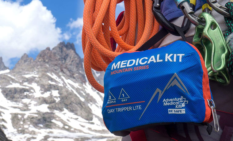
Every summit expedition we organize includes at least one designated rescue porter, a team member with specific first-response training who carries lighter personal equipment and is physically available to support an emergency descent at any point of the route. The rescue porter does not carry a standard expedition load; they carry the emergency medical kit, the supplemental oxygen, the portable stretcher, and the Gamow bag if one is included in the expedition’s equipment. This is not just an extra item on the team’s list; it is essential for making a safe descent possible from the icy high areas of Mount Stanley or from the distant upper camps on the six-peak routes.

The Gamow bag, a portable hyperbaric chamber that simulates descent by increasing air pressure around the patient, is one of the most effective emergency treatments for serious altitude illness. By inflating the bag with a foot pump, a guide can simulate the physiological equivalent of a 1,500- to 2,000-meter descent in altitude while the patient remains at the same physical elevation. This approach buys crucial time in a HACE or HAPE situation, where terrain or darkness limits the descent pace. Trekkers undertaking summit expeditions on the 8-Day Kilembe Trail or the 7-Day Central Circuit should confirm with their operator whether a Gamow bag is part of the expedition equipment.
GUIDE INSIGHTThe rescue porter is not there because accidents are common. They are there because the Rwenzori is a serious mountain and seriousness demands preparation. In over a decade of guiding on the Rwenzori, I have activated a full rescue carry three times. Each time, the outcome was positive precisely because the team was in place before the emergency occurred. You cannot assemble a rescue team after someone becomes seriously ill. |
Helicopter Access: The Reality, Not the Fantasy
Helicopter rescue is a topic that deserves a direct and honest answer rather than vague reassurance. In summary, helicopter rescue on the Rwenzori is theoretically feasible and does happen, but it is constrained by such significant factors that no responsible operator incorporates it as a primary response in their emergency protocol.

The Rwenzori’s cloud cover is the primary obstacle. The mountain generates its own persistent weather; this phenomenon is the same characteristic that gives it its extraordinary biodiversity and its famously difficult conditions, and the cloud base regularly sits below 3,000 metres, sometimes below 2,500 metres. Helicopter flight operations require a minimum ceiling of several hundred feet above the landing zone, and in the valleys and gorges of the Rwenzori’s mid-mountain terrain, those minimums are routinely unavailable. The upper mountain zones where the most serious altitude emergencies occur are, precisely because they are above cloud base, also the areas where hovering helicopter operations are most physically possible, but reaching them from a departure point at Kasese Airstrip involves transit through the cloud layers below, which creates its own operational constraints.
The Kasese Airstrip (Kasese Airport, code KSE) is the nearest fixed-wing landing point to the mountain, approximately thirty kilometers from the Nyakalengija trailhead. AMREF Flying Doctors, the East African air medical evacuation service based in Nairobi, operates aircraft and helicopters that can reach Kasese in approximately one to two hours from Nairobi or forty to sixty minutes from Kampala in optimal conditions. But AMREF’s Uganda operations are dependent on aircraft availability, pilot weather minimums, and daytime flight windows. Helicopter operations cannot realistically resolve a night emergency in poor weather on the upper mountain before dawn, regardless of the conditions.
Helicopter landing zones on the mountain itself are limited to certain open valley floors and cleared areas at the lower camps. Elena Hut, Bujuku Hut, and the upper Kilembe Trail camps do not have helicopter access under any operational conditions. The nearest feasible landing area above the trailhead on the Central Circuit is approximately in the Nyabitaba area (2,651 m), but even this location depends on conditions. What this means in simple terms is that if there is a serious emergency at Elena Camp, someone will need to guide the person down to a lower area before a helicopter can help, and by the time they get there, the person’s health is likely to be getting better.
The correct mental model is as follows: helicopter rescue is a useful tool for the final stage of evacuation, transporting a stabilized patient from the trailhead or Kasese to a Kampala hospital, not a primary rescue mechanism for the mountain itself. Our travel insurance guide provides a comprehensive explanation of the necessary coverage for both the helicopter and ground evacuation components in the event of an emergency.
Medical Facilities: From the Mountain to Kampala
At the Trailhead and Kasese
When an evacuation reaches the trailhead at Nyakalengija for the Central Circuit or at Kilembe for the Kilembe Trail, the Uganda Wildlife Authority park headquarters has basic medical provisions and trained staff who can perform a handoff assessment. Both trailheads have vehicle access capable of transporting a stretcher patient. From Nyakalengija, it is approximately twenty minutes by vehicle to Kasese town.
Kasese Municipal Hospital provides basic emergency care, imaging capabilities, intravenous fluid management, and physician assessment. For cases involving altitude illness, hypothermia, fractures, or acute respiratory distress, Kasese is a triage and stabilization point rather than a definitive treatment center. If Kampala-level care is needed, the patient will be transferred onward by road or air.
Kampala: Definitive Medical Care
International Hospital Kampala (IHK) and Case Medical Centre are the primary private medical facilities in Uganda’s capital offering advanced diagnostics, intensive care, and specialist consultation. Both institutions are familiar with altitude illness and high-altitude trauma presentations and have received Rwenzori evacuation patients. The overland journey from Kasese to Kampala takes approximately six to seven hours on a route that is entirely paved and generally reliable. AMREF Flying Doctors can reduce the journey to forty to sixty minutes of flight time for patients stable enough for transport.
Medical Repatriation
For cases requiring specialist care not available in Uganda, complex orthopedic surgery, neurosurgical intervention, or long-term intensive management, medical repatriation to the trekker’s home country becomes relevant. This is managed through the trekker’s travel insurance provider and AMREF’s regional evacuation coordination. The logistical complexity and cost of medical repatriation from Uganda make comprehensive insurance coverage not just advisable but financially essential for any trekker on a multi-day summit route.
Travel Insurance: What You Must Have for the Rwenzori
This section is not administrative formality. The difference lies between a well-managed emergency and one that results in a financial catastrophe on top of a medical one. Every trekker approaching Rwenzori on a summit route or any extended multi-day itinerary must carry travel insurance that explicitly covers the following, and they should verify each of these points in their policy wording before departure. Our comprehensive travel insurance guide for the Rwenzori Mountains goes into full detail on specific policy requirements and recommended providers.
High-Altitude Trekking Above 5,000 Metres
Many standard travel insurance policies contain altitude exclusion clauses that void medical cover above 3,000 metres, 4,000 metres, or 5,000 metres. For a Margherita Peak summit expedition, the relevant altitude reaches 5,109 metres. A policy that excludes altitudes above 4,500 meters is functionally useless for the most critical sections of your trek. Before purchasing, confirm explicitly in writing that your policy covers trekking up to 5,109 meters on a guided expedition.
Helicopter Rescue and Emergency Evacuation
Even given the practical limitations described above, helicopter involvement in Rwenzori evacuations does occur, and the cost can be substantial. AMREF helicopter charter rates for medical evacuations are significant, and the total cost of a coordinated air evacuation from Kasese to Kampala is not recoverable without appropriate insurance. Ensure your policy includes emergency evacuation coverage with a limit sufficient to cover both ground and air evacuations within Uganda, plus medical repatriation if needed.
AMREF Flying Doctors Membership
AMREF Flying Doctors membership is one of the most cost-effective emergency preparations available for trekkers spending extended time in East Africa, including most international visitors who combine the Rwenzori trek with a broader safari in Uganda or Rwanda. An annual membership (approximately USD 150 for East Africa coverage) provides access to AMREF’s air ambulance network, which operates from bases in Nairobi and Kampala, covers medical evacuation coordination, and includes access to a 24-hour medical advisory line. This membership complements but does not replace travel insurance; it is the operational mechanism by which aerial evacuation is coordinated on the ground.
Medical Treatment and Repatriation Cover
Ensure your policy covers inpatient medical treatment in Uganda at the realistic cost of private facility care and medical repatriation to your home country if required. A policy ceiling of USD 100,000 or more for medical treatment and repatriation is the minimum we consider adequate for a high-altitude summit expedition. For older trekkers or those with pre-existing medical conditions, reviewing the pre-existing condition clauses carefully is essential. Some policies provide cover for stable pre-existing conditions; others do not.
WARNINGDo not purchase travel insurance based on premium alone. The cheapest policies almost invariably contain altitude exclusions, adventure sports exclusions, or pre-existing condition exclusions that make them ineffective for a Rwenzori summit expedition. Verify every exclusion clause before paying. |
The UWA Rescue Fund and Park Emergency Infrastructure
Every trekker who enters Rwenzori Mountains National Park pays a mandatory rescue fund contribution as part of the park fee structure administered by the Uganda Wildlife Authority. This fund contributes to the maintenance of the mountain’s emergency infrastructure: the VHF radio network between camps, the UWA rangers and emergency staff stationed at the trailheads, and the basic medical provisions at the park headquarters.
It is worth being clear about what the rescue fund covers and what it does not. The UWA rescue contribution provides access to the park’s emergency response infrastructure guides, VHF communication, and basic ground-level support. It does not cover private medical expenses, hospital fees, helicopter charters, or any cost incurred outside the national park boundary. It is a contribution to the communal safety infrastructure, not a substitute for individual medical insurance. Every responsible operator explains this distinction clearly at the pre-trek briefing.
How Our Emergency Preparedness Differs from Minimum Standards
The minimum legal requirements for operating on the Rwenzori are set by UWA and include a registered guide, a mandatory rescue fund contribution, and standard park protocols. Our operational standards exceed these minimums in every category where it matters. For every summit trip we run, like the 7-Day Central Circuit or the 8-Day Kilembe Trail, we provide a dedicated rescue porter who is separate from the team carrying supplies; a full medical kit that includes oxygen, a Gamow bag, dexamethasone, nifedipine, and all necessary wound care items; satellite communication for areas where regular VHF signals don’t work; a pre-trek health check with each hiker to discuss altitude issues, existing health problems, and any medications they take; and a daily health assessment by the guide at each campsite to check oxygen levels, hydration, and sleep quality.
Our guides are trained in Wilderness First Responder protocols and have specific altitude illness management certification. They know the difference between an acclimatization headache and early HACE, between exertion fatigue and evolving HAPE. They know which combination of medications to administer, in which order, at which altitude threshold. That knowledge, applied by an experienced guide who has spent years on this specific mountain, is the most meaningful safety resource available to any trekker on our expeditions. For a detailed profile of what our mountain guides bring to each expedition, visit our Rwenzori mountaineering overview.
GUIDE INSIGHTWhen I do the pre-trek briefing on the morning of Day One, I tell every group the same thing: the emergency protocol is not for the worst-case scenario that we all hope never happens. It is the system that makes me comfortable taking people up to 5,109 meters with confidence. Knowing the plan makes me a better guide. Knowing the plan makes you a better trekker. We go through it together, every time. |
Reassurance for First-Timers: Putting the Risk in Proportion
If you have read this far and found yourself calculating risk rather than imagining the summit, it is worth pausing to put the information in proportion. The Rwenzori receives 1,000 to 1,500 trekkers per year. The overwhelming majority complete their treks without a medical incident of any significance. The routes are well-managed, the guide teams are experienced, and the park infrastructure, while not equivalent to a European alpine environment, is a functional emergency support system. The success rate for Margherita Peak with properly guided, adequately prepared parties is high. Serious altitude emergencies requiring full evacuation are uncommon events on this mountain.
The purpose of this guide is not to suggest that something will go wrong. This ensures that if something happens, you have the knowledge and preparation to respond appropriately, and that the operator you choose has the same. A first-timer planning their Rwenzori trek who has read this guide, selected a properly equipped and certified operator, purchased appropriate travel insurance, and understood the acclimatization principles outlined in our pre-acclimatization guide has done everything in their power to make their expedition both safe and successful. The mountain will do the rest.
Frequently Asked Questions: Rwenzori Medical Emergency & Evacuation Guide
What happens if I get altitude sickness on the Rwenzori?
If you develop symptoms of altitude sickness on the Rwenzori, such as headache, nausea, dizziness, or difficulty sleeping, your guide will conduct an assessment using the Lake Louise Score, a standard field diagnosis tool for AMS severity. Mild AMS is typically managed by halting ascent, resting at the current altitude, and monitoring for 24 hours. If symptoms do not resolve or worsen, descent begins immediately. For moderate to severe AMS, or any presentation suggesting HACE (ataxia, altered consciousness) or HAPE (breathlessness at rest, coughing), descent begins immediately without waiting for symptoms to stabilize. Our complete medical guide covers the full clinical picture of altitude illness management on the Rwenzori.
How long does evacuation from the upper Rwenzori take?
Evacuation timelines depend heavily on the starting camp and the patient’s mobility. From Elena Hut (4,541 m) to the Nyakalengija trailhead, an assisted carry under reasonable conditions takes approximately ten to fourteen hours, a full day of movement through technically demanding terrain. From Bujuku Hut (3,962 m), it takes eight to eleven hours. From John Matte Hut (3,505 m), five to seven hours. From Kilembe Trail’s Margherita Camp (4,540 m) to the Kilembe trailhead takes twelve to sixteen hours. These timelines are why the immediate response to a serious mountain emergency is always to begin descent rather than wait for external rescue.
Is helicopter rescue available on the Rwenzori?
Helicopter rescue is possible in principle but is not a reliable first-line emergency response on the Rwenzori. The mountain’s persistent cloud cover, complex terrain, and absence of formal landing zones at the higher camps mean that helicopter access is limited and weather-dependent. The nearest fixed-wing airstrip is Kasese Airport (KSE), approximately thirty kilometers from the Central Circuit trailhead. AMREF Flying Doctors operates air ambulance services from Nairobi and Kampala and can reach Kasese in one to two hours in good conditions. However, helicopter involvement is most practical for the final stage of evacuation, transporting a stabilized patient from the trailhead to Kampala, not for rescue from the mid- or upper mountain. Emergency planning for the Rwenzori should be built around guided descent as the primary response, with aerial transport as a secondary option for the final stage of evacuation.
What does a Rwenzori guide do when there is a medical emergency?
A trained Rwenzori guide’s immediate response to a medical emergency follows a structured protocol: rapid clinical assessment using the ABC framework (Airway, Breathing, Circulation), followed by altitude-specific assessment using the Lake Louise Score for AMS presentations. If the assessment indicates serious altitude illness (HACE or HAPE), hypothermia, or significant trauma, the guide initiates descent immediately, mobilizes the rescue porter, deploys emergency medications from the medical kit, communicates to park headquarters via VHF radio or satellite phone to alert support at the trailhead, and monitors the patient throughout the descent. The guide does not wait for the trekker to report feeling better if clinical signs indicate a serious condition. Decision authority in an emergency rests with the guide.
What travel insurance do I need for a Rwenzori trek?
Travel insurance for a Rwenzori summit expedition must explicitly cover trekking or mountaineering to altitudes of at least 5,200 meters (covering Margherita Peak at 5,109 meters with a margin); emergency evacuation and helicopter rescue; medical treatment in Uganda; and medical repatriation to your home country. Many standard travel policies contain altitude exclusions that void coverage above 3,000 to 4,500 metres; these policies are inadequate for a Rwenzori summit route and should not be purchased. We strongly recommend AMREF Flying Doctors membership (approximately USD 150 per year for East Africa) as a complement to travel insurance, providing direct access to East Africa’s primary air medical evacuation service. Our dedicated Rwenzori travel insurance guide provides specific guidance on policy requirements and covers the exclusion clauses to check before purchasing.
Can I be rescued by helicopter from Elena Hut?
No, Elena Hut at 4,541 metres does not have a helicopter landing zone, and the terrain and cloud conditions in the upper mountain zone make helicopter hover-and-lower operations extremely difficult. Even in ideal weather conditions, a helicopter cannot reliably reach and safely extract a patient from Elena Camp. The evacuation response from Elena Hut is a guided descent on foot, using the rescue porter and guide team, with the medical kit and, if necessary, a Gamow bag to manage the patient’s condition during descent. Helicopter involvement becomes feasible at lower altitudes once the descent team has reached the mid-mountain zone or, more reliably, once the patient has been evacuated to the trailhead and transported to Kasese Airstrip.
What is the Gamow bag, and does my expedition have one?
A Gamow bag is a portable hyperbaric chamber, essentially a sealed inflatable bag with a foot pump that simulates altitude descent by increasing air pressure around the patient. Inflating a Gamow bag at 4,500 metres creates internal pressure equivalent to an altitude of approximately 2,500 to 3,000 metres, providing significant physiological relief to a patient suffering from HACE or HAPE without any physical movement. It is one of the most effective emergency tools available at altitude and is standard equipment on all summit expeditions we operate. When evaluating operators for a Rwenzori summit bid, it is reasonable and important to confirm whether a Gamow bag is included in the expedition’s emergency kit.
What hospitals are near the Rwenzori Mountains?
Kasese Municipal Hospital, approximately thirty to forty minutes by vehicle from the Nyakalengija trailhead, provides basic emergency care, imaging, and physician assessments. It is adequate for stabilization and initial treatment of altitude illness, hypothermia, wound care, and fracture management. For cases requiring intensive care, neurosurgical assessment, or advanced imaging, patients are transferred to Kampala, approximately six to seven hours by road or forty to sixty minutes by AMREF air ambulance from Kasese Airstrip. International Hospital Kampala (IHK) and Case Medical Centre are the primary private facilities in Kampala with experience in altitude-related presentations and capacity for complex emergency management.
Plan Your Rwenzori Trek With an Operator Built for This Mountain
The Rwenzori demands preparation that goes deeper than fitness and gear. It demands an operator who has thought through every stage of the mountain experience, including the ones no one hopes to need. Our team has guided hundreds of expeditions on these mountains. We carry the equipment, hold the certifications, and maintain the protocols that make serious Rwenzori trekking as safe as demanding alpine environments allow. If you want to know exactly how we prepare for your specific route and itinerary, that conversation starts with a single message.
→ Contact Our Team to Start Planning Your Rwenzori Expedition


