Explore verified facts about the Rwenzori Mountains: height, glaciers, geology, wildlife & history, from Uganda’s Rwenzori trekking specialists
I have stood on the summit of Margherita Peak more times than I can now count from memory, and every single time, without exception, I have watched a client’s understanding of this mountain change completely somewhere between the trailhead and the glacier. Most trekkers arrive at Nyakalengija or Kilembe carrying a mental picture built from Kilimanjaro documentaries and vague African-safari associations, and almost none of that picture survives first contact with the real range. The Rwenzori Mountains are not a single volcanic cone. They are not seasonal in the way most of the world understands seasons. They are not, strictly speaking, “discovered” in the way popular history suggests. And they are, factually and verifiably, one of the strangest and most scientifically important mountain systems on the planet.
This article exists to correct the record properly, once, in full. What follows is a working guide to the facts that actually matter about the Rwenzori Mountains: what they are, how they were made, how tall they stand, why they carry permanent ice within a few degrees of the equator, what lives and grows on their slopes, and what more than a century of exploration and Bakonzo stewardship has taught us about them. Where a fact deserves more depth than a single guide article can hold, I have linked directly to the dedicated piece we have written on it, so that this page functions as the anchor point for everything else on the site. If you want the extended, thirty-item version of Rwenzori trivia after this, our 30 incredible facts about the Rwenzori piece goes further into individual curiosities. This article is the structural foundation underneath it.
What Exactly Are the Rwenzori Mountains?
The Rwenzori Mountains, known locally as the Rwenzururu and globally as the Mountains of the Moon, are a 120-kilometre-long mountain range straddling the border between Uganda and the Democratic Republic of the Congo. On the Ugandan side, they are protected as Rwenzori Mountains National Park, a roughly 1,000-square-kilometre UNESCO World Heritage Site administered by the Uganda Wildlife Authority. The range is not a single mountain but a chain of six distinct glaciated massifs, each with its own name, its own summit or summits, and its own approach route, which is a fact that surprises a great number of people who arrive expecting a single peak in the way Kilimanjaro or Mount Kenya present themselves.
The name “Rwenzori” derives from the local Bakonzo term generally translated as “rainmaker” or “place of snow,” a name that long predates any European encounter with the range and reflects an accurate, lived understanding of the mountain’s role in generating the region’s rainfall and river systems. For a fuller account of how the range earned both its indigenous and classical names, our dedicated piece on Ptolemy’s Mountains of the Moon and the Rwenzori’s naming history traces the full two-thousand-year story.
Where the Rwenzori Mountains Are Located
The range sits almost exactly on the equator, roughly 33 kilometres north of it, near the town of Kasese in western Uganda. This equatorial position is central to nearly every unusual fact about the mountain, since it is the reason a range this close to the equator can carry permanent glaciers, host five compressed vegetation zones within a single day’s walk of each other, and experience a rainfall pattern with two distinct wet seasons rather than the single wet-and-dry cycle found elsewhere in East Africa. The Ugandan portion spans three districts: Kasese, Kabarole, and Bundibugyo. Across the border, the Congolese slopes fall within Virunga National Park, meaning the Rwenzori sits at the meeting point of two of Africa’s most significant protected-area systems.
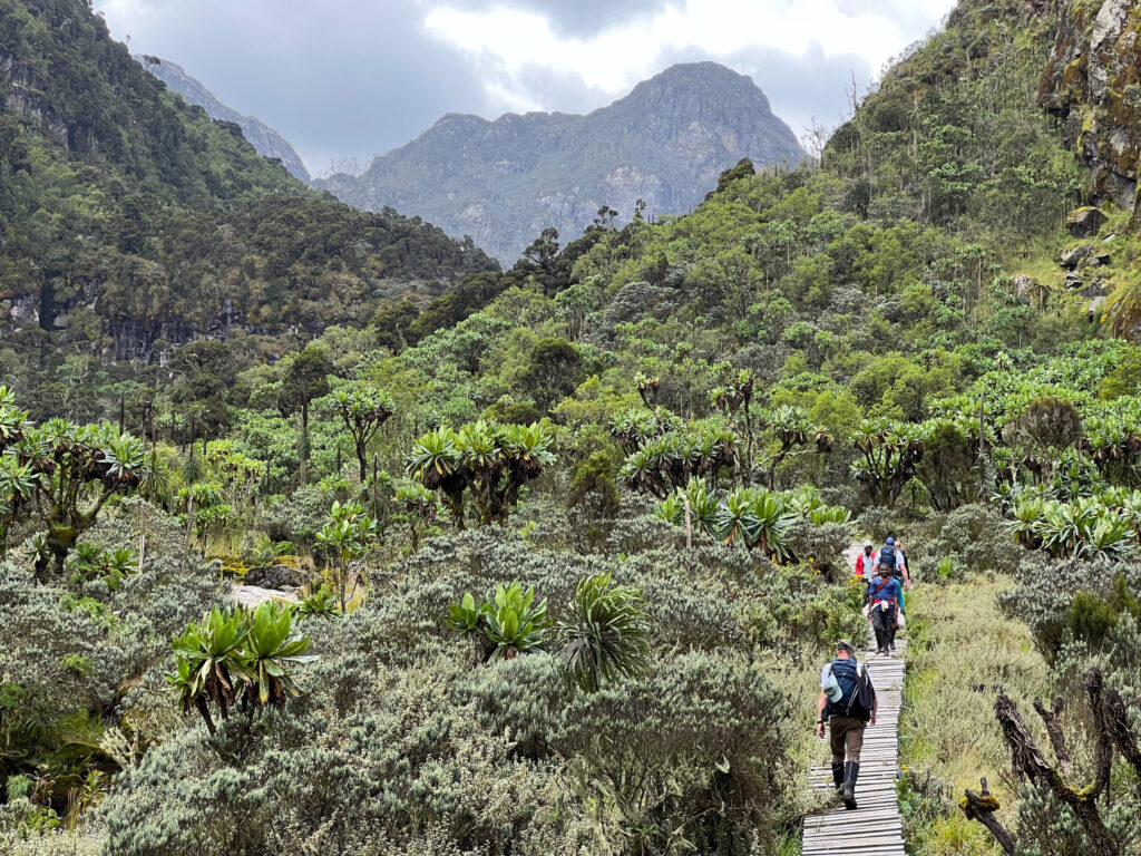
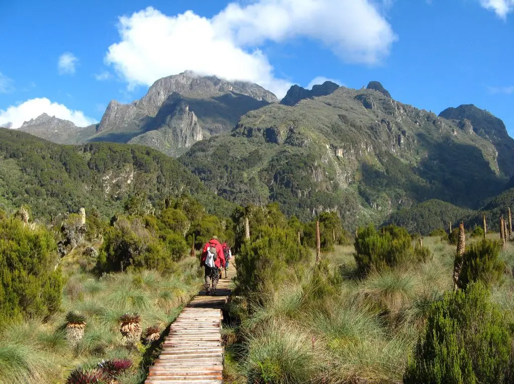
Trailheads on the Ugandan side are accessible from Kasese town, which functions as the logistical base for almost every expedition. The Central Circuit Trail begins at Nyakalengija, roughly 22 kilometres from Kasese; the Kilembe Trail begins at Kilembe, about 12 kilometres away; and the newer Bukurungu Wilderness Camping Trail enters from the Kasanzi gate on the range’s north-western flank. Our full Rwenzori Mountains map lays out every trailhead, route, and peak in relation to one another for anyone still deciding which approach fits their trip.
How the Rwenzori Mountains Were Formed
This is the single most consequential geological fact about the range, and it is the one that separates the Rwenzori conceptually from every other major East African mountain a trekker is likely to have researched. The Rwenzori are not volcanic. Kilimanjaro, Mount Kenya, and the Virunga range were all built by magma rising to the surface. The Rwenzori were built by faulting, an entirely different mechanism in which enormous blocks of ancient basement rock, some of it over two billion years old, were thrust upward along fault lines within the Albertine Rift, the western branch of the East African Rift System. The range is, in essence, a colossal tilted block of the Earth’s crust that has been forced upward between two parallel fault lines, rather than a cone built up from erupted material.
This distinction matters practically as well as intellectually. Because the Rwenzori is fault-block rather than volcanic, its rock is harder, older, and structurally more complex than the relatively young volcanic rock of Kilimanjaro, which is part of why the terrain feels more rugged, more broken, and in places more technical underfoot. The full mechanics of this process, including the role of the Albertine Rift and why the range continues to rise today, are covered in detail in our articles on the geology of the Rwenzori’s block-mountain formation and on how the Albertine Rift created the Rwenzori Mountains.
The Six Peaks and the Height of the Range
The Rwenzori range consists of six major glaciated massifs, each carrying multiple named summits, for a total of well over a dozen significant peaks across the chain. Understanding the range as six separate mountains rather than one is essential to planning a trek here, because it means a trekker is not simply choosing “the Rwenzori” as a destination but choosing among an entire portfolio of objectives, from the celebrated summit of Margherita Peak on Mount Stanley down to the quieter, technical slopes of Mount Luigi di Savoia. The table below sets out the six massifs and their highest points for quick reference.
| Massif | Highest Summit | Elevation |
| Mount Stanley | Margherita Peak | 5,109 m (16,762 ft) |
| Mount Speke | Vittorio Emanuele Peak | 4,890 m (16,040 ft) |
| Mount Baker | Edward Peak | 4,843 m (15,889 ft) |
| Mount Emin | Umberto Peak | 4,798 m (15,741 ft) |
| Mount Gessi | Iolanda Peak | 4,715 m (15,469 ft) |
| Mount Luigi di Savoia | Sella Peak | 4,627 m (15,180 ft) |
Margherita Peak, at 5,109 metres, is not only the highest point in the Rwenzori range but the highest point in Uganda and the third-highest summit on the African continent, exceeded only by Kilimanjaro and Mount Kenya. It sits within Uganda’s borders on the Mount Stanley massif, which straddles the Uganda–DRC boundary, and its full profile, including the technical glacier crossing that separates it from a straightforward trek, is covered on our dedicated Margherita Peak climb page. Interestingly, the actual highest point in the Democratic Republic of the Congo also lies on the Mount Stanley massif, a fact explored in our guide to the highest point in DR Congo. Between Stanley and Luigi di Savoia sit Mount Speke, Mount Baker, Mount Emin, and Mount Gessi, each accessible on multi-peak expeditions and each carrying its own distinct character, approach, and level of technical demand.
Glaciers on the Equator
Of every fact I share with first-time trekkers, this is the one that produces the most genuine disbelief: the Rwenzori Mountains carry permanent glaciers within roughly 33 kilometres of the equator. Standing on the Stanley Glacier at 5,000 metres, crampons on, ice axe in hand, in a country most people associate exclusively with tropical heat, is one of the most disorienting and memorable experiences in African mountaineering. This is possible because temperature, not latitude, governs whether ice can persist, and altitude drives temperature down by roughly 6°C for every 1,000 metres gained; by the time you reach the upper reaches of Mount Stanley, the environment is functionally polar despite sitting almost precisely on the equatorial line.

Cheptegei Peak, Rwenzori Mountains
The harder fact to sit with is that this ice is disappearing fast. The Rwenzori’s glaciers have retreated by more than 80 percent since they were first comprehensively photographed and mapped in 1906, and glaciologists project that the range’s remaining ice fields, along with those on Mount Kenya, will likely vanish entirely within the coming decades. Trekking the Rwenzori today means trekking through a landscape that is measurably, actively disappearing within a single human lifetime. We cover the mechanics, the projections, and what this means for the mountain’s future in full in our article on why the Rwenzori glaciers are disappearing.
The Five Vegetation Zones
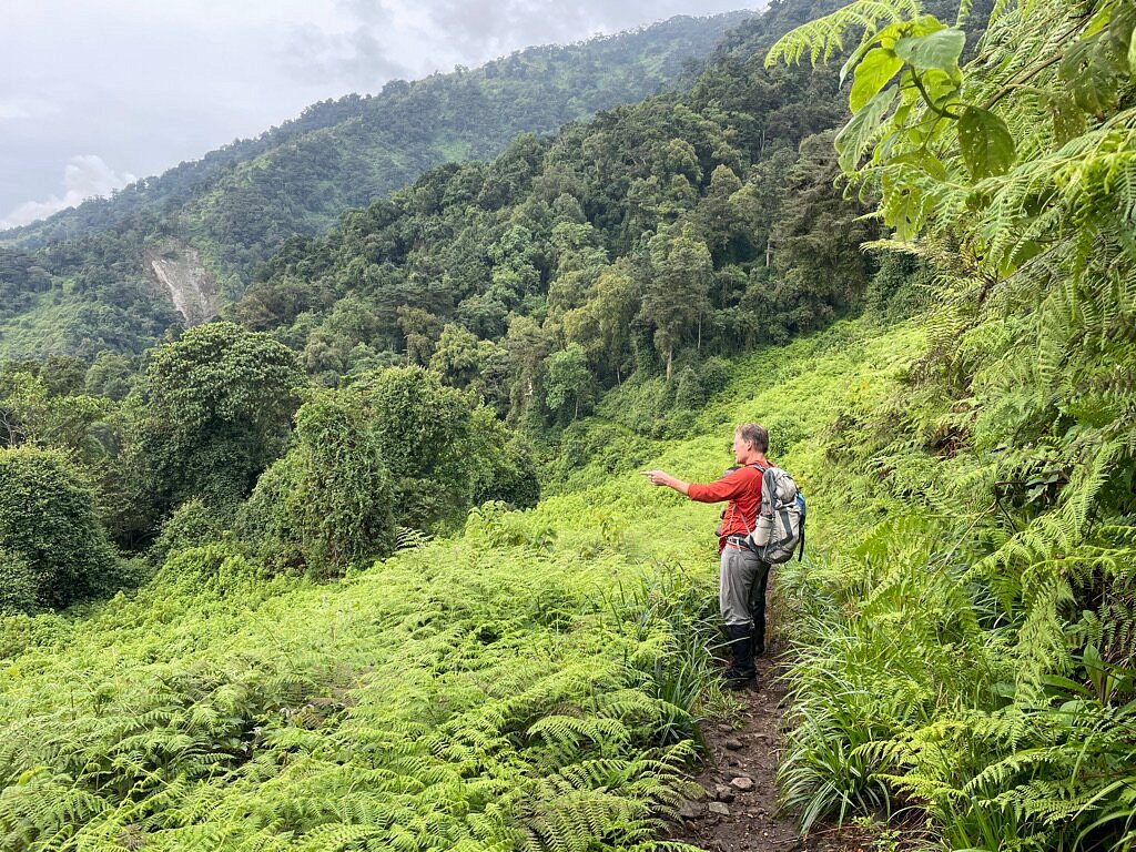
Few mountains on Earth compress as much ecological change into as short a horizontal distance as the Rwenzori. Ascending from the Kilembe trailhead at roughly 1,450 metres to Margherita Peak at 5,109 metres, a trekker passes through five distinct vegetation zones in the space of about 30 kilometres, a temperature gradient equivalent to travelling from equatorial Africa to sub-Arctic conditions without ever leaving Uganda. These are the Afro-Montane Forest, the Bamboo-Mimulopsis zone, the Heather-Rapanea zone, the Afro-Alpine moorland, and finally the Nival zone of bare rock, snow, and glacier ice above roughly 4,500 metres, where vegetation effectively ends except for hardy cushion plants and lichens clinging to the last sheltered rock faces.
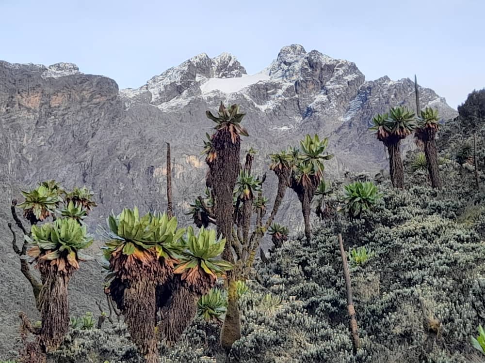
This zonation is not incidental scenery; it is one of the primary reasons UNESCO inscribed the range as a World Heritage Site, and it produces some of the most genuinely strange plant life anywhere on the continent, including giant lobelias and giant groundsels that grow to tree height at altitudes where almost nothing else survives. Our full vegetation zones guide breaks down the altitude ranges, defining species, and wildlife present in each zone, while our separate article on the range’s giant, prehistoric-looking plants goes deeper into the specific species that make the Afro-Alpine zone feel like walking through a different geological era entirely.
Wildlife Facts
The Rwenzori is not primarily a big-game destination in the way Uganda’s savannah parks are, and honest expectation-setting matters here: this is a mountain of birds, primates, and high-altitude endemics rather than large mammal sightings. The lower montane forest supports blue monkeys, black-and-white colobus, and the occasional forest elephant or duiker at the fringes, while the range as a whole is recognised as one of the most important sites in Africa for Albertine Rift endemic bird species, several of which, including the Rwenzori turaco and the collared apalis, occur nowhere else on Earth. The range’s isolation, created by the same rift-valley faulting that raised the mountains themselves, is what allowed this endemism to develop over evolutionary time.
What you will realistically see depends heavily on which altitude zone and which season you are trekking in, and setting accurate expectations before you arrive makes for a far better trip than assuming a savannah-safari density of animals. Our dedicated Rwenzori wildlife guide breaks this down zone by zone, covering realistic sighting probabilities, the range’s endemic species, and the conservation regulations that govern encounters within the national park.
Climate and Weather Facts
Because the Rwenzori sits directly on the equator, it does not experience a conventional four-season year. Instead, it has two wet seasons and two comparatively drier windows, driven by the passage of the Inter-Tropical Convergence Zone rather than by axial tilt. The mountain is also, famously, one of the wettest ranges in Africa; the lower and middle slopes receive extremely high annual rainfall, which is precisely why the range functions as one of the most important water catchments on the continent and one of the permanent sources of the River Nile. Weather here does not simply vary by month; it varies dramatically by altitude, with warm, humid montane forest at the base giving way to cold, frequently snow-dusted alpine conditions above 4,000 metres, sometimes within the same day.
The driest, most trek-friendly windows generally fall between December and February and again from June to August, though the Rwenzori’s equatorial position means rain and mist are realistic possibilities in any month, and trekkers should pack and plan accordingly rather than expecting the predictable dry-season certainty found on Kilimanjaro. If you are planning your trip dates specifically, it is worth reading our full climate and best-time-to-visit guides before booking.
UNESCO World Heritage Status and Conservation
Rwenzori Mountains National Park was established in 1991 and inscribed as a UNESCO World Heritage Site in 1994, recognised for the outstanding natural beauty of its glaciers, waterfalls, lakes, and, above all, the exceptional completeness of its five vegetation zones. According to UNESCO’s own listing, the park covers nearly 100,000 hectares, of which 70 percent lies above 2,500 metres, giving it a substantially larger alpine zone than either Kilimanjaro or Mount Kenya despite Margherita Peak being lower than both. The park was also designated a Ramsar Wetland of International Importance in 2009, in recognition of its role as a critical water catchment.
The park’s history has not been uninterrupted; insecurity linked to rebel militia activity forced its temporary closure between 1997 and 2001, and it briefly appeared on UNESCO’s List of World Heritage in Danger during that period before being removed once conditions stabilised. Today the park is managed by the Uganda Wildlife Authority, and every trekker entering it, regardless of route, is required to be accompanied by a UWA-certified guide at all times; solo trekking is not permitted under any circumstances. For a full breakdown of what this protection status means for planning, including entrance fees and permits, see our Rwenzori park entrance fees and permits guide.
History and Exploration Facts
The Rwenzori’s documented history stretches back nearly two thousand years before any European set foot on its slopes. The second-century Greek geographer Ptolemy described a range of snow-capped mountains in the interior of Africa, from whose melting snows the Nile drew its source, a description that maps remarkably well onto the Rwenzori’s actual hydrological role, and which is why the range carries the classical name “Mountains of the Moon” to this day. The first European to see and document the range with certainty was the explorer Henry Morton Stanley, in May 1888, during his Emin Pasha Relief Expedition, which is why the range’s highest massif today carries his name.
The first confirmed ascent of Margherita Peak came on 18 June 1906, led by Luigi Amedeo di Savoia, the Duke of Abruzzi, an Italian prince and one of the most accomplished mountaineers of his era, accompanied by the photographer Vittorio Sella, whose roughly 220 glass-plate images remain the most important visual record of the range’s glaciers before their modern retreat. The Duke’s expedition is also responsible for much of the naming convention still used across the range today, honouring European royalty on the highest summits and expedition scientists and explorers on the lower peaks, which is why Mount Luigi di Savoia’s twin summits are named Sella Peak and Weismann Peak. Our full account of the Duke of Abruzzi’s first climb of Margherita Peak and our separate deep dive into Ptolemy’s Mountains of the Moon cover both stories in full.
The Bakonzo People and Cultural Facts
No account of Rwenzori facts is complete without the range’s human history, which long predates and continues to outlast every European expedition. The Bakonzo people have lived on the slopes of the Rwenzori for generations, and their relationship to the mountain is not incidental to the trekking experience, it is central to it. Every guide and porter working on the range today is a certified Bakonzo mountain professional, carrying inherited, generational knowledge of the terrain, weather, and safe routes through the bogs that no amount of outside training could replicate. Ten percent of the proceeds from every trek we operate goes directly back into supporting local Bakonzo communities, their schools, homes, and orphan-support programmes, which means every booking is also a direct contribution to the people who have protected this landscape for generations.
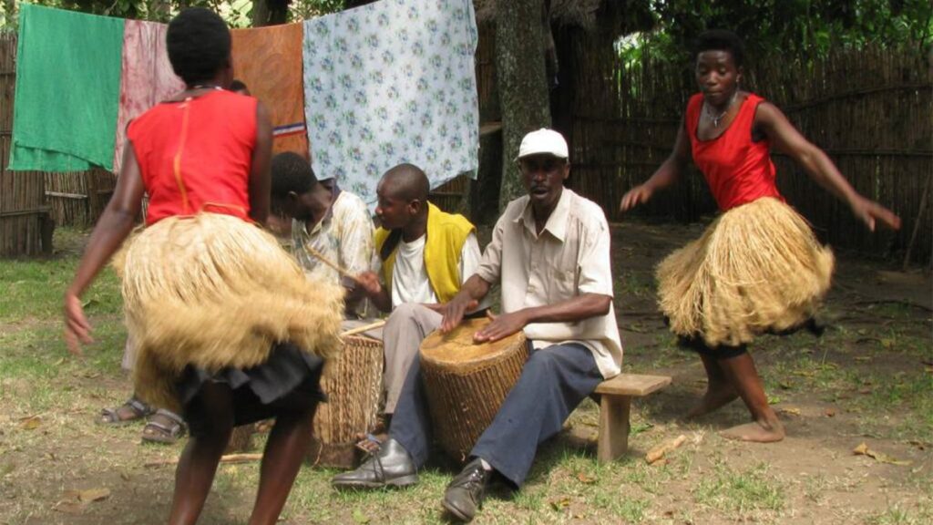
For readers who want to understand this dimension of the mountain in more depth, our articles on what makes the Rwenzori Mountains special and on what the Rwenzori Mountains are famous for both go further into the cultural and community side of a Rwenzori expedition, beyond the purely geological and ecological facts covered here.
Trekking Facts: Routes, Permits, and Access
There are three established routes into the Rwenzori’s high peaks. The Central Circuit Trail, the oldest and most established of the three, is managed by Rwenzori Mountaineering Services and begins at Nyakalengija; it is a hut-based route that takes roughly seven to nine days for a Margherita summit attempt. The Kilembe Trail, managed separately by Rwenzori Trekking Services, begins at Kilembe on the range’s southern side and typically runs eight to nine days, offering strong acclimatisation profile and hut infrastructure of its own. The newest option, the Bukurungu Wilderness Camping Trail, enters from the north-west and is a pure camping route with no huts, aimed at experienced wilderness trekkers who want an unmediated experience of the range and its four alpine lakes. A shorter, non-summit option, the three-day Mahoma Loop, offers a genuine taste of the lower forest and heather zones for trekkers without the time or fitness for a full summit expedition. Our detailed Central Circuit versus Kilembe comparison walks through the practical differences between the two main options in full.
Every route requires a Uganda Wildlife Authority park permit and a certified guide, and accommodation on both the Central Circuit and Kilembe trails is provided in mountain huts rather than tents, a fact that surprises trekkers expecting to carry their own camping equipment; our huts and camps guide sets out exactly what is provided on each route. A fully guided expedition to Margherita Peak typically runs seven to nine days and costs between roughly USD 1,800 and 2,500 per person depending on route, group size, and season, covering park fees, guide and porter wages, hut accommodation, and logistics, with full current figures available in our entrance fees and permits guide.
Frequently Asked Questions
What are the Rwenzori Mountains famous for?
The Rwenzori Mountains are famous for four things in combination: being one of the very few mountain ranges on Earth to carry permanent glaciers this close to the equator, being formed by tectonic faulting rather than volcanic activity, hosting five intact, scientifically exceptional vegetation zones within a single trek, and carrying the historic name “Mountains of the Moon,” first recorded by the Greek geographer Ptolemy nearly two thousand years ago. Together, these qualities earned the range its UNESCO World Heritage Site designation in 1994.
How tall are the Rwenzori Mountains?
The Rwenzori range reaches its highest point at Margherita Peak on Mount Stanley, which stands at 5,109 metres (16,762 feet). This makes it the highest point in Uganda and the third-highest peak in Africa, behind only Kilimanjaro and Mount Kenya. The range’s five other major massifs range from 4,627 metres at Mount Luigi di Savoia up to 4,890 metres at Mount Speke, so the “height” of the Rwenzori really refers to a chain of six separate high-altitude objectives rather than a single summit figure.
Are the Rwenzori Mountains volcanic?
No. Unlike Kilimanjaro, Mount Kenya, and the Virunga range, the Rwenzori Mountains are not volcanic. They were formed by faulting, a tectonic process in which massive blocks of ancient basement rock were thrust upward along fault lines within the Albertine Rift, the western branch of the East African Rift System. This makes the Rwenzori a fault-block, or horst, mountain range, built from rock that in places is more than two billion years old.
Do the Rwenzori Mountains have glaciers?
Yes, though they are retreating rapidly. The Rwenzori carries some of the last permanent glaciers in Africa, found on the upper slopes of Mount Stanley near Margherita Peak, despite the range sitting only about 33 kilometres north of the equator. Since these glaciers were first comprehensively photographed in 1906, they have retreated by more than 80 percent, and current projections suggest the remaining ice could disappear entirely within the coming decades, making a Rwenzori trek increasingly a race against climate change.
Why are the Rwenzori Mountains called the Mountains of the Moon?
The name traces back to the second-century Greek geographer Ptolemy, who described a range of snow-capped mountains deep in the African interior whose melting ice fed the source of the River Nile. His description corresponds closely to the Rwenzori’s actual geography and hydrological role, and the name “Mountains of the Moon” stuck through Arab and later European geography, even though the range was not conclusively identified and documented by a European until Henry Morton Stanley sighted it in 1888.
Where are the Rwenzori Mountains located?
The Rwenzori Mountains sit on the border between western Uganda and the Democratic Republic of the Congo, roughly 33 kilometres north of the equator, near the Ugandan town of Kasese. The Ugandan side of the range is protected as Rwenzori Mountains National Park, spanning the Kasese, Kabarole, and Bundibugyo districts, while the Congolese slopes form part of Virunga National Park.
How many peaks are in the Rwenzori Mountains?
The range consists of six major glaciated massifs, each carrying multiple named summits: Mount Stanley (highest point Margherita Peak, 5,109 m), Mount Speke (4,890 m), Mount Baker (4,843 m), Mount Emin (4,798 m), Mount Gessi (4,715 m), and Mount Luigi di Savoia (4,627 m). Counting individual named summits across all six massifs, the total number of significant peaks in the range is well over a dozen.
Is trekking the Rwenzori Mountains harder than Kilimanjaro?
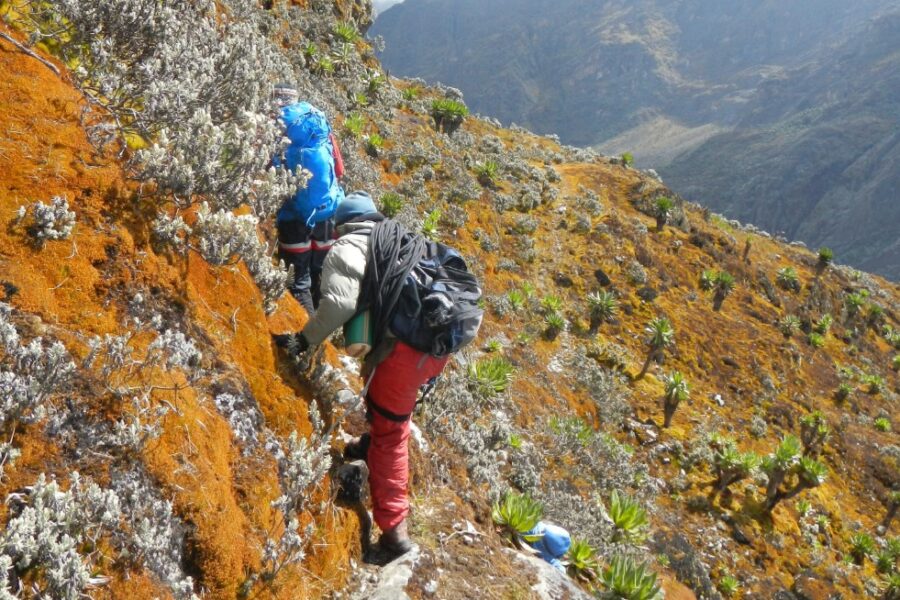
Most experienced guides, myself included, rate the Rwenzori as more physically and technically demanding than the standard Kilimanjaro routes. The terrain is rockier and more broken as a result of the range’s non-volcanic origin, the trails involve extensive bog-crossing, and the final approach to Margherita Peak requires roped glacier travel and basic technical climbing, none of which the standard Kilimanjaro trekking routes require. It is a serious mountaineering objective rather than a long walk to altitude.
Plan Your Rwenzori Trek
The Rwenzori Mountains reward preparation more than almost any range I have guided on, precisely because so much of what makes them extraordinary, the glaciers, the faulted geology, the compressed vegetation zones, the Bakonzo knowledge embedded in every route, only becomes real once you are standing inside it rather than reading about it. If these facts have done their job, you now understand this mountain the way a serious trekker should before setting foot on the trail. The next step is turning that understanding into a plan: a route, a season, and a team. Contact our expedition team directly and we will help you design the Rwenzori trek that fits your experience, timeline, and ambitions, whether that is a summit push on Margherita, a multi-peak expedition across the range, or an introductory trek through the lower vegetation zones.