Discover the Rwenzori Mountains’ climate zone by zone: rainfall, temperature, glaciers, and the best season for your trek. Expert guide.
Every mountain range has weather. Very few mountain ranges have a climate this layered, this contradictory, and this consequential for the people trying to climb through it. In the space of a single trekking day on the Rwenzori, you can walk out of a humid equatorial rainforest at twenty-five degrees Celsius, climb into a bamboo belt wrapped in cold drizzle, cross a moorland where hailstorms arrive out of nowhere at three in the afternoon, and finish the day shivering in a hut where the overnight temperature drops below freezing. I have guided groups through this sequence more times than I can count, and it never stops being the single hardest thing to explain to a first-time Rwenzori trekker over email. People ask “what’s the weather like?” as though there is one answer. On the Rwenzori, there are at least five, stacked vertically on top of each other, and understanding how they work is the difference between a trekker who arrives prepared and one who arrives with the wrong sleeping bag at 4,500 metres.
This guide sets out, in full, what actually happens to temperature, rainfall, humidity, cloud, and ice as you climb from the Nyakalengija and Kilembe trailheads to the glaciated summit of Margherita Peak. It draws on years of first-hand guiding experience on both the Central Circuit Trail and the Kilembe Trail, and it is written to be the single most complete answer available anywhere to the question of what the Rwenzori’s climate is actually like, month by month, zone by zone, and metre by metre.
Why the Rwenzori’s Climate Defies the Standard Equatorial Mountain Model
The Rwenzori sits almost directly on the equator, straddling the border between Uganda and the Democratic Republic of Congo along the floor of the Albertine Rift, the western arm of Africa’s Great Rift Valley. That position alone tells you very little about what conditions on the mountain actually feel like, because the Rwenzori’s climate is shaped by three forces working together rather than any single one acting alone.
The first is latitude. Sitting almost exactly at zero degrees means there is essentially no meaningful seasonal swing in day length or sun angle. The sun rises and sets at close to the same time every day of the year, and solar radiation at altitude is intense and constant rather than seasonal. The second is altitude. The range climbs from a valley floor around 1,450 metres to 5,109 metres at the summit of Margherita Peak on Mount Stanley, a vertical gain of more than 3,600 metres within a horizontal distance most trekkers cover on foot in under a week. Every thousand metres of ascent costs roughly six to seven degrees Celsius of average temperature, which is why the Rwenzori can put a trekker through the thermal range of a full hemisphere’s worth of latitude in a single expedition. The third, and the one visitors consistently underestimate, is the Rwenzori’s position relative to the Congo Basin’s moisture supply and the deep, glacier-carved valleys that trap and funnel that moisture upward against the massif. Unlike the isolated volcanic cones of Kilimanjaro or Mount Kenya, which stand apart from major moisture sources on relatively dry plains, the Rwenzori is fed almost continuously by warm, humid air drawn off the Congo Basin to the west, forced upward against the range, and wrung out as rain, mist, and cloud on a near-daily basis.
The result is a mountain that does not really have distinct seasons in the way a temperate mountain range does. It has degrees of wetness, degrees of cold, and a vertical sequence of climate belts, each with its own rules, that a trekker passes through in a matter of days rather than a matter of weeks or a change of latitude.
The Five Climate Belts of the Rwenzori
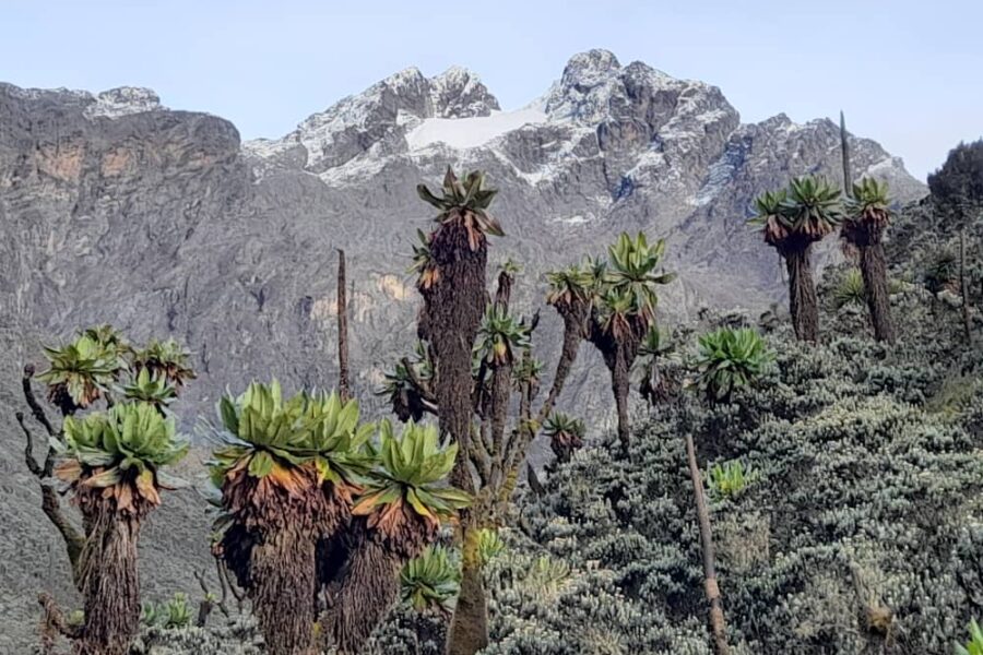
The most useful way to understand Rwenzori weather is not by month but by altitude. The mountain’s climate divides into five broadly recognised belts, and each one corresponds closely to the five vegetation zones that made the range a UNESCO World Heritage Site in the first place. Vegetation on the Rwenzori is, in large part, a visible record of climate; the giant heathers, giant groundsels, and afro-alpine bogs did not develop by accident, they developed because of the specific combination of temperature, rainfall, and UV exposure at each elevation band.
The Montane Forest Belt: Warm, Wet, and Alive
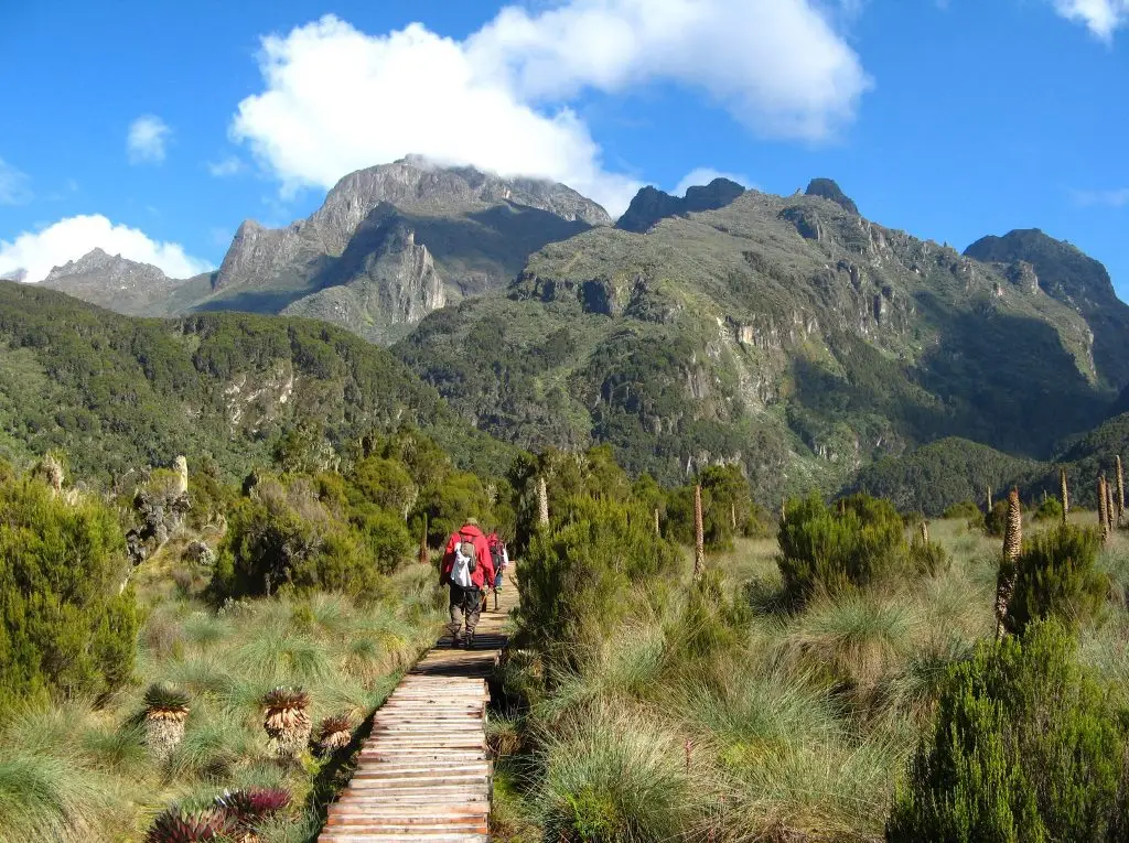
At the trailheads, whether Nyakalengija on the Central Circuit or Kilembe on the southern approach, the climate feels tropical because it is tropical. Daytime temperatures in the montane forest routinely sit between eighteen and twenty-six degrees Celsius, humidity hovers close to saturation for much of the year, and afternoon rain showers are close to a daily occurrence regardless of season.

This is the zone of chimpanzees, L’Hoest’s monkeys, and dense equatorial canopy, and it is also the zone where trekkers most often overheat in the wrong layering system, arriving in insulated jackets suited for the summit and sweating through the first two hours of trail.
The Bamboo Belt: The Mountain’s First Real Chill
Climbing above roughly 2,500 metres, the forest gives way to dense bamboo and Mimulopsis thickets, and the climate shifts noticeably.
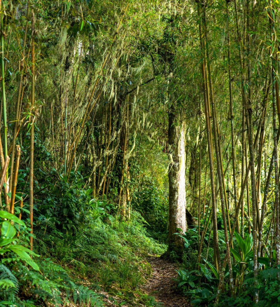
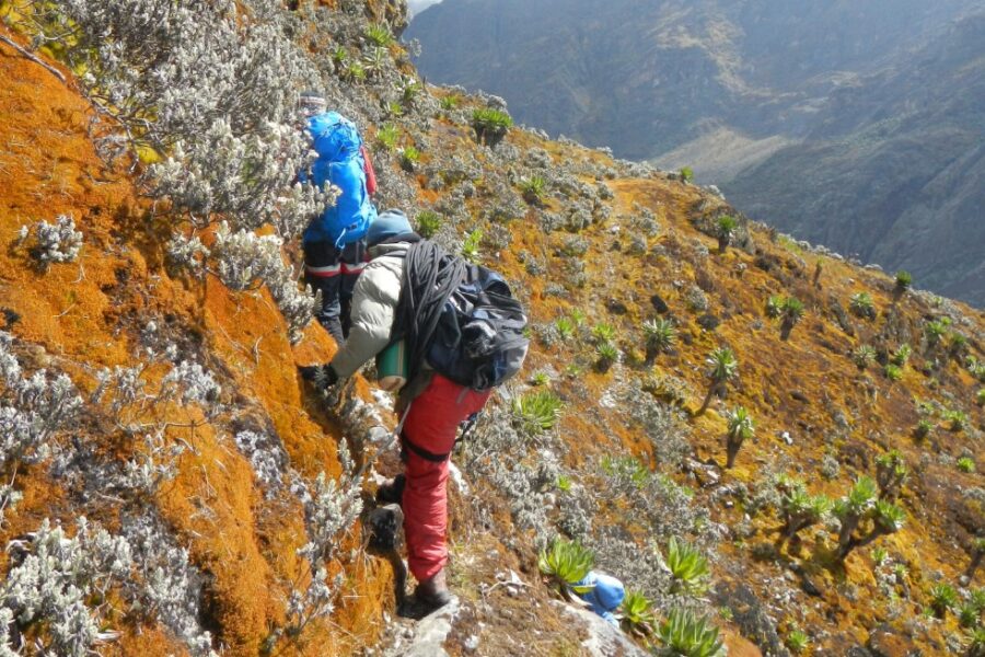
Cloud sits lower and more persistently here, temperatures drop into the low teens even at midday, and rainfall, if anything, intensifies rather than eases. This belt is frequently the muddiest section of trail on both major routes, a direct consequence of high, near-constant precipitation combined with limited direct sunlight to dry the ground between rain events.
The Heather-Moorland Belt: Where the Rwenzori Starts to Feel Alpine
Above 3,000 metres, bamboo thins out and gives way to giant heather forest and open moorland, and this is the belt where most trekkers first genuinely feel cold. Daytime highs rarely exceed fourteen degrees Celsius, overnight temperatures at camps like Bujuku Hut regularly fall close to freezing, and the moorland’s open exposure means wind chill becomes a real factor for the first time on the ascent. Hailstorms are a genuine and fairly common feature of this belt, typically arriving in the early to mid afternoon as convective cloud builds over the massif.
The Afro-alpine Belt: Freezing Nights, Fierce Sun
Between roughly 3,800 and 4,500 metres, the climate becomes genuinely high-mountain. Overnight temperatures fall reliably below freezing, sometimes well below it, while daytime sun at this altitude, filtered through thinner air and reflected off surrounding rock and residual ice, delivers UV exposure intense enough to cause serious sunburn within an hour of unprotected skin. This is the double-edged character of equatorial high altitude: brutal cold at night, fierce solar radiation by day, often within the same twenty-four-hour period.
The Nival and Glacial Zone: Permanent Winter on the Equator
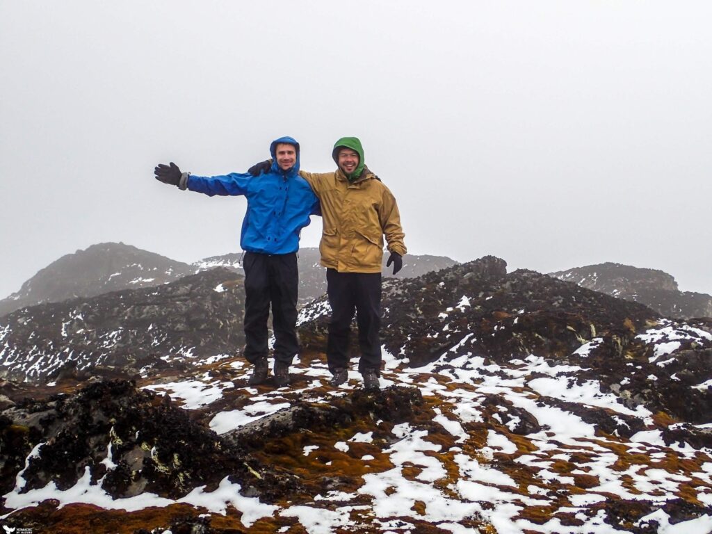
Above 4,500 metres, the Rwenzori enters permanent winter. This is the realm of Elena Hut, Margherita Camp, and the approach to the summit glaciers, where sub-zero temperatures are the norm rather than the exception, wind exposure is constant, and the mountain’s remaining ice fields cling to existence in defiance of their equatorial latitude.
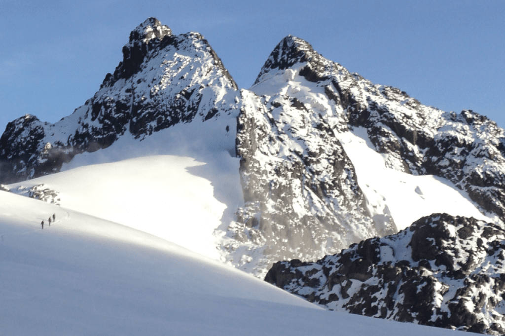
Our companion guide on whether you will see snow on the Rwenzori covers exactly what this zone looks and feels like on summit day.
Rainfall: The Wettest Major Trekking Range in East Africa
If there is one climate fact every prospective Rwenzori trekker needs to internalise before booking, it is this: there is no dry season on this mountain in the way that term is understood on Kilimanjaro or in the Virunga volcanoes. The Rwenzori receives measurable rainfall in every month of the year, a reality we cover in exhaustive detail in our dedicated piece on how much it actually rains in the Rwenzori. What changes through the year is not whether it rains, but how much, how often, and how disruptively.
The Two Wet Seasons
East Africa’s bimodal rainfall pattern applies to the Rwenzori just as it does to the wider region, producing two distinct wet seasons. The long rains run roughly from March through May, and the short rains from September through November. During these windows, rainfall becomes heavier, more sustained, and less predictable in its daily timing, trails turn to deep bog in the bamboo and lower heather zones, and river crossings on routes like the Central Circuit can shift from routine to genuinely hazardous within a few hours of sustained upstream rain, a dynamic explored fully in our guide to the mountain’s rivers and crossings. Yet wet-season trekking is not simply a diminished version of dry-season trekking. Cloud cover moderates the brutal overnight cold of the upper camps, the vegetation is at its most vivid, other trekking parties are scarce, and prices on combination packages typically fall. Our full breakdown of what a rainy-season Rwenzori expedition actually involves, and who should consider one, is available in our dedicated wet season trekking guide.
The Two Drier Windows
Between the wet seasons sit two comparatively drier windows: a longer one from June through August, and a shorter one from December through February. “Dry” on the Rwenzori is a relative term. Even at the height of the June-to-August window, rain falls on most days somewhere on the mountain, typically arriving as afternoon cloud build-up and showers after clear mornings, rather than the sustained multi-day downpours characteristic of the wet seasons. What genuinely improves during these windows is trail firmness, river crossing safety, and summit visibility, which is why the vast majority of Margherita Peak attempts are scheduled within them.

Our month-by-month guide to Rwenzori trekking conditions from January to December and our dedicated best time to visit resource both go far deeper into planning around these windows than is possible here.
Temperature: How Cold Does It Actually Get?
Temperature on the Rwenzori is a function of altitude far more than it is a function of the calendar. At the trailhead, daytime temperatures rarely fall outside the eighteen-to-twenty-six-degree range at any time of year. By the time a trekker reaches Elena Hut or Margherita Camp above 4,500 metres, overnight temperatures of minus five to minus ten degrees Celsius are entirely normal, and colder snaps below minus ten are not unusual during clear, dry-season nights when there is no cloud cover to trap residual heat. This is precisely why our detailed 7-day Margherita Peak itinerary specifies a sleeping bag rated to at least minus ten degrees Celsius as non-negotiable equipment.
A subtlety that catches even experienced mountaineers off guard is the disconnect between air temperature and felt temperature at altitude on the equator. Because the sun angle stays high year-round, direct sunlight at 4,000 metres can feel intensely hot on exposed skin even when the ambient air temperature is close to freezing, while stepping into shade or cloud shadow can produce an immediate, dramatic temperature drop. Trekkers frequently find themselves removing insulating layers in direct sun and putting them straight back on the moment cloud passes overhead, sometimes within the same ten-minute stretch of trail.
Humidity, Mist, and the Rwenzori’s Perpetual Cloud
Humidity on the Rwenzori sits consistently high through most of the elevation range, a direct product of the range’s proximity to Congo Basin moisture and the way its deep valleys trap rising air. Below 3,000 metres, relative humidity frequently exceeds eighty or ninety percent, and mist is a near-constant companion rather than an occasional weather event, particularly in the bamboo belt where cloud tends to sit low against the vegetation canopy for much of the day. This persistent moisture is also the reason the Rwenzori’s rivers run as powerfully as they do even outside the two wet seasons, and it is part of why the mountain’s vegetation zones are so exceptionally lush and species-rich compared with the drier volcanic ranges elsewhere in East Africa. Above 4,000 metres, humidity behaves differently: the air itself carries less moisture in absolute terms simply because cold air holds less water vapour, but cloud still forms rapidly around the peaks most afternoons as rising warm air condenses against the cold upper massif, which is why summit attempts are almost universally scheduled for the early morning hours, well before the daily cloud build-up obscures the route and drops visibility on the glacier.
Glaciers and the Rwenzori’s Vanishing Equatorial Ice
No account of Rwenzori climate is complete without addressing the mountain’s glaciers directly, because they are simultaneously a product of that climate and one of its most visible casualties. Permanent snow and ice on the Rwenzori begin at approximately 4,500 metres on the range’s highest massifs, Mount Stanley, Mount Speke, and Mount Baker, and their persistence at this altitude on the equator is, in strict climatological terms, an anomaly. Theoretical models of tropical glaciation suggest permanent ice should not exist below roughly 5,500 metres given current global average temperatures, yet the Rwenzori’s exceptional and near-constant moisture supply has allowed ice to persist a full kilometre below that threshold, continuously replenished by precipitation even as warming temperatures work against it. Our dedicated guide on crossing the Stanley Glacier explores exactly what this equatorial ice environment feels like underfoot.
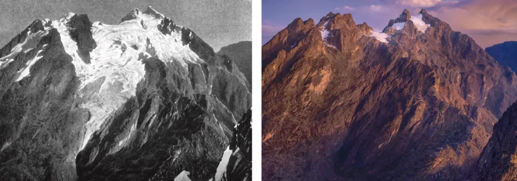
That persistence is under serious and accelerating threat. Satellite and ground-based observation shows the Rwenzori’s glaciers have lost more than eighty percent of their extent since the Duke of Abruzzi’s pioneering 1906 survey of the range, a retreat documented in detail in our piece on why the Rwenzori glaciers are disappearing and in the broader history of the Rwenzori Mountains. Climate scientists treat the Rwenzori’s ice as a particularly sensitive indicator of tropical atmospheric warming precisely because small equatorial glaciers respond faster and more visibly to temperature change than the vast polar ice sheets, where the same warming trend takes far longer to register. For trekkers, the practical consequence is straightforward: the glaciated summit routes you climb today are measurably smaller than the ones climbed a generation ago, and every guide who has worked this mountain for more than a decade can point to bare rock and moraine where solid ice used to sit.
How the Rwenzori’s Climate Compares to Kilimanjaro and Mount Kenya
Trekkers researching East African mountains for the first time often assume the region’s high peaks share a broadly similar climate, and this assumption causes more packing and planning mistakes than any other. Kilimanjaro and Mount Kenya are both volcanic, standing largely isolated above surrounding savannah and semi-arid plains with comparatively limited moisture supply feeding their slopes. Their climate belts are correspondingly thinner and drier, their dry seasons are closer to genuinely dry, and their trails, while cold and demanding at altitude, rarely present the sustained, days-long bog conditions typical of the Rwenzori’s lower belts. The Rwenzori’s non-volcanic, block-faulted origin along the Albertine Rift, combined with its direct exposure to Congo Basin moisture, produces a wetter, muddier, and in most respects more physically demanding mountain underfoot, even though its summit altitude of 5,109 metres is lower than Kilimanjaro’s 5,895 metres. Many experienced mountaineers who have climbed both describe the Rwenzori as the harder trek precisely because of this climate difference: less about thin air, more about relentless wet cold and technically difficult ground.
How Climate Should Shape Your Trek Planning
Every practical decision a Rwenzori trekker makes, from route selection to departure date to the contents of a duffel bag, should be filtered through the climate realities described above. Because rain falls somewhere on the mountain in every month, waterproofing is never optional, and our detailed guides on what climbing gear you actually need and what clothing works best on the Rwenzori both exist because generic packing advice copied from a Kilimanjaro blog consistently fails on this mountain. Because temperatures swing from tropical warmth to sub-zero exposure within the span of a single trek, layering systems need to cover a wider thermal range than most trekkers initially expect, and technical items like crampons and ice axes, addressed fully in our crampons and ropes guide, are essential rather than optional for any summit attempt.

And because standard travel insurance policies frequently exclude high-altitude trekking and glacier travel, reviewing coverage carefully before departure, as covered in our travel insurance guide, is a step we recommend to every client regardless of which season they choose to travel in.
Route choice interacts with climate too. The Central Circuit Trail and the Kilembe Trail traverse broadly the same climate belts but approach them from different valleys with different exposure and drainage characteristics, and our detailed comparison of which Rwenzori route is better addresses how each trail behaves under wet versus dry conditions. Whichever route and season you choose, our full Rwenzori Mountains guide and our Frequently Asked Questions page cover the remaining planning questions that fall outside the scope of climate specifically, from permits and pricing to acclimatisation schedules for Margherita Peak and the range’s other five major summits.
Frequently Asked Questions About Rwenzori Mountain Climate
Does it rain every day on the Rwenzori Mountains?
Not every single day, but rain falls somewhere on the mountain in every month of the year, and during an average multi-day trek it is unusual to complete the trip without encountering rain on at least several days. The lower montane forest and bamboo belts see the most frequent rainfall, often as predictable afternoon showers, while the upper mountain sees rain, hail, or snow depending on temperature at the time.
What is the coldest part of a Rwenzori trek?
The coldest conditions occur overnight at the highest camps, particularly Elena Hut and Margherita Camp above 4,500 metres, where temperatures regularly fall to minus five or minus ten degrees Celsius and colder snaps below minus ten are possible on clear nights. Summit day itself, undertaken before dawn to reach the peak while visibility is best, is typically the coldest few hours of the entire expedition.
Is the Rwenzori colder or wetter than Kilimanjaro?
The Rwenzori is generally wetter than Kilimanjaro at every altitude band, a consequence of its proximity to Congo Basin moisture rather than Kilimanjaro’s drier, more isolated volcanic setting. Summit temperatures on Kilimanjaro can be colder in absolute terms because its summit sits nearly 800 metres higher, but the Rwenzori’s combination of sustained rain, bog, and humidity makes it the more physically demanding mountain underfoot for most trekkers.
When is the driest time to climb the Rwenzori Mountains?
The two comparatively driest windows are June through August and December through February. Neither period is rain-free, but both offer firmer trails, safer river crossings, and better summit visibility than the wet-season months of March through May and September through November.
Why are there glaciers on a mountain at the equator?
The Rwenzori’s glaciers persist at the equator because the combination of high altitude, above 4,500 metres on the range’s tallest massifs, and exceptionally heavy year-round precipitation allows permanent ice to form and partially replenish itself despite the constant, intense equatorial sunlight. Rising global temperatures are steadily eroding this balance, and the glaciers have lost more than eighty percent of their extent since the early twentieth century.
Do I need different gear for wet-season versus dry-season Rwenzori trekking?
The core gear list stays largely the same across seasons because rain and cold are present year-round, but the emphasis shifts. Dry-season trekkers should prioritise a warm, high-quality sleeping bag and strong sun protection for the clearer, colder nights and more intense UV exposure, while wet-season trekkers should prioritise the highest-quality waterproof outer layers and footwear, since sustained rain and deeper bog conditions are more likely during those months.
Plan Your Rwenzori Trek With Guides Who Know This Climate Firsthand
Understanding the Rwenzori’s climate on paper is one thing. Standing in the bamboo belt in a cold drizzle, or watching cloud roll off the Congo Basin and swallow Mount Stanley twenty minutes before you reach it, is another. That is the difference experienced local guiding makes, and it is exactly what we offer every trekker who books with us, route selection, seasonal timing, and gear advice calibrated to the specific conditions you will actually face on your dates, not generic advice copied from another mountain. If you are ready to start planning a Rwenzori expedition built around real climate expertise, get in touch with our team and let’s start mapping out the right route, the right season, and the right preparation for your trek to the roof of the Mountains of the Moon.