Discover every major river in the Rwenzori Mountains: Mubuku, Nyamwamba, Bujuku & more, where they rise, where they flow, and how to cross them.
Long before you see the Rwenzori, you hear it. Standing at the Nyakalengija trailhead with your boots still dry, or descending through the equatorial dusk toward Kasese the evening before, the sound reaches you first: a low, continuous roar rolling down out of the forest, the noise of a mountain range that receives more than three metres of rain a year being funneled through a thousand channels of falling and rushing water. I have guided treks into these mountains for many seasons, and I still notice it on every trip, that moment when a first-time trekker realises the sound they assumed was wind is actually water, moving somewhere close by but out of sight, powerful enough to be felt in the chest as much as heard in the ears.
Rivers are not incidental to the Rwenzori experience. They are one of the central facts of this mountain, as defining to its character as its equatorial glaciers, its giant lobelia forests, or its six named massifs. Every itinerary we run, whether it is the Central Circuit Trail to Margherita Peak, the waterfall-lined Kilembe Trail, or a short introduction on the Mahoma Loop, is shaped by rivers: where they are crossed, where they are camped beside, where they are drunk from, and where, in a handful of dramatic places, they are watched falling for fifty metres or more off a cliff face. This guide is the account I wish had existed when I first started guiding here: the complete, first-hand story of every significant Rwenzori river, where each one is born, what it looks like on the ground, where it eventually goes, and what all of this means for the trek you are planning.
Why the Rwenzori Is One of Africa’s Great Water Towers
The Rwenzori range sits at the point where the Albertine Rift is at its most dramatic, a slab of ancient crystalline rock thrust nearly four kilometres above the floor of the rift valley by the same tectonic forces described in detail in our guide to the Albertine Rift’s formation of these mountains. That geology matters enormously to the story of the mountain’s rivers. Rwenzori bedrock is largely impermeable gneiss, granite, and amphibolite, among the oldest exposed rock on the African continent, as our full geology guide explains. Rain that falls on this rock cannot soak away into an aquifer the way it can on a porous volcanic mountain like Kilimanjaro. Instead it runs off almost immediately, gathering into streams within minutes of reaching the ground and building, within a few kilometres, into the powerful, cold, boulder-strewn rivers that define the lower and middle sections of every Rwenzori trail.
The scale of that runoff is genuinely significant beyond the boundary of the park. Rwenzori Mountains National Park was designated a Ramsar Wetland of International Importance in 2008, a recognition, detailed in our history of the Rwenzori Mountains, of the range’s role as one of the most reliable and permanent water sources feeding the Nile and Congo river systems. River-gauge studies from the mountain’s eastern slopes have found that Rwenzori runoff contributes roughly a billion cubic metres of water a year to Lake George alone, close to half of that lake’s entire water income. For the farming communities of Kasese, Kabarole, and Bundibugyo districts, and for the wildlife of neighbouring Queen Elizabeth National Park, the Rwenzori is not simply a beautiful mountain to trek. It is the water tower on which their entire agricultural and ecological system depends.
How a Rwenzori River Is Born
Every significant river on this mountain draws on two sources working together. The first is the mountain’s permanent and seasonal ice: the glaciers and snowfields clinging to the upper flanks of Mount Stanley, Mount Speke, and Mount Baker, the subject of our first-timer’s guide to crossing the Elena Glacier. Meltwater from these ice fields feeds the headwaters of the mountain’s central river system directly, particularly through the Bujuku and Mubuku catchments that drain the col between Stanley and Speke. The second, far larger source is simply rain. The Rwenzori’s five stacked vegetation zones, montane forest, bamboo, heather, Afro-alpine moorland, and bare rock, intercept and store an extraordinary volume of precipitation, and nowhere is that storage more visible than in the ancient peat bogs of the upper valleys.
The Bujuku Valley is the clearest example of this on the mountain. Its floor is a peat bog estimated to be one to two metres deep in places, built up over five to eight thousand years, and it functions exactly like a sponge: soaking up rainfall and glacial meltwater during and immediately after storms, then releasing it slowly and steadily into the Mubuku River system for days afterward. This is why Rwenzori rivers, unlike the flash-flood-prone watercourses of many drier mountain ranges, tend to run with a persistent, muscular volume even several days into a dry spell. Above roughly 1,200 metres, the rivers are steep, fast, and rocky, closer to continuous rapids than calm streams. Below that elevation, as the gradient eases onto the plains of the rift valley floor, they slow, widen, and finally spread into the swamps surrounding Lake George and Lake Edward.
The Major Rivers of the Rwenzori Mountains
The Rwenzori’s drainage system includes dozens of named streams, but a handful of principal rivers carry the overwhelming majority of the mountain’s water and are the rivers every serious trekker should know before setting out.
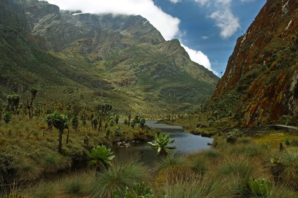
River Mubuku: The Central Circuit’s Defining Waterway
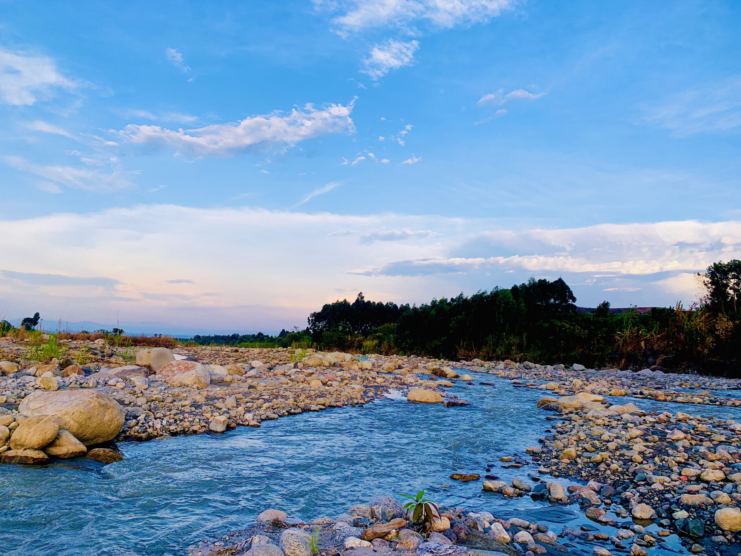
River Mubuku is the single most important river on the eastern side of the range, and it is the river that every trekker on the Central Circuit Trail walks beside for the majority of the approach. The Mubuku rises from the glaciated slopes around Mount Stanley and is fed by the outflow of the Bujuku system, carving a deep, forested gorge below Nyabitaba before flattening onto the plains near the Mubuku trading center in the Kasese district. Beyond its scenic role on the trek, the Mubuku is genuinely important to the regional economy: it hosts three hydroelectric power stations, Mubuku I, II, and III, and it supplies the water for the long-established Mubuku Irrigation Scheme, one of the most significant agricultural irrigation projects in western Uganda.
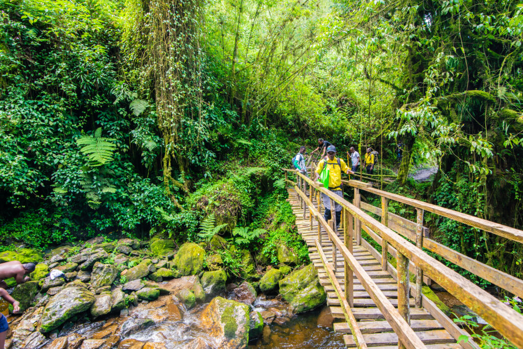
On the ground, trekkers encounter the Mubuku and its tributary streams repeatedly on the walk from Nyakalengija to Nyabitaba Camp, crossing feeder streams on log bridges as the trail climbs through banana plantations and community land before entering the true montane forest.
River Nyamwamba: The Kilembe Trail’s River of Waterfalls
If the Mubuku defines the Central Circuit, River Nyamwamba defines the Kilembe Trail. It rises high on the southern flanks of the range and drops through the dramatic Nyamwamba Valley in a sustained sequence of cascades and rapids, which most guides who have worked both trails consider the more visually dramatic of the two lower approaches. We cover this comparison in full in our Central Circuit versus Kilembe Trail guide.
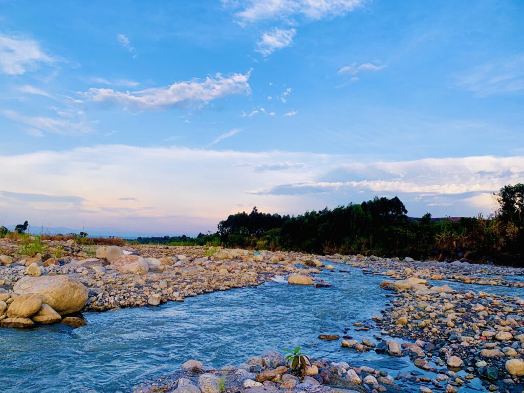
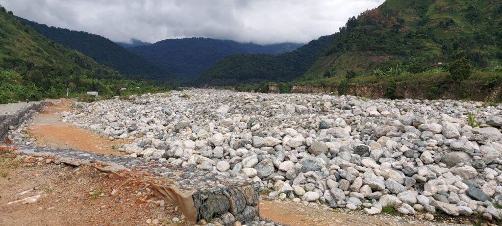
The Nyamwamba eventually reaches Kasese town and flows onward into Lake George. For the communities of Kasese, the river has a complicated relationship with the people who depend on it: it is the principal source of water for agriculture and domestic use on the mountain’s southern side, but its catchment is also prone to sudden, destructive flooding during periods of exceptionally heavy rainfall, a risk that underscores just how much volume this relatively modest-looking river can carry when the upper valley is saturated. For trekkers, the Nyamwamba’s real gift is the string of named waterfalls strung along its upper tributaries, which we cover in detail further down this guide.
River Bujuku: Out of the Valley of Giants
River Bujuku begins at the outflow of Lake Bujuku, the glacial tarn at the heart of the Bujuku Valley, fed in turn by streams draining the Speke and former Stanley glaciers above. From the lake, the young river winds through the valley’s extraordinary bog of giant groundsels and tussock sedge before descending to merge with the Mubuku system on its way to the lowlands.
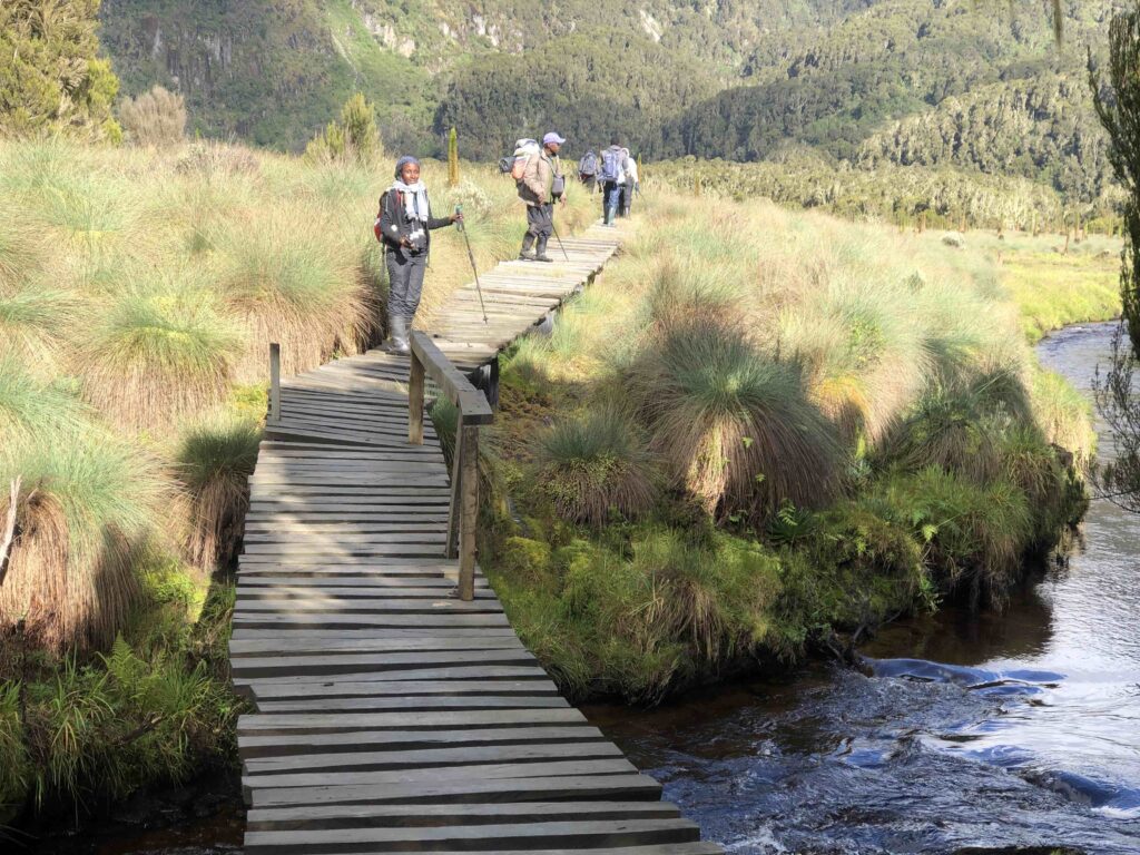
Trekkers on the Central Circuit encounter the Bujuku’s upper reaches directly at Bujuku Hut, where the camp’s water supply is drawn from the streams feeding the lake, and again on the climb toward Scott Elliot Pass, where the trail follows the valley’s characteristic bog-and-tussock terrain alongside the young river’s braided channels. A smaller stream performs a similar role at the Kitandara Lakes further along the circuit, connecting the twin tarns to one another before continuing into the same broader Mubuku drainage.
River Nyamugasani: The Remote Southern River
Rising on the western and southern slopes of the range, close to the wild lake country traversed by the Bukurungu Trail, River Nyamugasani is one of the Rwenzori’s less-visited but genuinely significant watercourses. It is a fast-flowing, scenic river associated with several waterfalls in its upper sections and with the high-altitude Kachope lake system that lies in one of its tributary valleys. Unlike the Mubuku and the Ruimi, which flow northeast into Lake George, the Nyamugasani drains south and west into Lake Edward, making it part of a distinct hydrological sub-system on the mountain’s less-trekked flank. For the small number of trekkers who venture onto the Bukurungu wilderness route each year, the Nyamugasani’s upper valley is part of what makes that corridor feel like a genuinely different mountain from the one most visitors experience on the two main trails.
River Ruimi (Rwimi) and the Eastern Foothill Rivers
Alongside the Mubuku and the Nyamwamba, River Ruimi, sometimes spelled Rwimi, is the third of the principal rivers draining the Rwenzori’s eastern slopes into Lake George. It rises from lower-altitude catchments than the Mubuku and Nyamwamba, without direct glacial input, and its character reflects that: a steady, rain-fed river rather than one shaped by ice melt from the high peaks. Together with the Mubuku and Nyamwamba, the Ruimi forms the trio of rivers that historical hydrological surveys identify as the principal contributors to Lake George’s water balance, underscoring just how much of this corner of the Albertine Rift’s water economy is quietly underwritten by the Rwenzori.
Butawu, Lamia and the Rivers of the Semliki System
On the mountain’s western side, a different set of rivers, including the Butawu and the Lamia (sometimes rendered Lamya), drain toward Lake Edward’s outflow, the Semliki River, which continues north to Lake Albert. These western rivers see far less trekking traffic than the Mubuku or Nyamwamba simply because the main trekking infrastructure, the huts and camps of the Central Circuit and Kilembe Trail, sits on the range’s eastern and southern flanks. But hydrologically they are just as important, completing the picture of a mountain that feeds two of the great lakes of the Albertine Rift from opposite sides of a single watershed. Rounding out the picture, River Mpanga rises from the range’s northern slopes near Fort Portal and drains toward Lake George by a separate, more northerly course, extending the Rwenzori’s water catchment even beyond the boundaries most trekkers associate with the park.
Where the Rivers Go: Lakes George, Edward, Albert and the Nile
Follow any Rwenzori river far enough downstream, and you arrive at one of the Albertine Rift’s great lakes. The Mubuku, Nyamwamba, and Ruimi all empty into Lake George and the swamps that surround it, a shallow, biologically rich lake that sits at the heart of Queen Elizabeth National Park and connects via the Kazinga Channel to Lake Edward. The Nyamugasani, along with the Butawu and Lamia, drains directly into Lake Edward. From Lake Edward, the water continues north along the Semliki River into Lake Albert, and from there it becomes the Albert Nile, the beginning of the White Nile’s long run north through South Sudan toward Khartoum. In this sense, every river you cross on a Rwenzori trek, from a shin-deep stream on the Mahoma Loop to the thundering Nyamwamba below Sine Camp, contributes, however modestly, to the same river system that eventually reaches the Mediterranean. This fact connects a Rwenzori trek to the same ancient geography that also drew explorers to the headwaters at Jinja on the Victoria Nile, the section of the Nile most visitors think of first.
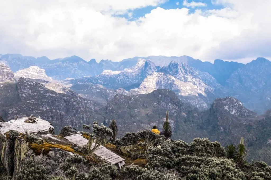
This phenomenon is also the reason the Rwenzori earned its ancient name. The Greek geographer Ptolemy described a range of snow-capped mountains he called the Lunae Montes, the Mountains of the Moon, that he believed fed the Nile from deep in the African interior, a story we tell in full in why the Rwenzori is called the Mountains of the Moon. Nineteenth-century explorers including John Hanning Speke and Samuel Baker, both commemorated in the names of two of the range’s own peaks as told in our account of who first climbed the Rwenzori Mountains, spent years searching for exactly the kind of high-altitude water source this mountain turned out to be.
Crossing Rwenzori Rivers on the Trail
For most trekkers, the abstract hydrology matters less than the very physical experience of getting a river to let you pass. Rwenzori river crossings come in three main forms, and you will likely experience all three on a multi-day trek. Log bridges, sturdy hewn trunks laid across the narrower channels, carry trekkers over many of the smaller tributary streams on both the Central Circuit and Kilembe Trail, including the crossing of the Mahoma tributary on the climb from Nyakalengija to Nyabitaba. Stepping-stone crossings appear on wider, shallower sections, requiring a bit more balance but rarely presenting real difficulty for a reasonably fit trekker with trekking poles. And on a handful of sections, particularly in the lower forest zone, the only option is simply wading, an experience that on a hot ascent day is one of the small, uncomplicated pleasures of Rwenzori trekking: the shock of genuinely cold glacial and rain-fed water against overheated feet.
The character of these crossings changes significantly with the season, and this is one of the most practical planning considerations covered in our guide to the best time to visit the Rwenzori. During the two dry-season windows, roughly December to February and June to September, river levels drop and crossings that might otherwise require careful footwork become straightforward. During the two wet seasons, March to May and October to November, the same rivers can rise dramatically within hours of sustained rain, and crossings that are routine in the dry season can become genuinely hazardous, a reality we address directly in our guide to trekking the Rwenzori in the rainy season. This is precisely why every Rwenzori Trekking Safaris expedition travels with certified local guides and porters, most of them Bakonzo men and women who have grown up beside these rivers, as detailed further in our guide to porters and guides on the mountain, and who read a river’s current mood with a precision no visiting trekker could match on a first visit.
Waterfalls: Where Rwenzori Rivers Reveal Their Power
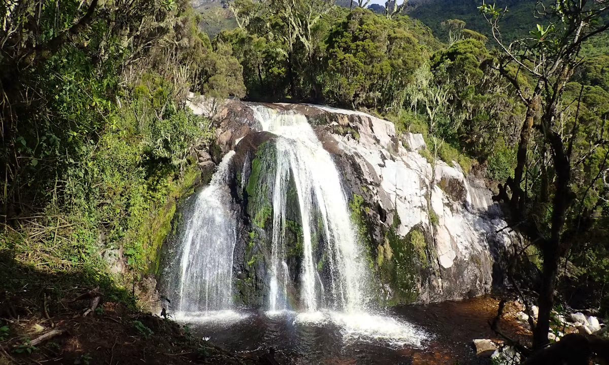
Nowhere do the Rwenzori’s rivers announce themselves more dramatically than on the lower Kilembe Trail, where the Nyamwamba’s tributary streams drop through the heather and forest zones in a genuine sequence of named waterfalls. Our dedicated 4-Day Rwenzori Waterfalls Hike exists specifically to bring trekkers to the best of them: Enock’s Falls, just a short walk from Sine Camp and easily visited in the evening light; the multi-drop Samalira Falls, tumbling through a narrow valley lined with giant heather near Samalira Camp; Cathy’s Falls, a comparatively recent discovery in the Nyamwamba Valley, at their most spectacular after heavy rain; Nyamwamba Falls itself, dropping a full fifty-two metres into a deep, swimmable pool at its base; and further downstream, Plozza Falls and Egwe Falls, both worked into the descent toward Forest View Camp. Shorter itineraries also touch parts of the same waterfall country. The 3-Day Sine Camp and Samalira Falls Trek is one of several compact options covered in our guide to shorter three-to-four-day Rwenzori treks for travelers who want the drama of the mountain’s rivers without committing to a full summit expedition.
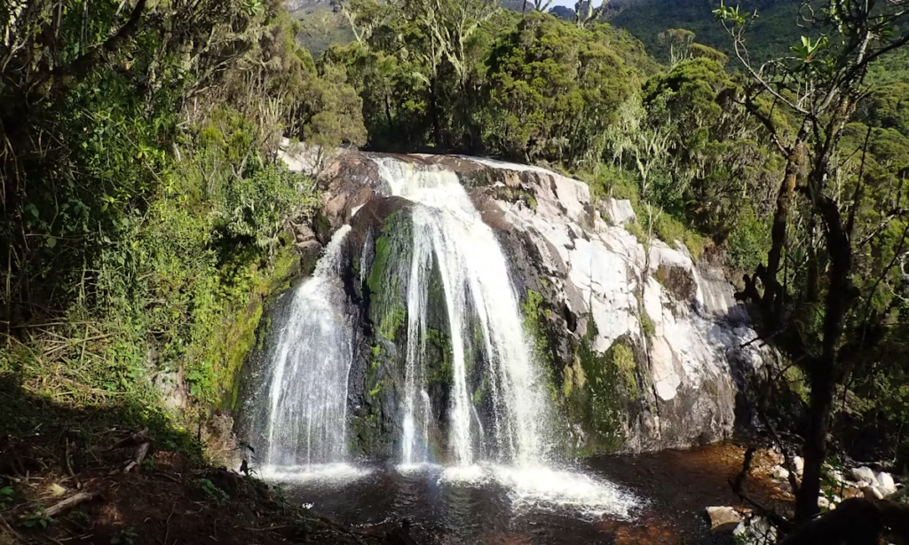
These waterfalls are not simply scenic set pieces. They mark the point where a river coming down off the moorland zone hits a resistant band of the Rwenzori’s ancient crystalline rock, the same geological story told in our guide to the range’s block-mountain formation, and the volume of water going over them changes dramatically with the season. In the dry months the falls run clear and strong; during the rains, particularly through April and October, they run at what our guides consistently describe as their most spectacular, transformed from pleasant scenic features into genuinely thunderous spectacles, one of the reasons the Waterfalls Hike remains one of the very best wet-season Rwenzori itineraries.
Drinking From the Mountain: Rivers as a Trail Water Source
Every established camp on the Rwenzori’s main trails draws its water directly from a river, stream, or lake outflow rather than from any piped or bottled supply, a system explained fully in our guides to Rwenzori huts and campsite facilities and to what every campsite on the mountain actually provides. Bujuku Hut draws from the streams feeding Lake Bujuku, Kitandara Hut draws directly from the Kitandara Lakes, and camps lower down the mountain draw from the Mubuku, Mahoma, or Nyamwamba systems depending on the trail. This water is, without exception, cold, clear, and startlingly fresh compared to anything most trekkers have tasted from a tap, and purification, whether by filter, tablet, or boiling, remains standard practice regardless of how clean a mountain stream looks. Our complete Rwenzori packing list covers exactly what to bring for reliable water purification on trek, and our medical guide to trekking the Rwenzori explains why this small precaution matters even on a mountain whose rivers look, and largely are, remarkably clean.
Rivers, Rainfall and the Rhythm of the Rwenzori’s Seasons
Because Rwenzori rivers respond so quickly and so directly to rainfall, understanding the mountain’s seasonal rhythm, laid out month by month in our Rwenzori trekking calendar, is really an exercise in understanding how its rivers will behave during your trek. January and July, sitting deep inside the two dry-season windows, offer the lowest, safest, most predictable river crossings of the year, alongside the best summit conditions. April and October, at the heart of the two wet seasons, bring the rivers to their most dramatic and least predictable state: waterfalls at full volume, forest streams running loud and brown with sediment, and river crossings that genuinely warrant caution and experienced guiding. Neither state is objectively better. A wet-season Rwenzori trek trades summit reliability for a version of the mountain’s rivers that few visitors ever witness, and many experienced trekkers, once they understand the trade-off, choose it deliberately.
Glacier Retreat and the Future of Rwenzori’s Rivers
It would be incomplete to write about Rwenzori rivers without acknowledging what is happening to one of their two sources. The glaciers of Mount Stanley, Mount Speke, and Mount Baker have retreated by more than eighty percent since the Duke of Abruzzi’s expedition first mapped them in 1906, a decline documented in detail in our report on the disappearing Rwenzori glaciers.
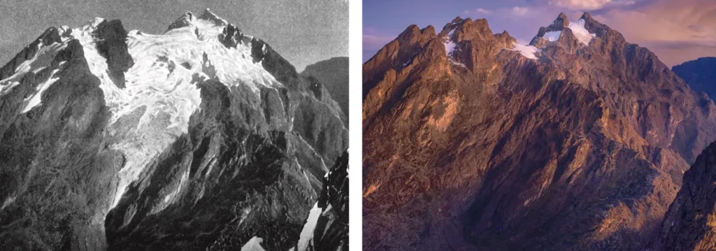
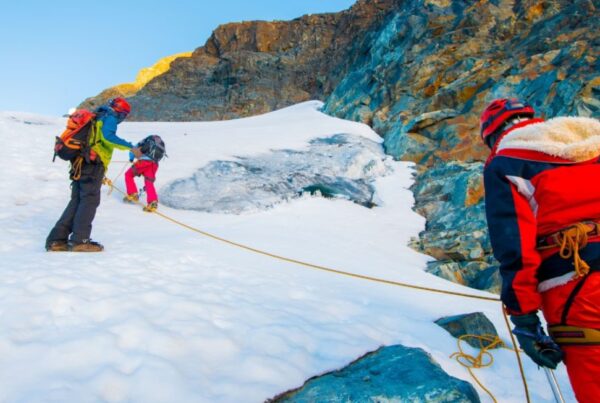
Glaciologists expect the remaining ice fields to vanish entirely within a matter of decades. Because the upper Mubuku and Bujuku systems currently draw part of their flow from this meltwater, that retreat carries a long-term hydrological consequence alongside its more visible mountaineering one: the loss of a dependable ice-melt contribution to the headwaters of rivers that, further downstream, tens of thousands of people rely on for drinking water, irrigation, and hydroelectric power. Crossing the Elena Glacier on your summit attempt, an experience we walk through step by step in our glacier crossing guide, is in a very real sense also a chance to witness and understand the upper end of the same river system you have been walking beside for days.
Planning a Rwenzori Trek Around Its Rivers
If the Rwenzori’s rivers and waterfalls are what draw you to this mountain, several of our itineraries are designed to put you directly in front of them. The 4-Day Rwenzori Waterfalls Hike remains the single best option for trekkers whose priority is the Nyamwamba’s waterfall sequence rather than a summit attempt. Trekkers wanting the full Mubuku and Bujuku river story alongside a Margherita Peak summit should look at our 7-Day Central Circuit climb, which follows the Mubuku system for its entire lower approach before tracking the Bujuku River up through its namesake valley. Those drawn to the mountain’s more remote southern rivers and the Kachope lake country should speak to us about a custom itinerary on the Bukurungu Trail. Whichever route matches your ambitions, our complete overview of every Rwenzori trekking route and trail, along with our guide to everything included in a guided Rwenzori trek, serves as the right next stops before you commit to dates.
Frequently Asked Questions About Rwenzori Mountain Rivers
What are the main rivers in the Rwenzori Mountains?
The principal rivers of the Rwenzori Mountains are the Mubuku, Nyamwamba, and Ruimi, all of which drain the range’s eastern slopes into Lake George, and the Nyamugasani, Butawu, and Lamia, which drain the western and southern slopes toward Lake Edward and its outflow, the Semliki River. The Bujuku River, which drains Lake Bujuku in the high Bujuku Valley, is the most significant of the mountain’s upper tributaries and eventually joins the Mubuku system. Together these rivers, along with dozens of smaller named and unnamed streams, make the Rwenzori one of the most important watersheds in the Albertine Rift.
Where do the Rwenzori Mountains rivers flow to?
The Rwenzori rivers ultimately flow into one of two of the Albertine Rift’s great lakes. The Mubuku, Nyamwamba, and Ruimi flow into Lake George, which connects via the Kazinga Channel to Lake Edward. The Nyamugasani, Butawu, and Lamia flow directly into Lake Edward. From Lake Edward, water continues north along the Semliki River into Lake Albert, where it becomes the Albert Nile, the beginning of the White Nile’s long journey northward through South Sudan and Sudan.
Is River Mubuku glacier-fed?
Yes, in part. River Mubuku’s headwaters draw on meltwater from the glaciers and snowfields of Mount Stanley via the Bujuku River system, in addition to the very substantial rainfall the mountain’s upper vegetation zones capture and release. This combination of glacial and rain-fed input is what gives the Mubuku its persistent, powerful volume even during drier periods, and it is why the river is considered the most significant watercourse on the Central Circuit Trail.
What is the biggest waterfall in the Rwenzori Mountains?
Nyamwamba Falls, on the lower Kilembe Trail, is the tallest of the Rwenzori’s well-documented named waterfalls at a total height of approximately fifty-two meters, dropping into a deep pool at its base that is sometimes used for swimming by trekkers on the 4-Day Rwenzori Waterfalls Hike. It sits within a wider sequence of falls on the same trail, including Enock’s Falls, Samalira Falls, Cathy’s Falls, Plozza Falls, and Egwe Falls, that together make the Nyamwamba Valley the most waterfall-rich section of any Rwenzori trekking route.
Do trekkers cross rivers during a Rwenzori hike?
Yes, river crossings are a routine and expected part of nearly every Rwenzori itinerary, from the shortest day hikes to the full multi-peak expeditions. Most crossings use log bridges or stepping stones over the mountain’s smaller tributary streams, though a handful of sections require wading through shallow, fast-flowing water. Crossings are generally straightforward in the dry season, from December to February and June to September, and can become more difficult and require greater caution during the wet seasons of March to May and October to November, which is one reason every trek is accompanied by experienced local guides.
Are Rwenzori rivers safe to drink from?
Rwenzori rivers and streams are exceptionally clean by global standards, but water should always be purified before drinking, whether by filter, purification tablets, or boiling, regardless of how clear it looks. This is standard practice at every mountain camp, all of which draw their water supply directly from a nearby river, stream, or lake outflow rather than from any treated source, and it is covered in detail in our packing list and medical guide for the mountain.
Do the Rwenzori rivers feed the Nile?
Yes. Rwenzori rivers feed Lake George and Lake Edward, which connect via the Semliki River to Lake Albert, from which the Albert Nile, the beginning stretch of the White Nile, flows north toward South Sudan. This hydrological connection is the basis for the ancient belief, dating to the Greek geographer Ptolemy, that the Rwenzori, his Lunae Montes or Mountains of the Moon, were a principal source of the Nile, a claim nineteenth-century explorers later confirmed to be substantially accurate.
Which Rwenzori trek shows the most rivers and waterfalls?
The 4-Day Rwenzori Waterfalls Hike on the Kilembe Trail is specifically designed around the Nyamwamba River’s waterfall sequence and shows the greatest concentration of named falls on any single itinerary. For trekkers who want a fuller river experience alongside a summit attempt, the 7-Day Central Circuit climb to Margherita Peak follows the Mubuku River for its entire lower approach before tracking the Bujuku River through the high Bujuku Valley, offering the most complete cross-section of the mountain’s river system available on a single trek.
Start Planning Your Rwenzori Trek Today
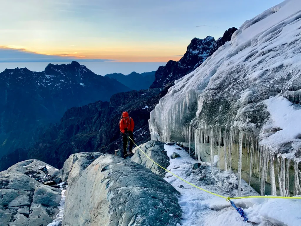
Few mountains anywhere in the world let you walk this closely alongside the source of a river system as significant as the Nile’s, crossing the same cold, glacier-and-rain-fed waters that sustain millions of people long after they leave this park behind. Whether your ambition is to stand on Margherita Peak beside the last equatorial ice feeding the Bujuku River or simply to spend four unforgettable days following the Nyamwamba past waterfall after waterfall, our guides know these rivers the way you know the streets of your hometown, because in every real sense, they grew up beside them. Get in touch with our team to start planning your Rwenzori trek, or message a mountain guide directly on WhatsApp at +256 773 256 104 for honest, experience-based advice on which route will put you closest to the rivers, waterfalls, and glaciers you most want to see.