Complete guide to the Bujuku Valley: Rwenzori’s ecological heart. Giant groundsels, bog crossings, Lake Bujuku, Bujuku Hut & the 3-peak summit hub. Expert guide.
There is a place on the Central Circuit Trail where the mountain stops behaving like a mountain and starts behaving like a planet that nobody has yet visited. You emerge from the heather forest above John Matte Hut onto a wide, saturated valley floor at approximately 3,500 metres, and the landscape changes so completely and so suddenly that the adjustment takes a moment. The sky above is the particular gray of high-altitude clouds moving fast across an equatorial morning. The ground beneath your feet, where it is not submerged bog, is a dense mat of moss and sedge in a dozen shades of green. And rising from that ground, at intervals that seem deliberately theatrical in their spacing, are plants that do not resemble anything in the temperate latitude experience of most trekkers: six-meter trunks of dead persistent leaves topped by cabbage-crown rosettes of grey-green; four-meter flower spikes of a blue-green density that should not exist; and giant heathers draped in moss-beards that reach the ground. You are in the Bujuku Valley. You are in the Afro-alpine heart of the Rwenzori Mountains. And nothing not the photographs, not the planning articles, and not the expedition accounts you have read has quite prepared you for the physical reality of it.
The Bujuku Valley is the ecological and geographical hub of the Rwenzori Mountains National Park trekking infrastructure. It is the point through which all Central Circuit Trail expeditions pass on their way to the high camps, the base from which summit attempts on Mount Stanley, Mount Speke, and Mount Baker are launched, and the landscape that most consistently produces the silence that experienced trekkers associate with genuinely extraordinary places. Bujuku Hut, at 3,977 metres sits at the valley’s upper end, surrounded on three sides by the massifs of the Rwenzori’s highest peaks, and serves as the mountain base from which multi-day summit itineraries radiate in every direction.
This article is the most complete account of the Bujuku Valley experience available anywhere: its geological formation, its ecology, its character across different times of day and season, the experience of the bog crossings that define its approach, the lake that occupies its floor, the hut that sleeps there, the peaks that surround it, and the specific quality of being in a place that the world’s mountain literature has not yet given the attention it deserves. If you are planning a Rwenzori expedition and want to understand what three to four days at the center of this range actually feel like, the Bujuku Valley is where that understanding begins.
The Bujuku Valley: Geography, Formation, and Physical Scale
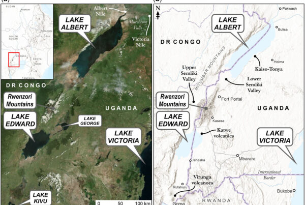
The Bujuku Valley is a U-shaped valley formed by a glacier, with a wide, flat floor and steep walls, and is located in the main highland zone of the Rwenzori range at altitudes between about 3,400 and 4,200 metres above sea level. It trends roughly east-west in its orientation, with the higher terrain of the Mount Stanley massif rising to the northwest and the ridgeline of the Scott Elliot Pass at its upper (western) end and the lower heather country of the Central Circuit Trail descending toward John Matte Hut at its eastern approach.
The valley’s width at its broadest section, the middle floor around Lake Bujuku, is approximately one to one and a half kilometers. Its length from the John Matte approach to the Scott Elliot Pass is roughly three to four kilometers. Although the Bujuku Valley’s dimensions are smaller than those of the magnificent glacial valleys of the Alps or the Himalayas, its impact on the trekker is still significant. It is a function of what fills it: the extraordinary density and scale of the Afro-alpine vegetation; the persistent atmospheric moisture that wraps the valley in mist for most of each day; and the three-peak skyline of Stanley, Speke, and Baker that frames the upper valley on the rare clear mornings when the cloud pulls back enough to reveal it in full.
The Glacial Origins of the Valley
The Bujuku Valley was carved by glacial ice during the Pleistocene glaciations when the Rwenzori’s ice system was dramatically more extensive than the remnant glaciers that survive today above 4,400 metres. At the Last Glacial Maximum, approximately 20,000 years ago, ice filling the Bujuku Valley would have reached altitudes down to approximately 3,500 metres which is to say, the ice extended over the entire floor of the valley’s current trekking environment. The valley’s characteristic U-shaped profile, with rounded walls rather than the V-shape of river-cut valleys, is the direct product of that glacial grinding, and the boulders scattered across the valley floor are glacial erratics: rocks transported and deposited by the ice far from their original geological position.
The valley floor itself is one of the Rwenzori’s ancient peat bog systems, a deep, waterlogged accumulation of partially decomposed plant material that has built up over thousands of years in the cold, wet, anaerobic conditions of the high valley floor. The peat beneath the Bujuku Valley bog is estimated to be one to two metres deep in the deepest sections, with a maximum age at the base of the peat profile of approximately 5,000 to 8,000 years. Walking across this bog is like walking on an ancient carbon archive, a record of vegetation and climate change stored in compressed organic layers far below the surface into which your boots are sinking.
The Mubuku River: The Valley’s Primary Drainage
The Mubuku River is the main waterway in the Bujuku Valley. It drains the valley floor and carries water from the Lake Bujuku outflow, bog seepage, and the large amounts of rain that fall in the valley down through the heather zone to the lowland plains and the Albertine Rift Valley below. The Mubuku is crossed at multiple points on the Central Circuit Trail on the approach from Nyakalengija on day one and on the valley floor crossings that connect the bog bridges of the middle valley to the hut approaches above. In the dry season, the Mubuku is a manageable, clear-running stream. After heavy rain, which in the Rwenzori can mean any afternoon in any season, the Mubuku runs brown with peat sediment and can rise to levels that require careful crossing management by the guide team.
The Bujuku Bog: Walking on Water and What It Teaches You About the Mountain
There is nothing quite like the Bujuku bog in the world of mountain trekking. Not in its ecological type, saturated high-altitude peatlands exist on other mountains in Africa and globally, but in its combination of extent, depth, and the extraordinary plant communities that rise from it. The bog that covers the floor of the Bujuku Valley between approximately 3,500 and 3,900 metres is the defining physical characteristic of the valley approach, and it requires more sustained attention, more careful navigation, and more deliberate physical engagement than any other section of the Central Circuit Trail except the glacier crossing above.
The bog’s surface is a mosaic of different wetland communities, dominated at the level of the peat surface by thick mats of Sphagnum mosses of multiple species, among which sedges (primarily Carex runssoroensis), small-leaved bog herbs, and the bases of the giant lobelia (Lobelia wollastonii) rosettes emerge from the saturated moss. The color range of this surface, from pale yellow-green to deep emerald to russet-brown where the sphagnum is partially desiccated, is extraordinary in its detail and richness when viewed from close range, as trekkers necessarily view it while navigating the stepping stones and bog bridges that provide the dry-ground path across it.
The Bog Bridges: Infrastructure in an Improbable Place
The wooden bog bridges that cross the most saturated sections of the Bujuku Valley floor are one of the most quietly remarkable pieces of infrastructure on any mountain trekking route in Africa. They consist of sections of rough-hewn timber, typically split logs of hardwood, laid across wooden supports sunk into the bog, forming a series of stepping platforms that allow passage without sinking into peat that would otherwise engulf a boot to the knee or beyond in the deepest sections. The bridges are maintained by park authority staff and by the mountain crews, and their condition varies from relatively solid and well-anchored to slick, mossy, and requiring careful footwork in wet conditions.
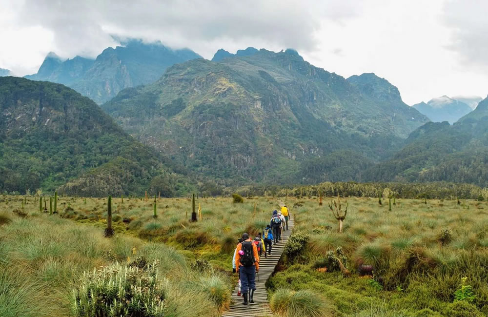
Walking the bog bridges requires a different quality of attention than walking on a dry trail. Each bridge section is narrow, typically 30 to 50 centimeters wide, and the crossing must be made one foot at a time, with full weight transferred before the next step is taken. The bridge surface is frequently wet and covered in a thin film of algae that can be extremely slippery, particularly in the morning when overnight condensation has made every surface additionally treacherous. Trekking poles are highly valuable for maintaining balance on the bog bridges, and trekkers who have learned to use sticks effectively on the lower trail sections will find them indispensable here. Our gear guide for Rwenzori conditions addresses the specific footwear requirements for the bog sections in detail.
The ecological function of the bog bridges goes beyond trekker convenience. The peat bog substrate of the Bujuku Valley is a fragile, slow-recovering system; the peat that underlies a meter-square section of bog surface took decades to accumulate, and a single season of unmanaged foot traffic would degrade it into compacted mud that takes years to recover its biological productivity. By channelling trekker movement onto constructed wooden surfaces, the bridges protect the surrounding bog from the physical damage that would otherwise occur. When you step carefully along a bog bridge rather than cutting around it, you are participating in the conservation management of one of the Rwenzori’s most ecologically significant habitats.
Reading the Fog for Weather
Experienced Bakonzo guides read the Bujuku bog for weather information with a precision that no meteorological instrument available at this altitude can match. The color and texture of the sphagnum surface, the activity of specific insect communities around the bog pools, and the movement of moisture in the valley’s air mass are all signs that trained observation can be used to make short-term weather predictions. A bog that is unusually dark and saturated at 7:00 am, even darker than the previous morning’s departure state, indicates heavy overnight rain in the upper catchment, which means the Mubuku will be running high and the bog bridges will be at their most challenging. A bog whose sphagnum shows unusual pale areas where the surface has dried slightly overnight suggests a drier-than-average night, which often (but not reliably) predicts a longer morning clear window before the afternoon clouds build.
This level of observational sophistication is part of what Bakonzo mountain knowledge brings to a guided Rwenzori expedition that no technology can replicate. The guides who lead groups through the Bujuku Valley on the 7-day Margherita Peak summit trek or the 13-day six-peaks expedition have walked this valley hundreds of times. Their relationship with it is intimate in the way that only repetition and observation over years can produce.
The Giant Plants: What the Bujuku Valley Actually Looks Like
The Bujuku Valley floor and its immediately surrounding slopes are the most densely populated giant plant environment in the entire Rwenzori range. The specific combination of deep peat substrate, near-permanent moisture, and the altitude band between 3,500 and 4,000 metres creates the optimal growing conditions for every species of the Rwenzori’s celebrated Afro-alpine vegetation community, producing densities of giant groundsel and giant lobelia that exceed anything found elsewhere in the range.
Senecio adnivalis: The Valley’s Dominant Architecture
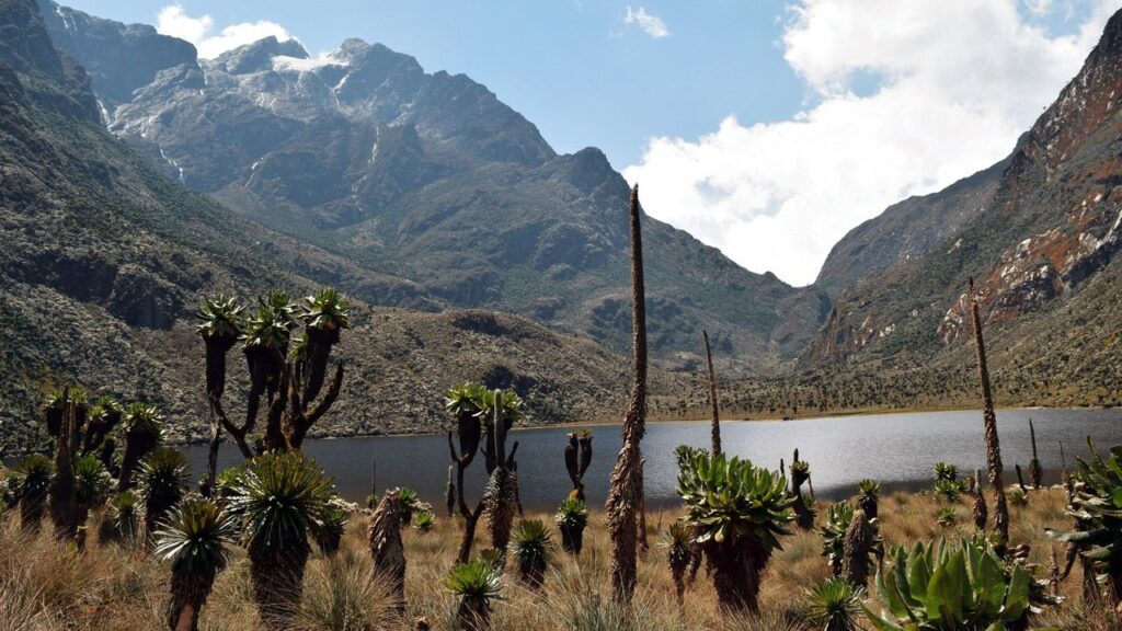
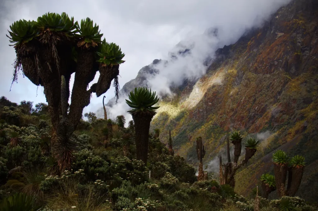
The giant groundsels of the Bujuku Valley are the first thing trekkers notice when they enter the Afro-alpine zone above John Matte, and they remain the defining visual element of the valley landscape from the heather-moorland transition all the way to Bujuku Hut at 3,977 metres. Senecio adnivalis, the snow groundsel, grows on the drier ridges and rocky outcrops within and above the bog, reaching heights of four to six metres, its shaggy trunk of persistent dead-leaf armor and its crown rosette of large grey-green leaves producing a silhouette that has no precedent in any other mountain environment that most trekkers have visited.
In the Bujuku Valley, the groundsel does not merely appear as an occasional specimen punctuating the landscape; it forms groves. In several sections of the valley floor immediately above the main bog crossings, the groundsel density is high enough that the trunks create a broken canopy overhead, and walking between them feels like moving through a forest of organisms that belong to a different evolutionary logic than the forests below. Their scale relative to a standing human being is consistently underestimated in photographs; a guide standing beside a mature specimen is typically not much more than half its height, and the rosette crown above the guide’s head is larger than a dining table. Standing among them in morning mist, in the particular silence that the valley holds before the wind systems of the equatorial afternoon develop, is an experience that stays with trekkers long after the summit photographs have been viewed and stored.
Lobelia wollastonii: The Valley’s Living Thermos
If the groundsels provide the Bujuku Valley’s architecture, Lobelia wollastonii provides its punctuation. The giant lobelia, which has a special way of keeping a water-filled cup rosette to protect itself from frost, is described in our giant plants guide as a masterpiece of evolutionary engineering. It grows in the wetter parts of the Bujuku Valley floor, coming directly from the sphagnum bog and forming dense groups that turn whole areas of the valley floor into a forest of upright blue-green flower spikes. At peak flowering, which occurs irregularly and not predictably by season, the lobelia spikes carry dense columns of small tubular flowers that are visited by the variable sunbird and other nectar-feeding species, one of the few moments in the Bujuku Valley where vivid bird activity is visible against the predominantly green and grey color palette.
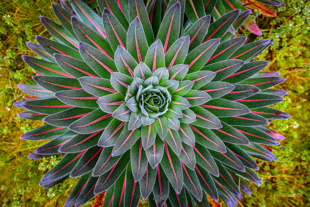
The lobelia’s relationship with the Bujuku bog is symbiotic and ancient: the plant’s root system penetrates the peat substrate, anchoring into the deep compressed organic layers, while its above-ground rosette intercepts rainfall and channels it back into the peat through runoff along the leaf surfaces. The bog maintains the moisture conditions the lobelia needs; the lobelia helps maintain the bog’s hydrological integrity. This mutual dependency has been developing for thousands of years in the Bujuku Valley, and it is being disrupted at the margins and over long timescales by the same hydrological changes that threaten the Rwenzori’s glaciers above.
The Heathers: The Valley’s Enclosing Walls
The Bujuku Valley’s bog floor and groundsel groves are enclosed on their upper slopes by the transition heather zone, the community of Erica arborea and Erica johnstonii tree heathers that, at the altitudes of the upper Bujuku approach, have reached their maximum development of trunk diameter and epiphyte loading. The heathers that flank the valley walls above the bog are festooned with hanging moss that reaches the ground in some cases, grey-green curtains of Sphagnum and hepatic communities draped from branches that in themselves are larger than any heather a European visitor has previously encountered. The combination of the hanging moss, the persistent mist that the valley traps, and the low light of the cloud-filtered sun creates a visual effect that trekkers consistently describe as the most atmospherically distinctive section of the entire Rwenzori trek, more visually alien than the glacier zone above and more immersively strange than the forest below.
Lake Bujuku: The Valley’s High Tarn
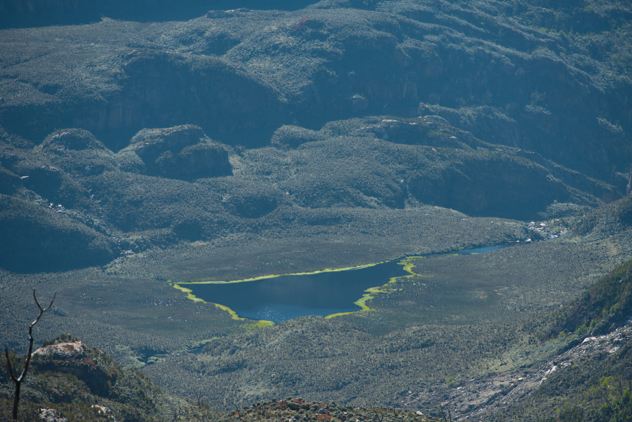
Lake Bujuku occupies the lowest section of the high valley floor, at approximately 3,800 metres, where the bog substrate transitions into the deeper water of the tarn itself. It is a smaller and more simply positioned lake than the famous twin Kitandara Lakes above the Freshfield Pass, less dramatically framed and less immediately arresting in its first-impression impact, but it possesses its own distinct quality that rewards the trekker who approaches it with attention rather than treating it merely as a waypoint on the route to Bujuku Hut.
The lake’s surface on still mornings reflects the groundsel-covered hillside on its northern shore, a brown-silver reflection of bark and sky that in the right light has a Japanese-ink-painting quality, spare and suggestive rather than grandly panoramic. The lake’s water is the characteristic dark brown of high-altitude tannic water, the dissolved organic compounds of the surrounding peat bog staining it the color of strong black tea. Alongside the lake margin, the mat of bog vegetation extends to the waterline and, in some sections, below it, creating the sense that the lake is not a separate water body but a deeper expression of the bog, a place where the bog has gone down further than the surrounding land and collected itself into this dark, still surface.
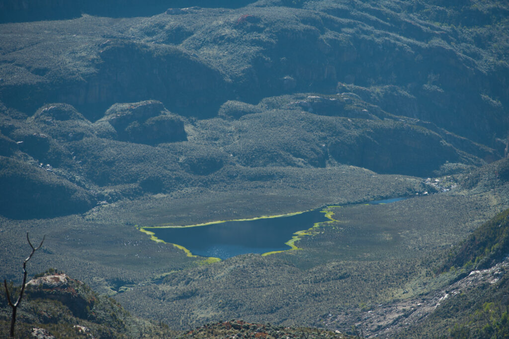
Lake Bujuku is most impressive in the early morning window before the clouds build. By mid-morning, when the lake is most commonly reached by trekkers departing John Matté, the cloud has usually encased the valley, and the lake’s reflective quality is reduced to nil. The best photographic opportunity at Lake Bujuku comes on the morning of departure from Bujuku Hut when an early start (before 7:00 am) can bring trekkers back to the lake shore in the brief clear window before the standard cloud build, with the benefit of having already established camp and being able to devote the morning light purely to the lake experience rather than moving onward immediately.
The Wildlife Dimension of the Valley and Lake
The Bujuku Valley is one of the best places to see wildlife on the upper Central Circuit, even though it is too high for the dramatic charismatic megafauna of the lower forest, such as L’Hoest’s monkeys, colobus, and three-horned chameleons. The valley’s wildlife community is dominated by the small, the camouflaged, and the surprisingly vivid: the Rwenzori double-collared sunbird (Cinnyris stuhlmanni), which visits the lobelia flower columns with a flash of iridescent green and red that seems incongruously tropical at 3,800 metres; the Alpine swift, which hunts insects in the updrafts above the valley floor with a speed and precision that makes the giant lobelias below seem stationary by comparison; and the occasional Rwenzori leopard footprint in the peat at the lake margin, evidence of a predator that operates in the high alpine zone with a confidence that the unfamiliar terrain might not suggest.
The lake itself harbors small invertebrate communities in its shallows; caddisfly larvae cases are visible on the submerged peat at the lake margin, and the surface film supports the tiny skating movements of water striders in the calmer morning hours. None of this is dramatic in the way of a safari game drive. All of it is genuinely captivating in the way of a place where you have time to stop moving and actually look at what is around you, which the pace of a Rwenzori expedition allows and rewards in ways that faster-moving mountain experiences do not.
Bujuku Hut: Living at the Valley’s Upper End
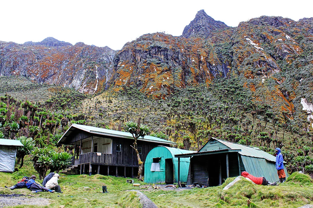
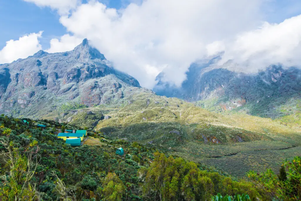
Bujuku Hut sits at 3,977 metres on a small elevated terrace above the valley floor, high enough above the bog to avoid the worst of the overnight cold air that pools in the lowest parts of the cirque and close enough to Lake Bujuku that the water is visible from the hut’s immediate surroundings. It is the hub camp of the Central Circuit Trail and the most strategically positioned camp in the entire Rwenzori hut network: from here, the routes to Mount Stanley, Mount Speke, and Mount Baker all depart, and the summit itineraries that use Bujuku as a base camp spend two or more nights here, using the rest day in between summit attempts as an acclimatization and recovery period.
The Three-Peak Panorama on Clear Mornings
On the clear mornings that occur most reliably in January, February, July, and August but can appear in any month, the view from the Bujuku Hut terrace and the surrounding valley is one of the great mountain panoramas in Africa. The Stanley massif fills the sky to the northwest, the ice-streaked ridgelines of Margherita Peak’s 5,109-meter summit zone visible above the nearer ridges, with the Elena Glacier’s blue-white visible in the upper cwm. To the northeast, the dark rock faces of Mount Speke rise to the Vittorio Emanuele Peak at 4,890 metres a profile that in good light is almost medieval in its tower-like vertical character. To the southeast, the broader, more complex massif of Mount Baker presents its northern face, with the approach to Edward Peak visible as a route of steep rock and occasional snow band.
This three-peak panorama is the Rwenzori’s most dramatic view, a simultaneous presentation of three of Africa’s highest mountains from a position that places the observer at the geographical center of their relationship. It is visible for perhaps two hours on the clearest days before clouds build from the valley floor upward and encase each peak in sequence. Trekkers fortunate enough to wake at Bujuku Hut to a clear morning should have their camera ready before leaving the hut, as the panorama can disappear before they finish breakfast.
Bujuku as a Multi-Night Base: The Extended Camp Experience
For trekkers on extended multi-peak itineraries, the 8-day three-peaks expedition, the 10-day four-peaks traverse, the 13-day six-peaks grand expedition, and the 18-day all-peaks traverse, Bujuku serves as the primary base camp from which multiple summit days radiate. A typical pattern on a 13-day expedition might involve arriving at Bujuku on day three, spending days four and five making summit attempts on Speke and Baker (returning to Bujuku each evening), and departing on day six for the Elena approach and the Stanley summit. This multi-night engagement with the Bujuku Valley produces a familiarity with its character, its morning moods, its afternoon mist patterns, the specific sound of the wind in the groundsel stands around the hut, and the particular quality of silence after the porter team has settled for the evening that single-night trekkers do not develop.
The extended camp experience at Bujuku also reveals the valley’s temporal dimension: the way the same view changes radically from morning to afternoon to evening to the following morning; the way cloud formation in the valley follows a daily rhythm that becomes predictable after two or three days of observation; and the way the giant plants themselves appear differently in different light, warm and expansive at dawn, mist-shrouded and intimate at noon, and dramatically lit in whatever late-afternoon gold the mountain occasionally provides. Trekkers who have spent three or four nights at Bujuku on extended expeditions consistently describe a growing sense of familiarity with the valley that they did not anticipate, a feeling of knowing a place that most of the world does not know exists.
Facilities at Bujuku Hut
Bujuku Hut follows the standard Central Circuit wooden hut design bunk frames with foam mattresses, a communal cooking and eating area, and outbuilding latrine facilities with the addition of the limited solar infrastructure that makes it one of two Central Circuit camps (along with Kitandara) where basic lighting and slow device charging are occasionally possible. As the charging guide for Rwenzori mountain camps makes clear, the solar output at Bujuku is weather-dependent and should be treated as supplementary to a well-prepared power bank rather than as a reliable charging source. Night temperatures at Bujuku range from 0°C to 6°C, closer to zero on still, clear nights when cold air settles into the valley and somewhat warmer on cloud-covered nights when the insulating effect of overcast reduces radiative cooling. A sleeping bag rated to a minimum of -5°C is required; -10°C is recommended for comfort on the coldest nights.
The Approach to the Bujuku Valley: Day Three of the Central Circuit
The approach to the Bujuku Valley from John Matte Hut at 3,414 metres is one of the most remarkable single trekking days available anywhere in East Africa, not for its difficulty (though the terrain demands consistent attention) but for the density and quality of the landscape transitions it moves through in a few hours of walking. The stage covers approximately seven to nine kilometers depending on exact route choice, gaining about 560 metres of altitude between John Matte and Bujuku Hut, and typically takes five to seven hours depending on group fitness, pace, and the state of the bog crossings.
Leaving John Matte: The Last Forest
The departure from John Matte takes you through the final sections of the heather forest zone, the last enclosed, moss-draped Erica arborea forest before the transition to the open Afro-alpine landscape of the Bujuku Valley. This section of the trail, in the morning light before the cloud builds, is the Rwenzori’s heather forest at its most impressive: the canopy closes overhead, the hanging moss filters the light to a diffuse grey-green, and the silence of the enclosed forest is broken only by the distant calling of Rwenzori-endemic birds in the upper branches. For trekkers who have been on the mountain for two days, this forest section carries the particular quality of a last familiar environment before the transition to something without precedent, which is precisely what the Bujuku Valley will provide.
The First Groundsels: The Transition Zone
As the trail gains altitude and the heather canopy opens, the first Senecio adnivalis specimens begin to appear, initially solitary, then in small groups, and finally in the dense groves that characterize the valley floor above. This transition zone, located between approximately 3,400 and 3,600 metres, is where the full character of the approaching landscape first becomes apparent. Each successive groundsel is taller than the last, and the bog surface underfoot becomes progressively more saturated as the valley floor approach begins. The first bog bridge sections appear as the trail descends slightly to cross the upper Mubuku tributaries, and the full reality of the bog crossing, which trekkers have been briefed about but which no amount of briefing fully conveys, begins to assert itself.
The Main Bog Crossing: The Heart of the Approach
The main bog crossing of the Bujuku Valley approach is the longest and most continuous section of bog bridge and stepping-stone navigation on the entire Central Circuit Trail, stretching for about one to two kilometres across the valley floor between the lower groundsel zone and the approach to Lake Bujuku. This is the section that most characterizes the Rwenzori’s reputation for boggy, demanding terrain, and it deserves a description that neither overstates its difficulty nor underplays its character.
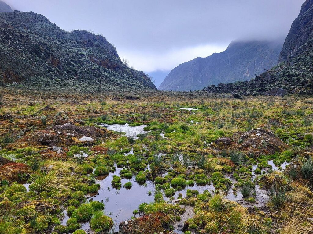
The bog crossing is not dangerous for trekkers with appropriate footwear and careful footing. It is slow, demanding of continuous attention, and genuinely impossible to keep entirely dry if conditions have been wet. The bog bridges are the primary navigation tool; they provide dry footing across the most saturated sections, but between bridge sections, stepping stones must be identified and used, and in some places the trail narrows to a single track across the top of a bog ridge where a missed step means a boot disappearing into peat to ankle or shin depth. Our guide to the best boots for the Rwenzori bogs makes the case for rubber-soled waterproof boots (specifically rubber boots or dedicated bog-walking footwear) rather than conventional leather or synthetic waterproof hiking boots for this section of the trail, a recommendation that every trekker who has experienced the bog crossing in conventional boots understands in retrospect.
The bog crossing should not be hurried. Slow, deliberate movement; identifying each stepping stone before committing weight to it; using trekking poles for balance; and maintaining a pace that allows the guide’s route selection to be followed rather than anticipated is both safer and more rewarding than trying to move quickly. You can best appreciate the giant plants that surround the crossing at the pace that the terrain enforces. The lobelia spikes emerging from the sphagnum at eye level, the groundsel trunks forming broken canopies ten metres to either side of the trail, and the specific sound of bog water moving beneath the peat surface underfoot are all experiential details that rapid movement reduces to blurred peripheral sensation, while slow movement resolves them into a clear, memorable experience.
Lake Bujuku to the Hut: The Final Approach
Beyond the main bog crossing, the trail passes Lake Bujuku’s southern shore and begins a gradual ascent of the valley’s upper section toward Bujuku Hut at 3,977 metres. This section of the approach is rocky and drier than the bog floor below. The trail moves off the peat substrate and onto the rocky ridgeline that carries the hut terrace above the valley floor, gaining the final 150 to 200 metres of altitude on firmer ground. The ascent is not technically demanding, but it comes after the extended effort of the bog crossing, and at this altitude the thin air makes the physical effort feel disproportionate to the modest gradient. Slow, steady movement, the mountain guide’s first commandment at altitude, is the appropriate strategy.
The arrival at Bujuku Hut, typically in the mid to late afternoon, depending on departure time from John Matte, is marked by the opening of the valley’s upper panorama: if cloud conditions allow even a partial clearing, the first view of the three-peak skyline from the hut terrace produces the most dramatic moment of the first three days of the expedition. On cloudy arrivals, which is the more common scenario, the mountain reveals itself progressively over the following hours and the following morning, making patience a more reliable strategy than expectation.
The Bujuku Valley Stage by Stage: Altitude, Experience, and Day Reference
| Stage / Camp | Altitude | 7-Day Circuit Day | What You Experience in the Valley |
| John Matte Hut | 3,414 m | Day 2 | Valley entrance; heather forest gives way to open moorland; first groundsel glimpses |
| Lower Bujuku Valley floor | 3,500–3,700 m | Day 3 (morning) | Maximum bog depth; wooden bog bridges; dense lobelia and groundsel colonies |
| Lake Bujuku shore | ~3,800 m | Day 3 (mid) | Tarn approach; reflective surface on calm mornings; valley panorama opens |
| Bujuku Hut | 3,977 m | Day 3 (arrival) | Hub camp; Stanley, Speke, Baker visible on clear days; Afro-alpine at maximum |
| Upper Valley/Scott Elliot approach | 4,000–4,372 m | Day 4 (morning) | Thinning vegetation; increasing rock, and transition to glacier approach zone |
| Scott Elliot Pass | 4,372 m | Day 4 (mid) | Exit from the Bujuku system into the Elena/Kitandara upper terrain |
Departing the Bujuku Valley: The Routes Upward and Onward
From Bujuku Hut, the main summit routes of the Rwenzori go in three directions, each leading to a different massif, each with a different type of terrain, and each passing through a different part of the valley’s upper-alpine area before reaching the zone above the vegetation line.
The Scott Elliot Pass Route: Toward Elena and Margherita
The primary departure route from Bujuku on the standard summit itinerary ascends to the Scott Elliot Pass at 4,372 metres the col between the Stanley massif and the broader upper ridgeline, and then descends to Elena Hut at 4,541 metres on the upper slopes of Mount Stanley. The approach to the Scott Elliot Pass from the Bujuku Valley follows the upper valley floor and then ascends rocky terrain on the eastern flank of the Stanley massif, gaining approximately 400 metres of altitude in conditions that shift progressively from the Afro-alpine vegetation of the upper valley to the barren rock of the approach to the pass. The final section before the pass is in exposed terrain where wind can be a significant factor, and the pass itself, a narrow gap in the ridgeline, is the point at which the Bujuku Valley system is finally left behind and the upper Stanley world begins.
The Speke Approach: The Northeast Valley Flank
The summit route to Mount Speke departs northeastward from Bujuku Hut and ascends the valley’s northeastern flank toward the Speke col, gaining the ridge that connects the Speke massif to the broader range. This approach goes through the upper part of the groundsel zone, where the sparse, highest-altitude specimens of Senecio adnivalis become thinner as altitude increases, before changing to the rocky, glacier-influenced terrain of the Speke approach. The Vittorio Emanuele Peak (4,890 m) is the primary summit target on this route and is accessible on a long summit day from Bujuku Hut, with a very early departure (4:00 to 5:00 am) required to complete the round trip before the afternoon deterioration.
The Valley’s South Exit: Toward Kitandara
For trekkers on the descending circuit coming from Elena toward Kitandara rather than ascending to it, the Bujuku Valley is entered from above via the Freshfield Pass (4,282m) rather than from below via John Matte. This reverse-entry experience creates a very different view of the valley: you arrive from above in the afternoon, with the Bujuku bog far below looking like a mosaic of green and dark water, and the groundsel-covered hillsides spread across the valley floor, which you can only see from the higher viewpoint of the pass approach. The reverse circuit creates a genuinely different relationship with the Bujuku Valley landscape than the ascending approach, and trekkers who complete the full circuit, arriving from John Matte on day three and departing via the Scott Elliot Pass on day four, see the valley from both approaches.
Photographing the Bujuku Valley: Where Light, Plants, and Mist Converge
The Bujuku Valley presents the single most complex and rewarding photography environment on the Central Circuit Trail. The Bujuku Valley’s photographic richness arises from the layered complexity of its plant communities and the atmospheric quality of its persistent mist and cloud, unlike the Kitandara Lakes, which primarily feature a reflective lake surface with a peak backdrop. The best images from the Bujuku Valley are not panoramas; they are intimate compositions: a single groundsel trunk with its dead-leaf texture emerging from a sea of lobelia spikes at dawn; the connecting stream between the bog crossings in long exposure with the mist-softened groundsels behind it; and the hut terrace at dawn with the first light catching the Stanley summit zone above the still-dark valley.
Bujuku Valley photography priorities: (1) Groundsel trunk detail low-angle shot looking up through the rosette crown against the sky; best in first-light conditions. (2) Bog crossing: long exposure, 2–4 seconds of the bog bridges and surrounding lobelia in pre-dawn or overcast light; requires a compact tripod. (3) The three-peak panorama from Bujuku Hut terrace, taken with the widest possible lens, was shot in the first clear window of the morning before the peaks cloud over. (4) Mist in the heather forest: the forest section approaching from John Matte in morning mist; these images are the most atmospheric and most distinctively Rwenzori of any available on the entire circuit. (5) On a still dawn morning, the reflection of Lake Bujuku creates a calm surface; this reflective quality is modest compared to Kitandara, but the tannic brown water and groundsel-covered shoreline produce a distinctive composition.
Battery management is critical in the Bujuku Valley; by day three of the expedition, most camera batteries will have experienced the cold-induced capacity reduction that high-altitude overnight temperatures produce, and the solar charging at Bujuku Hut is weather-dependent and may be insufficient to restore full capacity. Carry spare batteries in your sleeping bag overnight and pull them warm from the camera in the morning. Our complete electronics and charging guide addresses the specific battery management strategy for multi-night camps in the Bujuku Valley environment.
Altitude and Acclimatisation in the Bujuku Valley
Bujuku Hut, at 3,977 metres is the first camp on the Central Circuit where altitude becomes a genuine health consideration for a meaningful proportion of trekkers. The approach from John Matte at 3,414 metres means trekkers gain about 560 metres in one day, which is within the safe acclimatization rate of 300 to 500 metres per day. However, by the time they reach Bujuku, after coming from Nyakalengija at 1,646 metres via Nyabitaba at 2,651 metres and John Matte at 3,414 metres over three days, their bodies have been under constant demand to acclimatize.
The first night at Bujuku is often the night when altitude sickness symptoms first become apparent for susceptible trekkers: headache that develops in the late afternoon, nausea at the evening meal, and disturbed sleep. Mild symptoms of this kind are normal acclimatization responses at nearly 4,000 metres and are not grounds for immediate descent; they are grounds for communication with the guide, careful monitoring, and the rest and hydration protocols that your guide will recommend. The 7-day Central Circuit itinerary includes a structured acclimatization with a gradual altitude profile from day one to day three, specifically designed to give the body adequate time to adapt before reaching the Bujuku level.
Acclimatization practice at Bujuku: If you are on an extended multi-night expedition, use the rest day at Bujuku for a short acclimatization hike rather than remaining at the hut. The “climb high, sleep low” principle provides a meaningful acclimatization benefit for Elena by walking to 4,200 metres and returning to sleep at 3,977 metres, which is important for the summit days ahead. Your guide will recommend an appropriate acclimatization objective based on your group’s condition. The groundsel groves above the hut in the upper valley are the most rewarding destination for an acclimatization walk, and the additional altitude perspective on the valley floor below reveals the full extent of the bog system in a way that is not visible from the hut level.
Frequently Asked Questions: The Bujuku Valley on the Rwenzori Mountains
What is the Bujuku Valley in the Rwenzori Mountains?
The Bujuku Valley is a glacially carved U-valley at the geographical and ecological heart of the Rwenzori Mountains National Park in western Uganda, situated at altitudes between approximately 3,400 and 4,200 metres above sea level. It occupies the central highland zone of the Rwenzori range, surrounded by the three highest massifs, Mount Stanley (5,109 m), Mount Speke (4,890 m), and Mount Baker (4,843 m), and is traversed by all expeditions following the Central Circuit Trail. The valley’s floor has a high-altitude peat bog that is very important for ecology, and above it, giant groundsels (Senecio adnivalis, up to 6 metres) and giant lobelias (Lobelia wollastonii, up to 4 metres) make up the densest concentration of Afro-alpine vegetation in the whole Rwenzori range. Bujuku Hut, at 3,977 metres serves as the primary hub camp of the Central Circuit, from which summit routes to all three surrounding massifs depart.
What are the famous bog crossings of the Rwenzori, and do they cross the Bujuku Valley?
Yes, the Bujuku Valley contains the most extensive and significant bog crossings on the Central Circuit Trail. The valley floor, between approximately 3,500 and 3,900 metres, is covered by a deep peat bog of great ecological antiquity, with some peat deposits estimated to be 5,000 to 8,000 years old. The primary bog crossing, extending for approximately one to two kilometers across the valley floor, is navigated via wooden bog bridges (split-log platforms laid across timber supports in the bog) and stepping stones. The bog surface is covered in Sphagnum moss communities, sedges, and the base rosettes of giant lobelias. Appropriate waterproof footwear, specifically rubber mountain boots, is essential for bog crossings, as conventional waterproof hiking boots cannot guarantee dry feet in the deepest sections. The wooden bog bridges protect the peat substrate from erosion caused by foot traffic and are a critical element of the national park’s trail-maintenance infrastructure.
What altitude is Bujuku Hut, and what are the facilities?
Bujuku Hut sits at 3,977 metres (13,048 feet) above sea level in the upper Bujuku Valley, Rwenzori Mountains National Park, Uganda. It is the highest and most strategically positioned camp on the Central Circuit Trail, serving as the primary base for summit expeditions to Mount Stanley, Mount Speke, and Mount Baker. The hut provides the standard Central Circuit accommodation: wooden bunk frames with foam mattresses (bring your own sleeping bag rated to at least -5°C), a communal cooking and eating area where your expedition cook prepares all meals, and outbuilding latrine facilities. Limited solar panels provide basic lighting and occasional slow device charging in favorable conditions, though a personal power bank is essential. Night temperatures range from 0°C to 6°C, approaching 0°C on the coldest nights. Water is sourced from nearby streams and treated before use.
What giant plants will I see in the Bujuku Valley?
The Bujuku Valley contains the densest and most impressive concentration of Afro-alpine giant plants in the Rwenzori range. The dominant large species are the giant groundsel (Senecio adnivalis), which can grow four to six metres tall and has a shaggy trunk of dead leaves topped by a large grey-green rosette crown, and the giant lobelia (Lobelia wollastonii), which can grow up to four metres tall and has a water-filled cup rosette and a dense blue-green flower spike. Tree heathers (Erica arborea and Erica johnstonii), draped in hanging moss, form the enclosed walls of the valley’s enclosing slopes above the bog floor, and giant St. John’s Wort (Hypericum revolutum) adds vivid yellow-flowering shrubs to the rockier areas between bog sections. All of these species show high-altitude gigantism, which is the evolutionary response to the extreme daily freeze-thaw cycle at equatorial high altitudes that has led these plant lineages to become dramatically larger over millions of years.
How many days does it take to reach the Bujuku Valley on the Central Circuit Trek?
On the standard 7-day Central Circuit trek departing from the Nyakalengija trailhead (1,646 m), trekkers reach the Bujuku Valley and Bujuku Hut (3,977 m) on day three. The route progresses as follows: Day 1: Nyakalengija to Nyabitaba Hut (2,651 m), approximately 10 km and 1,000 m of ascent, taking 4-6 hours. Day 2: Nyabitaba to John Matte Hut (3,414 m), approximately 9 km with 760 m of ascent, 4-6 hours. Day 3: John Matte to Bujuku Hut (3,977 m), approximately 7-9 km and 560 m of ascent, taking 5-7 hours, including the major bog crossings of the valley floor. By the time day three arrives at Bujuku Hut, trekkers have gained more than 2,300 metres of altitude from the trailhead over three days, providing a gradual acclimatization profile that is appropriate for the altitude challenges of the upper mountain ahead.
What is Lake Bujuku, and where is it on the trek?
Lake Bujuku is a high-altitude tarn (mountain lake) on the floor of the Bujuku Valley at approximately 3,800 metres above sea level, situated between the bog crossings of the lower valley and the approach to Bujuku Hut above. It is a smaller and more intimately scaled lake than the famous twin Kitandara Lakes above the Freshfield Pass, with characteristic dark brown water stained by the dissolved organic compounds of the surrounding peat bog. On calm mornings before the daily clouds build, the lake reflects the groundsel-covered hillside on its northern shore, rewarding quiet observation despite lacking the dramatic peak reflections of Kitandara. Lake Bujuku is typically passed on the approach to Bujuku Hut in the mid-morning of day three of the 7-day Central Circuit itinerary.
Is the Bujuku Valley on the Kilembe Trail or only the Central Circuit?
The Bujuku Valley is specifically on the Central Circuit Trail and is not directly traversed by the Kilembe Trail. The Kilembe Trail approaches the Rwenzori range from the south via the Kilembe area and ascends through a different valley system, passing through Sine Camp, Mutinda Camp, Bugata Camp, and Hunwick’s Camp before reaching the high summit terrain. The two trail systems converge in the upper mountain zone and share access to the summit of Margherita Peak on Mount Stanley, but they do not exchange the Bujuku Valley section. Trekkers who want to experience the Bujuku Valley must use the Central Circuit Trail for at least the stage from John Matte Hut to Bujuku Hut. Several of our extended multi-trail itineraries, including the 13-day six-peaks expedition and the 18-day all-peaks traverse, include parts of both the Central Circuit and Kilembe Trail, so trekkers can experience the Bujuku Valley and the unique character of the Kilembe Trail.
Walk the Bujuku Valley: The Mountain’s Living Heart
The Bujuku Valley is not the most dramatic landscape in the Rwenzori in the way that the Kitandara Lakes at dawn are dramatic, or the glacier crossing on the approach to Margherita Peak is dramatic. It is something more pervasive and more sustained than dramatic: it is the mountain’s living heart, its ecological center, the place where the Rwenzori’s most extraordinary biological communities reach their maximum density and the landscape’s otherworldly quality its maximum intensity. Every expedition that crosses the Bujuku Valley, whether on the way to the Elena High Camp and Margherita, or to Speke’s summit, or to Baker, or simply as a traverse on the circuit route, passes through the environment that more than any other defines what the Rwenzori actually is.
The team at Rwenzori Trekking Safaris guides all Central Circuit itineraries through the Bujuku Valley with the expertise and local knowledge that three generations of Bakonzo mountain experience provides. Whether your Rwenzori expedition begins with the 7-day Central Circuit summit trek, which gives you one full day in the Bujuku Valley en route to Elena, or the comprehensive 13-day six-peaks expedition that spends multiple days using Bujuku as a summit base, or the ambitious 18-day all-peaks traverse, you will cross the Bujuku bog, navigate the bridges, walk among the groundsels, and arrive at the hut terrace on a clear morning with three of Africa’s highest peaks arranged above you.
Browse our complete range of Rwenzori trekking itineraries, review our month-by-month guide to when the valley is at its most accessible, and read the complete campsite and facilities guide to understand what life at nearly 4,000 metres actually looks like. When you are ready to walk the Afro-alpine heart of the Mountains of the Moon, contact our expedition team directly. The Bujuku Valley is waiting. The groundsel has been waiting much longer.