Ptolemy’s Mountains of the Moon: Myth & Rwenzori Truth. Ptolemy’s Lunae Montes: 2,000 years of myth, from ancient Greek geography to the 1888 discovery of the Rwenzori. This guide is the definitive history of the Mountains of the Moon.
There is a name that has haunted the geographical imagination of the Western world for two thousand years: the Mountains of the Moon. It appears first in the second century of the Common Era, in the works of the Alexandrian Greek geographer Claudius Ptolemy, as a range of snow-capped peaks somewhere in the unknown interior of sub-Saharan Africa, from whose meltwater the Nile River drew its ancient source. For seventeen centuries after Ptolemy wrote those words, the Mountains of the Moon were sought, debated, placed on maps, removed from maps, relocated, theorized, and theorized again, appearing and disappearing in the cartographic imagination of every civilization that engaged seriously with the question of what lay in the African interior without any European or Arab scholar obtaining a definitive, confirmed sighting of the range that might match the ancient description.
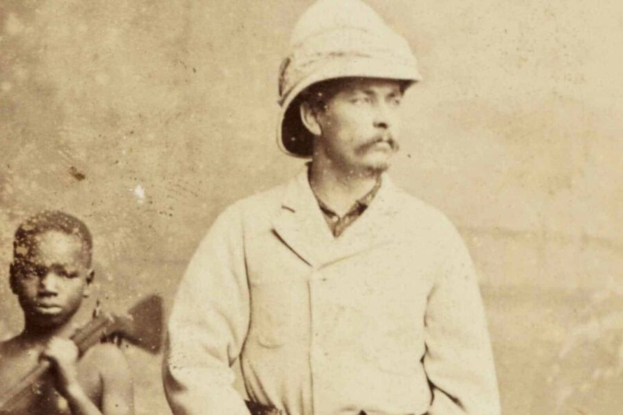
Then, on a morning in May 1888, Henry Morton Stanley looked up through a gap in the equatorial cloud somewhere north of Lake Albert and saw snow. The Rwenzori Mountains, which the Bakonzo people had long called Rwenzururu, “Place of Snow,” entered the European record. Two thousand years of myth resolved, in the fraction of a second it took for a gap in the cloud to open and close, into mountain reality: permanent glaciers on the equator feeding the lakes of the Albertine Rift Valley, precisely where the ancient sources had always said the mountains would be.
Henry Morton Stanley on the foothills of the Rwenzori Mountains
This article traces the full 2,000-year journey of the Mountains of the Moon from the ancient world’s geographical imagination to the UNESCO-protected wilderness through which trekkers now walk on the Central Circuit Trail and the Kilembe Trail. It is a story of ancient scholarship, of the persistence of genuine geographical knowledge across millennia of incomplete transmission, of the long history of European failure to find what was always there, and of what it means to climb a mountain that a Greek geographer working in Alexandria described from secondhand reports nearly two thousand years before the first European set foot on it.
Claudius Ptolemy and the Geographia: The Text That Defined a Mountain for Two Millennia
Claudius Ptolemy was born sometime around 100 CE, probably in Egypt, and worked in Alexandria during the second century of the Common Era, the intellectual capital of the ancient Mediterranean world. He was a mathematician, astronomer, and geographer whose works represent the most sophisticated scientific synthesis of the Greco-Roman world’s knowledge about the Earth, the heavens, and the geometry that connects them. His astronomical treatise, the Almagest, remained the foundational text of European astronomy for more than a thousand years. His geographical work, the Geographia, properly titled Cosmographia or Geographike Hyphegesis (Guide to Geography), was similarly canonical, shaping the European understanding of world geography from the second century CE until well into the age of European overseas exploration in the fifteenth and sixteenth centuries.
The Geographia is, in its essentials, a work of applied mathematics: a systematic attempt to place all known geographical features coastlines, rivers, mountains, cities, and peoples on a coordinate grid using latitude and longitude and to provide the mathematical framework for constructing accurate world maps from that data. Ptolemy was not an explorer; he never visited Africa’s interior. His information came from the reports of merchants, sailors, and travelers that had been accumulating in the libraries and trading records of the Mediterranean world for centuries. His genius lay in synthesizing and systematizing the accumulated information into a coherent geographical framework. However, his limitation was that the information he was systematizing was often incomplete, sometimes inaccurate, and filtered through multiple layers of secondhand transmission.
The Lunae Montes Passage: What Ptolemy Actually Wrote
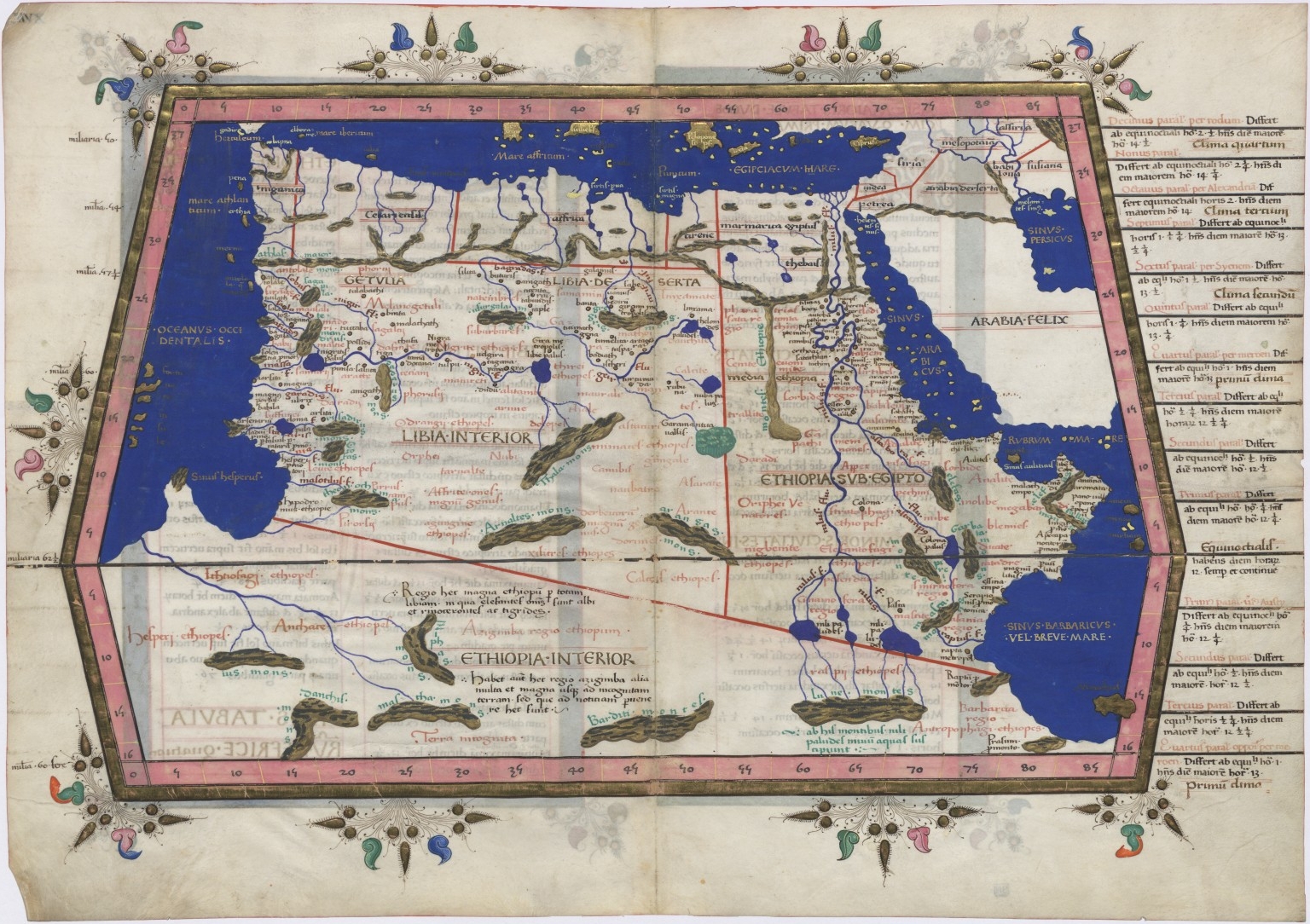
The passage in the Geographia that would shape 1,700 years of African geographical exploration is, in its original form, remarkably brief. In Book IV, Chapter 8, Ptolemy describes the Nile’s source in the following terms: the river draws its waters from two great lakes, which are themselves fed by the snows of a range of mountains that Ptolemy calls the “Selenean Mountains” or, in the more commonly reproduced Latin translation, the Lunae Montes, literally, the Mountains of the Moon. The mountains are given a rough position: somewhere in the southern interior of Africa, at latitudes broadly consistent (by Ptolemy’s coordinate system) with the equatorial highlands.
The mountains of the Moon receive snows, and the melting of these snows fills the lakes of the Nile. Claudius Ptolemy, Geographia, Book IV, Chapter 8 (c. 150 CE). Translated from Greek.
The brevity of the passage is as striking as its content. Ptolemy does not describe the mountains in any detail: no height estimate, no description of the vegetation or wildlife, and no account of the peoples who live in their shadow. He simply asserts their existence, names them for the Moon (the reason for this naming is debated; it may relate to the silver-white appearance of snowfields, to the mountains’ role in ancient cosmological geography, or to the specific name used by the trading sources from which the information was derived), locates them approximately, and assigns them the hydrological function of Nile source.
This brevity is simultaneously the passage’s strength and its weakness as a historical geographical record. Its strength: the core claim that snow mountains in the equatorial African interior feed the lakes that feed the Nile is, as we now know, factually correct. The weakness: the absence of detail made it impossible for seventeen centuries to confirm, locate precisely, or triangulate against other sources with sufficient specificity to distinguish the real Rwenzori Mountains from the numerous alternative candidates that subsequent geographical speculation proposed.
Ptolemy’s Sources: Who Told Him About the Mountains?
The source of Ptolemy’s information about the Lunae Montes is one of the most fascinating problems in ancient geography, with no definitive answer. Several source traditions have been proposed, and the truth was probably a combination of all of them rather than a single specific account.
A Greek trading manual of the first century CE documents the East African coast trade in considerable detail, demonstrating that Greek-speaking traders had direct knowledge of the coast from the Horn of Africa to at least the latitude of modern Kenya and Tanzania.
Interior knowledge reports of what lay inland of the coast was less direct but still present. Trading networks extended from the coast into the interior through chains of exchange that, while they did not involve direct Mediterranean participation, transmitted geographical information along with commodities. A merchant trading ivory at an East African coastal port in the first century CE might have received that ivory from an interior intermediary who had received it from communities living at the foot of snow-capped mountains in the equatorial interior. The information about snow mountains being remarkable, memorable, and easily transmissible could have passed along this chain to the coast and from the coast to the Mediterranean without any single link in the chain having personal knowledge of the mountains themselves.
There is also a possible connection through the ancient overland trade routes of the Nile Valley. Egyptian and Nubian traders had direct access to East African commodities through the Nile corridor, and their geographical knowledge of the Nile’s upper courses, while limited, extended further south than the coastal traders’ knowledge extended inland. Accounts of the Nile’s ultimate origins in distant snow mountains could have filtered northward through this channel to the scholars of Alexandria.
Why “Mountains of the Moon”? The Name’s Origins and Meanings
The name Ptolemy gives to the range, Selenean Mountains in Greek and Lunae Montes in the Latin translations that dominated European scholarship through the medieval and Renaissance periods, is one of the most evocative in the history of geographical nomenclature. Mountains of the Moon: It sounds like myth, like the title of a fantasy novel, like a name invented to suggest remoteness and mystery rather than to describe a specific geographical feature. And yet the name survived, was reproduced on map after map for fifteen centuries, and ultimately resolved onto a real mountain range that deserves the name on every occasion that trekkers stand in its morning mist and feel genuinely that they could be anywhere but in the ordinary world.
The Lunar Connection: Three Competing Explanations
Why did Ptolemy or his sources associate these mountains with the Moon? Scholars have offered three primary explanations, and all three genuinely merit consideration as partial answers to the question.
The first and most straightforward explanation is visual: the snowfields of a high equatorial mountain range, seen from a distance in daylight, are silver-white and luminous in a way that ancient observers, in a world without the other white or silver-white objects that fill the modern environment, might naturally associate with moonlight. The silver gleam of distant snow against a blue sky or dark storm cloud is a visual phenomenon that would have stood out dramatically to any pre-modern observer, and the association between that silver-white luminosity and the silver disc of the full moon is an intuitive, cross-cultural one. The Rwenzori’s glaciers today, when visible through the perpetual cloud cover from the valley floor, still have exactly this quality: a cold, silver-white brilliance that seems to belong to a different world from the green and brown of the surrounding equatorial lowlands.
The second explanation is linguistic: the name may preserve a translation or transliteration of an African indigenous name for the mountains that incorporated a lunar element, either because the mountains were associated with the Moon in local spiritual cosmology or because a linguistic cognate of a local place name sounded like a lunar reference to Greek-speaking intermediaries who transmitted it. This explanation is speculative but not implausible: the Bakonzo people’s name for the mountains Rwenzururu, Place of Snow, refers to the visual phenomenon of white (snow) rather than to the Moon directly, but it is entirely possible that other communities in the ancient trading network had different names incorporating lunar associations.
The third explanation is cosmological: in ancient Greek geographical thinking, the Moon was associated with moisture, rainfall, and the sources of rivers. The geographical logic that located a range of lunar mountains at the source of the Nile, the world’s greatest river, whose annual flood was the miracle of Egyptian civilization, may reflect a cosmological framework in which the Moon’s watery associations were made spatially literal by anchoring them to the mountains from which the great river’s waters flowed. In this reading, the “Mountains of the Moon” name is as much a statement about the mountains’ hydrological function as about their appearance. They are mountains of the Moon because they embody the Moon’s role as the source of life-giving water in the ancient cosmological geography of the Nile.
Medieval Transmission: How Arab and Islamic Geography Kept the Mountains Alive
When the Western Roman Empire collapsed in the fifth century CE and the intellectual institutions of the ancient Mediterranean world fragmented, much of the geographical knowledge that Ptolemy had systematized was at risk of being lost or distorted in the chaos of political and cultural transition. The survival of the Geographia and the Lunae Montes across the medieval period was primarily the work of scholars other than European Christians, who had limited access to and interest in the ancient geographical texts during the early medieval centuries. It was the work of Arab and Islamic scholars, who translated, preserved, refined, and extended the Ptolemaic geographical tradition through the remarkable period of Islamic scientific achievement that flourished from the seventh to the fifteenth centuries.
Al-Idrisi and the 12th-Century Synthesis
The most influential medieval treatment of the Mountains of the Moon appeared in the work of Muhammad al-Idrisi, the Moroccan-born Islamic geographer who worked at the court of the Norman King Roger II of Sicily in the twelfth century. Al-Idrisi’s great geographical work , known as the Nuzhat al-Mushtaq fi’khtiraq al-Afaq (The Book of Pleasant Journeys into Faraway Lands), or, in the abbreviated form commonly used in Western scholarship, the Tabula Rogeriana, was completed in 1154 and represented the most sophisticated synthesis of ancient and medieval geographical knowledge available at the time. The world map that accompanied it was drawn with south at the top (in the Islamic cartographic convention of the period) and placed the Mountains of the Moon in the African interior with considerable specificity, feeding two lakes whose outflows combined to form the Nile.
Al-Idrisi’s account of the Lunae Montes was more detailed than Ptolemy’s original, incorporating additional information that had accumulated over the intervening centuries through Arab trading contact with East Africa. His description of the mountains as a large, snow-covered range positioned at high latitude in the African interior, feeding multiple lakes through their meltwater, is consistent enough with the actual geography of the Rwenzori Mountains and the Great Lakes system to suggest that the underlying empirical kernel was genuine, even if the details had been distorted through multiple translations and retellings. Al-Idrisi’s Tabula Rogeriana became the cartographic reference point for European mapmakers in the high medieval period, and through it, the Mountains of the Moon entered the European visual and intellectual tradition in their most detailed and authoritative medieval form.
The Persistence of the Mountains on European Maps
From the late medieval period through the Renaissance and into the early modern era, the Mountains of the Moon appeared on virtually every serious European map of Africa. The remarkable Flemish cartographers of the sixteenth century, Gerard Mercator, Abraham Ortelius, and their contemporaries, reproduced the feature from Ptolemaic and Islamic sources, placing the mountains with varying degrees of precision across the equatorial interior of the continent. The famous Mercator world map of 1569, the one that introduced the cylindrical projection that now bears his name, shows the Lunae Montes prominently in the African interior, feeding a river system that flows northward to the Mediterranean. Ortelius’s Theatrum Orbis Terrarum of 1570, often cited as the first modern world atlas, reproduces the feature similarly.
The longevity of the Mountains of the Moon on European cartography is remarkable precisely because these maps were being produced in the same period during which European exploration was actively reshaping geographical knowledge: when the Portuguese were circumnavigating Africa, when Spanish and Dutch explorers were mapping the Americas, and when the coastlines of Africa were being charted with increasing accuracy. The interior of Africa remained, for this entire period, largely unknown to direct European observation, and the Ptolemaic inheritance, including the Lunae Montes, continued to fill the void on maps that were otherwise becoming more accurate with every passing decade.
The Long Search: Centuries of Failed Expeditions and Shifting Theories
The period from the sixteenth to the nineteenth centuries was marked by sustained European efforts to resolve the geographical mysteries of the African interior, particularly the question of the Nile’s source, which was inseparable in ancient and medieval traditions from the question of the Mountains of the Moon. Each major expedition that ventured toward the African interior generated new hypotheses about where the mountains might be, and each hypothesis was eventually falsified by the failure of subsequent expeditions to confirm the predicted geography.
The Blue Nile Distraction: James Bruce and the Ethiopian Highlands
In 1770, the Scottish explorer James Bruce reached the source of the Blue Nile at Lake Tana in the Ethiopian Highlands, marking one of the most significant redirections in the long search for the Mountains of the Moon. Bruce’s discovery was dramatic and personally triumphant in his telling, but controversial and contested in the reception it received from a skeptical European geographical establishment, raising the possibility that the Mountains of the Moon were not the equatorial peaks described by Ptolemy but rather the highland ranges of Ethiopia, from whose rivers the Blue Nile drew its primary seasonal flood contribution to the overall river system.
This hypothesis was geographically incorrect; the Blue Nile is a significant but not primary Nile source, and the Ethiopian Highlands, while high and with some seasonal snow at altitude, are not the glaciated equatorial peaks that Ptolemy’s sources were describing. But it was plausible enough to distract the geographical establishment for decades, diverting exploratory resources toward East African search areas that were well north and east of the Albertine Rift Valley where the Rwenzori actually lies.
Speke, Burton, and the Lake Victoria Era
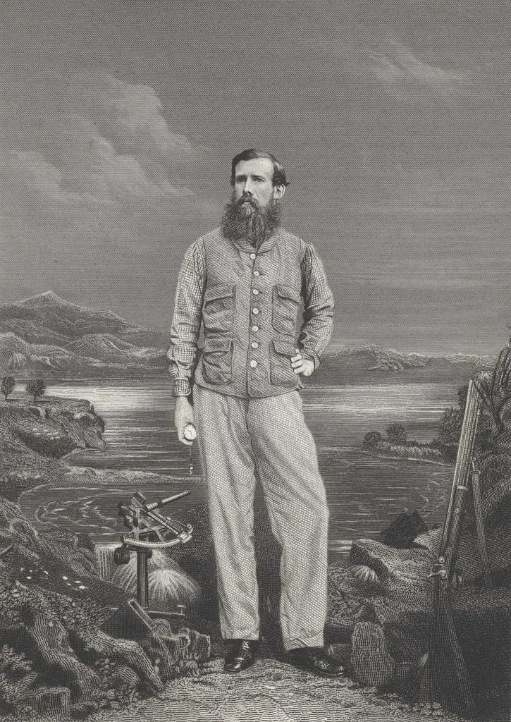
The Victorian age’s engagement with the Nile question, which was simultaneously a search for the ultimate source of the river and an implicit continuation of the quest for Ptolemy’s Mountains of the Moon, reached its most dramatic phase in the expeditions of John Hanning Speke and Richard Francis Burton in the 1850s and 1860s. Burton and Speke’s 1858 expedition to Lake Tanganyika and Speke’s subsequent solo exploration of Lake Victoria in 1858 generated the claim that Victoria was the primary Nile source, a claim that Burton disputed and that remained the subject of bitter personal and scientific controversy until the deaths of both men.
Speke, crucially, also theorized the existence of snow-capped mountains somewhere west of Lake Victoria, mountains that he believed to be the geographical reality behind Ptolemy’s Lunae Montes and that he suspected were feeding the western Nile tributaries through lakes he had not been able to reach. These theoretical Mountains of the Moon appeared in Speke’s maps and writings without visual confirmation; they were a deduction from Ptolemaic tradition, from geographical logic about where the Nile’s western sources might lie, and from the testimony of Buganda informants who described snow-capped mountains to the west. Speke was pointing, with remarkable accuracy, in the direction of the Rwenzori Mountains, but he died in a hunting accident in 1864 before any expedition reached a position from which the mountains were visible.
Samuel Baker and Lake Albert: The Last Piece Before the Discovery
Samuel White Baker’s 1864 discovery of Lake Albert, following the western tributaries of the Nile to their second great lake reservoir in the Albertine Rift, brought European exploration geographically close to the Rwenzori without producing a confirmed sighting. Baker’s route to Lake Albert took him through terrain from which, on clear days, the Rwenzori’s upper snowfields would have been theoretically visible, but the mountain’s characteristic and persistent cloud cover, which famously concealed it from Stanley on most days of his approach in 1888, appears to have done its usual work. Baker saw, or at least recorded seeing, nothing of the snow-capped range to the west and southwest that his near-miss position should have allowed. The Rwenzori Mountains continued to hide behind their cloud cover, as they had been hiding for all of recorded history, waiting for the specific combination of position, timing, and atmospheric conditions that would produce the clear window in which Stanley finally saw them in May 1888.
Resolution: Stanley’s 1888 Sighting and the Collapse of 1,700 Years of Uncertainty
The story of Stanley’s 1888 sighting of the Rwenzori Mountains is told in full in our companion article on Henry Morton Stanley and the Discovery of the Rwenzori Mountains. What is most relevant to the Ptolemy question and what deserves specific attention here is not the mechanical fact of the sighting but the intellectual significance of what it meant for the ancient geographical tradition when the sighting was confirmed.
When Stanley published his account of the Rwenzori sighting in In Darkest Africa in 1890 and argued explicitly that the range he had identified was the geographical reality behind Ptolemy’s Lunae Montes, the response from European scholars was not universal acceptance. Several alternative candidates for the Mountains of the Moon had been proposed over the preceding decades, and their proponents were not immediately persuaded. But the convergence of evidence was compelling: the Rwenzori’s position in the equatorial African interior was consistent with Ptolemy’s coordinate data (imprecise as that data was); the mountains clearly fed lakes Lake Edward and Lake Albert that were part of the Nile system; the permanent glaciers on the mountains’ upper flanks were the equatorial snow that Ptolemy’s sources had described; and the overall hydrological function of the range as a permanent, year-round water source for the Nile tributaries of the Albertine Rift matched the ancient description with a completeness that no other candidate had achieved.
The Duke of Abruzzi and Scientific Confirmation
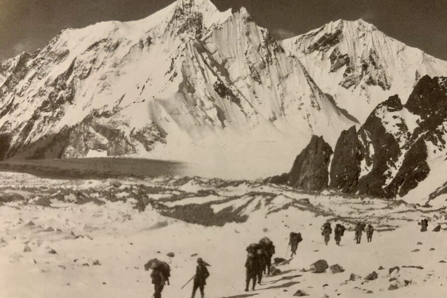
The definitive scientific confirmation that the Rwenzori Mountains were Ptolemy’s Mountains of the Moon came with the Duke of Abruzzi’s 1906 expedition, which combined the first ascents of all major Rwenzori peaks with a systematic scientific program of mapping, glaciological observation, botanical documentation, and photographic recording. The expedition’s results, published by the Duke in his 1909 account Il Ruwenzori and accompanied by Vittorio Sella’s extraordinary photographs, provided the most complete picture of the range that had yet been assembled and made the case for the Rwenzori-Lunae Montes identification on the basis of converging evidence that the scholarly community largely accepted.
By this point, the geographical logic overwhelmed us. Here was a range of permanently glaciated mountains at the equator, the equatorial snow that had been theorized from Ptolemy’s sources for 1,700 years. Here were the lakes Lake Edward and Lake Albert, whose locations and relationships to the Nile system matched the ancient description as well as could reasonably be expected given the imprecision of Ptolemy’s coordinate system. Here were the mountains’ extraordinary physical dimensions. Margherita Peak, at 5,109 metres across six massifs spanning Mount Stanley, Mount Speke, Mount Baker, Mount Emin, Mount Gessi, and Mount Luigi di Savoia, could plausibly have been described as a single great mountain range by ancient informants working from distant observation or secondhand report. And here were the Bakonzo people, who had been calling the mountains “Rwenzururu” Place of Snow for centuries longer than any of the European geographical debates had been running.
Surviving Doubts: Are the Rwenzori Mountains Definitely Ptolemy’s Lunae Montes?
Academic honesty requires acknowledging that the identification of the Rwenzori Mountains with Ptolemy’s Lunae Montes, while the dominant scholarly consensus, is not and perhaps cannot be established with the kind of unambiguous documentary proof that would satisfy the most rigorous historical standards. The primary difficulty is the brevity and imprecision of Ptolemy’s original text, combined with the transformation that the information underwent in passing through multiple languages, cultures, and centuries of transmission before Ptolemy received and systematized it.
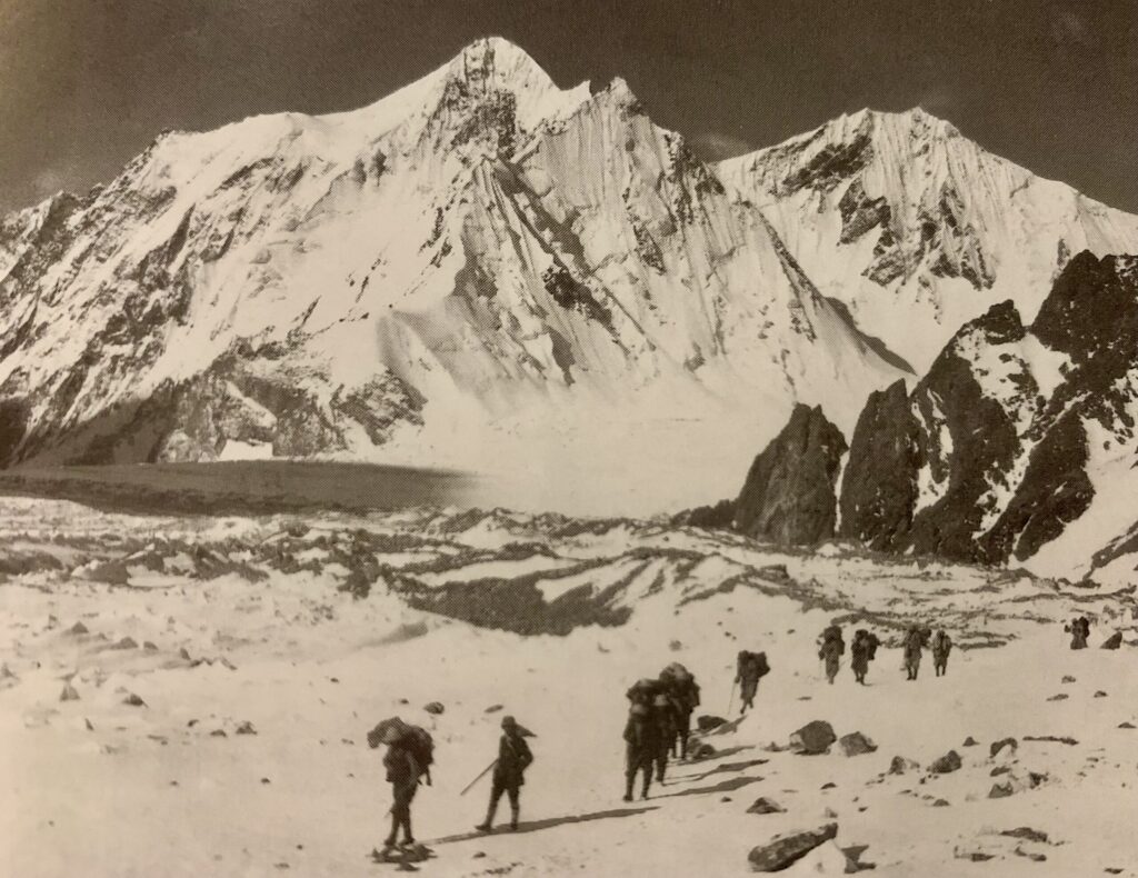
The Kilimanjaro Alternative
The most persistent alternative candidate for the Mountains of the Moon is Kilimanjaro, the volcanic massif in northern Tanzania that, at 5,895 metres is Africa’s highest peak. Kilimanjaro is permanently snow-capped, is located in the equatorial region of East Africa, and, under certain interpretations of Ptolemy’s coordinate data, falls within the geographical range that the ancient text might be describing. Its permanent glaciers (themselves now retreating rapidly) were visible from the surrounding savanna on clear days in a way that the Rwenzori’s cloud-obscured snowfields were not, making it a more “discoverable” mountain for ancient trading and exploration networks.
The primary argument against Kilimanjaro as the Lunae Montes is hydrological: Kilimanjaro does not feed the Nile system. Its meltwater flows eastward into the Pangani River, which reaches the Indian Ocean rather than the Nile. Ptolemy’s text is explicit that the Mountains of the Moon feed the lakes from which the Nile draws its source, and that description simply does not fit Kilimanjaro, whatever the coordinate arguments might suggest. The Rwenzori, by contrast, directly feeds Lake Edward via the Nyamwamba and other rivers and feeds Lake Albert via the Semliki, both lakes that are integral parts of the western Nile system.
The Possibility of a Composite Description
A third interpretive possibility, one that several scholars have found more satisfying than either a strict single-mountain identification, is that Ptolemy’s Lunae Montes represent a composite description: a synthesis of reports from several different snow-mountain sources that ancient trading networks had encountered in the East African interior, merged in the process of transmission into a single named feature on the Ptolemaic map. Under this reading, the Lunae Montes might incorporate elements derived from Kilimanjaro, the Rwenzori, Mount Kenya, and the Ethiopian Highlands, all of which were real snow-bearing mountains that ancient trading networks might have encountered reports of, and all of which might have contributed information to the accumulated tradition that Ptolemy’s sources were synthesizing.
This composite interpretation has the advantage of explaining some of the imprecision in Ptolemy’s description, particularly the latitude data, which places the Lunae Montes at coordinates that fit none of the candidate mountains perfectly while still allowing the Rwenzori to claim the most important element of the identification: the hydrological function of feeding the Nile source lakes. Whether the Lunae Montes are the Rwenzori alone or the Rwenzori is the primary candidate in a composite tradition, the mountain range that trekkers walk today on the Central Circuit Trail and the Kilembe Trail is the most substantively accurate candidate for Ptolemy’s ancient description.
From Ptolemy to the Present: A 2,000-Year Historical Timeline
The following timeline traces the Mountains of the Moon from their first appearance in ancient scholarship through to their modern confirmed identification with the Rwenzori.
| Period | Thinker / Event | How Lunae Montes Was Interpreted or Used |
| ~450 BCE | Herodotus | First hints of interior African geography; mentions sources of the Nile without the mountain detail |
| ~150 CE | Ptolemy’s Geographia | First written “Lunae Montes” Mountains of the Moon, as a named feature feeding two lakes that form the Nile |
| 7th–15th C | Arab geographers | Al-Idrisi and others reproduce and refine Ptolemy’s African geography; Lunae Montes persists on Islamic maps |
| 1154 CE | Al-Idrisi’s world map | The most sophisticated medieval map shows the Mountains of the Moon feeding the Nile; shapes European cartography |
| 15th–17th C | European cartographers | Renaissance maps place Lunae Montes across the African interior; Mercator, Ortelius, and others reproduce the feature |
| 1770 | James Bruce | Finds the Blue Nile source in Ethiopia; questions whether Lunae Montes could be there; redirects search south |
| 1858–1862 | Speke and Burton | Lake Victoria identified as primary Nile source; Speke theorises snow mountains are still without visual confirmation |
| May 1888 | Henry Morton Stanley | First confirmed European sighting of the Rwenzori Ptolemy’s Lunae Montes located after 1,700 years of search |
| 1906 | Duke of Abruzzi | Full scientific exploration and first ascents confirm the Rwenzori as the Mountains of the Moon beyond reasonable doubt |
Walking the Mountains of the Moon: What the Ancient Name Means Today.
The name “Mountains of the Moon” is not merely historical decoration. It is not a marketing tagline or a romantic embellishment. It is the name that Ptolemy’s ancient sources gave to a real mountain range based on real empirical observation passed through real, if imperfect and incomplete, trading networks across real distances of space and time. When you call the Rwenzori the Mountains of the Moon, you are participating in a 2,000-year tradition of naming that connects the present-day trekking experience to the oldest surviving written record of the range’s existence.

I have guided dozens of expeditions through the Rwenzori Mountains, and the moments that most consistently produce the visceral recognition of why the name feels right are not the summit photographs or the glacier crossings. They are the moments in the Bujuku Valley in the early morning, before the cloud builds, when the silver light of dawn catches the snowfields above Elena Hut and the giant groundsels and lobelias below stand in a landscape that seems, genuinely, to belong to a world other than the one you left at the Nyakalengija trailhead three days ago. This view is what Ptolemy’s sources saw, or heard about, or somehow understood at the end of an information chain of remarkable length and improbable accuracy. A landscape that deserves a mythological name because it produces, in those who enter it, an experience that the ordinary categories of description do not adequately contain.
The giant plants of the upper alpine zone, the six-meter groundsels, the four-meter lobelias, and the cathedral heather forests have no parallel anywhere else in Africa. The glaciers that linger above 4,400 metres at the equator are a geological and climatological anomaly that the physics of a warming world will soon erase. The biodiversity of the range, its 19 Albertine Rift endemic bird species, its unique mammal community, and its extraordinary endemism in the vegetation zones is the product of three to four million years of evolutionary isolation on a tectonic block that the Albertine Rift pushed skyward while the valley floor subsided around it. The Mountains of the Moon earned their name from their appearance, but they retain it because of their character.
Most trekkers hear the name “Mountains of the Moon” and the name “Rwenzori” used interchangeably in the context of planning a trek. Both refer to the same range. “Rwenzori” is the standardized Ugandan official name, derived from the Bakonzo’s own “Rwenzururu.” “Mountains of the Moon” is the informal historical name, carrying the Ptolemaic tradition forward into popular usage. On the mountain itself, your Bakonzo guide will most naturally say “Rwenzori.” You will hear “Mountains of the Moon” just as often in conversations with expedition veterans and travel journalists. Both are correct. Both are appropriate.
Frequently Asked Questions: Ptolemy’s Mountains of the Moon
What did Ptolemy say about the Mountains of the Moon?
In his second-century CE geographical work, the Geographia, Claudius Ptolemy described a range of snow-capped mountains in the interior of Africa that he called the Selenean Mountains in Greek, Lunae Montes, or Mountains of the Moon, in the Latin translations that dominated later European scholarship. Ptolemy wrote that these mountains received snow, and from the melting of that snow, two great lakes were formed. The Nile River drew its source from those lakes. He provided rough coordinate data placing the mountains in the equatorial interior of Africa, broadly consistent with the actual position of the Rwenzori range in western Uganda and eastern DRC. The passage is brief, just a few sentences, but it proved extraordinarily influential, shaping two thousand years of European and Islamic geographical speculation about the African interior and the sources of the Nile.
Are the Rwenzori Mountains Ptolemy’s Mountains of the Moon?
The consensus among geographers and historians of science is that the Rwenzori Mountains are the most likely geographical reality behind Ptolemy’s Lunae Montes, the Mountains of the Moon, though absolute certainty is impossible given the brevity and imprecision of Ptolemy’s text. The key arguments in favor of the Rwenzori identification are the mountains’ permanent glaciers at the equator match Ptolemy’s description of snow-covered peaks in the equatorial interior; the Rwenzori directly feeds the Nile system through Lake Edward and Lake Albert via the Semliki River, precisely fulfilling the ancient description of the Nile-source hydrological function; and the Bakonzo people’s name for the range, Rwenzururu, Place of Snow, indicates that the mountains were associated with permanent snow in local knowledge traditions far older than any European geographical record. Henry Morton Stanley was the first European to make a confirmed sighting of the Rwenzori in May 1888 and argued explicitly for the Ptolemy identification. The Duke of Abruzzi’s 1906 scientific expedition provided systematic evidence confirming this identification.
Why are the Rwenzori called the Mountains of the Moon?
The name “Mountains of the Moon” derives from Claudius Ptolemy’s second-century CE geographical work Geographia, in which he called the snow-covered equatorial African mountains that feed the Nile source “Lunae Montes” literally, Mountains of the Moon” in Latin. Three explanations have been proposed for the lunar association: the silver-white luminosity of the mountains’ snowfields, which ancient observers might naturally have associated with moonlight; a possible linguistic derivation from an African indigenous name incorporating a lunar element; and a cosmological association in ancient Greek geographical thought between the Moon, moisture, and the sources of great rivers. The name survived on European and Islamic maps for fifteen centuries and was confirmed as the label for the Rwenzori Range when Henry Morton Stanley made the first European sighting in 1888 and identified them with Ptolemy’s ancient description.
Who was Claudius Ptolemy, and why is he important to Rwenzori history?
Claudius Ptolemy was a Greek mathematician, astronomer, and geographer who worked in Alexandria, Egypt, in the second century CE. His geographical work, the Geographia, was the most comprehensive and systematic synthesis of ancient world geographical knowledge ever produced, and it shaped European understanding of world geography for more than a thousand years. In the context of Rwenzori history, Ptolemy is important because his Geographia contains the first recorded written reference to what appear to be the Rwenzori Mountains, described as “Lunae Montes” (Mountains of the Moon), a range of snow-capped peaks in the equatorial African interior from whose meltwater the Nile draws its source. This description, while secondhand and imprecise, proved accurate in its essential claims and launched 1,700 years of European geographical speculation and exploration that ultimately culminated in Stanley’s confirmed 1888 sighting.
How long has the Rwenzori been known as the Mountains of the Moon?
The name “Mountains of the Moon” has been associated with the Rwenzori range in Western geographical tradition since the first confirmed European sighting in 1888, when Henry Morton Stanley explicitly linked his discovery to Ptolemy’s ancient Lunae Montes. The underlying reference, Ptolemy’s description of the snow mountains that feed the Nile source, dates to approximately 150 CE, nearly 2,000 years ago. The Bakonzo people, whose ancestral homeland encompasses the Rwenzori foothills, have used their own name for the range, Rwenzururu, Place of Snow, for far longer than any recorded history exists, with linguistic evidence suggesting the name has been in continuous use for thousands of years. The name “Mountains of the Moon” therefore represents both a 2,000-year-old classical geographical tradition and, through the underlying Bakonzo naming, a far older indigenous tradition of naming the mountain for its most visually distinctive characteristic: its permanent equatorial snow.
What was Ptolemy’s source of information about the Mountains of the Moon?
Ptolemy did not personally visit Africa’s interior; he was a scholar working in Alexandria, relying on accumulated reports and records. His information about the Mountains of the Moon is believed to have derived from the extensive trading networks that connected the ancient Mediterranean world with sub-Saharan Africa through several channels: the East African coastal trade (documented in the Periplus of the Erythraean Sea and other ancient sources), which transmitted geographical knowledge from the East African coast to Mediterranean ports; the Nile Valley trading corridor, through which reports of the Nile’s upper sources filtered northward; and possibly direct accounts from merchants or explorers who had encountered the mountains or received reports of them from people who had. The information was certainly secondhand and possibly passed through multiple intermediaries before reaching Ptolemy, which explains both the accuracy of the essential claim (snow mountains in the equatorial interior feeding the Nile sources) and the imprecision of the coordinate details.
Did any other ancient civilizations know about the Mountains of the Moon?
The Ptolemaic description of the Lunae Montes was the primary ancient Western record, but there is evidence that awareness of the equatorial African snow mountains extended into other knowledge traditions of the ancient and medieval world. Arab and Islamic geographers who translated and extended Ptolemy’s work, particularly al-Idrisi, whose 1154 Tabula Rogeriana provided the most detailed medieval treatment of the feature, drew on additional information from Arab trading networks in East Africa that supplemented the Ptolemaic inheritance with more recent empirical knowledge. The Periplus of the Erythraean Sea, a first-century CE Greek trading manual, documents East African coastal trade that would have provided access to interior geographical knowledge. Ancient Egyptian and Nubian knowledge of the Nile’s ultimate origins, preserved in religious and mythological traditions about the Nile flood, may also have incorporated awareness of the equatorial highlands, though the evidence for this is indirect.
Is the “Mountains of the Moon” name still used today?
Yes. “Mountains of the Moon” remains in active use as a secondary or alternative name for the Rwenzori Mountains, alongside the standardized Ugandan official name “Rwenzori.” It appears in travel writing, expedition accounts, and popular geographical references with considerable frequency, and it is widely understood in the international trekking and adventure travel community as a reference to the Rwenzori. The name appears on our website, in our expedition materials, and in the descriptions of routes, including the Central Circuit Trail and the Kilembe Trail. It is also used in UNESCO documentation related to Rwenzori Mountains National Park. The name carries both the historical weight of Ptolemy’s ancient identification and the immediate descriptive power of a range whose equatorial glaciers, perpetual mists, and otherworldly vegetation make the lunar association feel, even today, genuinely appropriate.
Trek the Mountains That Ptolemy Described: Join a 2,000-Year Story
Two thousand years ago, in the magnificent library city of Alexandria, a Greek scholar wrote down what his trading sources told him about a range of snow-covered mountains in the interior of Africa. He called them the Mountains of the Moon. He could not have known, and neither could his sources, or their sources, or anyone in the long chain of transmission through which the information traveled, that his words would endure in the geographical literature of three civilizations for the next two millennia, shaping the routes of explorers and the maps of cartographers from the Arab world’s golden age through the Renaissance to the Victorian era. Ptolemy wrote a description. The world spent 1,700 years finding the mountain that matched it.

You can walk through that mountain today. The 7-day Margherita Peak summit trek takes you from the montane forest of the Rwenzori foothills through the bamboo and heather zones, into the giant groundsel and lobelia world of the Bujuku Valley, and ultimately across the glacier ice of the Elena approach to the summit of Margherita Peak at 5,109 metres. The 13-day six-peaks expedition traces the full topographic range of Ptolemy’s Lunae Montes across all six massifs. The 3-day Mahoma Loop brings you into the forest and lake landscapes of the mountain’s lower zone, where the rainfall that feeds the Nile begins its journey. Every route is a different entry point into the same 2,000-year story.
The team at Rwenzori Trekking Safaris is ready to put you on the mountain that Ptolemy named, that Stanley found, that the Duke of Abruzzi first climbed, and that the Bakonzo people have always known. Browse our full range of Rwenzori trekking itineraries, plan your visit with our month-by-month seasonal guide, and explore the 30 incredible facts about the range. When you are ready to become part of a 2,000-year tradition of human engagement with the Mountains of the Moon, contact our expedition team directly; we will help you walk the mountain that ancient scholarship only imagined.