Henry Morton Stanley’s 1888 discovery of the Rwenzori Mountains: the full story, the world’s reaction to equatorial snow, and the explorer legacy on today’s trails.
On a morning in May 1888, somewhere in the dense, fever-ridden forest country north of Lake Albert in central Africa, Henry Morton Stanley looked up. What he saw in the gap between the clouds was impossibly white and impossibly high, hanging above the green equatorial canopy like something painted onto the sky by a hand that had no business placing such a thing in such a place, and it stopped one of the nineteenth century’s most experienced and least easily surprised African explorers in his tracks. He had been on the continent for more than two decades. He had crossed it from east to west. He had navigated the Congo River. He had found Livingstone. And now, at the equator, he was looking at snow.
The mountains he saw that morning were the Rwenzori Mountains, the range that Ptolemy’s ancient geographers had called the Mountains of the Moon and that had been theorized, sought, and debated by European explorers for centuries without a single confirmed sighting. The moment of Stanley’s first view of the Rwenzori in May 1888 is one of the most significant episodes in the history of African exploration, the resolution of a geographical mystery that was more than 1,700 years old, achieved in the split second between cloud cover and cloud cover on a morning that Stanley himself described, with uncharacteristic restraint, as one of the most remarkable of his life.
This article is the definitive account of Stanley’s discovery, the context in which it happened, the reaction it provoked in the scientific and popular press of the time, and the legacy it left both in the mountain’s explorer history and in the names that now mark the peaks and features of the range that trekkers cross today on the Central Circuit Trail and the Kilembe Trail. Every expedition to Margherita Peak on Mount Stanley begins, in a very real sense, with that May morning in 1888.
Henry Morton Stanley: The Man Who Found the Mountains
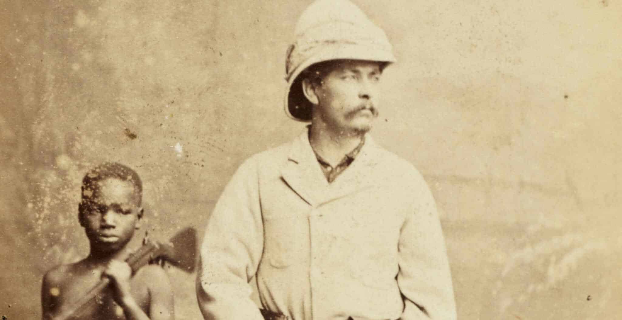
Henry Morton Stanley was, by 1888, the most famous explorer alive. Born John Rowlands in Denbigh, Wales, in 1841, he had reinvented himself as an American journalist before embarking on the African expeditions that made his name global. His 1871 mission to find the missing Scottish missionary David Livingstone turned him into a celebrity of the Victorian age, culminating in the famous greeting “Dr. Livingstone, I presume?” at Ujiji on the shores of Lake Tanganyika. His subsequent expeditions crossing the African continent from east to west by following the Congo River between 1874 and 1877, and establishing the Congo Free State for King Leopold II of Belgium between 1879 and 1884 had made him simultaneously the most admired and the most controversial figure in African exploration.
By 1887, Stanley was in his late forties and had already done more in Africa than any other living European. When the British and Egyptian governments sought someone to lead a relief expedition to Emin Pasha, the Governor of Equatoria province in southern Sudan, besieged by the Mahdist uprising and believed to be in desperate need of rescue, Stanley was the obvious and only choice. The Emin Pasha Relief Expedition of 1887 to 1889 would prove to be his last remarkable African venture, and it was during this expedition, one of the most chaotic, difficult, and ultimately ambiguous episodes in the history of African exploration, that he became the first European to lay confirmed eyes on the Rwenzori Mountains.
The Emin Pasha Relief Expedition: Context and Chaos
The Emin Pasha Relief Expedition was, from its outset, an enterprise of extraordinary logistical complexity and personal hardship. Stanley led a column of nearly 700 men, a mixture of Zanzibari porters, Sudanese soldiers, and European officers, from the mouth of the Congo River through the Ituri Forest to southern Sudan, a route chosen partly for its novelty and partly because Stanley’s principal backer, King Leopold II, wanted the expedition to serve Belgian commercial interests in the Congo Basin. The Ituri Forest section of the journey became one of the most harrowing in African exploration history: the dense, trackless equatorial forest claimed hundreds of lives from disease, starvation, and violence, and the survivors who emerged from it were in a state of physical and psychological devastation that Stanley’s subsequent written accounts only partially conveyed.
It was on the return journey from the disastrous Ituri crossing, moving southward toward Lake Albert in a landscape that Stanley was approaching from a direction no European expedition had previously taken, that the encounter with the Rwenzori Mountains became possible. The route from the Ituri toward Lake Albert brought Stanley’s column into the country of the Semliki Valley and the Rwenzori foothills, the Albertine Rift landscape in which the Rwenzori horst rises so dramatically from the rift floor that on a clear morning, the snow-capped summits are visible from considerable distances in the flat-floored valley below.
The Sighting of May 1888: A Moment That Changed Geographical History
The precise date of Stanley’s first sighting of the Rwenzori is recorded as 24 May 1888. The location was near the Semliki Valley, north of the point where the Semliki River enters Lake Albert, in what is now the border region between Uganda and the Democratic Republic of Congo. Stanley and his advance column were moving southward, looking for Emin Pasha and for the location of Lake Albert’s southern waters, when the clouds over the western horizon briefly parted.
“While looking to the south-west, I saw a peculiar-shaped cloud of a most beautiful silver color, which assumed the proportions and appearance of a vast mountain covered with snow.” Henry Morton Stanley, In Darkest Africa, 1890
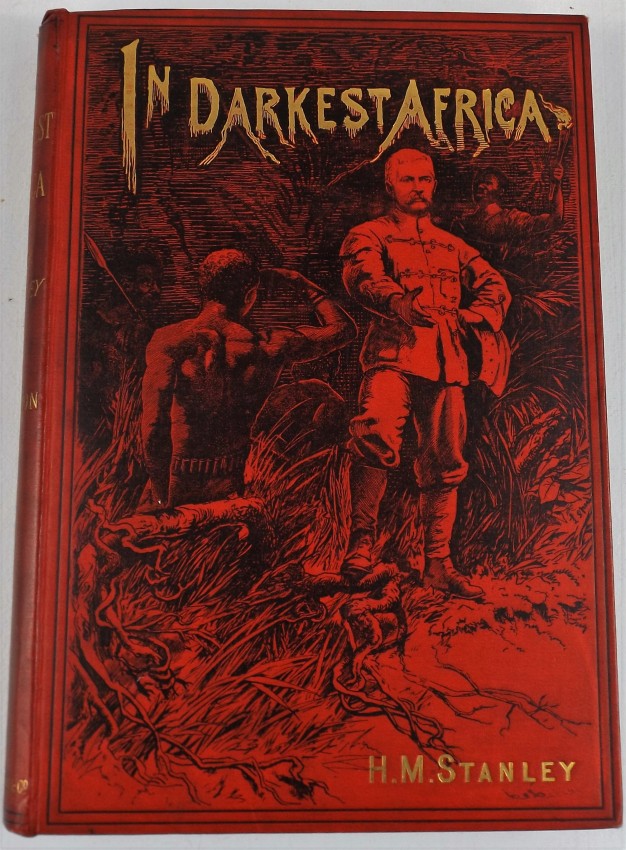
This is how Stanley described the moment in his subsequent account of the expedition, In Darkest Africa, published in 1890. The careful, observational, and uncertain language reflects something important about the encounter: Stanley was not initially sure that what he was seeing was real. A “peculiar-shaped cloud” that “assumed the proportions and appearance of a vast mountain covered with snow” is the description of a man whose eyes are telling him something that his mind is reluctant to immediately accept. At the equator, in central Africa, in a country that no European expedition had previously mapped, the idea of snow-capped mountains was, despite the theoretical possibility that the ancient literature had long proposed, a genuinely shocking visual datum.
Stanley was not a man prone to misidentification or romantic embellishment in his field observations. He was an experienced, pragmatic journalist-explorer who prided himself on accurate, verifiable reporting. The fact that he initially qualified his observation as possibly a cloud rather than definitively a mountain is therefore significant: even Stanley, with all his experience of African landscapes, found it difficult to immediately accept that he was looking at permanent snow on the equator.
Why the Sighting Was So Difficult to Believe
The intellectual difficulty of accepting snow at the equator in 1888 requires some contextualization. The Victorian scientific consensus on equatorial Africa was built on a foundation of incomplete and often inaccurate information, filtered through the lens of European assumptions about what tropical environments could and could not produce. The equator was associated with heat, fever, dense tropical vegetation, and extreme humidity, not with permanent snow and glaciers. The idea that mountains of sufficient altitude to support permanent snow could exist within a degree or two of the equator was theoretically possible under the physics of altitude and temperature, but it had never been confirmed by European observation and remained, for most Victorian scientists, a highly speculative proposition.
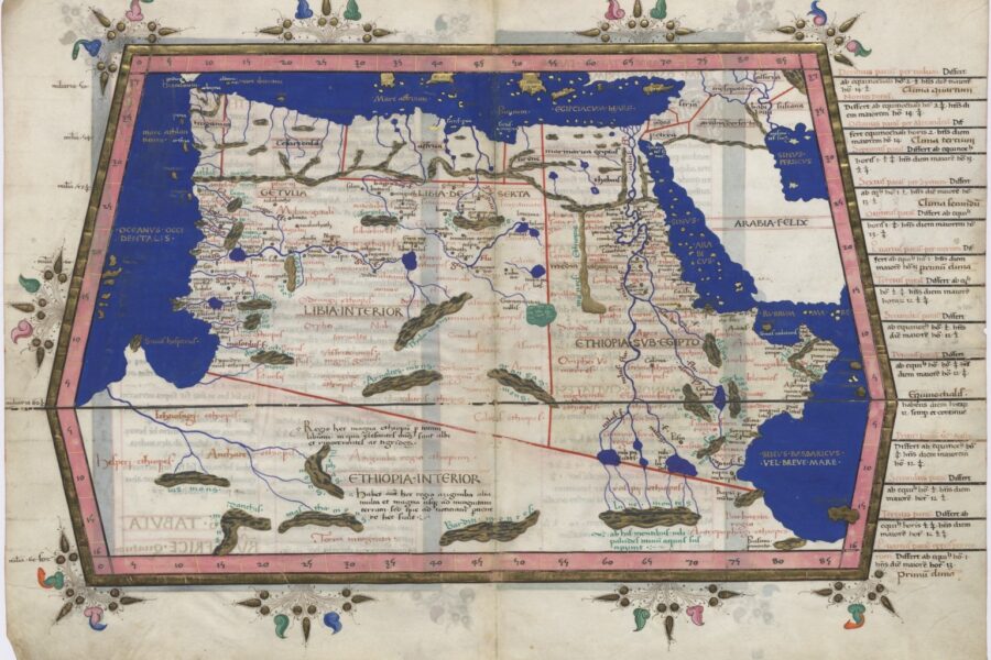
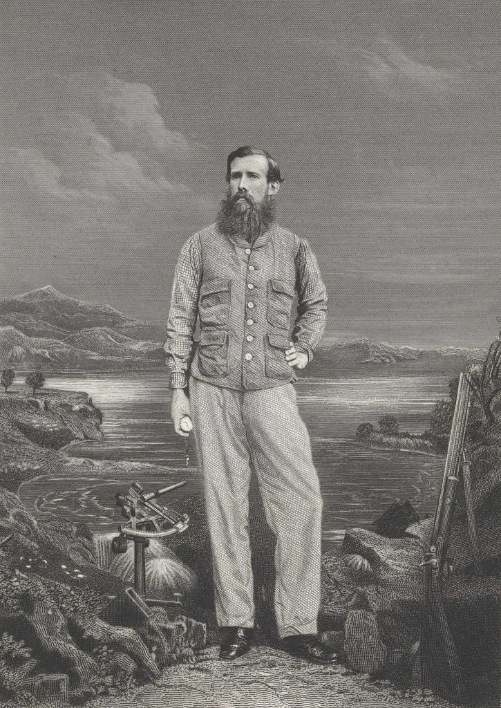
The theoretical case for the Mountains of the Moon had been made, most influentially, by the ancient geographer Ptolemy, who described mountains of snow in the interior of Africa from which the Nile drew its source. But Ptolemy’s text was nearly two thousand years old, his information was secondhand, and his geographical framework was so fundamentally different from nineteenth-century cartography that his “Mountains of the Moon” had been variously located across the African interior at different points in the history of European geographical speculation. The explorer John Hanning Speke, who had identified Lake Victoria as the primary Nile source in 1858 and 1862 had theorized the existence of snow mountains in the region, but he had never seen them. His speculation was widely doubted.
Stanley’s sighting, then, was not merely a geographical discovery in the sense of identifying an unknown place. It resolved one of the oldest, most debated questions in African geography: were the Mountains of the Moon real? Did equatorial snow exist? Had Ptolemy’s ancient informants been describing something that was actually there? Stanley’s answer, in May 1888, was yes.
The Second Sighting: Confirmation in June 1888
Stanley was cautious enough or experienced enough in the way that mirages and cloud formations can deceive even the most careful observer to wait for confirmation before presenting his May sighting as a definitive discovery. That confirmation came in June 1888, when a second, clearer sighting from a different position gave him an unambiguous view of the snow-capped peaks. This second sighting, from a location closer to the mountains and in better atmospheric conditions, left no room for the “cloud” qualification of the May encounter.
The June sighting confirmed not just the existence of the mountains but something of their scale and character. From the Semliki Valley floor, at an elevation of approximately 700 metres, the Rwenzori peaks, rising to what Stanley estimated at “certainly over 16,000 feet” (approximately 4,877 metres, close to the actual summit of what would be named Mount Baker at 4,843 metres), presented as a genuinely imposing and extraordinary sight. The snow-capped upper sections of the mountain were visible against the sky, producing the unmistakable silhouette of a glaciated peak in a landscape that had no right, by the geographical assumptions of the age, to contain one.
Stanley named the range “Ruwenzori” his anglicization of the Bakonzo people’s name for their mountain, “Rwenzururu” (Place of Snow). This was a moment of accidental appropriateness in colonial naming practices: Stanley adopted, with modifications, the indigenous name that the mountain’s peoples had been using for centuries, connecting his expedition’s documentation of the range to the far older naming tradition of the Bakonzo. The mountain that European geography had been theorizing about for two millennia was the mountain that the Bakonzo had been calling by their name all along.
The World’s Reaction: Why Equatorial Snow Shocked the Scientific Establishment
When Stanley returned from the Emin Pasha Relief Expedition in 1889 and published his account of the Rwenzori sighting first in lectures to the Royal Geographical Society in London and subsequently in In Darkest Africa in 1890, the response from the European scientific and popular press was a mixture of astonishment, excitement, and scholarly reassessment of unprecedented scope. The discovery of the Rwenzori Mountains rewrote several chapters of both geographical science and classical scholarship simultaneously.
The Resolution of the Ptolemy Question
The most immediate and dramatic intellectual consequence of Stanley’s discovery was the rehabilitation of Ptolemy. The ancient geographer’s “Mountains of the Moon,” which had been variously dismissed as myth, misattributed to other African features, or treated as an embarrassing classical error by the more skeptical Victorian geographers, were suddenly, demonstrably real. The Rwenzori’s existence, confirmed at almost exactly the latitude and in the general region that Ptolemy’s sources had indicated, suggested that the ancient trading and information networks of the pre-colonial era had preserved genuinely accurate geographical data across nearly 1,700 years of transmission.
The scholarly reassessment the discovery triggered was significant. Classical geographers who had been treating Ptolemy’s African passages with skepticism were forced to reconsider not just the Mountains of the Moon passage but potentially other elements of Ptolemaic African geography that had previously been dismissed as unreliable or mythological. The Rwenzori discovery was, in this sense, an argument for taking ancient sources more seriously, a validation of the idea that pre-modern information networks, even when transmitted through multiple intermediaries and filtered through alien conceptual frameworks, could preserve accurate empirical observations across millennia.
The Nile Question: A Partial Resolution
Beyond Ptolemy, the Rwenzori discovery also had implications for the long-contested “Nile question” the question of the primary source of Africa’s greatest river that had driven the most famous expeditions of the Victorian age. The discovery of Lake Victoria as the primary Nile source by Speke in 1858, subsequently confirmed by Baker’s identification of Lake Albert as a secondary reservoir in 1864, had been followed by years of further debate about the relative contributions of different water sources to the Nile’s flow.
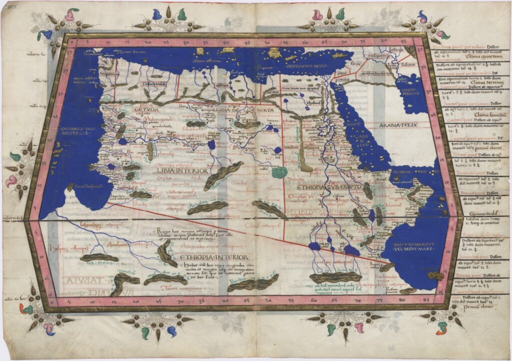
Ptolemy’s African Map
The Rwenzori Mountains, Stanley’s discovery established, were a significant contributor to both Lake Albert and Lake Edward via the rivers that drain their flanks: the Semliki River, the Mubuku, the Nyamwamba, and others. The mountain’s extraordinary precipitation, which makes it one of the wettest ranges in Africa, as every trekker on the Central Circuit Trail discovers within the first hour on the trail, meant that it was a year-round water source of genuine hydrological significance to the entire Albertine Rift Valley system. The Rwenzori were, in a meaningful sense, part of the Nile system’s source. Ptolemy’s description of the Mountains of the Moon as the origin of the Nile’s waters was not wrong; it was simply describing a component of a more complex hydrological system than the ancient geographer could have had the framework to articulate.
The Equatorial Snow Question: Science Recalibrates
The most broadly consequential scientific implication of Stanley’s discovery was its confirmation that permanent snow could exist at the equator, not as a geological relic or an exceptional and transient event, but as a continuous feature of an equatorial high-altitude mountain range. Victorian climatology and geographical theory had debated this question theoretically but had lacked confirmed observational data. The Rwenzori provided it.
The implications rippled outward from the Rwenzori discovery. If permanent snow could exist at the equator in Africa, what else might exist in the poorly mapped interior zones of the tropical continents? The intellectual effect was one of productive destabilization: the comfortably drawn boundaries of what was possible in equatorial environments were revealed as premature, and the Victorian scientific establishment was reminded that its models were still working from incomplete data in a world that was larger and stranger than its maps suggested.
Popular fascination with the equatorial snow question was considerable. The Victorian public, deeply engaged with the unfolding project of African exploration through the popular press and the lectures of the major geographical societies, found the idea of snow mountains at the equator uniquely compelling; it violated a basic expectation about the world that even non-scientists held confidently. The Rwenzori became, almost overnight, one of the most talked-about geographical discoveries of the age.
Stanley’s Description of the Rwenzori: What He Saw and How He Wrote It
Stanley’s written account of the Rwenzori in In Darkest Africa is remarkable for its quality as nature writing as much as for its historical significance as exploration literature. Stanley was a journalist by training and inclination, and his descriptions of the African landscape when he was not obscuring them under the fog of Victorian imperial ideology could achieve a genuine vividness and precision. His account of the Rwenzori sightings is among the best passages in his entire body of African writing.
“We saw a peculiar-shaped cloud of a most beautiful silver color, which assumed the proportions and appearance of a vast mountain covered with snow. Following its form, as it lay in the sky, I became more and more struck with its size and the beauty of the silver color… It was such a scene as one might imagine would be seen in the Arctic regions, but here we were in the very center of Africa, not a hundred miles from the equator.” Stanley, In Darkest Africa, 1890.”
The key phrase in this passage, “not a hundred miles from the equator” captures the psychological shock of the encounter. Stanley was not simply reporting a geographical observation; he was communicating to his European readers something that violated their expectations of what the equatorial world could contain. The snow, the silver color, the “Arctic regions” comparison these are the linguistic choices of a writer who is working to transfer a cognitive disruption across the page.
The Mountain’s Persistent Cloud Cover and Why It Hid for So Long
One of the most interesting aspects of Stanley’s account and one that has direct relevance to every trekker who has ever stood in the Bujuku Valley and wondered where the peaks are is his description of the mountain’s near-permanent cloud cover. Stanley noted that the clear-sky windows in which he obtained his sightings were brief and unexpected and that for most of his time in the surrounding area the mountain was completely invisible behind clouds.
This phenomenon is not a Victorian-era peculiarity of Stanley’s timing. The Rwenzori Mountains are famously and persistently cloud-covered; this is one of the defining characteristics of the range that distinguishes it from Kilimanjaro and Mount Kenya, where the peaks are more frequently visible from the surrounding lowlands. The mountain’s extraordinary precipitation, between 1,800 and 3,000 millimeters annually, is produced by a meteorological system in which the upper peaks generate their cloud cover almost continuously. The Kasese plain often hides the mountain, even on days when the sky above Kasese itself is blue and clear.
This persistent cloud cover is why, despite the Rwenzori’s size and the fact that the Semliki Valley has been inhabited and traversed by both African and Arab traders for centuries before Stanley’s arrival, the mountains had not been reliably reported to European geographical authorities. Oral traditions and trading networks knew of the snow mountains; the Bakonzo people had named them Rwenzururu (Place of Snow) long before any European arrived, but the mountains’ cloud cover had prevented the clear visual confirmation that European scientific culture required before it would accept a geographical report as fact.
The Name “Mountains of the Moon”: Stanley and the Classical Connection
In In Darkest Africa, Stanley explicitly drew the connection between his Rwenzori discovery and Ptolemy’s ancient “Mountains of the Moon,” arguing that the range he had sighted was the geographical reality behind the classical tradition. This argument was received with considerable enthusiasm by European scholars who had long sought to resolve the Ptolemy question, and it became the dominant interpretation of the Rwenzori’s historical significance in the decades following Stanley’s expedition.
The “Mountains of the Moon” designation has remained attached to the Rwenzori in popular usage as a secondary name that carries both the classical allusion and a sense of the otherworldly character that the mountain genuinely possesses. Trekkers who have walked through the giant lobelia and groundsel forests of the Bujuku Valley at altitude, in morning mist, surrounded by plants that look like nothing that should exist on Earth, understand viscerally why the name “Mountains of the Moon” has persisted: this is a landscape that looks, quite genuinely, as though it was built somewhere else and deposited here by a process that had nothing to do with the ordinary logic of equatorial Africa.
After Stanley: The Race to Explore the Mountains of the Moon
Stanley’s 1888 sighting opened a period of intense European interest in the Rwenzori that would last for nearly two decades, culminating in the Duke of Abruzzi’s definitive 1906 expedition that made the first ascents of all the range’s major peaks. The intervening years saw a series of exploratory expeditions of varying ambition and success, each adding incrementally to the European knowledge of a mountain that the local Bakonzo had known in full for centuries.
Stuhlmann and the First Ascent to the Snowline (1891)
The first European to reach the Rwenzori snowline was Dr. Franz Stuhlmann, a German naturalist who ascended the mountain’s lower slopes in 1891 as part of a broader Albertine Rift expedition. Stuhlmann reached an altitude of approximately 4,060 metres well into the Afro-alpine zone and above the point where the giant groundsels and giant lobelias begin to dominate the landscape before turning back. His account of the upper mountain’s vegetation was among the first scientific descriptions of the extraordinary Afro-alpine plant communities that would later make the Rwenzori famous among botanists worldwide. Stuhlmann’s naturalist training allowed him to recognize the significance of what he was walking through in a way that Stanley’s journalist perspective had not been positioned to capture.
The Johnston and Scott Elliot Expeditions (1900)
The early 1900s saw a cluster of British expeditions attempting to push further into the Rwenzori’s high zones. Frederick Jackson, Purvis, and George Scott Elliot all made approaches to the mountain between 1895 and 1900, with Scott Elliot’s 1895 expedition reaching the highest point yet achieved by a European, in the zone between the heather moorland and the lower Afro-alpine. Scott Elliot’s botanical work during this expedition was significant; he documented many of the vegetation zone transitions that are now the defining ecological features of the Central Circuit Trail experience. The Scott Elliot Pass at 4,372 metres the col between Mount Stanley and the broader Central Circuit route, is named for him as a permanent cartographic acknowledgment of his early exploratory work in the range.
The Duke of Abruzzi’s 1906 Definitive Expedition
The culminating chapter in the European exploration of the Rwenzori was written by Luigi Amedeo, Duke of the Abruzzi, an Italian prince and experienced Alpine and polar mountaineer who led a meticulously organized expedition to the range in 1906. The Duke’s expedition achieved what no previous European venture had managed: the first ascents of all the Rwenzori’s major peaks in a single season, including Margherita Peak at 5,109 metres on Mount Stanley, Mount Speke (4,890m), Mount Baker (4,843m), Mount Emin (4,798m), Mount Gessi (4,715m), and Mount Luigi di Savoia (4,627m) named in the Duke’s own honor.
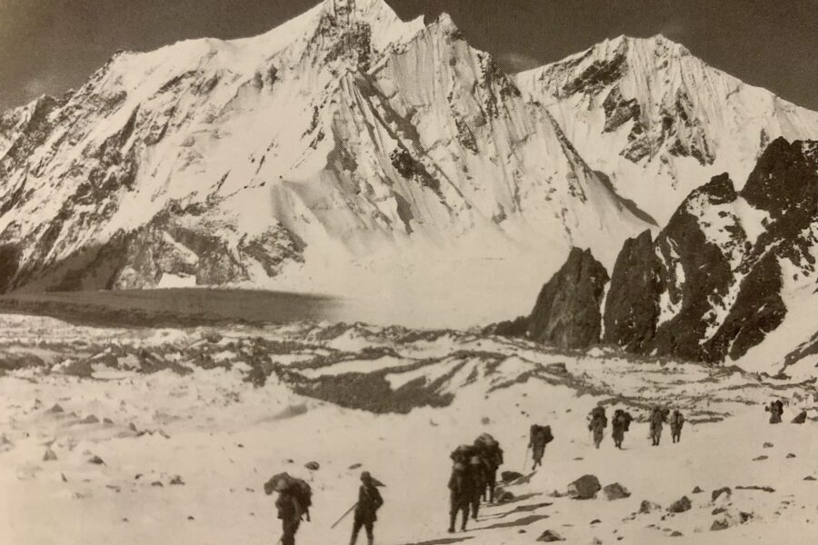
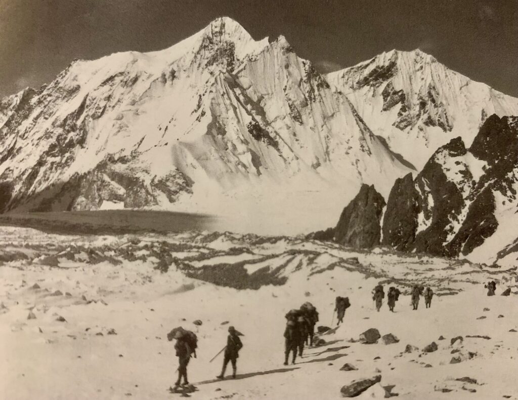 The expedition was accompanied by the photographer Vittorio Sella, whose images of the Rwenzori’s glaciers, peaks, and Afro-alpine vegetation constitute the most important photographic record of the range’s early-twentieth-century character. Sella’s photographs of glaciers that have since retreated dramatically, the visual record of what the Rwenzori’s glaciers looked like before a century of anthropogenic warming, are both beautiful historical documents and sobering evidence of ecological loss. The Duke subsequently published his expedition account, Il Ruwenzori, in 1909 a work that remains one of the finest pieces of mountain exploration literature from the colonial era.
Stanley’s Legacy: His Name on Africa’s Third Highest Mountain
The most tangible legacy of Stanley’s 1888 discovery in the contemporary Rwenzori experience is the name that adorns the range’s highest massif: Mount Stanley. Named in Henry Morton Stanley’s honor by the Duke of Abruzzi’s 1906 expedition, which made the first ascents of the mountain’s twin summits, Mount Stanley, at 5,109 metres is Africa’s third-highest mountain and the prize sought by every trekker on the 7-day Margherita Peak summit expedition and the 8-day Kilembe Trail summit trek. Every time a trekker says they are heading for Mount Stanley, they are invoking the memory of the Welsh-American journalist who looked up through a gap in the clouds on a May morning in 1888 and saw something that changed the map of Africa.
The naming of the mountain for Stanley by the Duke of Abruzzi was a deliberate act of explorer-to-explorer respect: Abruzzi acknowledged that while his expedition made the first ascents, it was Stanley who had established the mountain’s existence for European science. The twin summits of Mount Stanley carry this acknowledgment further: Margherita Peak (5,109m) is named for Queen Margherita of Savoy, the expedition’s patron, while Alexandra Peak (5,091m) honors Queen Alexandra of the United Kingdom. The naming convention reflects the political and dynastic world of 1906 European mountain exploration, but the mountain’s primary name carries Stanley’s memory forward to every generation of trekkers who attempt it.
The Other Explorer-Named Features of the Rwenzori
The broader Rwenzori range bears the names of the Victorian exploration era on its peaks and passes, as permanently as if they were carved in stone. Mount Speke (4,890 m) honors John Hanning Speke, who first identified Lake Victoria as the Nile source and theorized the existence of snow mountains in the region. Mount Baker (4,843 m) commemorates Samuel White Baker, who, with his wife Florence Baker, discovered Lake Albert in 1864 as a secondary Nile reservoir and made the first European trek through the region of the Rwenzori’s southern approaches. Mount Emin (4,798 m) is named for Emin Pasha himself, Eduard Schnitzer, the German-born administrator whose supposed need for rescue provided the stated justification for the very expedition during which Stanley made his Rwenzori discovery.
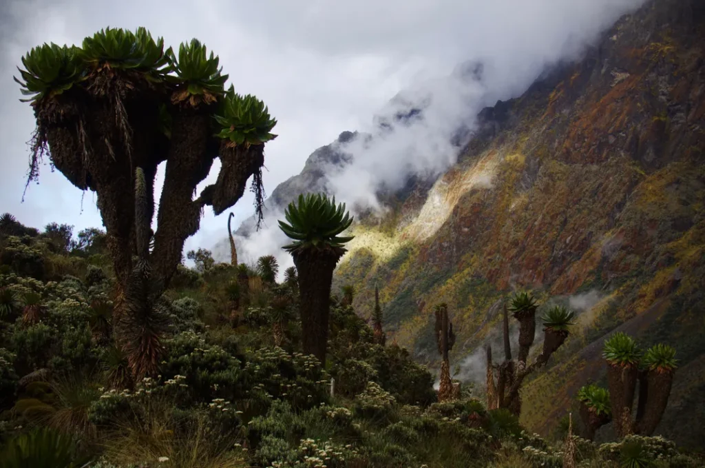
Scott Elliot Pass
The Scott Elliot Pass, at 4,372 metres on the Central Circuit Trail between Mount Stanley and the broader route, carries the name of the early botanical explorer who ventured further into the range before the Duke’s definitive expedition. The Freshfield Pass, at 4,282 metres, commemorates Douglas Freshfield, a president of the Alpine Club and one of the Rwenzori’s early European visitors. Trekkers who cross these passes today are literally walking through the landscape of Victorian and Edwardian exploration history, stepping where the figures whose names they know from exploration literature once walked, and seeing the mountain that those men found extraordinary, dangerous, and magnificent in conditions that technology has made considerably safer and more comfortable.
Rwenzori Exploration: A Historical Timeline
| Date | Explorer / Event | Significance to Rwenzori History |
| 2nd century CE | Ptolemy’s Geographia | First written reference to “Mountains of the Moon” as the source of the Nile is almost certainly describing the Rwenzori |
| 1864 | John Hanning Speke | Theorised mountains of snow in the interior of Africa as Nile source; never located the Rwenzori |
| May 1888 | Henry Morton Stanley | First confirmed European sighting of the Rwenzori, the “discovery” of the Mountains of the Moon |
| June 1888 | Stanley (confirmation) | Second, clearer sighting of the snow-capped peaks, confirming the initial observation was not a mirage |
| 1891 | Dr Franz Stuhlmann | First European to reach the Rwenzori snowline, ascending to approximately 4,060m with porters |
| 1900 | Various expeditions | Multiple European parties attempt and partially succeed in reaching the high snow zones |
| 1906 | Duke of Abruzzi | Definitive first ascents of all major Rwenzori peaks in a single season; scientific and photographic documentation |
Trekking in Stanley’s Footsteps: What History Adds to the Modern Expedition.
I want to be direct about something that is easy to overlook in the practical literature of Rwenzori trekking: the historical dimension of the expedition is not merely background decoration. It is part of the texture of the experience itself, and for trekkers who carry it consciously onto the mountain, it adds a layer of meaning to the journey that the summit altitude alone cannot provide.
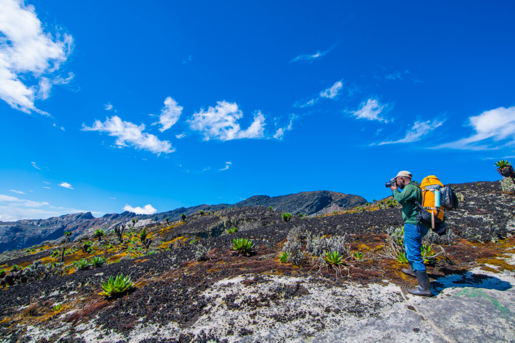
When you depart from the Nyakalengija trailhead and enter the montane forest on day one of the Central Circuit trek, you are entering terrain that remained unknown to European cartography until 1888. The rivers you cross and the forest you walk through were unnamed on European maps until Stanley’s expedition established, for the first time, that this mountain existed. The Bakonzo guides who lead you up the trail are the descendants of the people whose knowledge Stanley’s expedition encountered and whose name for the mountain Stanley adopted and transmitted to the wider world.
When you stand on Mount Stanley, the highest point in the range, the glacier-capped massif that bears the name of the man who first reported it to European science, you are standing on a summit that was first reached by human beings as recently as 1906. The geological history beneath your boots is two billion years old; the human history of European engagement with that summit is barely more than a century. This compression of ancient rock, recent discovery, and continuing exploration is one of the Rwenzori’s most distinctive qualities as a trekking destination.
The 13-day six-peaks expedition and the 18-day all-peaks traverse complete the full set of major summits that the Duke of Abruzzi first ascended in 1906 providing trekkers with the opportunity to trace the entire first-ascent map of the range in a single expedition. The 30 remarkable facts about the Rwenzori that we have documented elsewhere provide additional context for the historical, geological, and ecological dimensions of what you are walking through. Every camp, every pass, every peak carries a name that connects the present-day expedition to the history of the mountain’s discovery and exploration.
Frequently Asked Questions: Stanley and the Discovery of the Rwenzori
Who discovered the Rwenzori Mountains?
Henry Morton Stanley is credited as the first European to make a confirmed sighting of the Rwenzori Mountains on 24 May 1888 during the Emin Pasha Relief Expedition. His first sighting from the Semliki Valley region north of Lake Albert was initially cautious, describing what he saw as possibly “a peculiar-shaped cloud” with the “appearance of a vast mountain covered with snow.” A clearer second sighting in June 1888 confirmed the observation. Stanley subsequently named the range “Ruwenzori” (later standardized as “Rwenzori”), an anglicization of the Bakonzo people’s indigenous name “Rwenzururu” (Place of Snow), which the mountain’s indigenous inhabitants had been using for centuries before any European arrived.
When did Henry Morton Stanley discover the Rwenzori Mountains?
Henry Morton Stanley made his first confirmed sighting of the Rwenzori Mountains on 24 May 1888, while leading the Emin Pasha Relief Expedition through the Semliki Valley region of what is now the Uganda-DRC border area. A second, clearer sighting in June 1888 provided the confirmation that moved Stanley from tentative observation to definitive geographical claim. Stanley published his account of the discovery in his 1890 book In Darkest Africa, which became the primary source for European geographical knowledge of the Rwenzori until the subsequent expeditions of the 1890s and early 1900s began systematic exploration of the range.
Why was the discovery of the Rwenzori Mountains so significant?
The discovery was significant for several overlapping reasons. First, it confirmed the existence of permanent snow at the equator, a fact that had been theoretically possible but never observationally confirmed and that violated the prevailing European assumptions about what equatorial environments could produce. Second, it resolved or at least substantially advanced the resolution of the ancient geographical question of Ptolemy’s “Mountains of the Moon”: the Rwenzori appeared to be the geographical reality behind Ptolemy’s second-century CE description of snow mountains in the African interior from which the Nile drew its source. Third, it identified a major mountain range of significant altitude , with summits now known to reach 5,109 metres, that had been entirely absent from European maps. The discovery rewrote the geography of east-central Africa and triggered a period of intense exploratory interest in the range.
Why did the Rwenzori Mountains remain undiscovered by Europeans for so long?
The Rwenzori Mountains remained unreported to European geographical authorities for so long primarily because of their characteristic and persistent cloud cover. The range is one of the wettest mountain environments in Africa, generating its own near-permanent cloud system from the interaction of moisture-laden air masses from the Congo Basin to the west and Lake Victoria to the east. The result is a mountain that is invisible from the surrounding lowlands for the vast majority of the time, present, and enormous but hidden. Arab, Swahili, and local trading networks knew of the snow-capped mountains through reports from the Bakonzo people, who had their name for the range and a centuries-long relationship with its landscape. But the cloud cover prevented the clear visual confirmation that the European geographical establishment required before it would accept a geographical claim as established.
Is Mount Stanley named after Henry Morton Stanley?
Yes. Mount Stanley, the highest massif in the Rwenzori range, with its twin summits of Margherita Peak (5,109m, Africa’s third highest point) and Alexandra Peak (5,091m), was named in honor of Henry Morton Stanley by the Duke of Abruzzi’s 1906 expedition, which made the first ascents of the mountain’s summits. The naming was an act of exploration-era acknowledgment: Abruzzi’s expedition recognized that while it made the first ascents, it was Stanley who had established the mountain’s existence for European science in 1888. The summit of Margherita Peak on Mount Stanley is the destination of the premier Rwenzori trekking expeditions, including the 7-day Central Circuit summit trek and the 8-day Kilembe Trail expedition.
What was the Emin Pasha Relief Expedition?
The Emin Pasha Relief Expedition (1887–1889) was a British-backed rescue mission led by Henry Morton Stanley to relieve Eduard Schnitzer, known as Emin Pasha, the German-born Governor of Equatoria Province in the southern Sudan, who was besieged by the Mahdist uprising following the fall of Khartoum. The expedition was extraordinarily large and complex, involving nearly 700 men and approaching through the Congo Basin via the Ituri Forest, a choice partly motivated by the commercial interests of the expedition’s principal backer, King Leopold II of Belgium. The Ituri crossing was catastrophic in terms of human life lost to disease, starvation, and violence. It was during the expedition’s approach from the Ituri toward Lake Albert on the return from the initial relief phase that Stanley encountered the Rwenzori Mountains in May and June 1888. The expedition itself was ultimately ambiguous in its success: Emin Pasha was “rescued” but proved reluctant to leave, and the expedition’s human cost was enormous.
What were the Mountains of the Moon that Ptolemy described?
Claudius Ptolemy, the second-century CE Greek geographer who worked in Alexandria, described in his work Geographia a range of mountains in the interior of Africa from whose melting snows the Nile River drew its source. He called these the “Mountains of the Moon” Lunae Montes, in the Latin version of his text. Ptolemy’s information was based not on personal observation but on the reports of merchants and travelers who had knowledge of the African interior through trading networks. When Stanley sighted the Rwenzori Mountains in 1888 at almost exactly the latitude and in the general region that Ptolemy’s sources had indicated and confirmed the presence of permanent snow on the equatorial mountains, the scholarly consensus moved firmly toward identifying the Rwenzori as the geographical reality that Ptolemy’s sources had been describing. The Rwenzori has kept the “Mountains of the Moon” designation as a secondary name, reflecting this ancient-to-modern connection.
When were the Rwenzori Mountains first climbed?
The first confirmed ascents of the Rwenzori’s major peaks were made by the Italian expedition led by Luigi Amedeo, Duke of the Abruzzi, in the summer of 1906. In a single remarkable season, the Duke’s team, which included experienced Italian Alpine guides and was supported by a large team of local porters and guides, made first ascents of all the range’s major summits: Margherita Peak (5,109m) on Mount Stanley, Alexandra Peak (5,091m) also on Mount Stanley, Mount Speke (4,890m), Mount Baker (4,843m), Mount Emin (4,798m), Mount Gessi (4,715m), and Mount Luigi di Savoia (4,627m named for the Duke himself). Prior to this event, the German naturalist Franz Stuhlmann had reached the snowline (approximately 4,060m) in 1891, and various British expeditions had penetrated the heather and Afro-alpine zones through the 1890s and early 1900s.
Follow Stanley’s Gaze And Climb the Mountain He Discovered
On that May morning in 1888, Henry Morton Stanley looked up through a gap in the African clouds and saw a mountain that changed the map of the world. He could not climb it; the Emin Pasha Relief Expedition had neither the equipment nor the specific mandate for high-altitude mountaineering, and the mountain’s full scale was not yet understood. He could only record what he had seen and carry that record back to a world that would spend the next eighteen years trying to understand, reach, and ultimately ascend the range he had found.
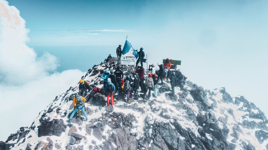
You have the advantage of everything that came after: the routes the Duke of Abruzzi pioneered, the mountain huts built into the landscape over decades of guided expeditions, the trained Bakonzo guides whose knowledge of the terrain makes the summit achievable in conditions that would have defeated Stanley’s column, and the accumulated understanding of the mountain’s ecology, climate, and altitude requirements that modern expedition planning provides. What Stanley had, and what you also have, is the mountain itself. It is still there, still extraordinary, and still capable of producing, on a clear morning from the right angle, the same shock of recognition that stopped the most experienced African explorer of the Victorian age in his tracks.
Whether your first encounter with Mount Stanley comes from the 7-day Central Circuit summit trek, the 8-day Kilembe Trail expedition, or the comprehensive 13-day six-peaks grand expedition that covers the full first-ascent map of the range, the team at Rwenzori Trekking Safaris is ready to put you on the mountain with the preparation, the guidance, and the historical context that transforms a difficult and beautiful trek into something larger than itself.
Browse our full range of Rwenzori trekking itineraries, plan your visit using our month-by-month seasonal guide, and explore the 30 incredible facts about the Rwenzori that place the mountain in its full historical context, and when you are ready to follow Stanley’s gaze all the way to the summit, contact our expedition team directly; we will help you reach the mountain that 1,700 years of geographical speculation and one extraordinary May morning in 1888, finally put on the map.