What is Rwenzori trekking and where does it happen? Expert guide to the Mountains of the Moon, its trails, six peaks & five ecological zones.
Long before you see the Rwenzori, you hear it, or more precisely, you feel it: the air changes, the heat of the Rift Valley floor gives way to something cooler and damper, and the flat plains around Kasese begin to buckle upward into a wall of forest and cloud that most first-time visitors genuinely do not expect. I have stood at that trailhead with hundreds of trekkers over the years, and the question I am asked most often, before route difficulty, before gear lists, before permit costs, is a deceptively simple one: what actually is Rwenzori trekking, and where, precisely, does it happen? It deserves a proper answer, because the Rwenzori is not a single mountain you walk up and back down in an afternoon, and it is not a destination that resembles Kilimanjaro, the Virungas, or the savannah parks most travelers already associate with East Africa. This guide sets out to answer that question as completely as it can be answered, from the geology under your boots to the exact villages where your trek will begin, so that anyone seriously researching a Rwenzori trip arrives with a genuinely accurate picture of what they are signing up for.
Defining Rwenzori Trekking
Rwenzori trekking is the activity of walking, camping, and in its higher forms, glacier mountaineering, through the Rwenzori Mountains National Park in western Uganda, a UNESCO World Heritage Site that rises from roughly 1,600 metres at its forested trailheads to 5,109 metres at the summit of Margherita Peak on Mount Stanley, Africa’s third-highest mountain. It is a multi-day wilderness expedition by nature, not a day hike, structured around a chain of staffed huts or designated campsites and led at every stage by licensed guides, since solo independent trekking inside the park is not permitted under Ugandan law. What separates Rwenzori trekking from most other African mountain experiences is the sheer ecological range packed into a relatively compact area: in a single week on the mountain, you pass through tropical rainforest, bamboo forest, dense Mimulopsis thicket, otherworldly heather and giant lobelia moorland, and finally bare rock, snow, and glacier, a vertical journey through five distinct life zones that our detailed guide to the Rwenzori Mountains covers in full ecological depth. For trekkers who want the complete technical picture of what the park itself protects and how it is managed, our companion piece on what Rwenzori Mountains National Park actually is is the right place to go deeper.
It is also worth being precise about terminology, because the words trekking, hiking, and mountaineering get used almost interchangeably by people planning their first trip, and on the Rwenzori they describe genuinely different experiences. A short, hut-to-hut walk such as the Mahoma Loop is trekking in the purest sense: sustained multi-day walking with a pack, at altitude, but without technical climbing. A summit push to Margherita Peak on Mount Stanley, by contrast, is mountaineering in the full sense of the word, involving roped glacier travel, crampons, an ice axe, and genuine objective hazard on the final approach, a distinction our mountaineering guide to the Rwenzori Mountains addresses directly. Most of what we organize sits between these two poles, multi-day trekking with the option of a technical summit bolted on at the end, and understanding where your own ambitions sit on that spectrum is the first real decision in planning a trip here.
Where the Rwenzori Mountains Actually Are
The range sits in western Uganda, hard against the border with the Democratic Republic of the Congo, roughly 33 kilometres north of the equator, a fact that surprises people who expect an equatorial mountain to be tropical and warm at every elevation rather than genuinely glaciated at its summit. The Rwenzori run approximately 120 kilometres from north to south and around 65 kilometres east to west, forming a compact, dramatic spine of rock and ice that our Rwenzori Mountains map guide illustrates with full route and peak detail. Geologically, this is not a volcanic range in the way Kilimanjaro or the Virunga chain are; it is a horst, an ancient block of Precambrian crystalline rock thrust skyward by the tectonic forces of the Albertine branch of the East African Rift over millions of years, which is precisely why its summits are jagged, glaciated, and structurally unlike the smooth volcanic cones found elsewhere on the continent.
On the Ugandan side, the range is protected within Rwenzori Mountains National Park, gazetted in 1991 and covering close to 1,000 square kilometres of the range’s eastern slopes. UNESCO inscribed the park as a World Heritage Site in 1994, one of only two natural World Heritage Sites in Uganda, and it received a further designation in 2008 as a Ramsar Wetland of International Importance, recognizing its role as a critical water tower feeding both the Nile and Congo river systems.
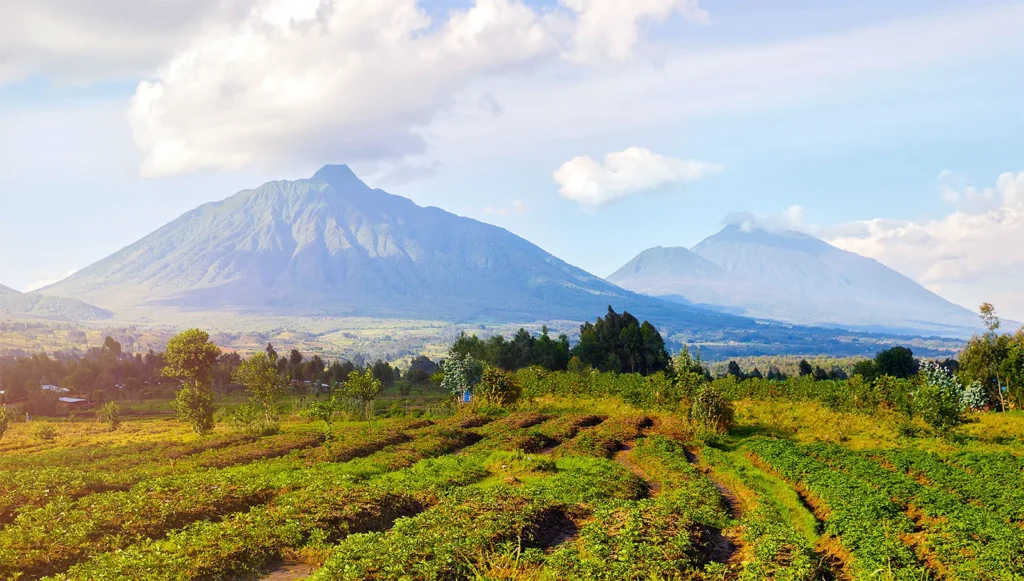
The DRC side of the range falls within Virunga National Park, though essentially all organized commercial trekking, including everything we run, takes place from the Ugandan side, where the trail infrastructure, hut network, and guiding culture are established and well maintained.
The Gateway Towns: Kasese and Nyakalengija
Every Rwenzori trek begins from one of two points, and knowing which one applies to your route matters for how you plan your travel into the region. Kasese, the district capital, sits immediately east of the southern end of the range and is the gateway to the Kilembe Trail as well as the nearest significant town for supplies, banking, and pre- or post-trek accommodation, covered thoroughly in our Kasese travel guide for trekkers. Nyakalengija, the trailhead for the Central Circuit Trail, sits around 22 kilometres north of Kasese along the Kasese-Fort Portal road, a small village that exists almost entirely in service of the trekking economy that has grown up around the park entrance. If you are still working out flights, road transfers, and where exactly to base yourself before your trek starts, our guide to where to land for a Rwenzori trek walks through the logistics in detail.
The Six Massifs
One detail catches almost every first-time visitor off guard: the Rwenzori is not a single peak in the way Kilimanjaro or Mount Kenya present themselves, but a chain of six distinct, individually named glaciated massifs, each with its own summit or summits, its own character, and in some cases its own approach route. Mount Stanley is the highest and carries Margherita Peak at 5,109 metres, the ultimate objective for most serious expeditions and the mountain covered in full in our dedicated Mount Stanley guide. Mount Speke and Mount Baker rise close behind, followed by Mount Emin, Mount Gessi, and Mount Luigi di Savoia, each requiring its own technical assessment and each summited as part of our 13-day six-peaks grand expedition for trekkers aiming to stand on every major summit in the range. Our comprehensive facts about the Rwenzori Mountains guide goes further into the individual character of each massif for anyone who wants the full structural picture before committing to an itinerary.
The Trails: Where the Trekking Actually Happens
Within the national park, trekking is organized around a small number of established, hut-supported trails, each entering the range from a different point and each delivering a genuinely different experience of the mountain. Understanding these routes, rather than the range as an undifferentiated whole, is the practical heart of trip planning.
The Central Circuit Trail
This is the classic, most established route into the range, beginning at Nyakalengija and forming a loop through the Afro-alpine heart of the mountain, including the extraordinary Bujuku Valley, before delivering climbers to the base camps used for Margherita Peak. The Central Circuit Trail has the most developed hut network, the deepest pool of experienced guides, and is generally the route we recommend for first-time Rwenzori trekkers with a genuine summit ambition.
The Kilembe Trail
Approaching from the town of Kasese on the southern flank of the range, the Kilembe Trail is quieter, arguably more scenic in its lower sections, and takes in a sequence of high-altitude lakes and waterfalls that give it a genuinely different character from the Central Circuit. Trekkers deciding between the two routes will find the specific trade-offs, in terrain, crowding, hut standards, and which peaks each route accesses, laid out in full in our comparison of the Central Circuit against the Kilembe Trail.
The Bukurungu Trail
For trekkers who have already completed the Central Circuit or Kilembe and want to see a wilder, far less visited corner of the range, the Bukurungu Trail passes through four high-altitude alpine lakes, Irene, Mughuli, Bukurungu, and Bujuku, in a sequence of landscapes that genuinely feels unexplored. It is not typically a first-time route, but for repeat visitors or serious Rwenzori enthusiasts, it is one of the most rewarding corners of the park.
The Mahoma Loop and Shorter Introductory Treks
Not every Rwenzori trip needs to be a multi-day summit expedition. The Mahoma Loop is a short, two-day introduction to the lower mountain, taking in Lake Mahoma and the montane forest zone without the sustained altitude exposure of a full circuit, and it is a genuinely good option for travelers combining a Rwenzori taste with a broader Uganda itinerary rather than committing a full week to the mountain.
Our full portfolio of Rwenzori hiking trails spans everything from this kind of gentle forest walk through to the comprehensive 18-day expedition summiting all eight major peaks in the range.
The Five Ecological Zones You Walk Through
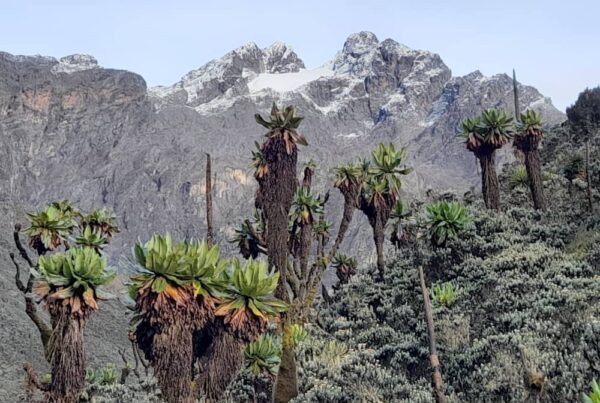
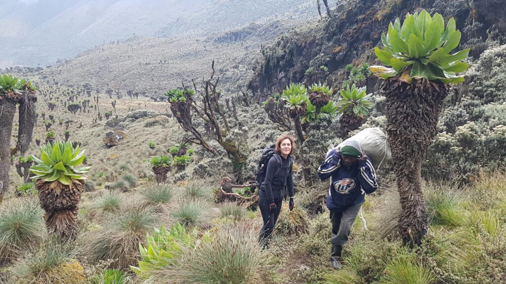
Part of what makes Rwenzori trekking such a distinctive experience, and part of why the geographic question in this article’s title matters so much, is that where you are on the mountain changes completely, and repeatedly, over the course of a single trek. You begin in dense montane rainforest, climb through a belt of bamboo, push through the notoriously thick Mimulopsis undergrowth that gives way to heather forest draped in old man’s beard lichen, and eventually emerge into the Afro-alpine zone above roughly 3,500 metres, home to the giant groundsels and giant lobelias that make this range look, in the words of early European explorers, genuinely lunar.
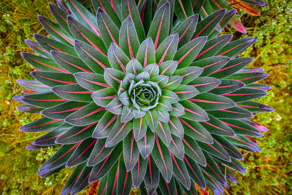
Above that, the vegetation zone ends entirely and you are on bare rock, snow, and the range’s shrinking equatorial glaciers. Our dedicated guide to the giant groundsels and lobelias of the Rwenzori covers this Afro-alpine zone in detail, and our piece on camping in the Rwenzori Mountains explains how the hut and campsite network is built specifically around this zone-by-zone progression.
When Rwenzori Trekking Takes Place
Because the Rwenzori sits almost exactly on the equator, temperature at any given point on the mountain is overwhelmingly a function of altitude rather than season, but rainfall is not, and rainfall is what actually shapes the trekking calendar here. December through March and June through August are the driest windows and the periods we recommend for most first-time trekkers and for anyone targeting a Margherita Peak summit, a subject our best time to visit the Rwenzori guide covers in full seasonal detail. That said, the mountain is trekkable year-round for the right kind of traveler; our month-by-month Rwenzori trekking guide breaks down exactly what each month delivers, including why April, the wettest month of the year, is nonetheless spectacular for trekkers drawn to the Kilembe Trail’s waterfalls rather than summit statistics.
Who Rwenzori Trekking Is For
This is not, and should not be marketed as, a beginner’s introduction to African mountains in the way a short Kilimanjaro itinerary sometimes is. Rwenzori trekking demands genuine multi-day fitness, comfort with sustained wet-weather walking, particularly in the lower forest zones, and for anyone targeting the glaciated summits, real cold-weather and, ideally, prior glacier or crampon experience. What it rewards in return is an experience that very few other mountains on earth can offer: five ecological zones in a single trek, some of the least-visited high-altitude terrain in Africa, and summit days that involve technical glacier travel rather than a straightforward walk-up. Our honest account of what to expect hiking the Rwenzori Mountains and our guide’s own reflections in the mountain life in the Rwenzori both go further into the physical and psychological reality of the trek than a route description alone can capture.
A Guide’s Perspective
I still remember a client, an experienced Alpine climber who had assumed, reasonably enough given how the range is sometimes marketed, that the Rwenzori would be a warm-up compared to the technical routes he already knew in Europe. He changed his view somewhere in the Bujuku Valley, standing in ankle-deep bog under six-metre groundsels with cloud rolling in off the Congo side of the range, and again two days later, roped up on the Stanley Glacier in conditions that had nothing tropical about them at all. What he told me afterward has stayed with me, because it captures something this article is trying to convey structurally rather than anecdotally: the Rwenzori is not one experience but five or six, stacked vertically, each demanding something different of you, and understanding that structure before you arrive is what separates trekkers who are genuinely prepared from those who are not.
Frequently Asked Questions
Is Rwenzori trekking the same as hiking Kilimanjaro?
No. Kilimanjaro is a single volcanic massif with a straightforward, largely non-technical walk-up to its summit. The Rwenzori is a chain of six distinct glaciated massifs formed from ancient block-faulted rock, and a genuine Margherita Peak summit involves roped glacier travel, crampons, and an ice axe, making it a technically harder and ecologically far more varied objective than Kilimanjaro despite Margherita Peak’s slightly lower elevation.
Do I need mountaineering experience to go Rwenzori trekking?
It depends entirely on your objective. Multi-day trekking routes such as the Central Circuit Trail, the Kilembe Trail, or the shorter Mahoma Loop require solid multi-day hiking fitness but no technical climbing skill. A summit attempt on Margherita Peak or any of the range’s other glaciated summits is genuine mountaineering, and while prior glacier experience is not an absolute prerequisite when climbing with our guides, it does make the final summit day considerably more comfortable and safer.
Can I trek the Rwenzori Mountains without a guide?
No. Solo independent trekking inside Rwenzori Mountains National Park is not permitted under Ugandan law. Every trekker is required to be accompanied by a licensed guide, and the huts, campsites, and rescue infrastructure on the mountain are all built around this guided model, which reflects both the genuine technical demands of the terrain and the practical need for coordinated permit and hut allocation through the Uganda Wildlife Authority.
Which side of the Rwenzori Mountains do treks take place on, Uganda or DRC?
Essentially all organized commercial trekking takes place on the Ugandan side, within Rwenzori Mountains National Park, where the trail network, huts, and guiding infrastructure are well established. The DRC side of the range falls within Virunga National Park, but it does not have a comparable commercial trekking infrastructure, and the Uganda side is the standard and recommended approach for international trekkers.
How many days does a typical Rwenzori trek take?
This varies enormously depending on your objective. A short introductory trek such as the Mahoma Loop can be completed in two days, a standard Central Circuit trek to Margherita Peak typically runs seven to nine days, and our full six-peaks grand expedition, summiting all six major massifs, runs thirteen days, with an eighteen-day itinerary available for trekkers aiming to summit all eight major peaks in the range.
What makes the Rwenzori Mountains different from other African trekking destinations?
The combination of factors is genuinely unusual: a non-volcanic, block-faulted mountain system with real glaciers sitting almost exactly on the equator, five distinct ecological zones compressed into a single multi-day trek, six separately named summits rather than one, UNESCO World Heritage status, and a level of visitor traffic far lower than Kilimanjaro or the East African savannah parks. Trekkers who have done both consistently describe the Rwenzori as the wilder, more technically engaging, and more ecologically varied of the two experiences.
Start Planning Your Rwenzori Trek
Understanding what Rwenzori trekking actually involves, and exactly where on the map it happens, is the foundation everything else in your planning builds on: your choice of route, your fitness preparation, your gear list, and your travel dates all follow from the picture laid out above. If you are ready to move from research to an actual itinerary, get in touch through our contact page and our guides, who between them have summited Margherita Peak hundreds of times, will help you choose the right trail and build a trip suited to your fitness, timeline, and ambitions. You can also browse our full FAQ page for answers to more of the questions serious Rwenzori trekkers ask us before booking. Few mountain ranges on earth reward the effort of getting there quite like this one, and we would be glad to guide you into it.