Rwenzori Mountains Huts & Camps. Every Campsite on Every Trail
Every Rwenzori mountain hut and camp on the Central Circuit and Kilembe Trail includes information on altitudes, facilities, mattresses, solar charging, and distances.
The hut and camp system of the Rwenzori Mountains is one of the most practical achievements of mountain conservation in East Africa. Maintained and managed by Rwenzori Mountaineering Services (RMS) on the Central Circuit Trail and by Rwenzori Trekking Services under Uganda Wildlife Authority oversight on the Kilembe Trail, the network of camps provides the infrastructure that makes sustained high-altitude trekking in this extraordinarily wet and challenging mountain environment both safe and genuinely enjoyable. Understanding the hut system before you arrive is not just useful; it is essential to planning a successful Rwenzori trek. Knowing what to expect at each camp informs your packing decisions, your daily pace, your water management, and your expectation of comfort. This guide gives you that knowledge in full.
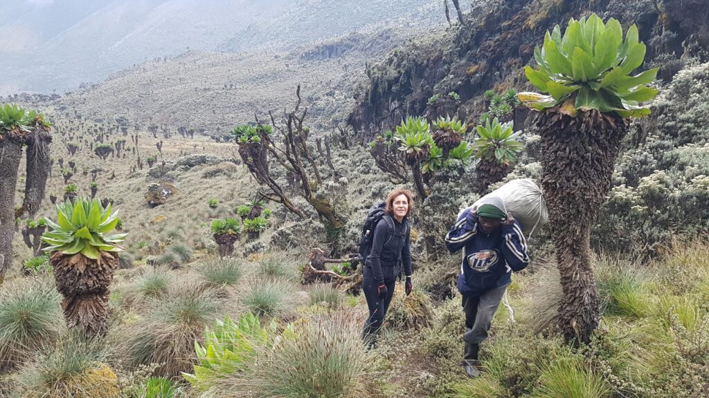
There is a particular moment, repeated on every trail in the Rwenzori Mountains, that no amount of pre-trip research fully prepares you for. You have been walking for hours through forest or heather, your boots are already sodden with mountain mud, and the last hour of ascent has taken something from your reserves that daylight hikes in your home country never require. Then the hut comes into view through the mist, a solid, dark-timbered structure sitting impossibly in this alien landscape, warm light visible through the window, the smell of food drifting across the bog. You step inside. There are mattresses, there is shelter, and there is a cook who somehow arrived before you did. The mountain exhales. So do you.
What follows is the most comprehensive, practical account of every hut and camp on the two main Rwenzori trails, the Central Circuit and the Kilembe Trail, plus notes on the Mahoma Loop and Bukulungu Trail. For each facility, you will find the altitude, the distance from the previous camp, the sleeping arrangements, the facilities available, the water sources, and a first-hand description of what the camp is actually like to spend a night in. Read it before you pack. Refer back to it as you plan your daily stages. Know what to expect when you arrive at the mountain, as it changes how you move through this extraordinary landscape.
Understanding the Rwenzori Hut System: What Every Trekker Needs to Know
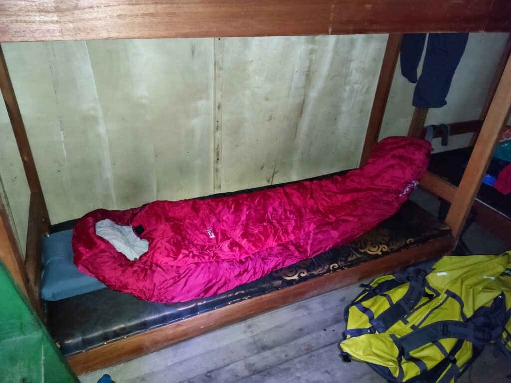
The huts on the Rwenzori are not alpine refuges in the Swiss or Austrian sense. They are purpose-built wooden structures designed specifically for this mountain’s conditions: high humidity, frequent rain, and temperatures that drop sharply above 3,500 metres. The construction philosophy prioritises waterproofing and basic comfort over aesthetic refinements. You will not find private rooms, hot showers, or bar service. What you will find, on every established hut on both main trails, is dry sleeping accommodation, a kitchen area where your cook can prepare hot meals, and toilet facilities. At most huts, that is genuinely enough.
Every trekker on the Rwenzori Mountain trails sleeps on provided mattresses inside the huts. You bring your sleeping bag; the mountain provides everything else in terms of the sleeping surface. The mattresses are high-density foam, regularly maintained by the camp management teams, and they are considerably more comfortable than the ground camping options available on trails in many other African mountain environments. If you are planning your first Rwenzori trek and wondering whether to bring a sleeping mat, the answer is no; it is unnecessary weight. The Rwenzori trekking FAQ covers these topics and similar gear questions in detail. What you should bring is a sleeping bag rated to at least 0°C and ideally to -5°C for the highest camps at Elena or Margherita.
Solar panels have been installed at several huts on both trails, principally to provide lighting and basic device charging. The capacity is limited, typically a single USB output shared among a group, and charging is best treated as a useful bonus rather than a reliable facility. Bring a fully charged power bank from Kasese. Water at all huts comes from mountain streams, rivers, or snowmelt at the highest camps and should be treated before drinking. Your cook and guides carry purification tablets; bringing your iodine tablets or a filter bottle is additional insurance in the higher, more remote camps where water quality can be affected by bog drainage.
The cook who accompanies your trekking group prepares meals in the kitchen areas at each hut. Typical Rwenzori mountain meals include ugali or rice with beans, vegetables, and occasionally eggs or meat at the lower camps where fresh food remains viable. Porridge and tea are standard breakfast fare. Hot food and hot drinks at altitude are genuine luxuries, and you will appreciate them with a depth of feeling that is proportionate to the cold and wetness of the preceding hours of walking.
Knowing what’s ahead at each camp changes how you pace the day. The trail is always long. The hut is always worth it.
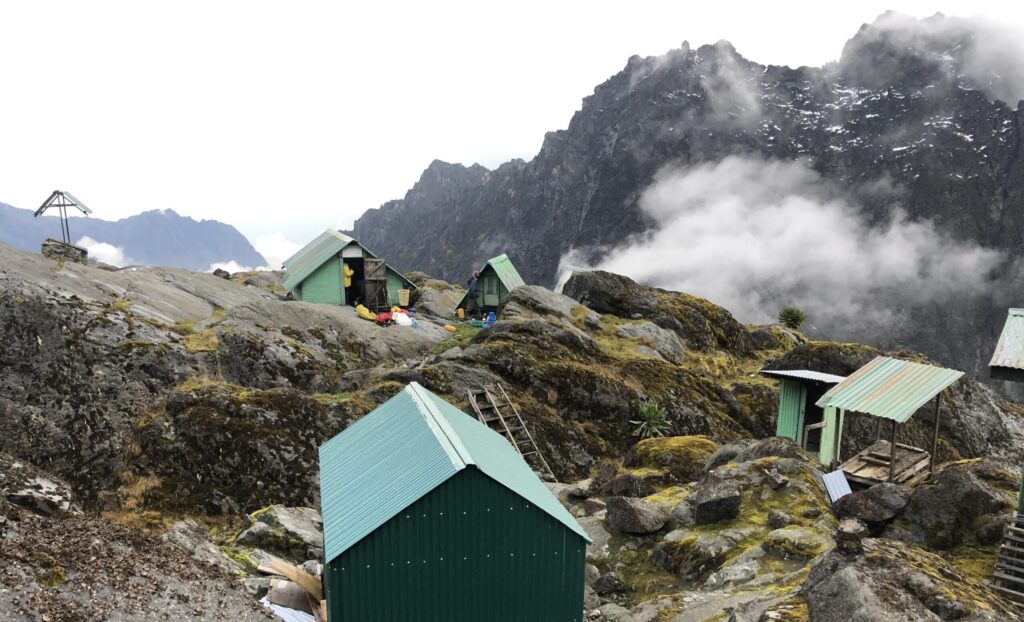
THE CENTRAL CIRCUIT TRAIL
The Central Circuit Trail is Rwenzori’s most established and comprehensively supported trekking route, a roughly 58-kilometre loop that begins and ends at the Nyakalengija trailhead in Kasese District and passes through all five major vegetation zones of the mountain, from tropical rainforest to glaciated high alpine. The hut system on the Central Circuit is the oldest on the mountain, with infrastructure that has been progressively upgraded since the park’s formal establishment in 1991. For trekkers on our 7-Day Central Circuit itinerary or the 9-Day Three-Peaks Trek, a thorough understanding of each night’s accommodation is essential groundwork for a well-planned expedition.
Central Circuit Camp Quick Reference
Camp / Hut
Altitude
Distance
Sleeping
Facilities
Vegetation Zone
Nyakalengija (Trailhead)
1,640 m
—
None
RMS HQ, toilets, briefing
Sub-montane forest edge
Nyabitaba Hut
2,651 m
8 km
Wooden bunks + mattresses
Hut, toilets, solar charging, kitchen
Montane rainforest
Nyamulejju Rock Shelter
3,100 m
5 km
Emergency shelter only
Rock overhang, stream nearby
Bamboo / lower Heather
John Matte Hut
3,505 m
11 km
Wooden bunks + mattresses
Hut, toilets, solar charging, kitchen, river water
Upper forest / bamboo
Bujuku Hut
3,977 m
9 km
Wooden bunks + mattresses
Hut, toilets, kitchen, bog boardwalk access, stream
Giant heather / bog
Elena Hut
4,541 m
5 km
Wooden bunks + mattresses
Hut, emergency toilet, kitchen, stream/snowmelt
Afro-alpine / glacier approach
Kitandara Hut
4,023 m
7 km
Wooden bunks + mattresses
Hut, toilets, kitchen, Kitandara Lakes water
Afro-alpine lakes
Guy Yeoman Hut
3,261 m
10 km
Wooden bunks + mattresses
Hut, toilets, solar charging, kitchen, stream
Heather / forest transition
Nyakalengija / Mihunga Trailhead (1,640 m)
The adventure begins at Nyakalengija, a small village in the Kasese District’s foothills, approximately 22 kilometres west of Kasese Town. This is where you register at the Rwenzori Mountaineering Services headquarters, collect your rubber boots (if you rent them), meet your guide and porter team, receive your mandatory safety briefing, and take your last photographs in a landscape that still resembles recognisable Africa before the mountain swallows them whole. There is no overnight accommodation at the trailhead itself; the standard practice is to spend the night before departure in Kasese town or at one of the guesthouses near Nyakalengija, but the RMS compound has clean toilets, a briefing room, a gear storage area, and a car park that is as secure as anything in the region. Arrive the morning of your first hiking day with your kit sorted, your stomach full, and your rain jacket accessible. You will almost certainly need it before the first hour is done.
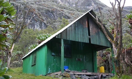
Nyabitaba Hut (2,651 m) | Day 1 Camp | 8 km from trailhead.
Nyabitaba Hut
Nyabitaba is the Central Circuit’s first mountain hut and the end point of what is typically a three-to-four-hour walk from Nyakalengija through sub-montane rainforest. The route to Nyabitaba passes through Bakonzo community farmland before entering the national park boundary, after which the trail becomes a proper mountain track threading through dense tropical forest draped in mosses and ferns. The final approach to the hut follows a ridge, offering gradually improving views north and east toward the plains if the cloud cooperates, which it often does not.
The hut at Nyabitaba is a well-maintained wooden structure positioned on a narrow forest ridge at the edge of the bamboo transition zone. It sleeps approximately 24 trekkers on wooden bunk platforms with foam mattresses, divided between two main sleeping rooms. There is a separate kitchen area, an outhouse toilet block a short walk from the main building, and a small covered outdoor area where trekkers can sit and watch the forest below in the evenings. Solar panels provide basic lighting in the sleeping areas and a USB charging point in the kitchen. Your cook will collect and treat the water from the Mubuku River, which you can hear from the hut. On clear evenings, the view from the ridge outside Nyabitaba creates a sense of genuine arrival on the mountain, looking toward the dark wall of forest below and the first suggestion of the heather zone above. Temperatures at night typically drop to 8–12°C; a sleeping bag is needed but not urgently thick.
Nyamulejju Rock Shelter: (~3,100 m) | Rest Point | 5 km from Nyabitaba.
Nyamulejju is not an overnight camp in the standard Central Circuit itinerary but functions as an important rest point and lunch stop between Nyabitaba and John Matte. It is a natural rock overhang extended and reinforced with weatherproof material to create a covered shelter capable of holding a trekking group in moderate comfort. The route from Nyabitaba to Nyamulejju crosses the famous Kurt Schafer Bridge, a swinging suspension bridge over the confluence of the Bujuku and Mubuku rivers, set in a gorge of spectacular, moss-smothered forest before ascending steeply into the bamboo zone. The shelter itself sits at a point where the forest begins its transition to open heath and, on clear days, offers early views toward the main massif interior. There is a stream nearby for water. Your cook will typically have lunch ready here; it is the right place to rest, eat properly, and take on water before the demanding push up to John Matte Camp.
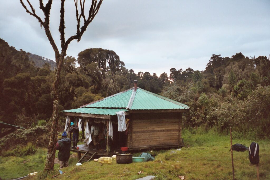
John Matte Hut: 3,505 m | Day 2 Camp | 11 km from Nyabitaba
John Matte Hut
John Matte is the Central Circuit’s second major hut and the camp that most trekkers identify as the first moment the Rwenzori feels genuinely alpine. Named after a Ugandan mountaineer and guide of historical significance to the mountain’s trekking development, it sits above the bamboo zone in open heather woodland with the Bujuku River running cold and fast immediately below the building. The position is magnificent: on clear mornings, Mount Stanley’s Margherita Glacier is visible from the hut’s approach, tucked between the Alexandra and Margherita peaks in a wall of white that appears shockingly close after two days of dense forest.
The hut at John Matté is the most spacious on the Central Circuit, with capacity for 30 or more trekkers on well-maintained bunk platforms with foam mattresses. The kitchen area is separate and well equipped for cooking at altitude. Toilet facilities are an outhouse block positioned downslope from the main building. Solar panels provide lighting and a basic charging point. Water from the Bujuku River is abundant and clean at this elevation. Night temperatures at John Matté typically range from 2°C to 8°C. You will need your sleeping bag properly deployed here, not just draped over you. Trekkers on the 7-day Central Circuit itinerary spend one full night at John Matte; those on longer expeditions targeting multiple peaks may spend two, allowing a rest day for acclimatisation and short exploratory hikes in the surrounding heather before pushing higher.
Bujuku Hut: 3,977 m | Day 3 Camp | 9 km from John Matte
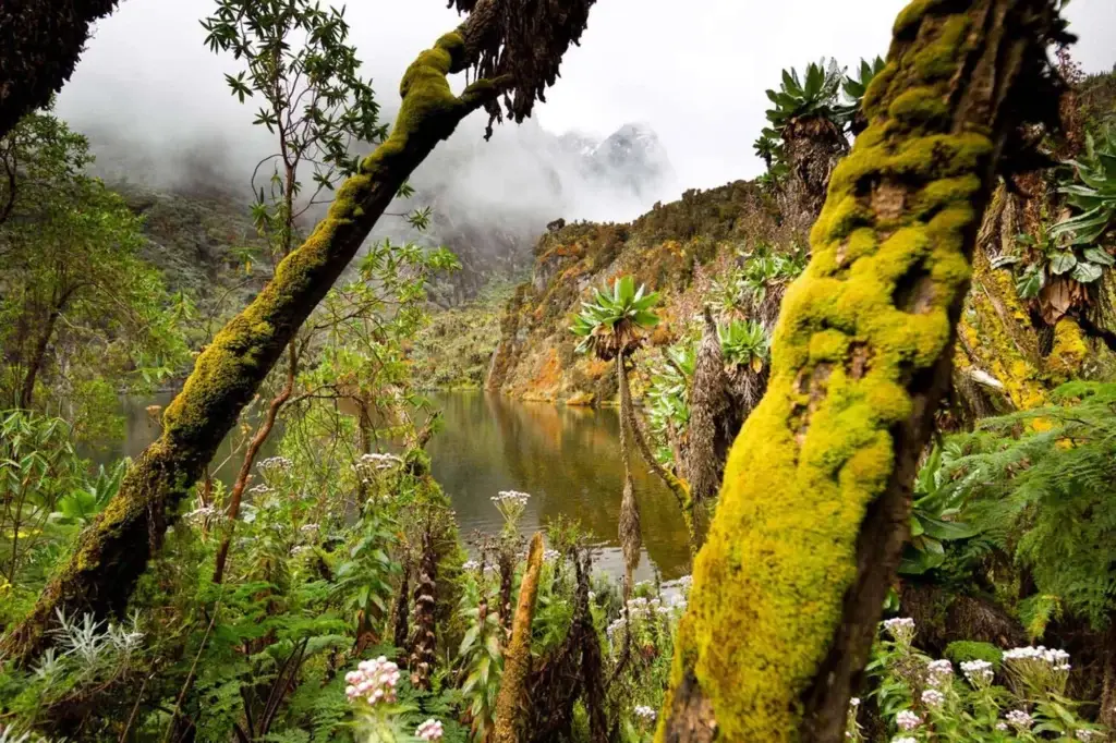
The approach from John Matte to Bujuku is among the most visually remarkable sections of any mountain trail in Africa. The trail traverses the notorious Bigo Bogs, a vast, saturated mosaic of sphagnum moss, peat pools, and submerged roots that spreads across the valley floor above 3,600 metres, following a boardwalk system that has been progressively extended and maintained to make passage through this extraordinary landscape both possible and less destructive. The bogs are bounded on either side by giant heather trees draped in moss curtains, and the valley contains the first of the range’s glacial lakes. In mist, which is the typical condition, the effect is profoundly otherworldly Tolkien’s Dead Marshes transposed to equatorial Africa. In clear moments, the view across the bogs toward the main peaks is one of the defining images of the entire Rwenzori experience.
Bujuku Hut occupies a position above the upper bog margin at the entrance to the Bujuku Valley proper, with Lake Bujuku nearby and a direct line of sight toward the Scott Elliot Pass above. It is a solid two-room structure with foam mattress bunks sleeping 20 to 24, a kitchen area, and toilet facilities. The solar panels here provide limited but reliable lighting. Water comes from the streams feeding into Lake Bujuku. Night temperatures can drop to 0°C or below at Bujuku, and the humidity of the bog environment means that damp sleeping gear and wet trail clothing need proactive management. Hang everything possible to dry and keep your sleeping bag sealed in a dry bag until you actually get into it. Trekkers on the 13-Day Six-Peaks Expedition use Bujuku as a staging camp for both the Scott Elliot Pass approach toward Elena and the Freshfield Pass approach toward the southern peaks.
Elena Hut: 4,541 m | Summit Camp | 5 km from Bujuku
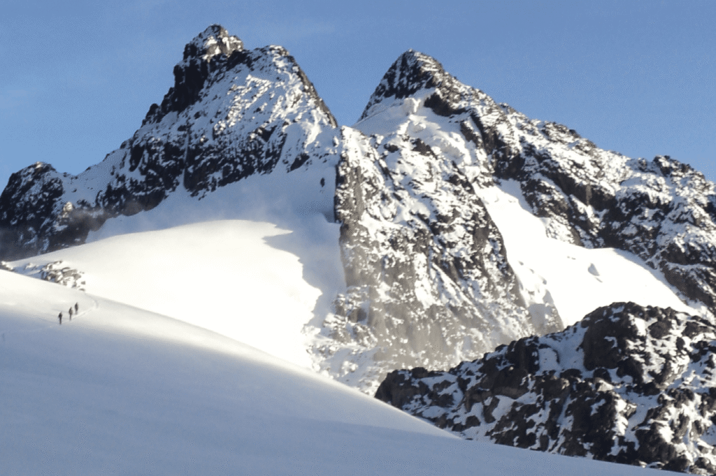
Elena Hut is the highest, coldest, and most dramatically positioned overnight camp on the Central Circuit. Named after Elena of Montenegro, the Italian queen whose husband sponsored the first major mountaineering expedition to Rwenzori in 1906, it sits on a rocky ridge immediately below the Stanley Plateau at 4,541 metres, close enough to the Margherita Peak glacier that trekkers can hear ice shifting on quiet nights. The approach from Bujuku crosses the Scott Elliot Pass (4,372 m) and then descends briefly before climbing steeply to the hut’s rocky bench, a demanding, often icy final section that requires crampons and careful route-finding in poor visibility.
The hut at Elena is smaller and more utilitarian than the lower camps, reflecting both the difficulty of supply at this altitude and the shorter duration most trekkers spend here. Bunk platforms with mattresses accommodate approximately 12 to 16 trekkers. The kitchen area is compact but functional; toilet facilities are a basic pit structure outside. There are no solar panels at Elena, so pack your headtorch fully charged. Water comes from stream drainage and snowmelt nearby; treat everything scrupulously at this elevation. Night temperatures at Elena range from -5°C to -10°C and lower in cold snaps, with wind adding significant chill. Your warmest sleeping bag, balaclava, glove liners, and dry thermal base layer are the essentials for a comfortable, cold night. Summit day begins in the dark from this camp, typically with a 3:00 to 4:00 a.m. departure to catch stable pre-dawn weather and avoid the afternoon cloud that routinely obscures the glacier.
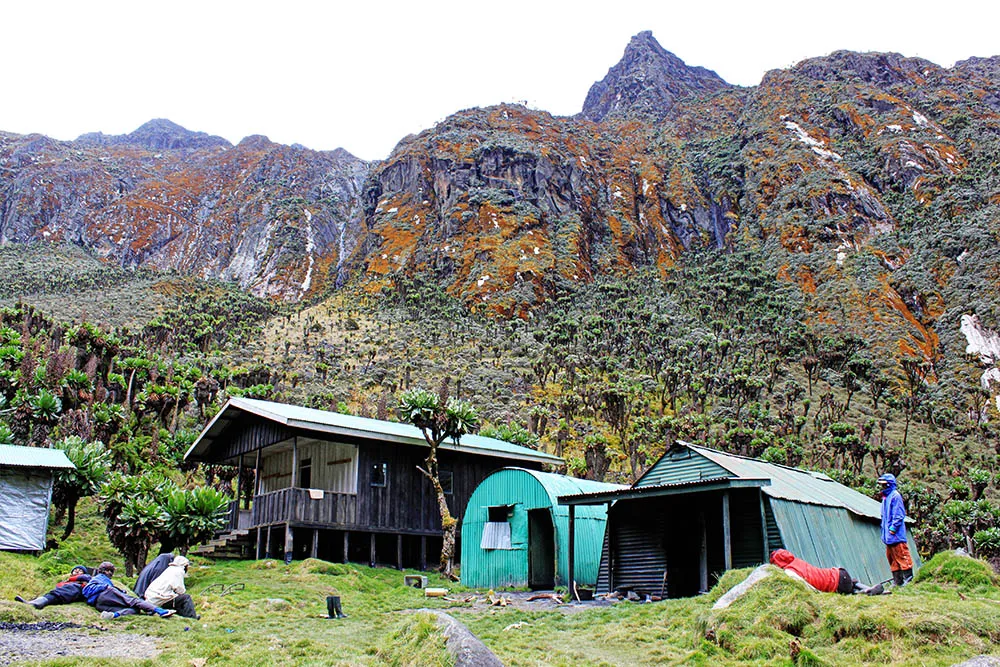
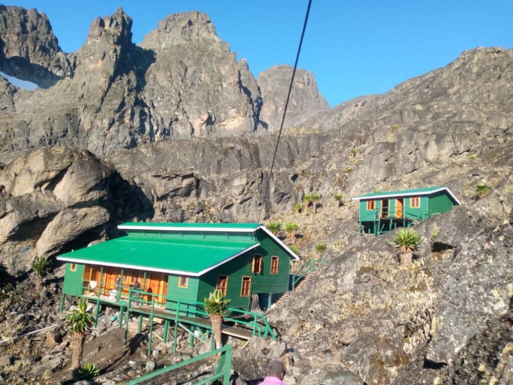
Kitandara Hut: 4,023 m | Descent Camp | 7 km from Elena
After summit day and the return from Elena, the route descends toward the southern sector of the Central Circuit via the Freshfield Pass (4,282 m), dropping into the Kitandara Valley and the extraordinary double lake system that many trekkers consider the single most beautiful location on the entire mountain. The Kitandara Lakes, two clear, cold glacial lakes set in a bowl of alpine vegetation with the majestic peaks rising behind them, are among the most photographed landscapes in the Rwenzori Mountains National Park, and rightly so. The hut sits on the shoreline of the lower lake, and waking here on a clear morning to glass-calm water reflecting the sky and the peaks is an experience that justifies the entire mountain even without the summit.
Kitandara Hut
The Kitandara Hut is a well-maintained two-room structure with foam mattress bunks accommodating 20 to 24 trekkers, a kitchen area, and toilet facilities. Water is drawn directly from the Kitandara Lakes; it is clear and cold and one of the finest water sources on the mountain, though purification is still standard practice. Solar panels provide basic lighting. Night temperatures are similar to Bujuku 0°C to 5°C, and the lake valley creates its own cold drainage air that can make evenings here significantly colder than the altitude alone would suggest. This is the camp where trekkers often feel the post-summit release most completely: the climbing is behind you, the most beautiful scenery of the circuit is surrounding you, and the ache in your legs is the right kind of ache.
Guy Yeoman Hut: 3,261 m | Final Camp | 10 km from Kitandara
Guy Yeoman, the last overnight camp on the Central Circuit before the descent to Nyakalengija, is positioned in the heather and forest transition zone at 3,261 meters. It is named after the British botanist who conducted important botanical surveys on the Rwenzori in the 1960s. To get to it from Kitandara, you take a long downhill path that goes through the upper heather moorland and then back into the bamboo area, covering ten kilometres that include some of the most striking changes in the landscape along with the tiredness from the latter parts of the hike. The camp at Guy Yeoman marks the psychological end of the high mountain: you are back in the forest, back in warmth, and back within a day’s walk of the lowlands. Many trekkers on the 7-day Central Circuit spend their last mountain night here before the final descent on day seven.
The hut is a well-maintained two-room structure with foam mattress bunks sleeping 20 to 24, a kitchen area, toilet facilities, and solar panels for lighting and charging. Water comes from the stream system adjacent to the camp. Night temperatures at Guy Yeoman are noticeably warmer than the higher camps, typically 8°C to 14°C, and the return of forest sounds and forest warmth after days in the high alpine creates a physical sense of re-entry that is emotionally disorienting in the best possible way. The forest below this camp on the final morning descent contains some of the richest bird and wildlife activity on the entire circuit. Try to walk slowly, despite the pull of the lowlands ahead of you.
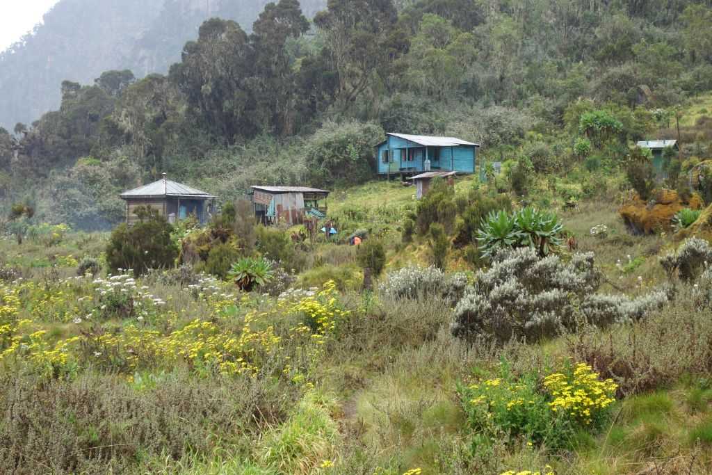
The Kilembe Trail approaches the Rwenzori from the south, entering the mountain through the former copper mining valley of Kilembe near Kasese town and ascending through a sequence of camps that is distinct in character from the Central Circuit’s hut system. Rwenzori Trekking Services officially initiated the Kilembe Trail in 2011, with oversight from the Uganda Wildlife Authority. The camps along this trail are newer and generally better equipped than those on the Central Circuit, with solar panels available at all Kilembe camps, and the camp designs have improved based on experiences from the older trail. For trekkers on our 8-Day Kilembe Trail trek, the 4-Day Mutinda Loop, or the 8-Day Cheptegei Peak Trek, the camp system below describes each stopping point in the order you will encounter it.
Kilembe Trail: Camp Quick Reference
Camp
Altitude
Distance
Sleeping
Facilities
Vegetation Zone
Kilembe Trailhead Gate
~1,400 m
—
None
UWA gate, registration, permits
Kilembe valley / settlement
Sine Camp
~2,583 m
9.5 km
Wooden bunks + mattresses
Camp hut, toilets, kitchen, stream water
Montane rainforest
Forest Camp (Acclimatisation)
~2,600 m
~1 km
Wooden bunks + mattresses
Newer camp hut, toilets, solar panels, stream
Lower montane forest
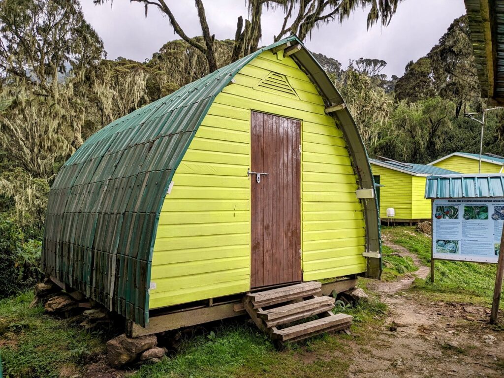
Kalalama Camp
3,134 m
~7 km
Wooden bunks + mattresses
Hut, toilets, solar panels, kitchen, stream
Montane forest
Mutinda Camp
3,688 m
~8 km
Wooden bunks + mattresses
Hut, toilets, solar panels, kitchen, stream, views
Heather moorland
Bugata Camp
4,062 m
~6 km
Wooden bunks + mattresses
Hut, toilets, solar panels, kitchen, alpine stream
Alpine / lower glacial
Hunwick’s Camp
3,874 m
~4 km
Wooden bunks + mattresses
Hut, toilets, solar panels, kitchen, stream
Upper heather / alpine
Margherita Camp
~4,485 m
~5 km
Wooden bunks + mattresses
Hut, emergency toilet, kitchen, stream/snowmelt
High alpine / glacier approach
Kilembe Trailhead Gate (~1,400 m)
The Kilembe Trail begins at the Uganda Wildlife Authority registration gate in the Kilembe valley, accessible by vehicle from Kasese town (about 10 kilometres away) on a road that passes through the old copper mining settlement. The Kilembe Valley is a place of layered history; copper was mined here commercially from the 1950s through the 1970s, and the abandoned infrastructure of that era sits alongside newer ecotourism development in a striking juxtaposition. At the gate, trekkers register, pay park fees, meet their guide and porter team from Rwenzori Trekking Services, and collect any rented equipment. There are toilet facilities at the gate area and a briefing compound. This is the last point of reliable mobile phone signal before the mountain closes around you; make any final calls and download offline maps here.
Sine Camp: ~2,583 m | Day 1 Camp | 9.5 km from gate
Sine Camp is the Kilembe Trail’s first major overnight stop, reached after a nine-and-a-half-kilometre approach through a dense, submontane rainforest that is among the most species-rich in the entire Rwenzori. The trail to Sine climbs steadily through a forest characterised by enormous fig trees and tree ferns, as well as the beginnings of the moss and lichen systems that define higher elevations. This lower forest section is prime territory for the bird species that make the Rwenzori one of Africa’s most important birding destinations, including Grauer’s broadbill and the African green broadbill, both Albertine Rift endemics with extremely limited global ranges. The 2-Day Sine Camp Trek is offered as a standalone introductory itinerary specifically because this lower forest section is so rewarding for naturalists and casual trekkers alike.
The camp at Sine is a well-maintained wooden structure with bunk platforms and foam mattresses sleeping 20 to 24 trekkers, a kitchen area, toilet block, and a reliable stream for water. The setting is a deep forest, cool, and humid, with the sounds of the Nyamwamba River audible from the camp in the evenings. Night temperatures at Sine are typically 10°C to 15°C warmer than the higher Kilembe camps but significantly cooler than Kasese. A light sleeping bag or liner is sufficient for most visitors.
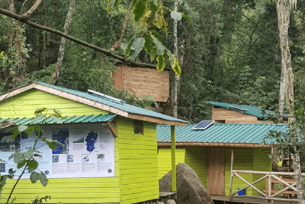
Forest Camp (Acclimatisation Camp): ~2,600 m | ~1 km from Sine
Forest Camp is a new addition to the Kilembe Trail, created to help trekkers adjust to the altitude more easily in the lower forest area, especially for those with schedules that allow for a slower climb. It sits approximately one kilometre above Sine Camp in the same forest zone, offering a graduated elevation step that makes a genuine physiological difference for trekkers who are sensitive to altitude or who are building to a Margherita summit attempt over eight or more days. The camp is a newer, somewhat smaller hut with bunk mattresses, toilet facilities, a kitchen area, and solar panels providing both lighting and device charging. The forest setting is pristine, and the camp is positioned on a slight ridge that captures morning light earlier than the valley-bottom camps below. On longer itineraries, we recommend that trekkers spend a night at Forest Camp, followed by a push to Kalalama the next day to maximise acclimatisation without unnecessarily extending the total trek duration.
Kalalama Camp: 3,134 m | ~7 km from Forest Camp
Kalalama marks the transition from rainforest trekking to the mountain proper. By the time trekkers reach this camp, the sub-montane forest has given way to denser, higher montane forest with a distinctly different character — smaller trees, heavier moss loading on every surface, the first orchid species appearing on branches, and the beginning of the bamboo transition zone that makes mid-elevation Rwenzori trekking so botanically extraordinary. The camp is surrounded by lush montane vegetation and positioned beside a reliable stream that provides excellent, clean water throughout the year.
Kalalama Camp
The Kalalama Camp hut is a solidly built wooden structure with foam mattress bunks for 20 to 24 trekkers, a separate kitchen block, toilet facilities, and solar panels that provide lighting and a USB charging point. The site is level and well drained according to Rwenzori standards, and the protected forest position means that even in heavy rain, the camp feels sheltered. Night temperatures at Kalalama are typically 5°C to 10°C. This is the camp where the mountain’s persistent humidity first becomes apparent in your gear; anything left outside or in the outer pockets of your pack will be damp by morning. Keep your sleeping bag inside its dry liner from here upward.
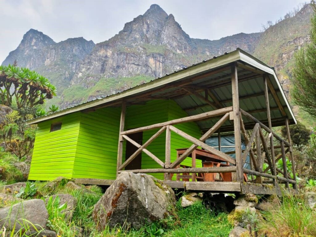
Mutinda Camp: 3,688 m | ~8 km from Kalalama
Mutinda Camp is widely regarded as the finest viewpoint on the entire Kilembe Trail and one of the great overnight camp positions in the whole of the Rwenzori Mountains. Positioned at 3,688 metres in the open heather moorland with an unobstructed panorama in multiple directions, Mutinda offers clear morning views toward the central massif to the north, across the Kilembe Valley to the east, and into the dramatic ridge systems of the mountain’s southern arm. The 4-Day Mutinda Loop uses this camp as its high point, and for good reason: reaching Mutinda at approximately 4,000 meters by the third day of a short trek gives trekkers a genuine high-altitude experience, standing above the clouds and looking across the full visual drama of the Rwenzori, which is entirely disproportionate to the technical difficulty of the approach.
The camp hut at Mutinda is a well-maintained wooden structure with bunk mattresses for 20 to 24, a separate kitchen, toilet block, and solar panels providing lighting and charging. Water comes from the moorland streams above and around the camp. Night temperatures at Mutinda range from -2°C to 5°C, and the open moorland position means wind exposure is significant. You need your full layering system from the moment you arrive, not just at bedtime. The temperature drops quickly after sunset at this elevation. Trekkers targeting the Rwenzori turaco and high heather zone birds should be awake and watching the moorland from the hut in the hour before sunrise: the bird activity around Mutinda at dawn is exceptional.
Bugata Camp: 4,062 m | ~6 km from Mutinda
Bugata Camp pushes the Kilembe Trail into genuinely high-altitude alpine territory. At 4,062 meters, it is positioned in the upper heather and alpine zones, where giant heather trees gradually give way to groundsel forests and giant lobelia fields that characterise the Rwenzori’s most biologically distinctive vegetation zone. The camp looks out toward the majestic peaks of the massif, with Mount Stanley’s upper glaciers visible in clear conditions and the full vertical scale of the mountain apparent for the first time from a sleeping position. From Bugata, trekkers on the full Kilembe Trail itinerary have access to Mount Baker, Mount Speke, and the passes connecting to the Central Circuit’s southern huts.
The hut structure at Bugata is well maintained, with foam mattress bunks for 20 to 24 trekkers, a kitchen area, toilet facilities, and solar panels that are a genuine asset at this elevation where natural light is reduced by cloud for most of each day. Water comes from alpine streams and requires purification. Night temperatures at Bugata regularly drop to -5°C and occasionally lower; a warm, dry sleeping bag and full thermal layering are mandatory, not optional. The giant groundsel forest immediately above the camp is outstanding for photography in any weather condition, and the Ruwenzori double-collared sunbird works the lobelia flowers around the camp perimeter with enough regularity to guarantee close encounters for any birder willing to sit still for twenty minutes.
Hunwick’s Camp: 3,874 m | ~4 km from Bugata
Hunwick’s Camp is a bit lower than Bugata at 3,874 metres and is located on a different part of the upper Kilembe Trail system, usually included in plans that take a different path up and down or that reach the summit from a different side of the southern massif. The camp is named after an early Rwenzori expedition supporter and provides an important staging point on routes linking the Kilembe Trail’s upper sections with the Margherita approach via the Kilembe-side glacier routes. The hut is a solid wooden structure with foam mattress bunks, kitchen facilities, a toilet block, and solar panels, the same standard facilities maintained across all established Kilembe camps. Water comes from nearby streams. Night temperatures mirror those at Bugata. Trekkers using Hunwick’s as a penultimate camp before the Margherita push appreciate its position as a slightly warmer and more sheltered staging point than the higher Margherita camp.
Margherita Camp: ~4,485 m | Summit Camp | ~5 km from Bugata/Hunwick’s
Margherita Camp is the highest overnight camp on the Kilembe Trail and the launching point for the glacier ascent to Margherita Peak, at 5,109 meters. Positioned at approximately 4,485 meters in the high alpine zone, just below the glacier approach, it is equivalent in altitude and character to the Central Circuit’s Elena Hut, though it accesses the summit from the Kilembe (southern) side rather than the Bujuku (northern) side. The camp has strategic importance for acclimatisation: arriving here in the afternoon before summit day and resting at this altitude before pre-dawn departure gives trekkers the best possible physiological preparation for the glacier crossing.
The camp hut at Margherita is compact and functional, with foam mattress bunks sleeping 12 to 16 trekkers, a minimal kitchen area for hot drinks and pre-summit breakfast preparation, and a basic toilet facility. There are no solar panels at this elevation; light is by headtorch. Water comes from snowmelt and high-alpine stream drainage immediately adjacent to the camp; purification is essential. The nighttime temperatures here regularly range from -8°C to -12°C. Condensation inside the hut from trekkers’ breath can be significant; keep gear in dry bags. Summit departure is typically 3:00 to 4:00 a.m. Your guide will call you. When you hear that knock on the door in the dark and the cold, you will know exactly what the next several hours hold: the glacier, the fixed ropes, the thin air, and the summit that the whole journey has been building toward.
The 3-Day Mahoma Loop is the Rwenzori’s most accessible trekking option, beginning from the Mihunga Gate and traversing heather woodland, bamboo, and montane rainforest to reach Lake Mahoma at approximately 2,960 metres. The camping on the Mahoma Loop is more basic than the established hut system on the main trails. The route uses a combination of a simple camp hut near Lake Mahoma and tent camping at designated ground sites. The lake itself is one of the mountain’s most beautiful and most accessible natural features, a dark glacial lake set in a bowl of giant heather with morning mist trailing across its surface. The Mahoma Loop’s simple camping perfectly suits families with older children, trekkers on limited time, and visitors combining the Rwenzori with a broader Uganda safari who want a genuine mountain experience without a major summit commitment, all while offering an extraordinary setting.
The Bukurungu Trail, Wilderness Camping.
The Bukurungu Trail, the Rwenzori’s wilderness route established through a 2018 partnership between the Uganda Wildlife Authority and WWF, uses a combination of natural rock shelters and ground tent camping rather than fixed huts. The primary overnight shelters on the Bukulungu Trail include the Bukurungu Rock Shelter (used prominently on the 6-Day Portal Peaks Trek), a substantial natural overhang extended with weatherproof material that accommodates a full trekking group. Additional nights on the Bukulungu Trail use designated ground camping sites where porters set up tents from the group’s equipment. The trail’s remoteness and limited infrastructure are features, not shortcomings; they are precisely what makes the Bukulungu the most authentically wild experience on the entire mountain. Trekkers choosing this route should discuss camping specifications with our team during pre-trip planning.
Managing the Mountain Huts: Practical Tips from the Trail
After years of guiding trekkers through every camp on the Rwenzori, certain practical lessons recur consistently. Wet gear management is the single biggest determinant of comfort across the full trek: store your sleeping bag in a compression dry sack inside your main pack, and never allow it to be stacked at the bottom of a porter load without a waterproof pack liner. The mountain will find any moisture vulnerability in your packing system, and a wet sleeping bag at Elena or Margherita Camp is a serious problem, not merely an inconvenience.
Typically, camps with solar charging share a slow USB point. A fully charged power bank from Kasese gives you three to four full phone charges without relying on the mountain’s power supply. Photography is one of the primary reasons people carry charged devices; your camera or phone battery will drain faster in cold than it does at sea level. Keep electronics in an inner jacket pocket during cold days on the trail.
Tipping is an important part of the mountain culture and economy. Your guide and cook receive the same gratuity independent of group size. As a guideline, porters receive approximately $10 per day, cooks $12, and guides $20. Tips are traditionally presented in a group ceremony on the final morning at the last mountain hut, in an envelope given to the lead guide for distribution. For full guidance on the tipping culture and the right amounts, see our detailed Rwenzori Mountains guide tipping section.
Finally: respect the huts. They are maintained by communities and management organisations at considerable expense and effort in a mountain environment that is hostile to infrastructure. Close doors behind you. Use toilet facilities properly. Take all your rubbish with you. The trekkers who follow you deserve to find the mountain exactly as you found it.
Frequently Asked Questions: Rwenzori Mountain Huts and Camps
Do I need to bring a tent to trek the Rwenzori?
No. On both the Central Circuit Trail and the Kilembe Trail, trekkers sleep in established mountain huts at every overnight camp. The hut fee is included in your trekking package when booking through Rwenzori Trekking Safaris, and all sleeping is done on foam mattresses inside the wooden hut structures. You do not need to carry or bring a tent for these two main trails. Accommodation on the Bukulungu Trail and in certain sections of the Portal Peaks itinerary that use the Bukurungu Rock Shelter is provided in a substantial natural shelter, extended with weatherproof material, eliminating the need for a personal tent. If you are planning a completely custom or off-trail expedition, discuss camping requirements with our team during pre-planning. Tents can be provided for such arrangements.
Do Rwenzori mountain huts have mattresses?
Yes, all established huts on both the Central Circuit Trail and the Kilembe Trail provide foam mattresses on wooden bunk platforms. The camp management teams regularly maintain the mattresses, ensuring their reasonable quality in the mountain environment. You should bring your sleeping bag rated to at least 0°C for the middle-elevation camps (John Matte, Bujuku, Kitandara, Kalalama, and Mutinda) and to at least -5°C for the high camps (Elena Hut, Margherita Camp, Bugata, and Hunwick’s). You do not need a sleeping mat; it is unnecessary additional weight given the provided mattresses.
Is there solar charging available in the Rwenzori mountain huts?
Solar panels with USB charging points are available at most established camps on both trails, but the capacity is limited and should be treated as a supplement to your own power bank rather than a reliable primary charging source. On the Central Circuit, solar charging is available at Nyabitaba, John Matte, Kitandara, and Guy Yeoman huts. Elena Hut does not have solar panels. On the Kilembe Trail, solar panels are standard at all established camps from Sine Camp upward, including Forest Camp, Kalalama, Mutinda, Bugata, and Hunwick’s; Margherita Camp does not have solar panels. A fully charged power bank with at least 20,000 mAh capacity is strongly recommended for all trekkers as the primary power reserve.
How cold does it get in the Rwenzori mountain huts at night?
Night temperatures in the Rwenzori huts vary significantly with altitude. At Nyabitaba (2,651 m) and Sine Camp (2,583 m), temperatures typically stay between 8°C and 14°C. At John Matte (3,505 m) and Kalalama (3,134 m), expect 2°C to 8°C. At Bujuku (3,977 m), Kitandara (4,023 m), and Mutinda (3,688 m), temperatures reach 0°C to -3°C. At Elena Hut (4,541 m) and Margherita Camp (4,485 m), temperatures regularly drop to -5°C to -12°C, with wind chill potentially taking the effective temperature lower. The huts provide shelter and windproofing that helps significantly, but you should dress for these temperatures inside the hut as well as on the trail. The Rwenzori’s humidity also increases the apparent cold; a 0°C Rwenzori night feels colder than a 0°C night in a dry alpine environment.
Is there running water at Rwenzori Mountain huts?
There is no piped running water at any Rwenzori mountain hut. All camps draw water from natural mountain sources: rivers, streams, glacial lakes, or snowmelt at the highest camps. The water is generally clean and plentiful given the mountain’s extraordinary rainfall, but purification is standard practice at all camps and is carried out by your cook for all cooking and drinking water. Trekkers should carry personal water purification tablets or a filter bottle as backup, particularly at higher camps where stream sources can be affected by bog drainage. Your water bottle should be refilled at every camp; the distance between camps on some sections of the Central Circuit makes adequate hydration a genuine planning consideration.
Can I leave luggage at the lower huts while summiting?
Yes, this procedure is standard practice on both trails. Most trekkers leave the bulk of their non-summit gear at the last major hut before the high camp, either Mutinda or Bugata, on the Kilembe Trail. For the Central Circuit, since it is a circular loop, trekkers leave all their luggage at our offices, RMS offices, or even at the lodge, carrying only the essential summit kit to the high camps. Your porters and guides will advise on exactly what to take for the final push versus what can stay securely at the lower camp. The huts are staffed, and the mountain community is small and known; gear left at huts is safe. This logistics approach significantly reduces the physical load for the hardest sections of the trek and is recommended for all trekkers regardless of fitness level.
Which hut on the Rwenzori is considered the most beautiful campsite?
Trekkers consistently identify three camps as the mountain’s most remarkable in terms of setting. Kitandara Hut on the Central Circuit, positioned on the shore of the Kitandara Lakes at 4,023 metres with the magnificent peaks reflected in the water on clear mornings, is probably the single most photographed camp location on the mountain and widely regarded as the most beautiful overnight position. Mutinda Camp on the Kilembe Trail, at 3,688 meters with its panoramic open moorland views across the massif, is the most dramatic viewpoint camp. Elena Hut at 4,541 meters on the Central Circuit, positioned immediately below the Stanley Glacier with audible sounds of ice movement at night, is the most intense and memorable in terms of mountain atmosphere. Each has its particular magic, and which one you consider most beautiful will depend entirely on the weather, the light, and the state of your legs when you arrive.
How far apart are the huts on the Central Circuit?
The hut distances on the Central Circuit vary by section. The distance from Nyakalengija to Nyabitaba is 8 kilometres, typically three to four hours. The distance from Nyabitaba to John Matte is 11 kilometres, typically five to six hours, including the lunch stop at Nyamulejju Rock Shelter. John Matié to Bujuku is 9 kilometres with significant altitude gain and bog crossing, typically taking five to seven hours. Bujuku to Elena Hut is 5 kilometres, including the Scott Elliot Pass crossing at 4,372 meters, which typically takes three to five hours. Elena to Kitandara is 7 kilometres via the Freshfield Pass, typically four to six hours on descent. Kitandara to Guy Yeoman is 10 kilometres of significant descent, typically five to six hours. The descent from Guy Yeoman to Nyakalengija is 10 kilometres through forest and typically takes three to five hours. All times are weather-dependent and assume a moderate pace; birdwatchers and photographers will add time at every section.
Your Hut on the Mountain Is Already Waiting for You.
Every hut described in this guide has had a fire of sorts lit in it, a meal cooked in it, and a trekker asleep in it who arrived exhausted and left enriched. That sequence is waiting to happen for you too, on whichever trail you choose and whichever summit draws you up. The team at Rwenzori Trekking Safaris knows every camp on this mountain intimately: how the light falls on the Kitandara Lakes at first light, what the temperature feels like at Elena before a summit departure, and which section of the Kilembe Trail produces the best birding on the approach to Kalalama. That knowledge is yours to use.
If you need any clarification about a Rwenzori trek, contact one of our trekking experts to start planning your journey today.
A 10% percentage of your safari proceeds goes to supporting the local Bakonjo Communities (orphans, schools & homes)
Hi there, welcome. Need help planning a trek, safari, or adventure? Chat directly with a real expert and mountain guide for honest advice, clear answers, and practical recommendations. No guesswork, no pressure.