Climb Margherita Peak, Speke and Baker on the 9 days Rwenzori trek: a full Central Circuit traverse with glacier travel, expert guides, and smart pacing.
9 Days Rwenzori Trek: Stanley, Speke & Baker Summits
9-Day Rwenzori 3 Peaks Trek: Mount Stanley, Speke, and Baker on the Central Circuit.
Nine days. Three summits above 4,800 meters. One unbroken traverse of the Mountains of the Moon. The 9-day Rwenzori trek strings Margherita Peak (5,109 m), Vittorio Emanuele Peak on Mount Speke (4,890 m), and Edward Peak on Mount Baker (4,843 m) along the full arc of the Central Circuit, from equatorial rainforest to the Elena Glacier and back, with a pace that allows your body the time to earn every summit.
Fewer than a thousand people trek in the Rwenzori each year, and only a fraction of them complete all three of these summits in one push. You will have the ridges, the lakes, and the ice almost entirely to yourself.
9 Days Rwenzori Trek at a Glance.
| Duration | 9 days / 8 nights |
| Summits | Margherita Peak, Mount Stanley (5,109 m); Vittorio Emanuele Peak, Mount Speke (4,890 m); Edward Peak, Mount Baker (4,843 m) |
| Total distance | Approx. 75-80 km, including summit days. |
| Max elevation | 5,109m (Margherita Peak, Day 6) |
| Highest sleeping point | 4,541m (Elena Camp, Night 5) |
| Starting elevation | 1,646m (Nyakalengija Trailhead) |
| Difficulty | Very strenuous: glacier travel, three summit days, nights above 3,900m |
| Start / end point | Nyakalengija Trailhead, Rwenzori Mountains National Park, near Kasese, western Uganda |
| Trek route / trail | Central Circuit Trail (clockwise: Nyabitaba, John Matte, Bujuku, Elena, Kitandara, Guy Yeoman) |
| Best season | June to August and December to February |
| Group size | 1 to 10 trekkers; solo travellers welcome |
| Accommodation | Mountain huts at every camp; shared dormitory-style bunks with foam mattresses |
| Glacier equipment | Crampons, an ice axe, and a harness are provided for Margherita Peak |
Why the 9 Days Rwenzori Trek Is the Right Way to Climb Three Peaks.
The 9-day Rwenzori trek is the most complete multi-peak itinerary you can trek on the Central Circuit Trail without crossing into all-out expedition territory. In nine days you will walk through every vegetation zone on the mountain, cross the Mubuku River Valley, stand beside Lake Bujuku and the twin Kitandara Lakes, cross the Elena Glacier and the Stanley Glacier to the highest point in Uganda, and finish with a long, quiet descent back down through the bamboo and the forest. You will summit three of the six major massifs on the Rwenzori range: Mount Speke, Mount Stanley, and Mount Baker.
What makes this itinerary different from a faster 3-peaks traverse is how it spends its time. Each summit has its own day. Speke climbed on Day 4 from a camp you have already slept at once, which means you arrive at 4,890 m with three nights of altitude behind you rather than two. Margherita Peak is reached from Elena Camp at 4,541 m after a full afternoon of rest and a proper night at that elevation. Baker is saved for Day 7, when your legs and lungs have adapted and the ridge scramble to Edward Peak can be enjoyed rather than endured. The descent is split over two days so that your knees are not asked to lose 1,600 meters in a single push. If you have been comparing this 9-day Rwenzori Trek with our 8-day Rwenzori 3 Peaks Trek, this is the difference: one extra day, used entirely for acclimatisation, recovery, and summit-day margin.
The Rwenzori Mountains you are climbing are not ordinary mountains like our African counterparts. The Rwenzori is a UNESCO World Heritage Site and a block of ancient crystalline rock thrust up through the floor of the Albertine Rift, a range with its own weather, its alien botany, and its own mythology. Every summit on this trek was first climbed by the Duke of the Abruzzi’s 1906 expedition; you will follow with better hiking boots in the enormous footsteps of the legendary explorers.
You will also be walking in one of the quietest mountain wildernesses in the world. Only a few hundred people a year make it above the forest zone because of the demanding terrain of the Rwenzori Mountains. Kilimanjaro sees tens of thousands; here you may go days without meeting another group of hikers. The price of that solitude is the honest difficulty and the weather conditions.
Full Day-by-Day Itinerary: 9 Days Rwenzori 3 Peaks Trek (Day-by-Day)
Day 1: Nyakalengija to Nyabitaba Camp | 2,652m | 8km
Elevation: 1,646m to 2,652m | Hiking time: 4-5 hours | Terrain: sustained forest ascent
Your 9-day Rwenzori trek begins at Nyakalengija, the Central Circuit trailhead 22 km from Kasese. After UWA registration, gear inspection, and a full briefing from your lead guide, the trail slips into Rwenzori Mountains National Park within minutes. This is the last flat ground you will see for nine days, and the guides will tell you to enjoy it briefly: the climb to Nyabitaba is steady, humid, and immediately rewarding.
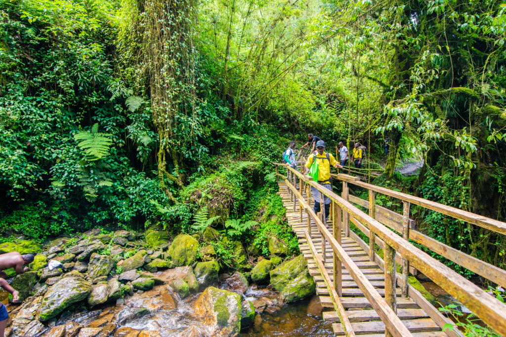
The lower montane forest is dense and loud. Podocarpus and Hagenia form a closed canopy, the understory is crowded with flowering Impatiens, and black-and-white colobus monkeys crash through the upper branches while red-tailed monkeys watch from the side of the trail. The Rwenzori turaco, a bird so vividly colored it looks painted, calls from the forest edge. Your porters, who have carried the bulk of your kit up this ridge countless times, will pass you at a measured walk and arrive in camp long before you. You cross the Mubuku River and then climb steadily up a ridge for the remainder of the day.
Nyabitaba Camp sits on a forested ridge at 2,652m and delivers the expedition’s first open views: the Mubuku Valley falling away below, the Albertine Rift stretching west, and above the cloud the ridgelines you will be standing on within a week. Dinner is hot, the briefing is short, and the early night is deliberate. You are starting a long climb.
Highlights: Mubuku River crossing, colobus and red-tailed monkeys, Rwenzori turaco, and first ridge views across the Albertine Rift.
Meals: Packed lunch on the trail, hot dinner in camp.
Sleep: Nyabitaba Camp (2,652 m), shared hut with foam mattresses and a toilet block.
Day 2: Nyabitaba Camp to John Matte Camp | 3,414m | 8km
Elevation: 2,652 m to 3,414 m | Hiking time: 5-7 hours | Terrain: bamboo, then giant heather, then the Mubuku Valley floor
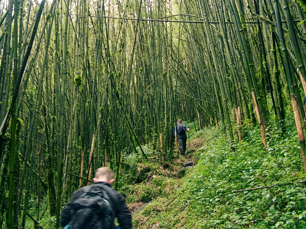
Day 2 takes you through three ecosystems in a single walk. You leave Nyabitaba, descend to the Mubuku River, cross it, and climb through the bamboo zone where Arundinaria alpina arches over a narrow trail like the nave of a green cathedral. It is short and atmospheric, yielding abruptly to Heather. Our guide to the vegetation zones of the Rwenzori explains why these bands appear so cleanly on this mountain, but nothing prepares you for walking through them.
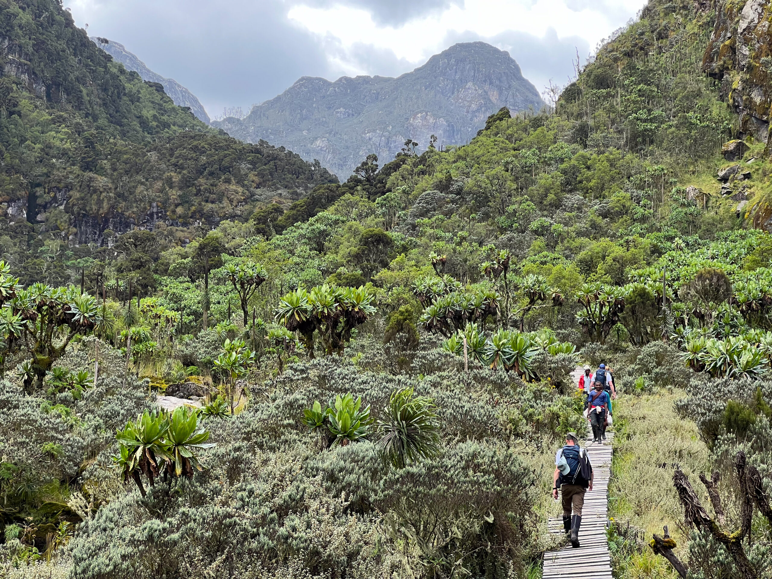
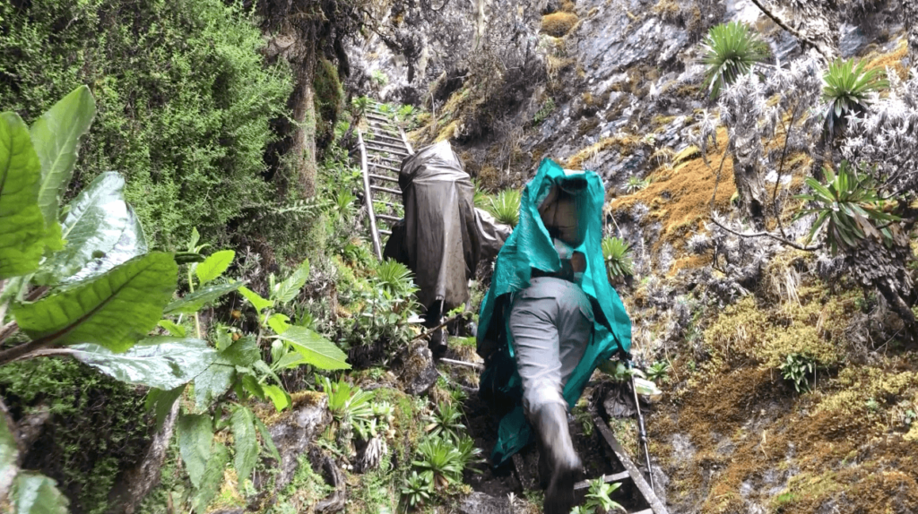
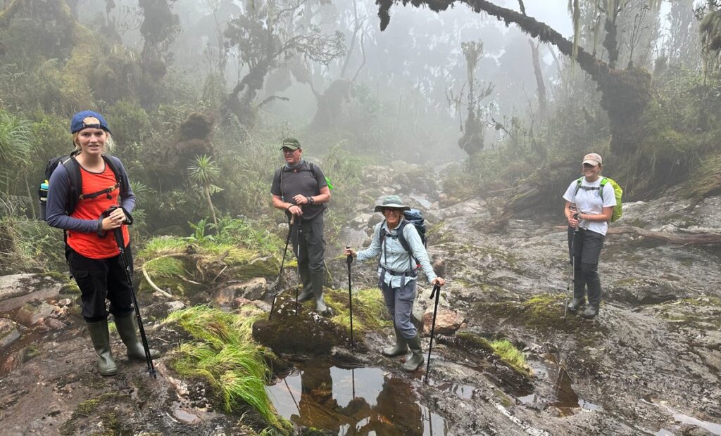
Above the bamboo, the giant heathers, Erica arborea and Erica trimera, climb to five and six meters tall, every branch draped in Usnea lichen, and the trail becomes a series of root-stepped tunnels through moss. The ground underfoot is wet for most of the year. This area is where rubber boots earn their reputation. The Mubuku Valley opens ahead of you, and you cross the river again over the Kurt Shafer Bridge, then climb the final stretch through heather to camp.
John Matte Camp at 3,414 m is the first authentic high-altitude camp of the expedition. In clear weather, the snow on the flanks of Mount Stanley shows above the heather canopy, the first physical evidence of the summit world you are heading toward. Drink at least three liters today and eat everything you are given. Altitude begins to register from here.
Highlights: Bamboo forest, giant heather tunnels, Kurt Shafer Bridge, and first view of Mount Stanley’s snowline in clear weather.
Meals: Packed lunch on the trail, hot dinner in camp.
Sleep: John Matte Camp (3,414 m), shared hut, and cook shelter.
Day 3: John Matte Camp to Bujuku Camp | 3,977m | 7km
Elevation: 3,414m to 3,977m | Hiking time: 5-6 hours | Terrain: Bigo Bog, Afro-alpine valley, lakeside approach
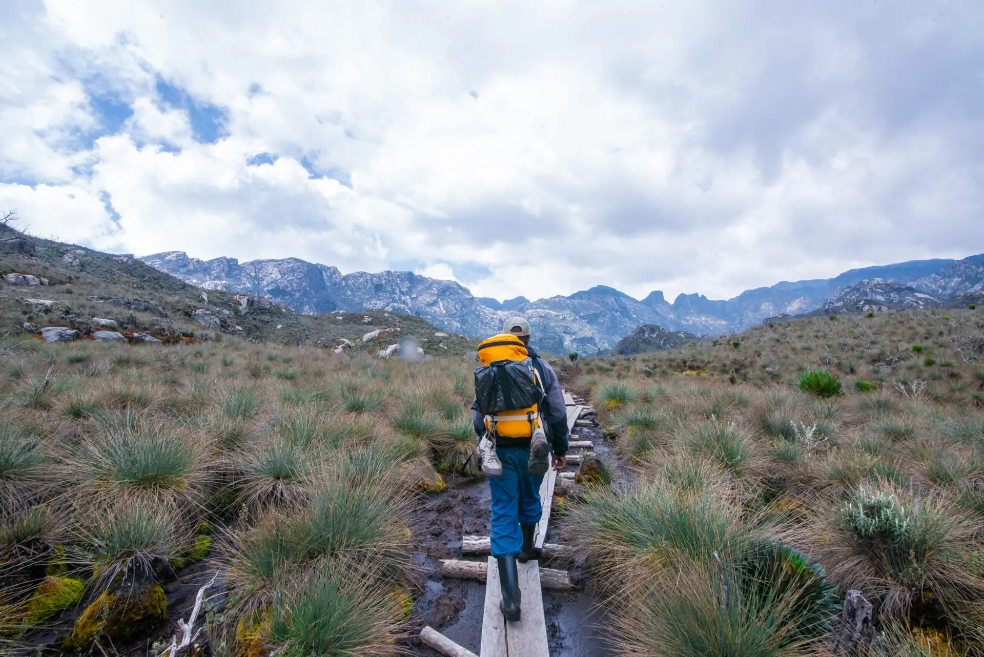
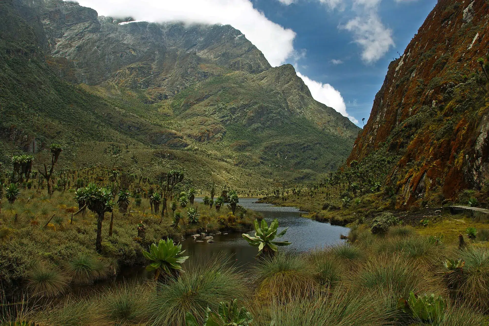
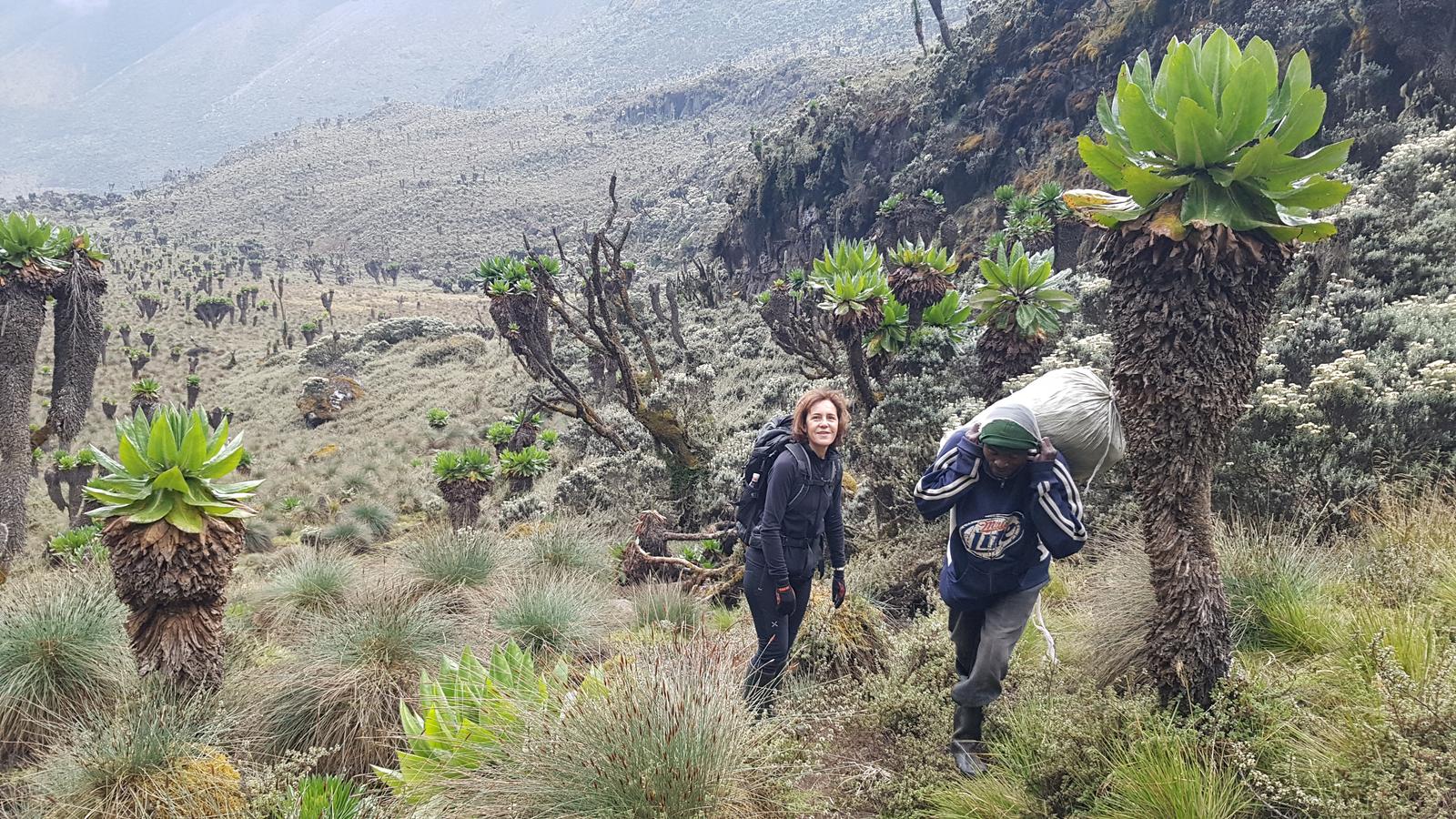
Day 3 is the strangest and most beautiful day in the Rwenzori. You cross Bigo Bog on boardwalk and mud, then enter the Afro-alpine zone, where giant groundsels (Senecio adnivalis) and giant lobelias (Lobelia wollastonii) rise from the mist in shapes that feel more like a stage set than a real mountain. These are not scaled-up versions of garden plants. They are separate evolutionary lineages that converged on the same strategy of tall growth and a tightly closed rosette that shields the growing tip from night frosts. Nowhere else in Africa will you walk through this vegetation at this density.
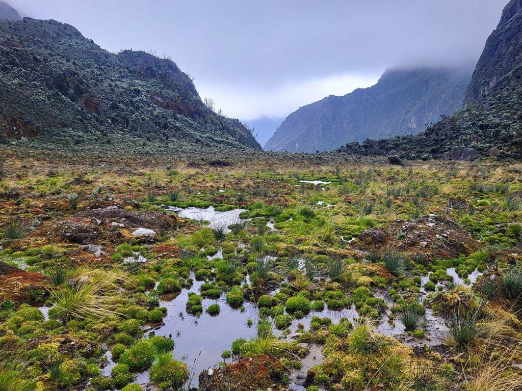
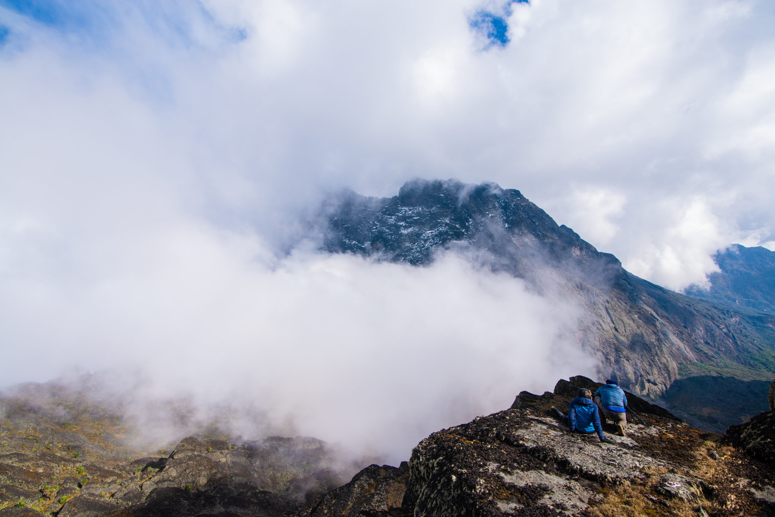
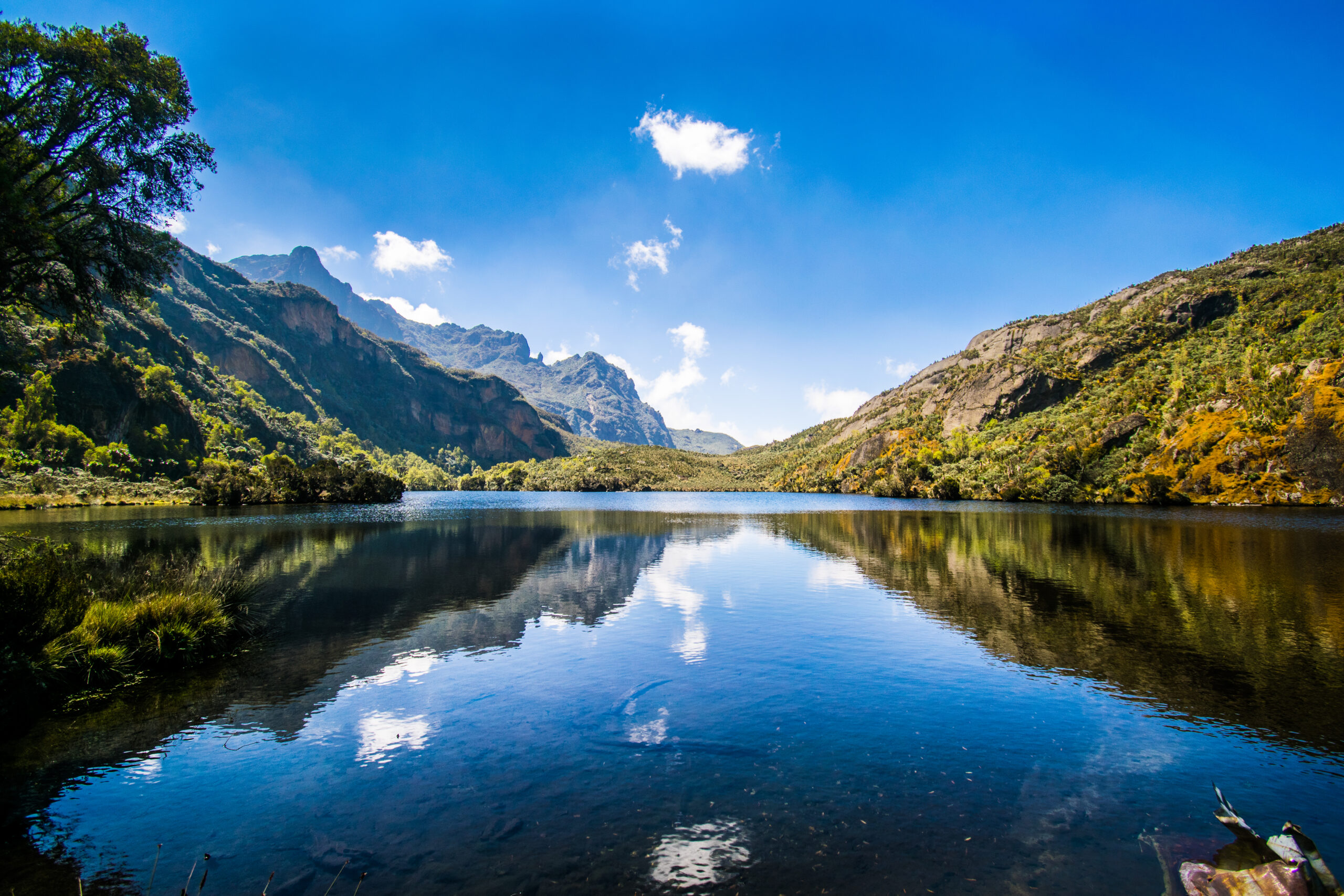
The trail crests into the Lake Bujuku basin, and the expedition becomes suddenly, viscerally real. The glacial tarn reflects Mount Stanley to the west and Mount Speke to the north, the two massifs you will summit over the next three days. The summits look specific now, with ridges and gullies rather than a blur in the cloud. Most first-time visitors stop walking at this point, even without anyone asking them.
Bujuku Camp at 3,977 m is the highest of the standard Central Circuit camps and the hub of this itinerary: you sleep here twice. Headaches, broken sleep, and reduced appetite are common and normal at this elevation. Your guide will check your oxygen saturation and symptoms this evening.
Highlights: Bigo Bog, giant groundsel and lobelia forest, Lake Bujuku with Stanley and Speke overhead, and first evening altitude check.
Meals: Packed lunch on the trail, hot dinner in camp.
Sleep: Bujuku Camp (3,977 m), trail huts; a sleeping bag rated to -10°C or colder is essential from tonight.
Day 4: Summit Day One, Mount Speke (Vittorio Emanuele Peak, 4,890m) and Return to Bujuku Camp | 3,977m | 12km
Elevation: 3,977 m to 4,890 m and back to 3,977 m | Hiking time: 8-10 hours | Terrain: Afro-alpine moraine, granite scrambling, exposed ridge
Your first summit day begins before dawn from Bujuku, which is the point of sleeping here twice: you attempt the lowest of the three summits from a camp you have already slept at, which is a textbook acclimatisation pattern. The route climbs out of the Bujuku basin across open Afro-alpine slopes and moraine, then steepens into the rockier upper massif of Mount Speke above 4,500m.
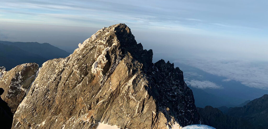
Vittorio Emanuele Peak
The summit of Vittorio Emanuele Peak, at 4,890m, is a scrambler’s summit. The rock is good crystalline granite, the movement is sustained and sometimes exposed, and the route is technically less committed than the Elena Glacier but mentally demanding in its own way. Your guides set the pace and choose the line. The view from the top looks south across Lake Bujuku, the basin you have spent two nights beside, and north toward the escarpment that marks the border with the Democratic Republic of Congo.
You descend the same way and reach Bujuku by mid- to late afternoon. Nothing at altitude is fast; a long meal and an early night are the work of the evening. Tomorrow is short on purpose.
Summit 1: Vittorio Emanuele Peak, Mount Speke, 4,890m (second-highest massif in the Rwenzori).
Meals: Early breakfast, packed lunch, hot dinner in camp.
Sleep: Bujuku Camp (3,977 m), second night.
Day 5: Bujuku Camp to Elena Camp | 4,541m | 4km
Elevation: 3,977 m to 4,541 m | Hiking time: 3-4 hours | Terrain: steep upper Afro-alpine, rock, and scree.
Day 5 is deliberately short. You leave Bujuku after a late breakfast and climb steeply on the southern side of the Stanley massif, where the last Afro-alpine vegetation thins to lichen and cushion plants and the terrain turns to rock. It is only four kilometers, but the gain is over 560 meters, and the air is noticeably thinner with every step. This is the day that explains why the itinerary is nine days and not eight: your body gets the afternoon it needs at 4,541m before it is asked to do anything difficult.
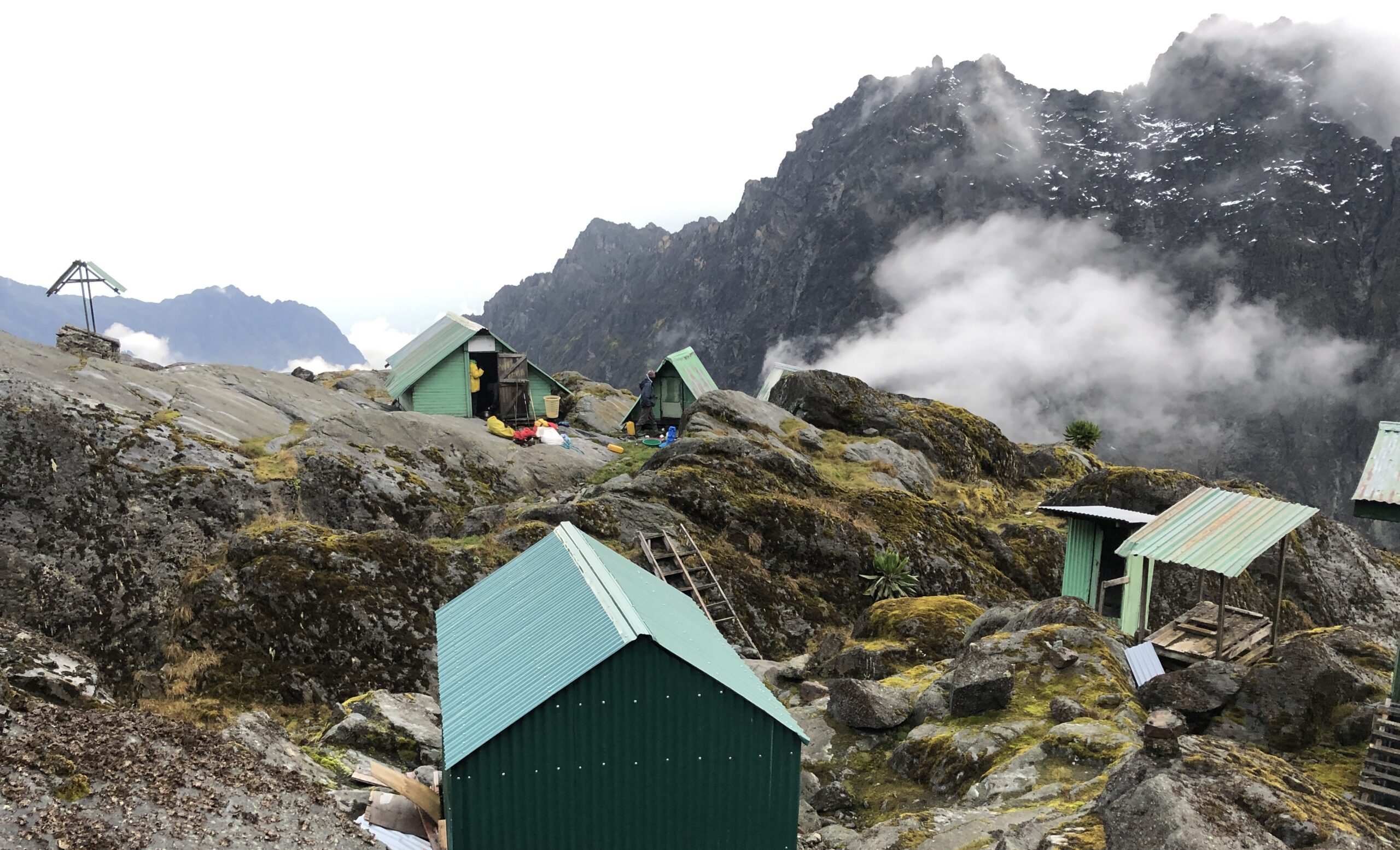
Elena Camp is one of the most dramatically placed huts in African mountaineering. It sits on a rocky bench directly below the Elena Glacier, and from the doorstep you can see the ice rising above it. This is where your guides issue the glacier equipment, fit your crampons, check the harness, and review ice-axe technique. The Elena and Stanley glaciers are shrinking fast.
Dinner is quiet and purposeful. Appetite falls at this elevation; eat what you can and drink more than you want to. Lay your summit kit out before you sleep and aim to be in your bag early. Departure tomorrow is between 4:30 and 6:00am depending on conditions.
Highlights: Steep upper Afro-alpine climb, first view of the Elena Glacier, glacier kit fitting, and technique briefing.
Meals: Late breakfast, packed lunch or early lunch in camp, and hot dinner.
Sleep: Elena Camp (4,541 m), the highest sleeping point of the expedition.
Day 6: Summit Day Two, Margherita Peak (5,109m) to Kitandara Lakes Camp | 4,023m | 13km
Elevation: 4,541 m to 5,109 m, then over Scott Elliot Pass (4,372 m) to 4,023 m | Hiking time: 9-12 hours | Terrain: glacier, rocky summit ridge, high pass
This is the day you came for. You leave Elena in the dark, roped in teams with your guide, crampons on, and ice axe in hand. The approach to the Elena Glacier begins on moraine, and then you step onto the ice, and the world narrows to the rhythm of placing one crampon in front of the other. The glacier route crosses the Stanley Plateau toward the summit ridge; your guides read the crevasses, choose the line, and adjust the route to the glacier’s condition on the day, which changes from season to season.
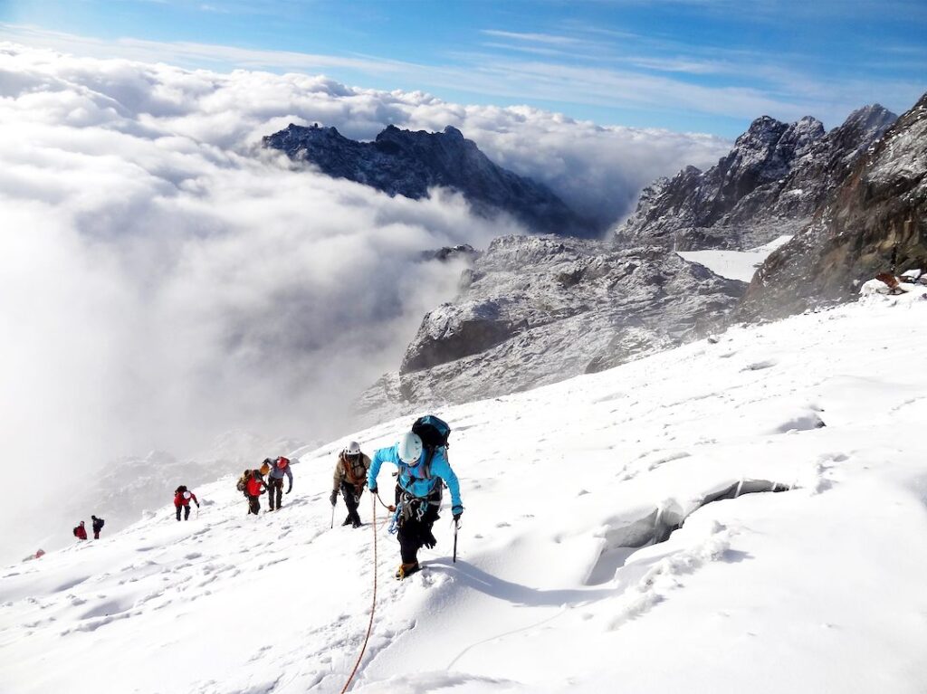
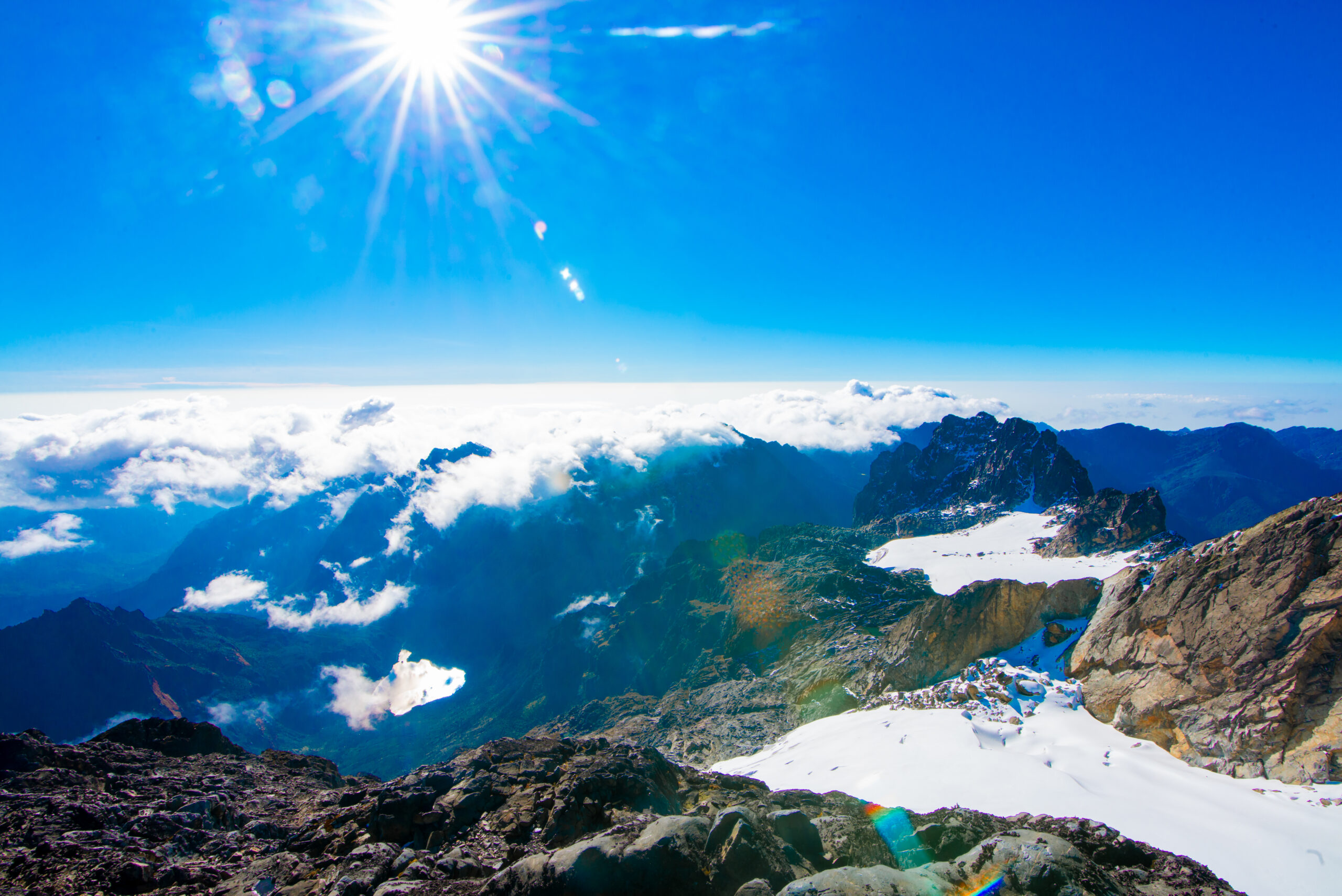
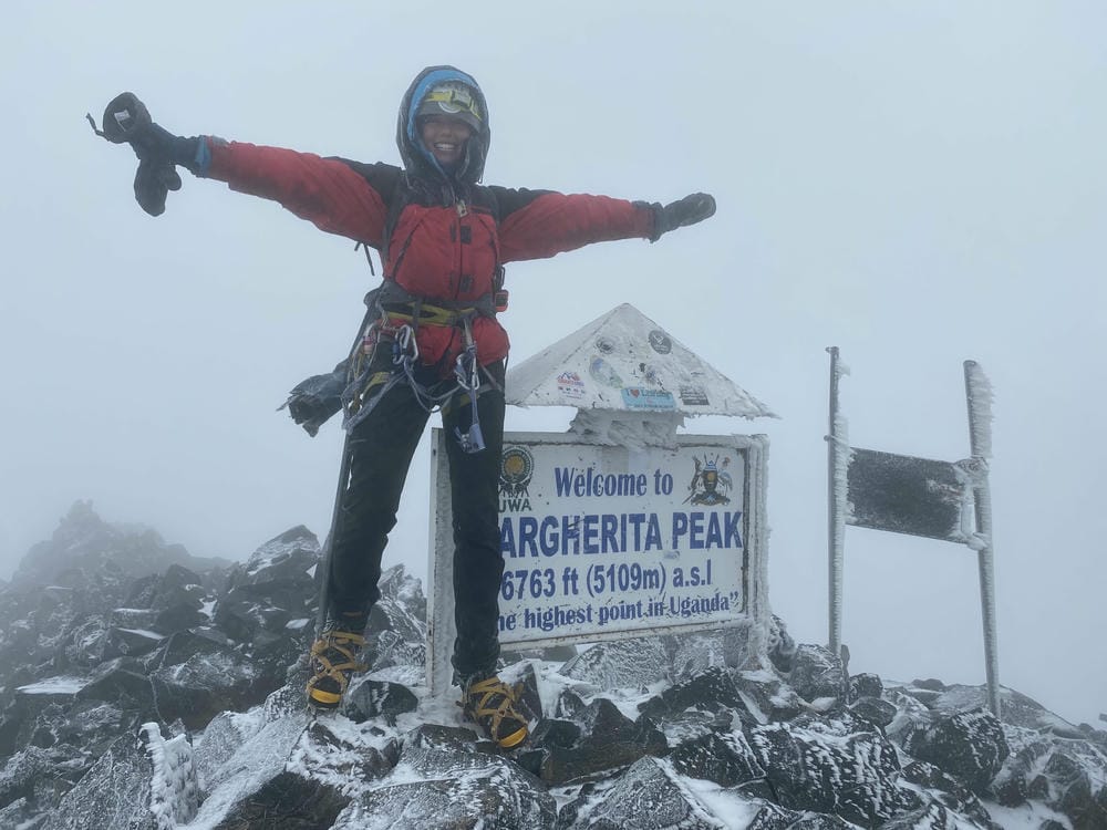
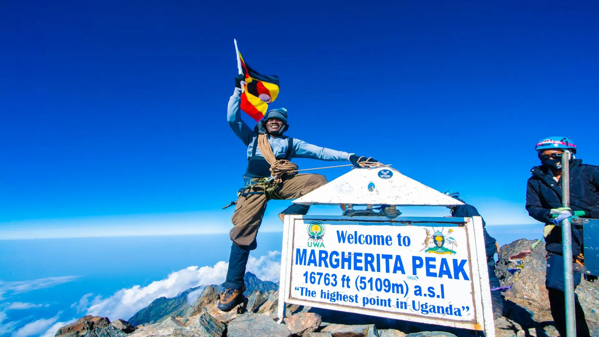
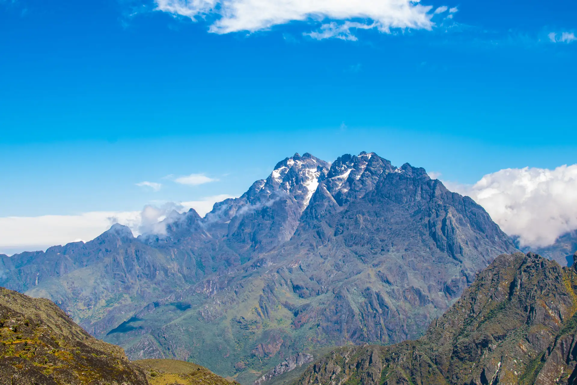
The final approach to Margherita Peak, the highest point on Mount Stanley and the third-highest summit in Africa, involves a short, exposed rocky section that rewards careful footwork. Then you are on top at 5,109m. The view takes in the full arc of the range: Lake Bujuku far below, the Kitandara Lakes to the southwest, the hills of the Democratic Republic of Congo on the western horizon, and the plains of the Albertine Rift to the east. You are standing on the equator, on a glacier that scientists expect to disappear within a few decades.
The day is not over. You descend the same glacier route to Elena, then continue over Scott Elliot Pass at 4,372 m and drop to Kitandara Lakes Camp at 4,023 m, one of the most photogenic camps on the circuit, set beside two dark alpine lakes beneath the cliffs of Mount Luigi di Savoia. Expect to arrive weary and deeply content. This is a long day, typically nine to twelve hours, and the descent on weary legs is where your trekking poles and your discipline matter most.
Summit 2: Margherita Peak, Mount Stanley, 5,109 m (Africa’s third-highest summit).
Meals: Early breakfast, packed lunch, and hot dinner at Kitandara.
Sleep: Kitandara Lakes Camp (4,023 m), a trail hut beside the lakes.
Day 7: Summit Day Three, Mount Baker (Edward Peak, 4,843m) to Guy Yeoman Camp | 3,261m | 12km
Elevation: 4,023m to 4,843m, then down to 3,261m | Hiking time: 9-11 hours | Terrain: Freshfield Pass, rocky ridge scramble, long descent
Your third and final summit day starts with a climb from Kitandara toward Freshfield Pass at around 4,282m, the high saddle that separates the Kitandara basin from the eastern side of the range. From the pass the route turns onto the eastern flank of the Mount Baker massif, gains the summit ridge above 4,600 m, and continues by sustained scrambling on good, grippy rock to Edward Peak at 4,843 m.
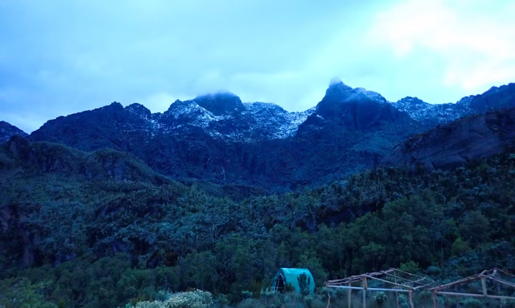
Baker is the most intimate of the three summits. There is no glacier, no rope team, and no crowd: only you, your guide, and a narrow ridge of ancient crystalline rock with the entire range laid out around you. To the north-west, you can see Margherita Peak and the ridges of Speke, which are summits you stood on within the last four days. Guides consistently report the same thing: trekkers go quiet at this point.
After the summit you descend via Freshfield Pass into the upper Bujuku-Kitandara watershed and continue down to Guy Yeoman Camp at 3,261 m. The air thickens, the vegetation returns, and the altitude fog begins to lift. Most trekkers sleep better here than anywhere else on the circuit. Tonight is the appropriate evening for the team debrief and for marking the moment: all three summits are behind you.
Summit 3: Edward Peak, Mount Baker, 4,843m (third-highest massif in the Rwenzori).
Meals: Early breakfast, packed lunch, hot dinner, and celebration at Guy Yeoman.
Sleep: Guy Yeoman Camp (3,261 m), the warmest camp since Nyabitaba.
Day 8: Guy Yeoman Camp to Nyabitaba Camp | 2,652m | 9km
Elevation: 3,261m to 2,652m | Hiking time: 5-6 hours | Terrain: heather, bamboo, montane forest (descent)
The trail drops from Guy Yeoman through heather and moss and into the bamboo zone, reversing the ecological journey of Day 2 at a relaxed pace. There are no summits today and no deadline. Your legs will feel the accumulated work of seven days, especially the quadriceps, and trekking poles will save your knees on the steeper drops. The forest welcomes you back with the smell of wet earth, the calls of turacos, and the warmth of a lower altitude.
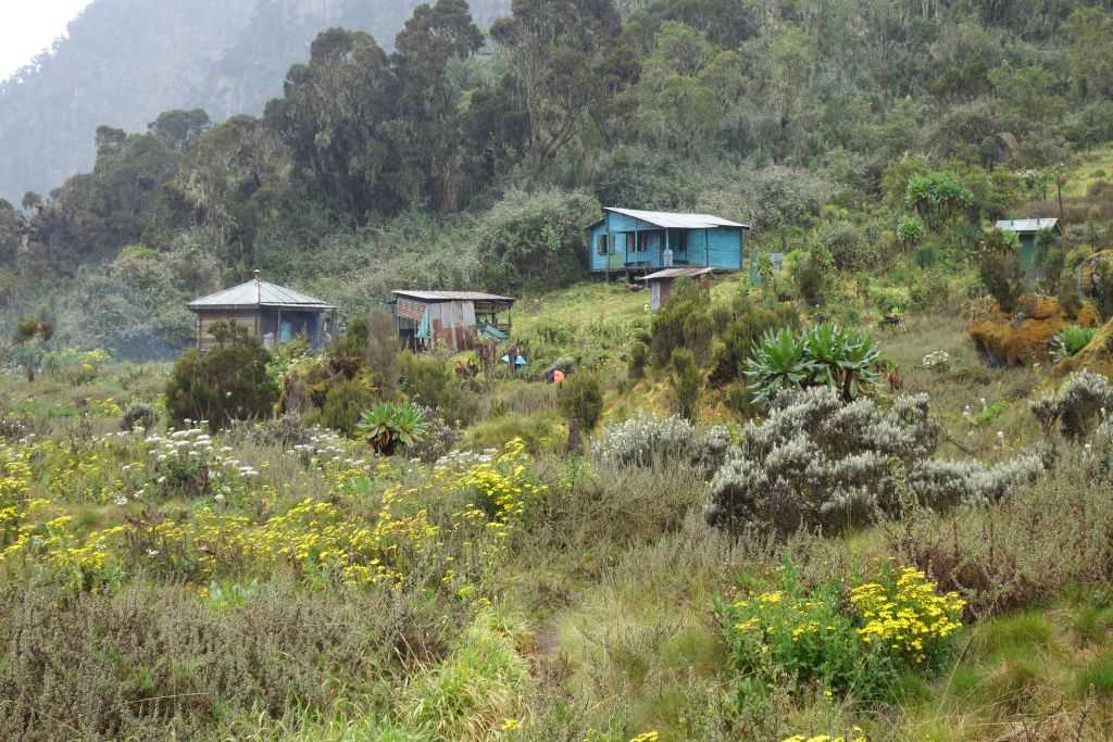
You arrive at Nyabitaba in the early afternoon, the same ridge-top camp where your journey began, but it is a different place now. You have the clean, slightly ridiculous feeling of having climbed three peaks and coming back to a camp with hot water and a place to sit down. Take the afternoon slowly, repack your kit, and enjoy the views across the valley.
Splitting the final descent into two days, rather than forcing a 14-kilometer, 1,600-meter drop in a single push, is a deliberate choice that protects your joints and gives you one last evening on the mountain. The night is for stories and for a good night’s sleep.
Highlights: Heather to bamboo to forest in reverse, relaxed pace, and final evening at Nyabitaba.
Meals: Breakfast, packed lunch, hot dinner, and farewell evening.
Sleep: Nyabitaba Camp (2,652 m), second night.
Day 9: Nyabitaba Camp to Nyakalengija Trailhead and Transfer to Kasese | 1,646m | 8km
Elevation: 2,652m to 1,646m | Hiking time: 3-4 hours | Terrain: forest descent
The final morning is an easy descent of around a thousand meters through the lower forest, the same route you climbed on Day 1. The air warms, the canopy thickens, and the monkeys and birds that accompanied your first day reappear. At Nyakalengija you complete the exit formalities with UWA, and your lead guide presents your 3 Peaks Completion Certificate, documenting your summits of Margherita Peak, Mount Speke, and Mount Baker.
From the trailhead, you are transferred back to Kasese for a hot shower, a cold drink, and, for most trekkers, the first full meal they have genuinely tasted in days. If you have time, our guide to hotels in Kasese and Fort Portal will help you choose a comfortable place to recover. Many trekkers extend the trip with gorilla tracking or a safari; explore our Rwenzori and gorilla trekking combination and Queen Elizabeth National Park guides.
The planning for the next expedition starts here, whether it is the 10-Day 4 Peaks Trek, the 13-Day 6 Peaks Grand Expedition, or the full 18-Day All 8 Peaks Trek.
Highlights: Forest re-entry, 3 Peaks Completion Certificate, and transfer to Kasese.
Meals: Breakfast on the mountain; lunch in Kasese is not included.
End point: Nyakalengija Trailhead (1,646m).
What’s Included and What’s Not Included
What Is Included
- UWA park entry permit for all nine days.
- UWA hut accommodation for all eight nights
- Lead guide (UWA-certified) and assistant guide on summit days
- One porter per trekker (15 kg main luggage limit)
- Camp cook and full board, all meals from Day 1 breakfast to Day 9 breakfast
- Emergency first aid kit, pulse oximeter, and altitude medication carried by the guides
- 3 Peaks Completion Certificate
- Kasese to Nyakalengija round-trip transfers on Day 1 and Day 9
What Is Not Included
- Personal technical gear: mountaineering boots, gaiters, -15°C sleeping bag, trekking poles (rentals on request)
- Glacier equipment: crampons, ice axe, and harness (helmet on request)
- International flights and domestic transport to Kasese (arrangeable on request)
- Travel insurance with emergency evacuation cover to at least 5,200 m
- Gratuities: guide USD 100-120, assistant guide USD 60-80, porter USD 60-80, cook USD 60
- Personal snacks, alcoholic drinks, hotels before and after the trek, and lunch in Kasese on Day 9
Elevation Profile Summary: Nine Days, Three Summit Arcs.
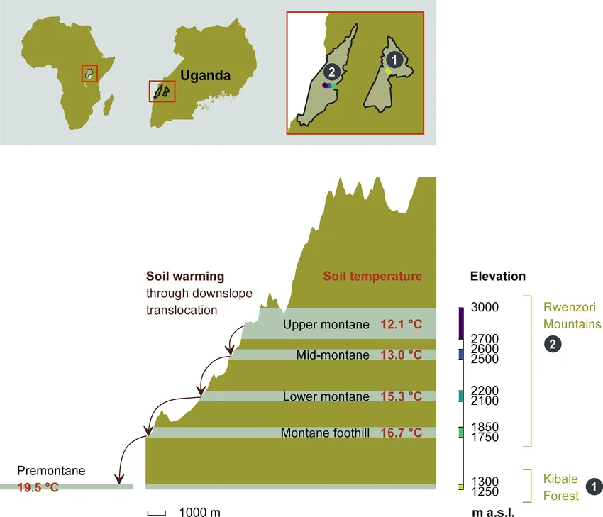
The 9-day Rwenzori trek climbs from 1,646 m at Nyakalengija to a maximum of 5,109 m on Margherita Peak on Day 6, with two additional summit arcs to 4,890 m and 4,843 m. Across the nine days, you gain approximately 5,200 meters and lose approximately 5,200 meters, a figure that reflects that almost every day has a significant vertical component. The profile has a clear rhythm: four days of steady ascent to Bujuku and Elena with a summit day embedded halfway, one big glacier day at the apex, one final summit on the descent side of the circuit, and two days of long descent through the vegetation zones in reverse.
| Day | Route | Gain / loss | Character |
| 1 | 1,646m to 2,652m | +1,006m | Sustained forest ascent |
| 2 | 2,652m to 3,414m | +762m | Bamboo, then giant heather |
| 3 | 3,414m to 3,977m | +563m | Bigo Bog, Afro-alpine entry, Lake Bujuku |
| 4 | 3,977m to 4,890m and back | +913m / -913m | Speke summit, return to Bujuku |
| 5 | 3,977m to 4,541m | +564m | Short climb to Elena, acclimatization |
| 6 | 4,541m to 5,109m to 4,023m | +568m / -1,082m | Margherita, Scott Elliot Pass, Kitandara |
| 7 | 4,023m to 4,843m to 3,261m | +816m / -1,582m | Baker Summit, Freshfield Pass, long descent |
| 8 | 3,261m to 2,652m | -609m | Heather to bamboo, relaxed descent |
| 9 | 2,652m to 1,646m | -1,006 m | Forest descent to trailhead |
The summits are sequenced so that the two highest come when you are best acclimatized and the lowest, Baker, is held back until your body has had six nights above 2,600 m. All elevation figures are approximate and may vary by a few meters between GPS devices and official UWA signage.
Camps and Accommodation on the 9-Day Rwenzori Trek.
Every camp on the Central Circuit is a mountain hut managed under UWA permit, and all are basic but sound. Expect wooden bunks or shared sleeping platforms with foam mattresses, a communal cook shelter where your camp cook prepares meals, and a toilet block at each site.
Nyabitaba Camp, 2,652 m (Nights 1 and 8)
A wide forested ridge above the Mubuku Valley with the first open views toward the Albertine Rift. It is the busiest camp on the circuit, the most comfortable, and the warmest, with night temperatures typically 12-18°C. You sleep here on the first and penultimate nights of the trek.
John Matte Camp, 3,414 m (Night 2)
A clearing in the giant heather offers views of Mount Stanley on clear evenings. Night temperatures drop to 5-10°C, and a mid-layer is required. It is the first camp where you feel the mountain’s real character.
Bujuku Camp, 3,977 m (Nights 3 and 4)
The hub of the expedition, set beside Lake Bujuku beneath Mount Stanley and within striking distance of Mount Speke. At nearly 4,000 m, acclimatization is a real challenge here. The huts have hosted generations of Rwenzori expeditions. A sleeping bag rated to -10C is the minimum sensible choice.
Elena Camp, 4,541 m (Night 5)
The highest sleeping point of the trek, on a rocky ledge below the Elena Glacier and the base for Margherita Peak. Most trekkers sleep lightly at this elevation. Nights regularly fall to -8C or lower; a -15C-rated bag and a liner are strongly recommended.
Kitandara Lakes Camp, 4,023 m (Night 6)
A high alpine camp beside the twin Kitandara Lakes, framed by the cliffs of Mount Luigi di Savoia. It is one of the most scenic camps on the entire circuit, and it is usually a cold one. It is where you come to rest after the longest day of the trek.
Guy Yeoman Camp, 3,261 m (Night 7)
Your lowest camp since the heather and the last night above the forest. Noticeably warmer at 8-14°C and more sheltered than any camp above it. Many trekkers report their best sleep of the expedition here.
Flora and Wildlife to Expect on the Central Circuit
The 9-day Rwenzori trek passes through all five vegetation zones and gives you a complete ecological cross-section from equatorial rainforest to bare glacier. For species lists by zone, our vegetation zones guide and Rwenzori wildlife guide are the reference guides.
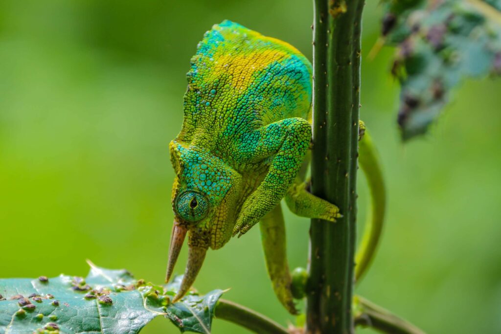
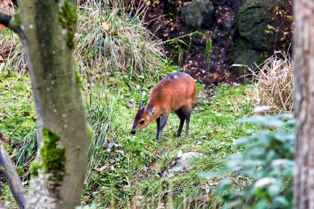
The montane forest (below about 2,500 m) is where you meet the Rwenzori turaco, black-and-white colobus, red-tailed and blue monkeys, three-horned chameleons, and more than a dozen species of sunbird. The bamboo zone (around 2,500-2,800 m) is brief and atmospheric, and the giant heather zone above it (2,800-3,500 m) is dominated by Erica arborea and Erica trimera draped in Usnea lichen, with ground orchids and Hypericum trees scattered through it.
The Afro-alpine zone (3,500-4,500 m) is the most famous and the strangest. Giant lobelias and giant groundsels dominate the valleys, everlasting flowers carpet the slopes, and the lakes hold otters, while rock hyraxes bask on the boulders in clear weather. The nival zone above 4,500 m is bare rock, scree, and ice, and Day 6 takes you across the Elena Glacier, one of the last equatorial glaciers in Africa. Birders should bring binoculars; the Rwenzori has many endemics and near-endemics, including Rwenzori turaco and Rwenzori batis.
Physical Difficulty and Fitness Requirements
The 9-day Rwenzori trek is rated very strenuous, the highest category we use. It is high-altitude mountaineering rather than trekking: three summit days, a roped glacier crossing with crampons and ice axe on Day 6, sustained scrambling to 4,843 m and 4,890 m, nights at 3,977 m and 4,541 m, and approximately 5,200 meters of cumulative ascent over nine days. Long days of nine to twelve hours are standard on summit days, and the conditions are often cold, wet, and muddy.
The minimum we recommend is the ability to hike for six to eight hours a day for several consecutive days, carrying a daypack at altitude, with no serious injuries or cardiovascular problems. Prior experience on Kilimanjaro, Mount Kenya, the Alps, or a comparable multi-day altitude trek is a significant advantage. Previous glacier experience is not required; your guides brief and supervise the Elena Glacier crossing on Day 5 and Day 6. Our fitness and training guide sets out a full program; if you are new to big mountains, start with can beginners climb the Rwenzori, and if you are over fifty, read our guide for older trekkers.
Begin serious training ten to fourteen weeks before departure: weighted uphill hiking with a 10-12 kg pack for three to four hours, cardiovascular work four to five days a week, and ideally a back-to-back long hiking weekend. The itinerary is paced for acclimatisation, with two nights at 3,977 m, a short Day 5, and a recovery descent, but individuals respond differently to altitude. Speak with your doctor about altitude medication before you travel, and read our complete medical guide and the general background on altitude sickness.
Best Time to Go: Seasons on the 9-Day Rwenzori Trek
The best months for this trek are June to August, the long dry season, and December to February, the short dry season. In both windows the glacier is most stable, the rocky ridges of Speke and Baker are driest, and the odds of clear summit views are highest. June to August is the most reliable window; December and January often produce excellent visibility too. Book four to six months ahead for either season.

March to May and September to November are the wet seasons. We do not recommend the three-peaks itinerary in these months: wet rock on Speke and Baker becomes dangerous, glacier conditions become less predictable, and the lower trails turn to deep mud. Rain can still occur in the dry season, and the Rwenzori is never truly dry, so bring waterproofs regardless.
Packing and Gear List for the 9-Day Rwenzori Trek
The Rwenzori is cold, wet, and muddy on most days, and the climate swings from warm forest to sub-zero ridges in a matter of hours.
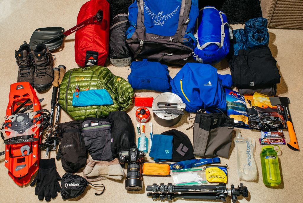
Footwear
- Stiff-soled mountaineering boots compatible with step-in crampons for summit days
- Waterproof gaiters (essential from John Matte upward)
- Rubber gumboots for the muddy lower sections (hire in Kasese), plus camp shoes
- 4 or more pairs of merino wool socks (no cotton)
Clothing and Layering
- 2 sets of merino wool thermal base layers
- Heavyweight fleece mid-layer and a down jacket (600-fill or warmer)
- Waterproof, taped-seam shell jacket and waterproof trousers
- Insulated summit gloves plus liner gloves; balaclava or neck gaiter
- Warm hat, sun hat, UV400 glacier goggles, and sunglasses
Sleep System
- Sleeping bag rated to -15C comfort, plus a liner
- An insulated sleeping pad is optional; foam mattresses are provided in the huts
Technical and Personal
- Trekking poles, headlamp with spare batteries, 2-3 liter water system, dry bags
- Personal first aid, blister kit, sun cream SPF 50, lip balm, and altitude medication as advised by your doctor
- Crampons, an ice axe, and a harness are provided; bring your own only if you have fitted, tested equipment
Permits, Park Fees, and Costs
Park fees are the largest fixed cost on any Rwenzori trek and are included in the package price. The figures below are the published UWA rates we use in our itinerary costings. The Uganda Wildlife Authority sets official rates, which can change, and we confirm the current rates at the time of booking.
| Cost item | Amount |
| UWA park entry | USD 45 per person per day x 9 days = USD 405 |
| UWA hut accommodation | USD 30 per person per night x 8 nights = USD 240 |
| Lead guide and assistant guide | Included in package |
| Glacier equipment | Included in package |
| Porter (1 per trekker, 15 kg) | Included in package |
| Camp cook and full board | Included in package |
| Kasese to trailhead transfers | Included in package |
| Emergency first aid and medical kit | Included in package |
| Recommended gratuities | Approx. USD 280-360 for the team |
Per-person cost falls in groups of four or more, and solo trekkers are always welcome. Ask for a tailored quote through our contact page.
Getting to Nyakalengija: Transport and Logistics.
You can reach the Nyakalengija Trailhead, which is 22 km from Kasese town, by road. Our Kasese gateway guide and our guide to getting to the Rwenzori Mountains cover the full logistics. Most international trekkers will also need a visa; apply through the official Uganda eVisa portal.
From Kampala
The drive from Kampala to Kasese is roughly 385km and takes five to six hours by private vehicle. Scheduled buses also run daily. We recommend a private 4WD for groups carrying technical gear, arranged through us at approximately USD 120-150 one way.
From Entebbe International Airport
The distance from Entebbe is around 420km, five and a half to seven hours by road. Plan a night in Kampala or Entebbe after landing, and budget a full travel day before your trek starts. Arrive in Kasese the evening before Day 1 for the pre-trek briefing.
From Kasese to Nyakalengija
Kasese to the trailhead is 22 km and takes 35-45 minutes. The transfer is included on Day 1 and Day 9. UWA permit verification, equipment inspection, and the porter briefing all happen at the trailhead before you begin walking.
Book Your Slot
Respond within Minutes
From
$1,400
per person
- Duration 9 Days / 8 Nights
- Group Size 1–12 people
- Start Point Nyakalengija
- Departures Year-round
- Summits Margherita, Vittorio Emanuele, Edward Peak
No booking fee. We respond within Minutes.
Our Popular Rwenzori Treks
Magheritah Peak (8 Days Kilembe Trail)
$1705 Per Person
Mutinda LookOut (4 Days)
$645 Per Person
Short Magherita Hike (5 Days Central Circuit)
$1200 Per Person
Rwenzori Hike (7 Days Central Circuit)
$1400 Per Person


Frequently Asked Questions About the 9-Day Rwenzori Trek.
How hard is the 9 days Rwenzori trek?
The 9-day Rwenzori trek is very strenuous, the top difficulty level we use. Three summit days, a roped glacier crossing on Margherita Peak, sustained scrambling to 4,890 m and 4,843 m, nights up to 4,541 m, and approximately 5,200 m of total ascent make this a genuine high-altitude expedition. It is significantly harder than a standard Margherita Peak climb and is best suited to trekkers who are already strong walkers.
What makes it achievable is pacing. The nine-day schedule sleeps twice at Bujuku, includes a short approach to Elena, and splits the descent over two days. Most fit trekkers who have trained properly and have some multi-day altitude experience complete it.
How much does the 9-day Rwenzori 3 Peaks trek cost?
Pricing for the 9-day trek starts from USD [] per person on a full-board, guided basis, including park fees, hut accommodation, guides, and porters. Group size, season, and any add-ons such as pre- and post-trek hotels influence the final figure.
Not included are international flights, travel insurance with evacuation cover, gratuities, and personal gear. A detailed breakdown is in our Rwenzori cost guide, and you can get a personalized quote through our contact page or on WhatsApp at +256 773 256 104.
Can a first-time mountaineer do the 9 days Rwenzori trek?
It is possible but not recommended as a first mountain. The itinerary assumes a good baseline of hiking fitness, comfort with long days, and some tolerance for cold and wet conditions. You do not need technical climbing skills because the guides brief and lead the glacier section, but you do need to be resilient.
If you have never trekked above 3,000m, we suggest starting with our 7-Day Margherita Peak Climb or the 6-Day Central Circuit trek to Margherita Peak and building toward three peaks later.
What is the best time of year for the 9-day Rwenzori trek?
The best months are June to August and December to February, the two dry seasons. June to August is the most reliable, with the most stable glacier conditions and the clearest summit views. December and January are also excellent.
The wet seasons of March to May and September to November make the three-peaks route significantly harder and riskier, particularly on the wet rock of Speke and Baker. We generally decline to run the full three-peaks itinerary in those months.
Do I need glacier or technical climbing experience for Margherita Peak?
No prior glacier or technical experience is required. Crampons, an ice axe, and a harness are needed, and your guides give a full technique briefing at Elena Camp on Day 5 before the summit attempt. The glacier is crossed roped, in small teams, with a guide leading the way.
What you do need is a good level of fitness, steady footing, and the discipline to follow your guide’s instructions. The rocky sections on Speke and Baker involve hands-on scrambling, so comfort with exposure helps.
How is the 9-day trek different from the 8-day 3 Peaks trek?
Both itineraries summit the same three peaks: Margherita, Speke, and Baker. The 9-day version adds one day, which is used for acclimatisation and recovery: a second night at Bujuku, a short and restful approach to Elena, and a split descent instead of a single long one.
In practice the extra day makes the summit days safer and the trek more enjoyable. If you are a strong, fast trekker with prior altitude experience, the 8-Day Rwenzori 3 Peaks Trek may suit you. If you want more margin or a higher chance of summiting all three, choose the 9-day.
How high do you sleep, and how do you avoid altitude sickness?
You sleep at 3,977 m at Bujuku twice, at 4,541 m at Elena, and at 4,023 m at Kitandara. These are significant elevations, and altitude symptoms such as headache, poor sleep, and reduced appetite are common. The ascent profile is designed around the “climb high, sleep low” principle: you summit Speke from Bujuku and return to sleep there, you rest at Elena before Margherita, and you finish at lower camps.
Drink three to four liters of water a day, eat regularly, and tell your guide about any symptoms immediately. Guides carry pulse oximeters and emergency altitude medication and are trained to descend trekkers early if needed.
What are the huts like on the Central Circuit?
Huts are basic but solid. You sleep in shared bunks or on platforms with foam mattresses, meals are cooked in a communal cook shelter, and each site has a toilet block. There is no electricity, no hot showers, and no mobile signal on most of the route.
Bring a warm sleeping bag and a liner and expect condensation in the huts. Comfort improves at the lower camps: Nyabitaba and Guy Yeoman are the warmest. Our mountain huts and campsites guide explains what to expect on each trail.
Is it muddy, and do I need rubber boots?
Yes, the Rwenzori is muddy, particularly between Nyabitaba and Bujuku, where Bigo Bog and the heather zone can be waterlogged for much of the year. Rubber boots are the standard solution for the lower and middle trail and are available to hire in Kasese. For the summit days, you will want stiff-soled mountaineering boots that can take crampons.
Gaiters, waterproof trousers, and a spare set of dry socks for camp are essential. See our boots and footwear guide for recommendations.
How do I get from Entebbe or Kampala to Nyakalengija?
From Entebbe it is roughly 420km to Kasese and then a further 22km to Nyakalengija, about six to seven hours of driving in total plus the transfer. From Kampala, it is about 385 km, taking five to six hours by private vehicle. We recommend a private 4WD or a hired vehicle with a driver for groups carrying technical equipment.
We can arrange everything from the airport pick-up to the Kasese hotel. The Kasese to Nyakalengija transfer is included on Day 1 and Day 9. Explore our guide to getting to the Rwenzori Mountains.
What travel insurance do I need for the 9 days Rwenzori trek?
You need comprehensive travel insurance that explicitly covers trekking and mountaineering to at least 5,200m, including emergency medical treatment and evacuation. Standard policies often exclude glacier travel or cap altitude at 4,000m, so check the wording carefully and ask your insurer to confirm in writing.
Because evacuation from the Rwenzori can be complex, we require proof of cover before departure. Our guide to travel insurance for the Rwenzori explains exactly what to look for. For the full question bank, browse our Rwenzori FAQ page.
Book Your 9 Days Rwenzori Trek
Three summits. One traverse. The 9-day Rwenzori trek is the most complete expression of the Mountains of the Moon that you can walk in a single trip, and it is done by a remarkable number of people each year. Standing on Margherita Peak, then Speke, then Baker, with the rest of the range laid out below you, is the kind of experience that changes how you measure other mountains.
Our guides have led Margherita Peak climbs more than two hundred times, and we plan every itinerary around safety first and summits second. Share your dates and experience, and we’ll let you know if this trek is right for you and when to go.
| REQUEST A QUOTE | WHATSAPP A MOUNTAIN GUIDE |
Not sure if three peaks is right for you? Compare the 8-Day 3 Peaks Trek, the 10-Day 4 Peaks Trek, and the Central Circuit vs Kilembe Trail guide, or read what other trekkers say on TripAdvisor.