
Wondering how many days the Kilembe Trail is? Discover 7-, 9-, and 14-day itineraries, day-by-day breakdowns, difficulty ratings, and expert tips for Uganda’s Rwenzori Mountains.
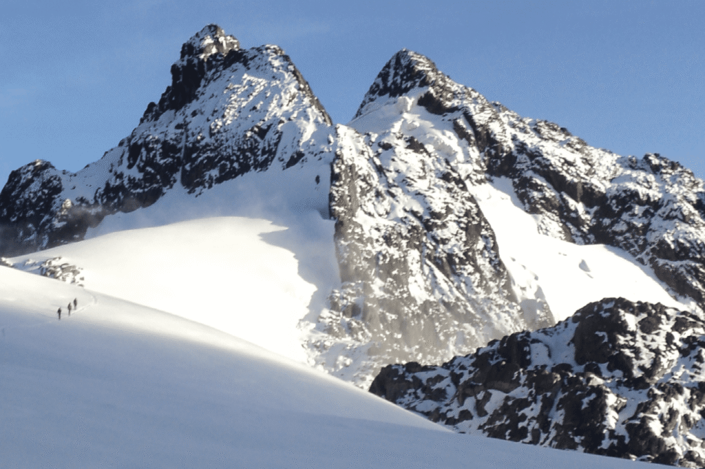
There is a moment on the Kilembe Trail that never loses its power, no matter how many times you have walked it. You are above the heather zone, the last tendrils of cloud breaking apart below you, and the twin glacial pools of Lake Kitandara open up ahead mirror-still, cobalt-blue, flanked by the towering ice-capped ridgeline of Mount Stanley. The Mountains of the Moon live up to every syllable of their name, and the Kilembe Trail is, in the opinion of many experienced Rwenzori guides, the most rewarding way to experience them.
If you are researching this route seriously, the first question you are likely asking is a practical one: how many days is the Kilembe Trail? The answer depends on your objectives, your fitness level, and whether you intend to attempt a summit. The standard guided Kilembe Trail trek runs over nine days, which allows for proper acclimatisation, a summit push to Margherita Peak on Mount Stanley at 5,109 metres, and a safe, unhurried descent. A non-summit circuit can be completed in seven days, while multi-peak expeditions, those targeting two or more of the Rwenzori’s major summits, typically require eleven to fourteen days.
This guide will give you everything you need to understand the Kilembe Trail in depth: its daily structure, its terrain, how it compares to the Central Circuit, what to expect at each camp, and how to decide which itinerary is right for you. By the time you finish reading, you will understand not just the logistics but the character of this route, because the Kilembe Trail is not simply a path to a summit. It is one of the best mountain journeys in East Africa.
What Is the Kilembe Trail?
The Kilembe Trail, also called the Southern Circuit, is the most modern, most scenic, and most technically well-developed trekking route in the Rwenzori Mountains National Park. It takes its name from Kilembe, a town at the foot of southern Rwenzori at 1,450 meters above sea level, historically known for its copper mines and today the base of operations for Rwenzori Trekking Services. The trail was formally established in 2009 and officially relaunched under its current name and management structure in 2011.
Unlike the Central Circuit Trail, which begins at Nyakalengija on the northern side of the range and is managed under a different authority, the Kilembe Trail operates as a fully self-contained southern circuit. It ascends into the Rwenzori through the Nyamwamba and Namusangi valleys, reaches the glaciated high peaks of Mount Stanley and Mount Baker, and returns to Kilembe via an entirely different descent route, Oliver’s Pass and the Nyamwamba Valley. You begin and end at the same town, and every metre of trail in between is Kilembe Trail territory.
The Kilembe Trail huts are among the best-maintained mountain shelters in the entire Rwenzori range, a direct result of focused management by Rwenzori Trekking Services, which has invested heavily in the infrastructure since the trail’s establishment. The route is widely regarded as the best option for reaching Margherita Peak because of its logical acclimatisation profile, its stunning visual approach to the high mountains, and its extraordinary variety of terrain, from the rainforest floor to the summit glacier.
How Many Days Is the Kilembe Trail?
The honest answer is that the Kilembe Trail does not have a single fixed duration. It has a set of natural breakpoint camps, acclimatisation windows, and summit objectives that form three distinct itinerary lengths. Understanding the logic behind each one will help you choose the right trip for your experience and goals.
The 9-Day Kilembe Trail: The Standard Summit Itinerary
Nine days is the itinerary recommended by experienced Rwenzori guides for trekkers who want to attempt Margherita Peak, the highest point in Uganda and the Democratic Republic of Congo and the third-highest summit in Africa at 5,109 metres. This duration is not a commercial convenience. It reflects the physiological realities of altitude acclimatisation at Rwenzori, where the ascent profile is steep and the weather is unpredictable.

Over nine days, you ascend from Kilembe through the montane forest, bamboo belt, giant heather moorland, and Afroalpine zone before reaching the glaciated slopes of Mount Stanley. A dedicated rest day at Lake Kitandara, one of the most breathtaking campsites anywhere in equatorial Africa, allows your body to adjust properly at approximately 4,027 metres before you push higher. The summit day itself is long and technically demanding, typically involving a pre-dawn start from Elena Hut or a high camp at around 4,541 metres. The descent then carries you across the Central Circuit to Nyabitaba Hut and out to Nyakalengija, completing a total trip of about 85 kilometres.
The 7-Day Kilembe Trail: The Non-Summit Circuit
For trekkers whose primary objective is the wilderness experience rather than the summit, a seven-day itinerary covers the Kilembe Trail through the Kitandara basin and back without a Margherita attempt. This option is well-suited to those who have limited time, who are new to high-altitude trekking, or who simply want to immerse themselves in the Rwenzori’s extraordinary ecology without the added physical and technical demands of glacier travel.
On a seven-day trek, you still reach altitudes above 4,000 metres, and you still experience the full sweep of the Rwenzori’s vegetation zones. You spend time at the Kitandara Lakes, which many experienced trekkers consider the spiritual heart of the entire range, and you descend via a route that showcases the northern slopes of the mountains in all their brooding grandeur. What you trade is the summit, and that, in the end, is a deeply personal calculation.
Extended Itineraries: 11 to 14 Days for Multi-Peak Expeditions
The Rwenzori is one of the few places on earth where a single expedition can legitimately attempt multiple glaciated summits at 4,800 meters or higher. Trekkers with mountaineering experience and sufficient time can combine the Kilembe Trail approach with objectives on Mount Speke, Mount Baker, Mount Emin, or the rarely climbed Mount Luigi di Savoia. These extended expeditions require eleven to fourteen days on the mountain and should be planned with a specialist operator who has deep logistical experience in the range. At Rwenzori Trekking Safaris, our multi-peak expeditions are tailored to each group’s ambitions and managed by guides who know every camp, every ridge line, and every weather window in the Rwenzori intimately.
Day-by-Day Breakdown of the 8-Day Kilembe Trail with Margherita Summit.
What follows is the complete, authoritative day-by-day breakdown of the standard eight-day Kilembe Trail itinerary as run by Rwenzori Trekking Safaris. All elevation figures, timings, and camp details are drawn directly from operational experience on the trail. Conditions vary with weather and season; your lead guide will adjust pacing as needed.
| Day | Route Segment | Est. Time | Elevation Change |
| Day 1 | Kilembe Trailhead (1,450m) → Sine Camp (2,596m) | ~5–6 hrs | +1,146m |
| Day 2 | Sine Camp → Kalalama Camp (3,147m) → Mutinda Camp (3,588m) | ~5–6 hrs | +992m |
| Day 3 | Mutinda Camp → Bugata Camp (4,062m) | ~6–7 hrs | +474m |
| Day 4 | Bugata Camp → Bamwanjara Pass (4,450 m) → Hunwick’s Camp (3,974m) | ~6–7 hrs | Varied (+/−) |
| Day 5 | Hunwick’s Camp → Lake Kitandara → Scott Elliott’s Pass → Margherita Camp (4,485 m) | ~5–6 hrs | +511m |
| Day 6 | Summit Day: Margherita Peak (5,109 m) → descend to Hunwick’s Camp (3,874 m) | ~10–12 hrs | +624m / −1,235m |
| Day 7 | Hunwick’s Camp → Oliver’s Pass (4,505m) → Nyamwamba Valley → Kiharo Camp (3,460 m) | ~7–8 hrs | Varied descent |
| Day 8 | Kiharo Camp → Kilembe Trailhead (1,450 m) → Transfer to Kasese | ~5–6 hrs | −2,010m |
Day 1: Kilembe Trailhead to Sine Camp (2,596m)
Your Rwenzori expedition begins at the Kilembe gate at 1,450 metres, where Rwenzori Trekking Services staff conduct a comprehensive briefing covering the route plan, mountain safety protocols, and the history of the Kilembe Trail. Here, you will get your technical summit gear, which includes ropes, ice axes, helmets, harnesses, and rubber boots. This is everything you will need for the next few days.
On its first day, it climbs 1,146 meters through the Afro-Montane Forest Zone, following the valley floor along a gradual trail until the gradient sharpens. The forest here is extraordinary: towering trees draped in moss and lichen, bamboo thickets, cascading vines, and a bird life that includes Rwenzori turaco, L’Hoest’s monkey, and occasional sightings of black-and-white Colobus monkeys moving through the high canopy. In the lower forest, one occasionally hears the elusive call of chimpanzees. Just 200 metres before Sine Camp, Enock’s Falls tumbles into view, one of the first of many waterfalls that define the Kilembe Trail’s character. Fit trekkers may push on to Kalalama Camp (3,134 m) if conditions and daylight allow, buying additional time at Mutinda Camp the following day.
Day 2: Sine Camp to Mutinda Camp (3,588m)
Shortly after 8:30 AM, the trail enters the Bamboo-Mimulopsis Zone, steep and high-stepped, and in the wet season coated in a treacherous skim of mud that demands full attention on every footfall. This is the Rwenzori as most trekkers imagine it: dense, dripping, simultaneously beautiful and demanding. The bamboo zone is brief, but its transition into the giant heather forest above is one of the outstanding moments of the first half of the trail.
The 992-metre climb takes you through Kalalama Camp at 3,147 metres, which serves as a rest stop and, for some groups, an overnight stop if conditions dictate, before continuing up into the Heather-Rapanea Zone. The giant tree heathers here, some of them over fifteen metres tall, are buried under so much moss and old men’s beard lichen that they look less like trees and more like slow-motion sculptures. The trail winds and twists up through a misty, moss-walled valley before arriving at Mutinda Camp at 3,588 metres.
From Mutinda, an optional acclimatisation hike to Mutinda Lookout at 3,975 meters rewards you with a sweeping panorama: Kasese Town lying out on the plains below, Lake George shimmering in the distance, and the full arc of the Rwenzori ridgeline above. This acclimatisation excursion is strongly recommended for any group planning a Margherita summit; the altitude gain and return significantly improve your readiness for the days ahead.
Day 3: Mutinda Camp to Bugata Camp (4,062m)
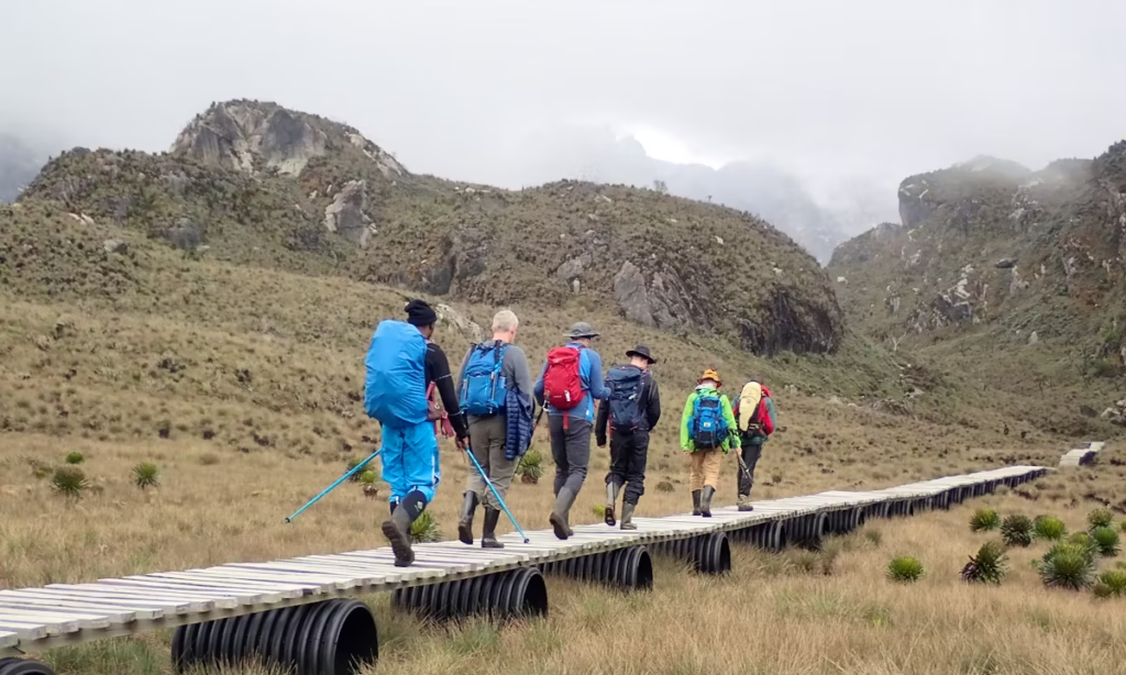
Day three takes you definitively to the alpine zone. The trail crosses the broad Mutinda Valley boggy in the wet season, requiring careful navigation between tussocks and ascends through a landscape of everlasting flowers and the first of the Rwenzori’s famous giant lobelias, their towering flower spikes rising above the surrounding vegetation like natural obelisks.

The climb through the Namusangi Valley, at 3,840 meters, is the most demanding section of the day, with vertical waterfalls visible in multiple directions and, looking back, striking views of the Mutinda Peaks receding below. The trail gains 474 metres from Mutinda before arriving at Bugata Camp at 4,062 metres, above 4,000 metres for the first time, in a landscape where the last of the heather gives way to the open, wind-raked moorland of the high Rwenzori. The cold at Bugata is serious. Your guides will secure your hut properly, advising you to sleep early and stay hydrated throughout the evening.
Day 4: Bugata Camp to Hunwick’s Camp (3,974m) via Bamwanjara Pass
This is the day the mountains reveal themselves fully. From Bugata, the trail climbs to Bamwanjara Pass at 4,450 metres, the highest point of the approach section, and from the pass, on a clear day, the three great peaks open up ahead: the ice-capped massif of Mount Stanley with Margherita hidden in its upper ramparts, the dark ridgeline of Mount Baker to the west, and the pyramid of Weismann’s Peak standing sentinel between them. A small emergency shelter sits at the pass; if the weather deteriorates rapidly, its location provides short-term refuge before a decision is made about continuing.
The descent from Bamwanjara winds through evergreen thickets, giant lobelias, moss fields, and swamp sections that are home to the iridescent Malachite Sunbird, one of the Rwenzori’s most photographed and beloved residents. Hunwick’s Camp, at 3,974 meters, sits on the edge of a wide valley with direct sightlines to Stanley, Baker, Weismann’s Peak, and McConnell’s Prong. This campsite, despite the demanding day required to reach it, feels like a reward: the scale of the surrounding peaks is almost incomprehensible from ground level.
Day 5: Hunwick’s Camp to Margherita Camp (4,485m)
Day five features a high approach that is shorter in distance but significant in meaning, as it leads to the last camp before the glacier. The route descends briefly from Hunwick’s to cross the valley floor, passing Lake Kitandara, a deep glacial lake whose dark water and lush surrounding vegetation provide one of the most atmospheric moments of the entire trail. This scene is a glimpse of the same glacially carved basin visible from the summit approaches above, and seeing it from the valley floor gives a visceral sense of the geological forces that shaped this landscape.
From the lake, the trail climbs over Scott Elliott’s Pass and continues up the ridge to Margherita Camp, at 4,485 meters. The camp sits tucked between giant boulders that provide natural wind protection, a detail not lost on those who have experienced how ferociously the wind can move at this altitude. The historical resonance here is remarkable: in 1906, the Duke of Abruzzi made this same camp his staging post for the first ascent of Margherita Peak. That afternoon, your guides will conduct a thorough summit briefing kit check, rope protocols, glacier movement techniques, turnaround time, and contingency plans. The rule on summit day is firm: turnaround at 10:00 AM, regardless of position on the mountain. Weather builds fast from the Congo basin in the early afternoon, and that rule has kept people safe for years.
Day 6: Summit Day: Margherita Peak (5,109m) and Descent to Hunwick’s Camp
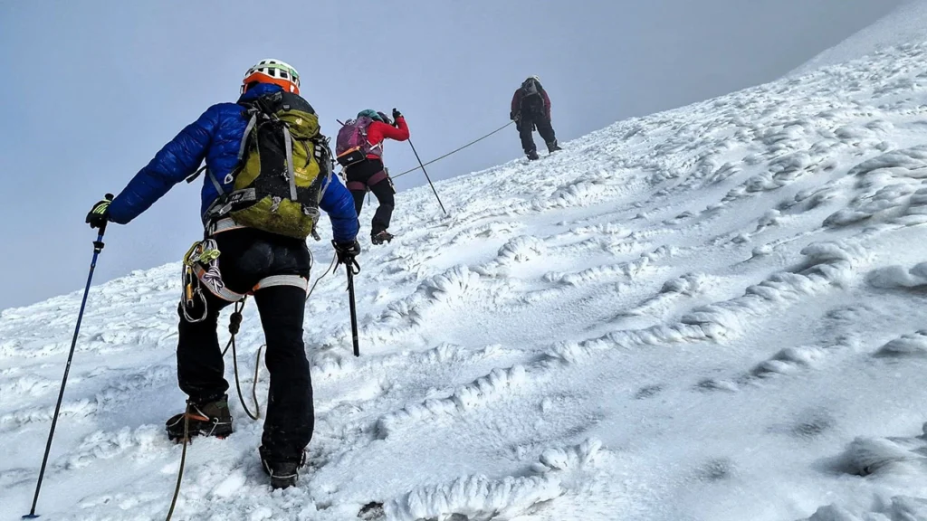
Wake-up is at 2:00 AM. Departure is at 2:30 AM. The ascent of Margherita Peak begins in complete darkness, your headlamp beam illuminating the ice ahead and nothing beyond it. The Stanley Glacier requires crampons, ice axes, and roped team movement from this point. The glacier has retreated significantly in recent decades due to climate change, and the ice has steepened as a result, a detail your guides will brief you on specifically. Angles of up to 60° are possible on the upper sections; the climb is not a scramble; it is a genuine alpine climb, and it demands your full concentration and trust in your guide.
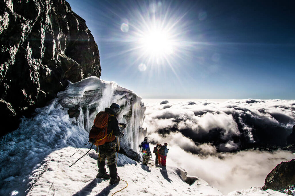
At the summit at 5,109 metres, you are standing on the highest point in Uganda and the Democratic Republic of Congo and the third-highest peak in Africa. On a clear morning, the Congo basin stretches west in an unbroken green canopy to the horizon. The entire Rwenzori range spreads north and south. The world is very far below and very quiet. After photographs and a short rest, descent begins immediately back toward Margherita Camp and then down to Hunwick’s Camp. The full summit day from Margherita Camp and back to Hunwick’s typically runs ten to twelve hours. It is the hardest day of the trek and the most unforgettable one.
Day 7: Hunwick’s Camp to Kiharo Camp (3,460m) via Oliver’s Pass
Day seven is the outstanding hidden gift of the Kilembe Trail, a descent route that most of the trekking world has never heard of, through terrain that earns its reputation for raw, dramatic beauty. From Hunwick’s Camp, the trail climbs a ridge toward McConnell’s Prong, then traverses around to Oliver’s Pass at 4,505 meters, which is actually the highest pass of the entire trek, offering a last magnificent view of the Three Peaks and Scott Elliott’s Pass below.
The descent from Oliver’s Pass drops into the Nyamwamba Valley via a route that passes the confluence of the Nyamwamba and Kilembe rivers, whose combined waters flow downstream through Kasese and ultimately into Lake George in Queen Elizabeth National Park. The trail weaves down the valley between bogs, moraines, ancient debris left by retreating glaciers and ridges of stone and soil that read like pages from the mountain’s geological history. Kiharo Camp, at 3,460 meters, sits in a hidden valley, cradled by towering cliffs on three sides, beside a river that you can hear long before you see it. It is one of the most secluded campsites in the entire Rwenzori, and after summit day, its combination of shelter, running water, and silence is close to perfect.
Day 8: Kiharo Camp to Kilembe Trailhead and Transfer to Kasese
The final sixteen kilometres of trail from Kiharo Camp back to the Kilembe Park gates descend through some of the richest wildlife habitat on the entire route. Rwenzori red duikers, shy forest antelope, are frequently sighted in clearings near the river. The trail passes a series of spectacular cascades as the Nyamwamba drops steeply off the mountain, then climbs briefly to a high ridge with broad valley views before descending through dense woodland to Forest View Camp for lunch. From there, the remaining kilometres carry you back to the base camp and the gate at Kilembe, completing the full circuit.
At the gate, Rwenzori Trekking Services presents your certificate, one of the most earnest pieces of paper in East African mountaineering. A vehicle transfers you back to Kasese for the first proper shower, hot meal, and flat bed in eight days. The mountains are already receding in the rearview mirror, but they will not leave you. The Kilembe Trail tends to come back in dreams.
Kilembe Trail vs. Central Circuit: Two Trails, Two Worlds.
The question frequently arises, and it requires a straightforward response: the Kilembe Trail and the Central Circuit Trail are distinct routes. They are separate trails, managed by separate entities, with different infrastructure, different camp sequences, different approaches to the high peaks, and different descent routes. They do not share camps or management structures, and an itinerary that mixes them is not a creative hybrid; it is an error that could strand a trekker in the wrong part of the park with the wrong operator’s logistics.
The Central Circuit begins and ends at Nyakalengija on the northern side of the range and is managed under a different operational framework. Its camps, Nyabitaba, John Matte, Bujuku, and Elena, are north-side infrastructure. The Kilembe Trail’s camps, Sine, Mutinda, Bugata, Hunwick’s, Margherita Camp, and Kiharo, are south-side infrastructure managed by Rwenzori Trekking Services. No legitimate point-to-point itinerary, claiming to be the Kilembe Trail, utilises Kilembe as the entry point and Nyakalengija as the exit. If you are reading an itinerary that does this, it is either an error by the author or a deliberate conflation.
The practical differences between the two routes are significant. The Kilembe Trail has newer, better-maintained huts built to a higher standard. Its approach to the high peaks from the south is widely considered more spectacular, particularly the Bamwanjara Pass viewpoint and the approach to Margherita Camp via Scott Elliott’s Pass. The trail’s full-loop nature means no shuttle logistics are required, and the descent via Oliver’s Pass through the Nyamwamba Valley is a route of considerable wilderness beauty that the Central Circuit simply does not offer.
The Central Circuit has its virtues: it is the longer-established route, it covers different terrain in the northern valleys, and it has a well-documented track record. For trekkers who want to experience both sides of the Rwenzori, multi-route expeditions are possible over extended timeframes. But for the Kilembe Trail, the advice is to trust the trail as designed: eight days, Kilembe to Kilembe, no detours into Central Circuit territory.
Five Worlds in Eight Days: The Vegetation Zones of the Kilembe Trail
The complete passage through five distinct ecological zones during a single ascent is one of the defining features of the Kilembe Trail and a primary reason the Rwenzori is a UNESCO World Heritage Site. No other path in East Africa offers such a continuous climb through different tropical mountain ecosystems, and the Kilembe Trail’s loop design allows you to experience both going up and coming down through these zones, giving you two different views of the mountain.
The journey begins in the Afro-Montane Forest Zone, between 1,450 and 2,600 meters, with a cathedral of Podocarpus trees, climbing plants, fungi, and extraordinary bird life. This is a living forest, humid and dynamic, with the sound of water always nearby. Above it, the Bamboo-Mimulopsis Zone offers a brief but atmospheric passage through groves of bamboo that click and creak in the mountain wind, before the Heather-Rapanea Zone takes over, the zone that most surprises first-time Rwenzori visitors with its surreal giant heathers draped in metres of dripping green moss and Usnea lichen.
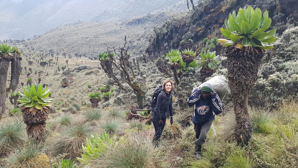
The Afroalpine Zone above 3,500 metres introduces the Rwenzori’s most famous botanical residents: the giant lobelia (Lobelia wollastonii), reaching five metres in full flower, and the giant groundsel (Senecio adnivalis), whose rosette-topped clusters have no true equivalent anywhere else on Earth. These species are the product of millions of years of isolated evolution in the equatorial mountains, and walking among them at 4,000 meters is one of the genuine privileges of the Kilembe Trail. Finally, above 4,500 metres, the Nival Zone takes over: rock, ice, and the Stanley Glacier are the uppermost world and the most demanding.
How Hard Is the Kilembe Trail? Difficulty and Physical Preparation.
The Kilembe Trail is described by Rwenzori Trekking Services as the most challenging trail in the Rwenzori Mountains, and that description is accurate and should be taken seriously. It is not a trail for beginners. It is a trail for trekkers who have prepared, who understand altitude, and who are willing to commit eight hard days to the mountain. The rewards are proportional to the effort, but it is real.
For the parts of the trek that don’t reach the summit, specifically days one to five and days seven and eight, you mainly need good heart and lung fitness, the ability to walk on steep, wet, and uneven ground, and the mental strength to keep going strong for several days in a row. The cumulative vertical gain of the approach is significant; each day builds on the one before, and by day four your legs are carrying eight days’ accumulated fatigue. Begin training at least eight weeks before your trek with a program that includes regular hill walking, stair climbing, or running and simulates a multi-day back-to-back effort wherever possible.
Summit day, day six, is in a different category. The glacier travel on Mount Stanley involves crampons, ice axes, roped teams, and sections of ice at angles up to 60°. Basic mountaineering competence is an advantage, but our guides provide full pre-summit instruction at Margherita Camp for trekkers without prior glacier experience. Base fitness and altitude tolerance must be learned at home, not camp. Altitude sickness does not discriminate by experience level. The acclimatisation profile of the eight-day itinerary, including the Mutinda Lookout excursion on Day 2 and the gradual ascent through Bugata, Hunwick’s, and Margherita’s Camp, is designed to give your body the best possible preparation. Trust the process, hydrate aggressively, and communicate any symptoms to your guide immediately.
When to Trek the Kilembe Trail: Seasons and Summit Windows.
The Rwenzori Mountains earned their name as the “rainmaker” for good reason. They are among the wettest mountains in Africa, receiving over 2,500 millimetres of rainfall annually, and there is no month of the year when rain is impossible on the high peaks. However, there are clear seasonal patterns that define the best trekking windows, and choosing the right time to visit significantly affects both your experience on the lower trail and your summit success rate.
The primary dry season runs from late June through early September. July and August are the most reliable months for the Kilembe Trail, offering lower rainfall, firmer trail conditions in the lower forest and moorland zones, better glacial conditions on summit day, and generally cleaner views from the high passes. This window aligns with the Northern Hemisphere summer and is the peak booking period. If a Margherita summit is your primary objective, July and August represent the highest probability of a successful ascent.
The secondary dry season from late December through February is increasingly popular, particularly among trekkers who want to combine a Rwenzori expedition with Uganda’s other world-class wildlife experiences. Bwindi Impenetrable Forest for gorilla trekking, Queen Elizabeth National Park for wildlife viewing, and Murchison Falls National Park are all within comfortable driving distance of Kasese and can be combined into a broader Uganda itinerary. December and January conditions at altitude are generally excellent, though the shoulder months of November and March can be unpredictably heavy. The wettest and most demanding months for trekking are April, May, and November, possibly with experienced guides but significantly more arduous, with deeper mud and more difficult river crossings. We operate year-round and can advise on current conditions for any planned travel date.
Mountain Camps, Huts, and Food on the Kilembe Trail.
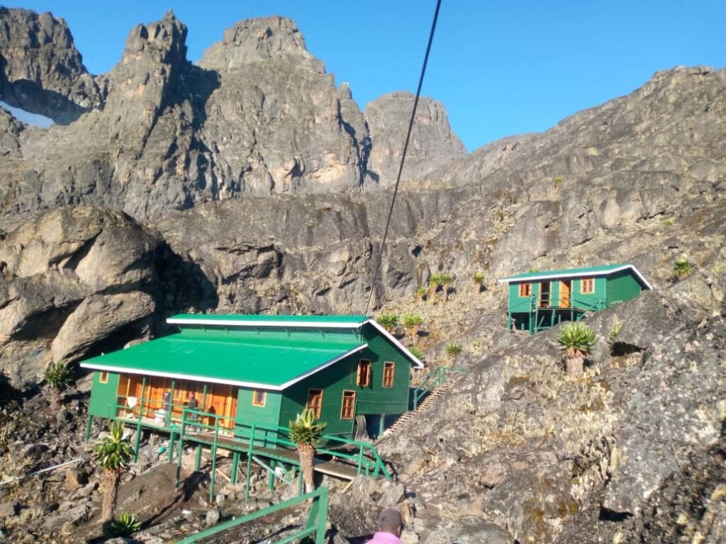
The seven mountain camps of the Kilembe Trail represent some of the finest hut infrastructure in the Rwenzori Mountains National Park. Rwenzori Trekking Services has invested in purpose-built wooden huts at each camp, equipped with sleeping platforms, cooking facilities, and basic amenities. They are functional mountain shelters operating in a demanding wilderness environment, not boutique lodges, but their quality and maintenance set a standard above much of what is available on other Rwenzori routes.
All meals on the Kilembe Trail are prepared by the expedition’s mountain cook team, using ingredients carried from Kilembe. Three hot meals per day are standard, along with a constant supply of hot drinks, tea, coffee, and hot chocolate that become increasingly precious as altitude climbs and temperatures drop. The cooking on Rwenzori expeditions has its character: generous, calorie-dense, and deeply warming. Porridge in the morning, at 4,000 meters, after a cold night and the prospect of another hard day, tastes genuinely extraordinary. Special dietary requirements can be accommodated with advance notice.
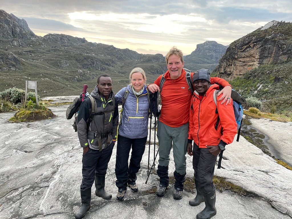
Your porter and guide team on the Kilembe Trail are members of the Bakonjo community, the indigenous mountain people of the Rwenzori foothills, whose relationship with these peaks spans generations. Rwenzori Trekking Safaris is committed to the fair pay, proper equipment provision, and overall welfare of every mountain staff member. A portion of all trek proceeds goes directly to supporting local Bakonjo communities, orphans, schools, and households in the Kilembe area. When you book with us, your trek is also an act of community investment.
Other Kilembe Trail Itineraries: From 2 to 18 Days.
The full eight-day Margherita summit expedition is the centrepiece of the Kilembe Trail, but it is by no means the only option. Rwenzori Trekking Safaris offers a full range of Kilembe Trail itineraries for trekkers of different experience levels and time commitments. The 2-day Sine Camp trek is an accessible introduction to the Rwenzori for those with limited time, reaching 2,596 metres through the lower forest zones. The 4-day Mutinda Lookout trek carries you to 3,975 meters in the Afroalpine Zone, with sweeping views over Kasese and Lake George.
For those with summit ambitions beyond Margherita, the Kilembe Trail also serves as the approach for the 8-day Cheptegei Peak (4,907m) expedition, the 10-day Mount Stanley and Mount Baker double summit, and the extraordinary 18-day all-eight-peaks expedition that covers the full crown of the Rwenzori range. Whatever your ambition, the Kilembe Trail has an itinerary built for it.
Permits, Costs, and How to Book
All trekking on the Kilembe Trail requires valid permits issued by the Uganda Wildlife Authority (UWA). The trail itself is managed and operated exclusively by Rwenzori Trekking Services (RTS), which means independent trekking on the Kilembe Trail is not permitted; all groups must be accompanied by licensed RTS guides. Such an arrangement is not a bureaucratic inconvenience; it is a safety requirement on a serious mountain, and it is a commitment to the conservation and management standards that have made the Kilembe Trail’s infrastructure the finest in the range.
The all-inclusive eight-day package with Rwenzori Trekking Safaris covers national park permit fees, all hut accommodation fees, a certified lead guide and assistant guide, a full porter team, all meals from day one to day eight, technical summit equipment (ropes, ice axes, helmets, harnesses, rubber boots), first aid equipment including supplemental oxygen, and transfers between Kasese and the Kilembe trailhead. International flights, personal travel insurance, and pre/post-trek accommodation in Kasese are arranged separately.
Travel insurance for the Kilembe Trail must explicitly cover high-altitude trekking ( above 5,000 meters; glacier travel, mountain rescue, and emergency medical evacuation. Standard travel policies frequently exclude these activities or impose altitude caps; check your policy carefully before booking. Our team can advise on appropriate insurance products.
For full pricing and current availability, visit our 8-day Kilembe Trail trek page or reach out to us directly.
Frequently Asked Questions About the Kilembe Trail.
How many days is the Kilembe Trail?
The standard Kilembe Trail itinerary for a Margherita Peak summit attempt is 8 days and seven nights in mountain camps, beginning and ending at the Kilembe trailhead in Kasese, western Uganda. Shorter itineraries on the same trail include a 4-day trek to Mutinda Lookout and a 2-day introduction to Sine Camp. Extended multi-peak expeditions on the Kilembe Trail run for 10, 13, or 18 days. The eight-day itinerary is the recommended standard for any trekker targeting Margherita Peak (5,109 m), as it provides an optimal acclimatisation profile, sufficient time at each camp, and the safest possible approach to summit day.
Where does the Kilembe Trail start and finish?
The Kilembe Trail starts and finishes at the Kilembe trailhead in Kilembe town, approximately 12 kilometres from Kasese in western Uganda, at an elevation of 1,450 metres. Unlike the Central Circuit Trail, which begins at Nyakalengija on the northern side of the Rwenzori, the Kilembe Trail is a complete southern circuit; it ascends into the mountains, reaches the high peaks, and descends back to Kilembe via a different route (Oliver’s Pass and the Nyamwamba Valley). No shuttle transfers between different trailheads are required. Any itinerary claiming to be the Kilembe Trail that exits via Nyakalengija or Nyabitaba Hut is inaccurate; those are Central Circuit infrastructures managed by a different entity.
What camps are on the Kilembe Trail?
The seven camps on the standard 8-day Kilembe Trail itinerary are, in order of ascent: Sine Camp (2,596 m), Kalalama Camp (3,147 m intermediate stop on Day 2), Mutinda Camp (3,588 m), Bugata Camp (4,062 m), Hunwick’s Camp (3,974 m), Margherita Camp (4,485 m, the summit staging camp), and Kiharo Camp (3,460 m on the descent). All camps use purpose-built wooden mountain huts managed by Rwenzori Trekking Services and are equipped with sleeping platforms and basic cooking facilities. Hut fees are included in all-inclusive packages from Rwenzori Trekking Safaris.
Is the Kilembe Trail harder than the Central Circuit?
The Kilembe Trail is generally considered the more demanding of the two main Rwenzori routes. Its terrain in the lower and middle sections is steeper, more technically varied, and, in wet conditions, more challenging than the Central Circuit’s equivalent stages. The overall elevation profile is more aggressive, and the trail’s remote, southern character means fewer trekkers and a stronger wilderness feel. Both routes reach the same summit objectives. Margherita Peak on Mount Stanley requires glacier travel regardless of approach, but the Kilembe Trail demands a higher baseline fitness and greater experience of sustained difficult terrain. The Kilembe Trail huts, however, are better maintained than much of the Central Circuit infrastructure.
Do I need mountaineering experience for the Kilembe Trail summit?
Technical mountaineering experience is not a strict prerequisite, but it is a significant advantage. Summit day on the Kilembe Trail involves glacier travel on the Stanley Glacier using crampons and ice axes, with roped team movement and sections of ice at angles up to 60° due to recent glacier recession. Our certified guides provide full crampon and ice axe instruction at Margherita Camp before summit day. What is essential and cannot be taught on the mountain is high base fitness, solid multi-day hiking experience, and comfort with sustained physical effort at altitude. If you have completed a demanding high-altitude trek like Kilimanjaro, the Inca Trail, or Himalayan trekking, you are broadly in the right preparation bracket.
What is the best time of year to trek the Kilembe Trail?
The best months for the Kilembe Trail are July and August (primary dry season) and late December through February (secondary dry season). July and August offer the most reliable conditions: lower rainfall, firmer trails, better glacial conditions, and the highest summit success rates. The December-February window is popular for trekkers who combine a Rwenzori expedition with Uganda gorilla trekking or wildlife safaris at Queen Elizabeth National Park. The wettest months, April, May, and November, are possible with experienced guides but significantly more demanding. Rwenzori Trekking Safaris runs guided Kilembe Trail treks year-round and can advise on current conditions for any planned travel date.
What is included in the Kilembe Trail package?
The all-inclusive 8-day Kilembe Trail package from Rwenzori Trekking Safaris includes: UWA national park permit fees, all mountain hut accommodation fees, a certified lead guide and assistant guide from Rwenzori Trekking Services, a full porter team, all meals from day one to day eight (three hot meals per day plus hot drinks), complete technical summit equipment (ropes, ice axes, helmets, harnesses, rubber boots for loan), first aid equipment including supplemental oxygen, and transfers between Kasese and the Kilembe trailhead. Not included: international flights, travel insurance, pre/post-trek accommodation in Kasese, personal expenses, gratuities, and rescue/evacuation insurance. Travel insurance covering high-altitude trekking (above 5,000 meters) and glacier travel is mandatory.
Can beginners do the Kilembe Trail?
The Kilembe Trail is explicitly not recommended for complete beginners. Rwenzori Trekking Services classifies it as the most challenging trail in the Rwenzori Mountains, and that classification is accurate. It requires genuine cardiovascular fitness, multi-day hiking experience on steep and uneven terrain, and the physical and mental resilience to sustain consistent effort across eight consecutive days at increasing altitude. The shorter Kilembe Trail options, the 2-day Sine Camp trek or the 4-day Mutinda Lookout trek, are suitable for active beginners and provide an excellent introduction to the Rwenzori without the demands of the full summit circuit. We strongly recommend prior high-altitude trekking experience and a structured training program lasting at least eight weeks for the eight-day Margherita summit.
How long is the Kilembe Trail in total?
The eight-day Kilembe Trail circuit covers approximately 80 to 85 kilometres of on-trail distance, including the return descent via Oliver’s Pass and the Nyamwamba Valley. The final day from Kiharo Camp to the Kilembe Park Gate alone covers 16 kilometres, plus an additional 2.8 kilometres to the Trekkers Hostel. Total elevation gain from the trailhead at 1,450 metres to Margherita Peak at 5,109 metres represents a net ascent of 3,659 metres, one of the most dramatic vertical profiles of any trail in East Africa, made all the more remarkable by the fact that it begins and ends in the same town.
Ready to trek the Kilembe Trail? Let’s Start Planning.
The Kilembe Trail is not a mountain for those seeking an effortless tick. This mountain is for those who want to earn it through eight days of genuine effort across five unique ecosystems, reaching a summit that ranks among the highest prizes of African mountaineering. The certificate at the end is just paper. What stays with you is the glacier at 2:30 in the morning, the lobelia forests at dusk, the waterfall at Enock’s Falls on the first day, and the hidden silence of Kiharo Camp on the last night.
At Rwenzori Trekking Safaris, we have operated the Kilembe Trail in partnership with Rwenzori Trekking Services since the trail’s establishment. Every guide, every camp, every kilometre of this route is known to us intimately. We do not run itineraries that mix trails. We do not cut corners with acclimatisation. And we do not overpromise on what the mountain will give you because what it gives you, when you respect it and prepare for it, is already more than enough.
Contact our team today at the Contact Us page to begin planning your Kilembe Trail expedition. Tell us your travel dates, your fitness background, your summit ambitions, and any questions you have about the mountain. We will design an itinerary that gives you the best possible chance of standing on Margherita Peak and, more than that, the best possible eight days the Mountains of the Moon have to offer.


