Rwenzori Mountains National Park: The Complete Trekker’s Guide to Africa’s Mountains of the Moon.
Everything you need to know about Rwenzori Mountains National Park, peaks, trails, wildlife, permits, the best time to visit, and how to plan a personalized trek to Margherita Peak, Africa’s third-highest summit. Expert guide from Uganda’s leading Rwenzori trekking specialists
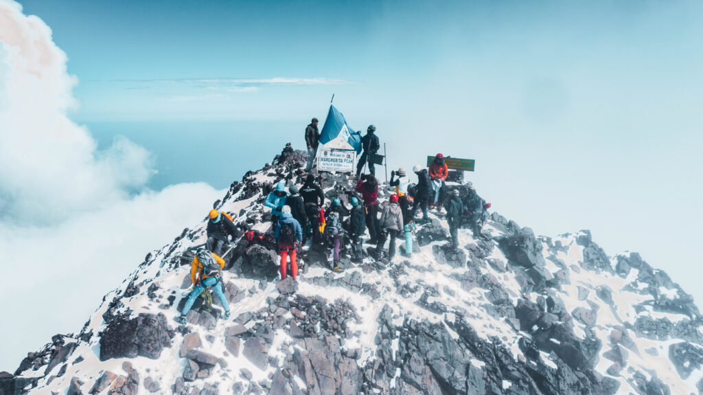
There is a moment, somewhere above 4,000 meters on the Rwenzori Mountains, when the forest falls away and the world goes completely quiet. The giant heathers stand like sentinels draped in old-man’s-beard lichen. The air smells of cold peat and high altitude. Somewhere ahead, cloaked in the mist that has haunted these slopes since antiquity, lies the summit of Africa’s third-highest peak, Margherita, 5,109 meters above sea level, perched atop the perpetual snows of Mount Stanley. You did not come here because it was easy. You came because nowhere else on Earth offers this: tropical glaciers above the equator, Afro-alpine vegetation so alien it belongs in a science-fiction film, and a wilderness so intact that you can hike for days without crossing paths with another expedition. This is Rwenzori Mountains National Park.
If you are the kind of hiker who bristles at the thought of being herded up a mountain in a convoy of strangers and who wants a guide who actually knows the route rather than a rehearsed script, then you are in exactly the right place. This guide covers everything a serious trekker needs to know before setting foot inside Rwenzori Mountains National Park: the geography, the peaks, the trails, the wildlife, the seasons, the permits, the gear, and every practical question in between.
What Is Rwenzori Mountains National Park?
Location, Size, and Boundaries
Rwenzori Mountains National Park sits astride the border between western Uganda and the Democratic Republic of Congo in the Albertine Rift Valley, one of the most biodiverse corridors on the African continent. The Ugandan side, which is the primary access point for international trekkers, covers approximately 996 square kilometers and rises from the foothills around Kasese District up to the permanent snowfields crowning the central massif. On the Congolese side, the range continues as a Virunga National Park extension, though virtually all organized trekking happens in Uganda.
The park’s boundaries encompass the entire high-altitude range, from the montane rainforest that begins around 2,000 meters through bamboo zones, giant heather moorlands, Afro-alpine bogs, and finally the rock and ice of the glaciated summits. This vertical range of nearly 3,000 meters of altitude gain within the park is what makes Rwenzori Mountains National Park one of the most extraordinary protected areas on Earth.
UNESCO World Heritage Status
Rwenzori Mountains National Park was inscribed as a UNESCO World Heritage Site in 1994, recognized for its outstanding universal value both as a natural landscape and as a globally significant biodiversity hotspot. The Albertine Rift, of which the Rwenzoris form a central pillar, holds more endemic vertebrate species than any other region in Africa. UNESCO’s designation was not merely ceremonial; it triggered increased protection measures, international research attention, and the conservation infrastructure that makes responsible trekking possible today.
For trekkers, the UNESCO status means the area is not a degraded or heavily touristed environment. The park’s relative remoteness and the logistical challenge of trekking here have kept visitor numbers low compared to Kilimanjaro or the Virungas. When you walk these trails, you are moving through one of the last truly wild mountain environments in Africa.
The Geography and Geology of Rwenzori Mountains National Park.
Unlike Kilimanjaro and Mount Kenya, which are volcanic in origin, the Rwenzori Mountains are a horst, a block of ancient crystalline rock that was lifted by tectonic forces along the western branch of the East African Rift System. The uplift began roughly 3 to 5 million years ago and is, in geological terms, still ongoing. The rock itself, primarily gneiss, amphibolite, and granite, is far older, some of it dating back over two billion years to the Precambrian basement of the continent.
This tectonic origin has profound consequences for the trekking experience. Volcanic activity did not build the range, so it lacks Kilimanjaro’s symmetrical conical profile. Instead, the Rwenzoris form a chaotic jumble of ridges, deep valleys, and multiple distinct massifs, each with its character, its summit profile, and its demands on the mountaineer. The navigation here is genuinely complex, making experienced local guides not just recommended but absolutely essential.
The mountains intercept moisture-laden air masses from the Congo Basin to the west, creating one of the wettest environments on the African continent. Annual precipitation in the higher zones can exceed 3,000 millimeters, much of it falling as mist, drizzle, or sudden heavy rain. This relentless moisture is responsible for the extraordinary vegetation zones that make trekking here so visually unlike anywhere else in Africa, and it is also the force that has carved the deep, bog-filled valleys and stream-laced gorges that define the landscape of the lower and middle altitudes.
The glaciers that once covered much of the upper massif are retreating rapidly, a trend well documented since scientific surveys began in the early twentieth century. If you see equatorial snow and ice on your list, the window is narrowing. The reasons behind this accelerating retreat, and what it means for the mountain’s ecology, are explored in detail in our analysis of why the Rwenzori glaciers are disappearing.
The Six Major Peaks of Rwenzori Mountains National Park.
The Rwenzori massif contains six distinct mountains above 4,500 meters, each named after an explorer, colonial-era ruler, or expedition patron, and each offering a genuinely different summit experience. Together they form a trekking canvas that ranges from a challenging but technically straightforward high-altitude walk to genuine glaciated mountaineering requiring ice axes and crampons.
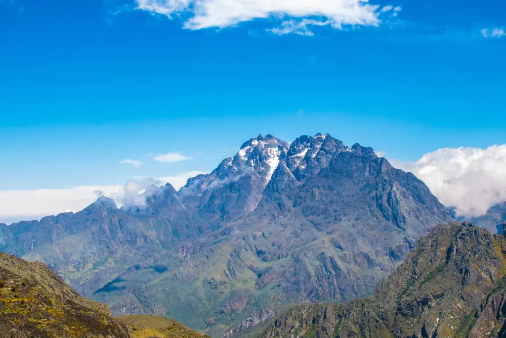
Mount Stanley, The Roof of Uganda
Mount Stanley is the highest point in the Rwenzori range and the third-highest mountain in Africa, with its summit, Margherita Peak, reaching 5,109 meters above sea level. Named after the explorer Sir Henry Morton Stanley, the massif contains multiple summits of significance: Margherita (5,109 m) and Alexandra (5,091 m) are the two highest, with Albert (5,087 m), Savoia, Elena, Moebius, and Philip also forming part of this extraordinary glaciated crown. Standing on Margherita, the objective of most serious expeditions into the park is among the most rewarding summit experiences available anywhere in Africa.
Mount Speke, The Dramatic Ridge
At 4,890 meters, Mount Speke commands a spectacular ridge above the Bujuku Valley and is named after the Victorian explorer John Hanning Speke. Its highest point, Vittoria Emanuele Peak, was first summited during the Duke of Abruzzi’s landmark 1906 expedition, the same journey that produced the first systematic mapping of the entire range. Speke is a worthy objective in its own right, and reaching its summit via the 5-Day Mount Speke Trek offers an intimate encounter with the park’s glacial heritage that few trekkers pursue.
Mount Baker, Edward Peak and the Western Wall
Mount Baker rises to 4,843 meters at its highest point, Edward Peak, and presents a formidable face to trekkers approaching from the Kitandara Lakes. The mountain’s ridgelines are among the most photogenic in the park, particularly in the early morning when the mist lifts briefly and the rock walls catch the equatorial light. Baker sits at the heart of the Central Circuit route, and many trekkers on the 7-Day Central Circuit will camp in its shadow without ever realizing they are spending the night below one of Uganda’s magnificent peaks.
Mount Luigi di Savoia, Weismann, and Sella
Mount Luigi di Savoia carries two distinct summits: Sella Peak at 4,627 meters and the slightly lower Weismann Peak. Named after the Italian prince who led the 1906 Abruzzi expedition, this mountain straddles both the Central Circuit and Kilembe Trail approaches, making Weismann Peak a popular summit for trekkers on the Kilembe route who want a genuine high-altitude objective without committing to the full technical demands of Margherita.
Mount Gessi and Mount Emin, The Forgotten Giants
Mount Gessi (4,715 m) and Mount Emin (4,798 m) stand at the northern end of the massif and are rarely visited precisely because reaching them requires extended expeditions through some of the most remote terrain in the park. Named respectively after Italian explorer Romolo Gessi and the German physician Emin Pasha, both peaks see a fraction of the traffic that Stanley and Speke attract. The 7-Day Mount Gessi Trek or the 7-Day Mount Emin route offers an extraordinary and genuinely adventurous objective for trekkers seeking genuine solitude and a summit story that will surprise people.
The Vegetation Zones of Rwenzori Mountains National Park.
One of the most dramatic aspects of trekking in Rwenzori Mountains National Park is the journey through its stacked vegetation zones: five distinct ecological communities arranged by altitude, each more otherworldly than the last. No other trekking destination in Africa takes you through such a complete sequence of life zones in the space of a single trek.
The lowest zone, from the park boundary up to approximately 2,500 meters, is dense, dark tropical montane rainforest dripping with moisture. Ancient Podocarpus and Symphonia trees form a high canopy over a mid-story rich in tree ferns, wild bananas, and the red-flowered Mimulopsis that erupts into color after rain. This part is where you will almost certainly hear, and occasionally see, chimpanzees moving through the canopy, along with the metallic flash of sunbirds and the percussion of a Rwenzori turaco calling from the ridgetop.
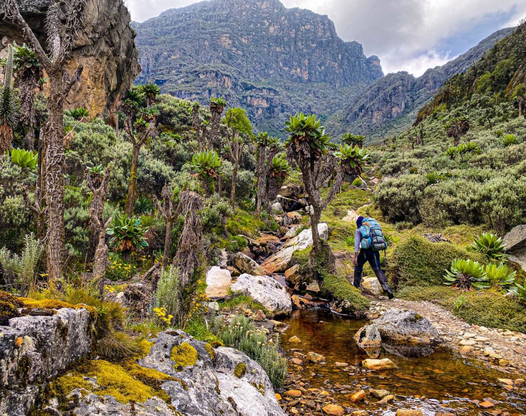
Above the forest, from roughly 2,500 to 3,500 meters, the bamboo zone transitions into giant heather (Erica arborea) and Philippia species that grow to six meters or more and are festooned with old-man’s-beard lichen. One of the most atmospheric experiences in African mountaineering is walking through the heather forest in mist; the light filters green and silver, the ground is spongy underfoot, and the sense of being truly removed from the world of roads and noise is complete.
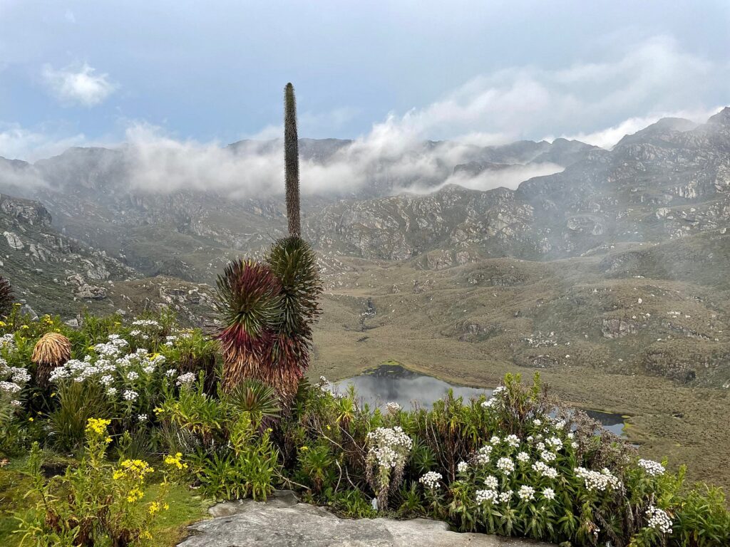
Higher still, from 3,500 to 4,500 meters, lies the zone that stuns every first-time visitor: the Afro-alpine moorland, where giant lobelias (Lobelia wollastonii) rise like botanical sculptures to three meters in height, and the massive rosettes of Senecio (groundsel) trees impart to the landscape a quality that there is really no other word for but prehistoric. The bogs of this zone are legendary for their ability to swallow a boot whole if you misplace a step, and the peat-dark water of the streams runs cold and clear year-round. Above 4,500 meters, the vegetation dramatically thins, revealing bare rock, residual ice, and the last push towards the glaciers.
Wildlife in Rwenzori Mountains National Park
The Rwenzori Mountains National Park is not primarily a wildlife-viewing destination in the safari sense; you will not see savannah megafauna here. What you will encounter, if you move quietly and pay attention, is some of the most specialized and endemic mountain wildlife in Africa, much of it found nowhere else on Earth.
The Albertine Rift endemic species list for the Rwenzoris is extraordinary: the Rwenzori turaco (Ruwenzorornis johnstoni), with its crimson primary feathers and green-and-red crest, is perhaps the most spectacular bird in the park and a near-certain sighting on the forest trails. The Rwenzori double-collared sunbird, the handsome Francolin, and at least twelve other Albertine Rift endemics make this one of the most important birding sites in Africa. If birds define a great wilderness, Rwenzori Mountains National Park excels.
Mammals in the park include forest elephants (rarely seen, but their trails and broken bamboo are evident at lower elevations); the three-horned chameleon (Trioceros johnstoni), a Rwenzori endemic that looks like something from a Jurassic fantasy; the African golden cat; the giant forest hog; and troops of chimpanzees and colobus monkeys in the lower forest. The chimpanzee presence in the montane forest below the park proper, around the Kasese area, and in adjoining forest reserves is one reason that combining a Rwenzori trek with a primate safari makes such natural sense.
The insect fauna at altitude is equally remarkable, particularly the giant earthworms and the bizarre Afro-alpine insects that have evolved to survive temperature swings from above 0°C to near-freezing within a single day. This is biology at its most inventive, shaped by an environment that would seem designed to eliminate life.
Trekking Routes Through Rwenzori Mountains National Park.
Three established routes penetrate the high interior of Rwenzori Mountains National Park, each with its character, difficulty profile, and summit access. Choosing the right route is not simply a matter of time available; it depends on your experience level, your specific summit objectives, and how you want the landscape to unfold around you.
The Central Circuit Trail: The Classic Experience
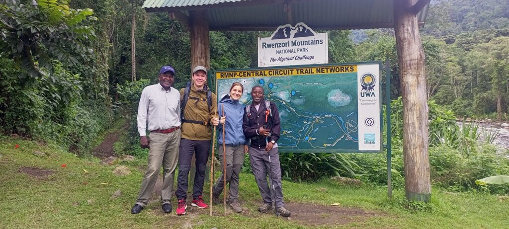
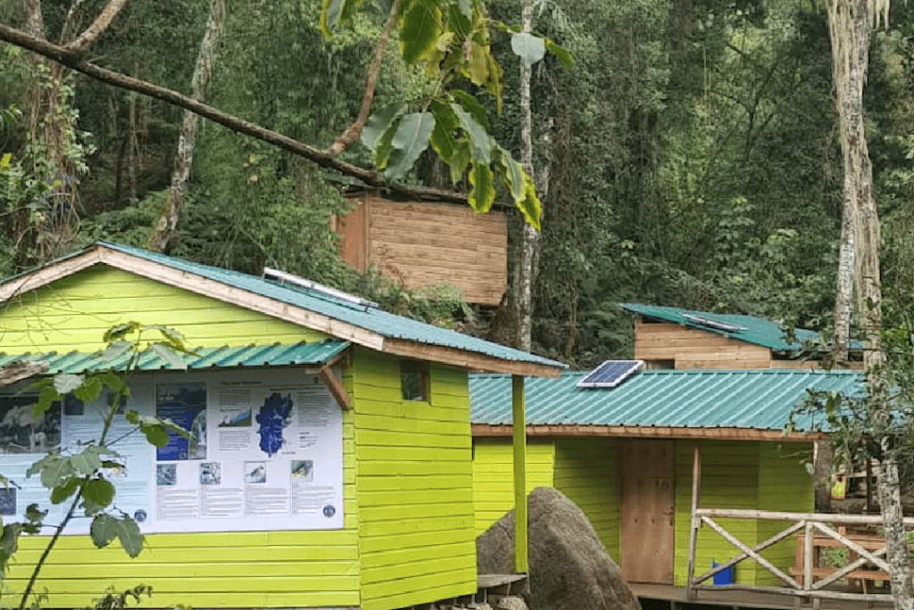
The Central Circuit Trail begins at Nyakalengija, the main park gate 22 kilometers from Kasese town, and loops through the heart of the massif over seven to thirteen days depending on objectives. It is the most established route in the park, with a chain of mountain huts at Nyabitaba, John Matte, Bujuku, Elena, Kitandara, and Guy Yeoman providing shelter at each major camp. The huts are basic but functional wooden structures with sleeping platforms, blankets, and, at most camps, a cook room, and their presence means you carry a lighter personal pack than on a full wild-camping expedition.
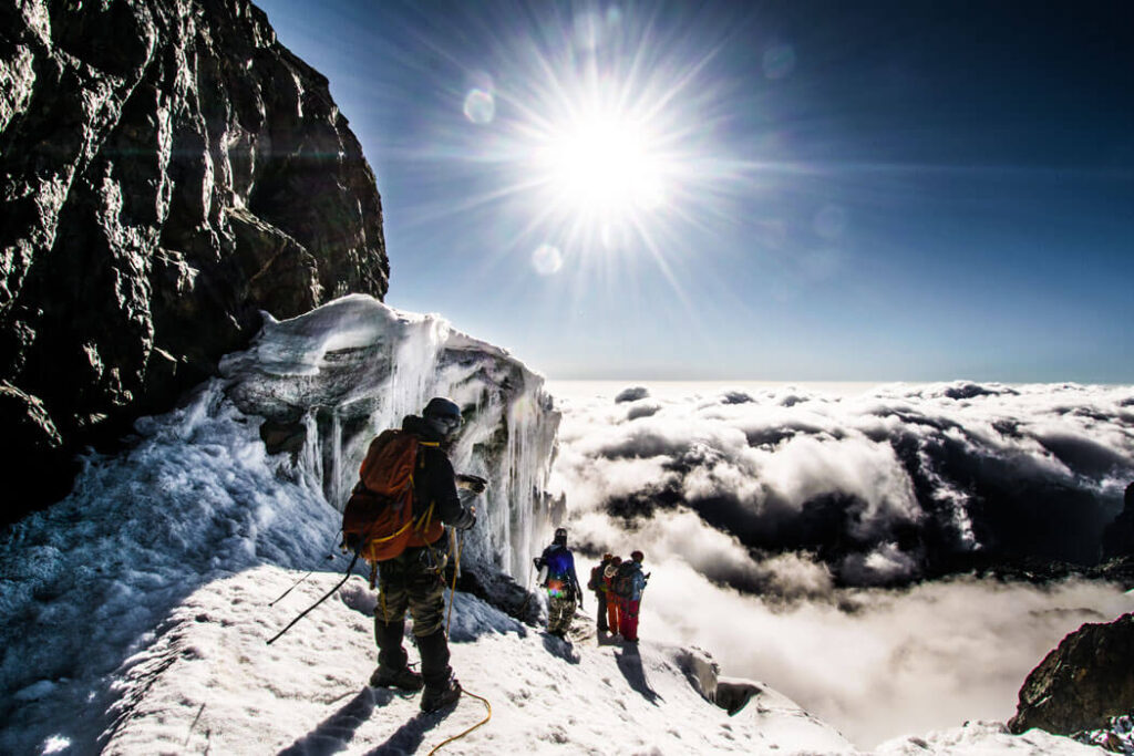
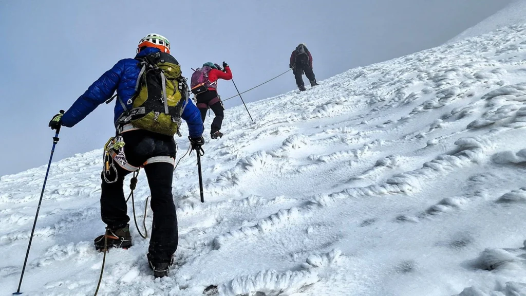
The Central Circuit is the route of choice for first-time Rwenzori trekkers aiming for Margherita Peak. The 7-Day Central Circuit itinerary builds in adequate acclimatization time, loops past the twin Kitandara Lakes, one of the most beautiful spots in the park, and approaches Margherita via the Elena Glacier from the Elena hut at 4,541 meters. The glacier crossing itself is the one section that requires crampons and rope work, and it is the moment when the distinction between trekking and mountaineering becomes genuinely meaningful.
The Kilembe Trail, The Scenic Challenge
Opening in 2013 and developed through collaboration between the Uganda Wildlife Authority and local communities, the Kilembe Trail begins at the old Kilembe copper mines near Kasese and penetrates the range from the south. It is generally considered a tougher and more isolated path than the Central Circuit, featuring long climbs, more exposed ridges, and several high camps like Sine, Mutinda, Bugata, Hunwicks, and Margherita Camp, but the payoff is a landscape that feels less crowded and more dramatically diverse.
The Kilembe Trail is the route for trekkers who want the full wilderness experience with maximum scenery per hour of effort. The 8-Day Kilembe Trail itinerary to Margherita combines summit access with a traverse that takes in Weismann Peak on Mount Luigi di Savoia, offering two meaningful summit objectives in a single expedition. For trekkers with limited time who still want a genuine high-altitude experience, the 4-Day Mutinda Lookout trek via Kilembe delivers panoramic views at 4,000 meters without the full commitment of a summit push.
Shorter Treks and Day Hikes
Not every visit to Rwenzori Mountains National Park needs to end on a glacier. The lower forest and moorland zones are magnificent in their own right, and a range of shorter itineraries allow trekkers to experience the park’s character without committing to a multi-day high-altitude expedition. The 1-Day Nyabitaba Trek takes you into the lower forest and gives a vivid taste of what lies above; the 2-Day Lake Mahoma Loop circles a crater lake of extraordinary beauty through bamboo and heather forest. For those who want to experience the magic of the Afro-alpine zone without the technical demands of Margherita, the 3-Day Mahoma Loop is an outstanding option that gives you the giant lobelias, the mountain silence, and the lake views that make the Rwenzoris genuinely unforgettable.
Multi-Peak and Grand Traverse Expeditions
The park rewards mountaineers who want to push deeper into what this range truly offers with extended expeditions that string multiple summits together. The 8-Day Three-Peaks Trek combines Mount Stanley, Speke, and Baker in a single continuous circuit. The 13-Day Six-Peaks Expedition, our most comprehensive standard itinerary, takes in all six major summits, including the remote Gessi and Emin in the park’s northern quarter. And for the truly committed, the 18-Day All Eight Peaks Expedition represents one of the most complete high-altitude traverses available on the African continent. Browse the full range of Rwenzori trekking itineraries to find the itinerary that fits your ambition and your schedule.
How Difficult Is Trekking in Rwenzori Mountains National Park?
Honest answer: harder than most people expect, and more rewarding than most people imagine. The Rwenzoris are consistently rated as one of the most physically demanding high-altitude treks in Africa, harder than Kilimanjaro’s standard routes and comparable to the more technical approaches on Mount Kenya. The full difficulty comparison between Rwenzori and Kilimanjaro is worth reading carefully if you are using Kili as your benchmark.
The challenge comes from several compounding factors. The terrain is technically rougher than any other major African trek; the trail crosses slippery bog, exposed root systems, steep scree, and, at the summit approaches, snow and ice. The altitude gain is sustained and relentless. The weather is unpredictable even in the dry season, which means wet gear and cold camps are real probabilities rather than theoretical risks. And the mud is in a category of its own. The bogs of the middle altitudes have swallowed boots, trekking poles, and the confidence of many experienced hikers. Waterproof gaiters are not optional here.
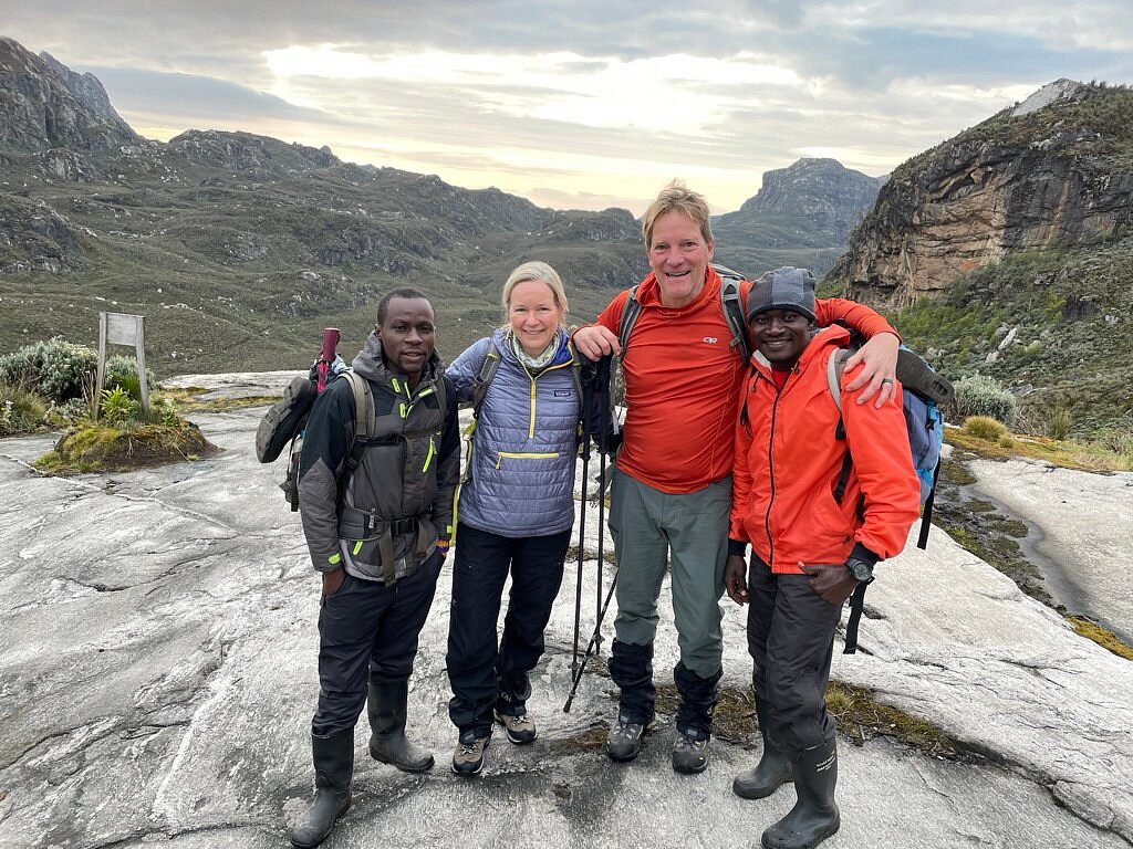
That said, the mountain is not closed to capable beginners; it simply requires honest self-assessment and proper preparation. Whether beginners can climb the Rwenzori Mountains depends heavily on physical fitness, mental resilience, and the quality of the support team around them. The physical fitness requirements for the Rwenzori are significant: you should be able to hike six to eight hours a day over rough terrain for multiple consecutive days before you arrive. The trekking guide on your rope knows this terrain intimately; their job is to keep you moving safely, not to keep you comfortable. The combination of that expertise and your preparation is what determines success.
For the summit push to Margherita, trekkers are required to use technical glacier gear, including crampons, ice axes, and harnesses. Trekkers who have only experienced trail-based high-altitude walks often underestimate this section. How technical the climb to Margherita Peak actually is and whether you need crampons and ropes for the Rwenzori is something every summit-bound trekker should understand before arriving.
Best Time to Visit Rwenzori Mountains National Park.
The Rwenzori Mountains are notorious for their weather. This is the wettest major mountain range in Africa, and clouds, mist, and rain are part of the landscape regardless of season. What the dry seasons offer is a reduction in the intensity of the precipitation and an increase in the probability of clear summit days, not a guarantee. The two primary dry windows are December to February and June to August. Within these periods, experienced trekkers generally favor January and July as the months with the most stable conditions in the upper zones.
Trekking in the rainy season (April, May, October, and November) is entirely possible and occasionally spectacular, with the vegetation at its most lush and the waterfalls at full volume. It is, however, significantly harder: the trails are wetter, the bogs deeper, the summit views more elusive, and the gear-drying opportunities non-existent. What wet-season trekking in the Rwenzori actually involves is worth understanding in detail if your travel dates fall in those months. Similarly, how much it actually rains in the Rwenzori Mountains and what the practical implications are for your packing list and expectations is one of the most frequently misunderstood aspects of planning a trek here.
One practical advantage of the Rwenzoris over Kilimanjaro or the Himalayas: because visitor numbers are low year-round, there is no equivalent of the peak-season crowding that can make popular treks feel like queuing for a theme-park ride. Even in the best months, you are unlikely to share your mountain hut with more than one or two other trekking parties.
How to Get to Rwenzori Mountains National Park.
The gateway to Rwenzori Mountains National Park is Kasese, a district capital in western Uganda approximately 410 kilometers from Kampala by road. Three primary options, each with different trade-offs of time, comfort, and cost, connect Kasese to the capital.
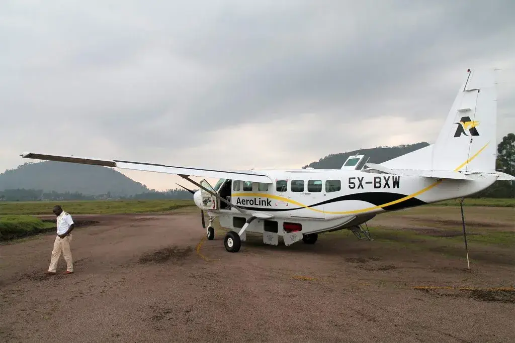
The fastest option is a domestic flight from Entebbe International Airport to Kasese Airport, a journey of roughly one hour that eliminates an entire day of overland travel. AeroLink provides scheduled services on this route, but it’s important to book in advance due to limited seats. Trekkers connecting through Nairobi or Addis Ababa can fly directly to Entebbe and transfer to the Kasese flight, making it possible to arrive at the park gate within hours of landing in Uganda.
By road, the Kampala to Kasese route runs through Fort Portal and takes five to seven hours in a private vehicle, significantly longer by public transport. The road passes through some of the most beautiful countryside in Uganda, including the Queen Elizabeth National Park corridor and the Toro Kingdom area centered on Fort Portal, making a road transfer a worthwhile experience in itself rather than merely dead time. A private vehicle, arranged through your trekking operator, allows stops en route and arrival on your own schedule.
From Kasese, the main park gate at Nyakalengija is 22 kilometers away, a short transfer by vehicle that takes roughly 30 to 45 minutes. For trekkers using the Kilembe Trail, the start point at the old Kilembe mines is even closer to Kasese town. Travellers approaching from Rwanda via Kigali can cross into Uganda at the Katuna border post and connect to Kasese through Kabale and Mbarara, a beautiful route through southwestern Uganda’s rolling hills.
Park Fees, Permits, and Regulations for Rwenzori Mountains National Park
Entry to Rwenzori Mountains National Park is managed by the Uganda Wildlife Authority (UWA), and trekkers are required to pay park fees before commencing any trek. These fees contribute directly to conservation and community development programs in and around the park and are a non-negotiable part of the trekking budget.
Park entry fees vary by nationality (international non-East African citizens pay the highest rate), and additional fees apply for specific services, including mountain hut accommodation, guided ascent of the glaciated summit zones, and mandatory rescue fund contributions. All fees are paid at the park headquarters in Nyakalengija or Kilembe, and receipts must be retained for checkpoint inspections on the trail.
No solo trekking is permitted in Rwenzori Mountains National Park. Every trekking party must be accompanied by a registered park guide, and porters, while technically optional, are strongly recommended for any itinerary of more than two days. The porter system is both a safety infrastructure and a community economic engine: the vast majority of park guides and porters come from villages adjacent to the mountain, and their income from trekking is a significant part of the local economy.
Uganda requires a valid entry visa for almost all nationalities. This can be obtained online through the Uganda e-Visa system in advance (recommended) or on arrival at Entebbe International Airport. Ensure your passport has at least six months’ validity beyond your travel dates. For any other questions about entry requirements and park regulations, the comprehensive answers are in our Rwenzori FAQs.
Accommodation in Rwenzori Mountains National Park
Accommodation inside Rwenzori Mountains National Park exists in two forms: the established mountain huts along the Central Circuit and the more basic shelters and tent platforms along the Kilembe Trail.
On the Central Circuit, six permanent hut camps Nyabitaba (2,651 m), John Matte (3,505 m), Bujuku (3,962 m), Elena (4,541 m), Kitandara (4,023 m), and Guy Yeoman (3,261 m), provide wooden sleeping platforms with foam mattresses and blankets. The huts are basic but weatherproof, and most include a separate cooking area where your camp cook can prepare hot meals at the end of a long day on the trail. A fire is standard at the lower camps, and the social atmosphere around it, with guides, porters, and trekkers sharing the warmth, is one of the genuine pleasures of the experience.
Along the Kilembe Trail, the camps at Kalalama, Sine, Mutinda, Bugata, Hunwicks, and Margherita range from semi-permanent hut structures to platforms designed for tenting. The newer camps on this route, including the Forest Camp added for altitude acclimatization purposes, have been thoughtfully positioned to maximize both safety and the landscape experience.
Before and after the trek, Kasese town offers a range of accommodation options from budget guesthouses to mid-range hotels. Most trekking operators, including ourselves, will handle pre- and post-trek accommodation as part of the package arrangement.
What to Pack for Rwenzori Mountains National Park.
Gear preparation for the Rwenzoris is not a matter to approach casually. The environment is wetter, colder, and more technically demanding than most trekkers expect, and the consequences of being under-equipped at 4,500 meters in driving rain are serious. The full packing list is covered in depth in our guide to whether you need to bring your climbing gear for a Rwenzori trek, but the essential principles are worth stating clearly here.
Waterproofing is the single most important gear category on the Rwenzoris. You need waterproof outer layers for both your upper and lower body that are genuinely waterproof, not water-resistant, and you need gaiters that will keep the bog water off your ankles and out of your boots. Your boots themselves need to be waterproof, broken-in, stiff-soled mountain boots with ankle support; trail running shoes are inappropriate for the terrain above 3,000 meters.
For the summit approach, warmth becomes the critical factor alongside waterproofing. Temperatures at the Elena hut and above regularly drop to minus six degrees Celsius or lower at night, and the windchill on the exposed glacier can be savage. We must ensure a comprehensive layering system, with a base layer, an insulating mid-layer, and a waterproof shell, and not rely solely on chance. Exactly how cold it gets on Margherita Peak is detailed in our full cold-weather guide for the summit zone, along with the specific gear recommendations we give every expedition client. And yes, there is still snow on the Rwenzori Mountains, though the glaciers are retreating. Treat the summit as a winter mountaineering objective, not a warm-weather high-altitude hike.
For trekkers concerned about the gear burden, rental equipment is available through the park’s outfitter system and through Rwenzori Trekking Safaris. Crampons, ice axes, harnesses, and helmets can all be hired locally, which reduces the expense and logistical complexity of international travel with technical mountaineering equipment. Walking poles are strongly recommended for all altitudes above the forest zone.
Safety in Rwenzori Mountains National Park
The Rwenzori Mountains have an excellent safety record when trekked with professional guides and proper preparation. The primary risks of altitude sickness, hypothermia, and trail injuries from the technical terrain are all manageable with competent leadership and honest communication. The question of whether it is safe to trek the Rwenzori Mountains has a clear answer: yes, with the right team. The mandatory park guide system ensures that every trekking party has someone on the mountain who has done this route many times and knows the signs of altitude-related illness, the location of emergency descent routes, and the conditions that warrant turning back.
The summit success rate for Margherita Peak varies significantly depending on route, preparation, and weather; this is not a mountain where a determined attitude alone guarantees the top. Altitude acclimatization is the factor most often cited in unsuccessful summit attempts; pushing too fast through the middle altitude zones is the single most common planning mistake. Our itineraries are designed to acclimatize properly, not to get you up and down as quickly as possible.
Park fees include a contribution to the Uganda Wildlife Authority rescue fund, and major camps have access to an emergency helicopter evacuation system. Expedition leaders use satellite communication on longer routes, but the forest zone restricts cell phone coverage.
Combining Rwenzori Mountains National Park with a Uganda Safari
Western Uganda is one of the most wildlife-rich regions on the continent, and Rwenzori Mountains National Park sits at its center. Queen Elizabeth National Park, famous for its tree-climbing lions, hippo channels, and vast savannah, begins just south of Kasese. Bwindi Impenetrable National Park, home to almost half the world’s remaining mountain gorillas, is four to five hours from the Rwenzori trailhead. The Kibale Forest, Uganda’s premier chimpanzee trekking destination, lies north of Fort Portal along the road from Kasese to Kampala. Ugandan safari options that pair naturally with a Rwenzori trek are extensive, and combining them creates an itinerary that would be genuinely impossible to replicate anywhere else in Africa.
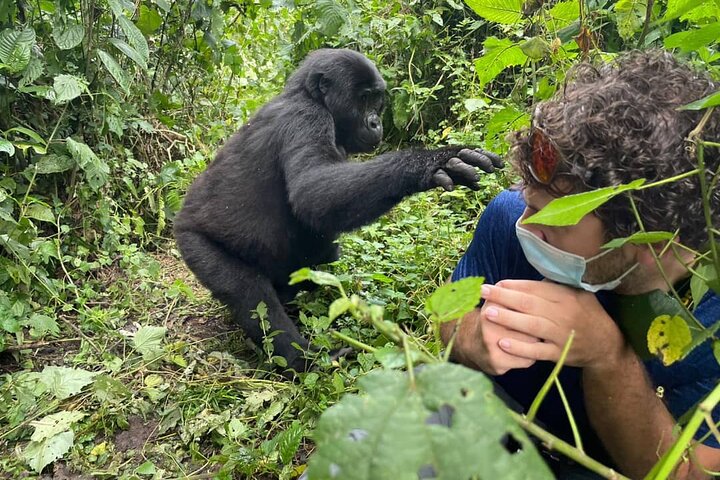
The 12-Day Rwenzori and Gorilla Trek Combination is our most popular extended itinerary: seven days in the mountains followed by gorilla trekking in Bwindi, a sequence that takes you from the ice of Margherita to the forest floor of one of the most moving wildlife encounters on Earth. The 19-Day Grand Uganda Adventure adds chimpanzee tracking in Kibale, Queen Elizabeth game drives, and white-water rafting on the Nile at Jinja, creating a complete Ugandan experience built around the Rwenzori trek as its centerpiece. For an affordable primate extension during the low season, Uganda’s reduced gorilla permit pricing makes April, May, and November particularly good months to extend your trip. Details are in our guide on low-season gorilla permits in Uganda.
Frequently Asked Questions About Rwenzori Mountains National Park
Is Rwenzori Mountains National Park open all year?
Yes. The park operates year-round with no complete closure periods. Park entry, guided treks, and mountain hut accommodation are available in all seasons. The dry season months (December–February and June–August) are generally recommended for summit-bound trekkers due to better weather conditions, though the park is trekable and rewarding throughout the year.
Do I need a visa to visit Rwenzori Mountains National Park?
Yes. Uganda requires a visa for entry for most nationalities. The Uganda e-Visa is available online and should be applied for at least two weeks before travel. Visas can also be obtained on arrival at Entebbe International Airport, though online processing is faster and more reliable. The visa covers your entire stay in Uganda, including your time in the park.
How many days do I need for a Rwenzori Mountains National Park trek?
The minimum meaningful experience in the park is three days, which takes you through the lower forest and into the heather zone. To reach the Afro-alpine zone with its giant lobelias, plan five to seven days minimum. Summit expeditions to Margherita Peak require at least seven days on the Central Circuit and eight days or more on the Kilembe Trail to allow adequate acclimatization. For a comprehensive picture of timing, our guide on how many days it takes to reach Margherita Peak covers the full range of itinerary options.
Can beginners trek in Rwenzori Mountains National Park?
Beginners can absolutely access the lower and mid-altitude zones of the park, and several itineraries are designed specifically for hikers who are physically fit but lack technical mountaineering experience. The summit of Margherita Peak, however, involves glacier travel that requires at least a basic introduction to ice and rope techniques, which experienced guides provide on the mountain. The key is honest fitness preparation; the terrain is demanding regardless of altitude. Our guide to trekking difficulties in the Rwenzori Mountains provides an honest assessment.
Is there an altitude sickness risk in Rwenzori Mountains National Park?
Yes. Altitude sickness (acute mountain sickness) is a genuine risk on any trek above 3,000 meters, including in the Rwenzori Mountains. The risk is manageable with properly paced itineraries that allow the body to acclimatize gradually. Our standard itineraries are designed with acclimatization in mind rather than speed, and our guides are trained to recognize AMS symptoms and respond appropriately. Trekkers who have previously experienced altitude sickness commonly use Diamox (acetazolamide) as a prophylactic; consult your physician before the trek.
Are there malaria risks inside Rwenzori Mountains National Park?
The high-altitude zones of the park (above approximately 2,500 meters) are too cold for Anopheles mosquitoes, making malaria effectively absent from the trekking routes themselves. At lower elevations, particularly in Kasese town and the surrounding lowlands, malaria is present, and anti-malarial medication is recommended. Carry insect repellent and cover exposed skin at lower elevations, especially at dawn and dusk.
What is the best route for a first-time trekker in Rwenzori Mountains National Park?
For first-time visitors aiming for Margherita Peak, the Central Circuit is the most established and logistically supported route, with well-maintained huts at each camp and the most experienced guide pool. For a first visit that does not target the summit, the 3-Day Mahoma Loop or the 4-Day Mutinda Lookout Trek via Kilembe are outstanding introductions to the park. For a comprehensive comparison of routes, please refer to our guide on the best trekking route in the Rwenzori Mountains.
How much does trekking in Rwenzori Mountains National Park cost?
Costs depend on the length of the trek, the route chosen, the group size, and the level of service included. A short three-to-four-day experience typically starts from around $580–$700 USD per person for a small group, including park fees, guide, porter, accommodation, and meals on the mountain. Full summit expeditions to Margherita via the Central Circuit or Kilembe Trail range from approximately $1,300 to $1,750 USD per person. Extended multi-peak expeditions and combination safaris are priced accordingly. All-inclusive expedition packages combine transport, accommodation before and after the trek, and all mountain costs, making them the most stress-free approach to budgeting.
Why are the Rwenzori Mountains called the Mountains of the Moon?
The name traces to the ancient Greek geographer Claudius Ptolemy, who in the second century AD referred to a range of snow-capped mountains deep in the African interior as the “Lunae Montes,” the Mountains of the Moon, and identified them as the source of the Nile. The mountains’ perpetual mist, their snow-covered peaks visible from the hot lowlands, and their association with the life-giving waters of the Nile gave them a mythological character that persisted through centuries of exploration. When European explorers finally confirmed their existence in the late nineteenth century, the ancient name stuck. The full history behind why the Rwenzori is called the Mountains of the Moon is one of the most fascinating stories in African exploration history.
Are the Rwenzori glaciers disappearing?
Yes, and rapidly. Scientific measurements taken since the early twentieth century document a dramatic retreat of the glacial coverage on the upper summits of the Rwenzori range. In 1906, the glaciers covered an estimated 7.5 square kilometers; by the time of the most recent comprehensive surveys, that coverage had declined by over 80 percent. If current trends continue, permanent ice on the Rwenzoris may be gone within two to three decades. The current situation underscores the urgency for serious mountaineers to visit the glaciated summits and witness this extraordinary relic of the last ice age. Our in-depth piece examines the causes and implications of the disappearing Rwenzori glaciers.
Plan Your Custom Rwenzori Mountains National Park Trek
Rwenzori Mountains National Park is not a destination that rewards passive planning. The right itinerary, the right team, and the right preparation are what separate a transformative mountain experience from an expensive misadventure. Every trek we design at Rwenzori Trekking Safaris is built around the specific objectives, fitness level, and travel dates of the individual, not around a fixed template that fills seats and moves groups up the mountain on a schedule.
Whether you are targeting Margherita Peak for the first time, pursuing a multi-peak traverse that most trekkers do not even know is possible, or searching for a shorter experience that still puts you genuinely inside one of Africa’s most extraordinary landscapes, we have done it, we know the route intimately, and we know what it takes to do it properly. Our guides are not contractors hired for the season; they are mountain people who have spent years on these trails.
Get in touch through our contact page and tell us what you are thinking. What are your dates? What summit are you aiming for? How much time do you have? We will come back to you with a personalized recommendation, not a brochure, not a booking form, but an actual conversation about your mountain. The Rwenzoris are waiting. They have been waiting since Ptolemy first heard of them, wreathed in mist above the heart of Africa. Let’s go.