Discover the wonders of Uganda’s Rwenzori Mountains, snowcapped peaks, rare wildlife, alpine lakes & vibrant Bakonzo culture. This nation is a true African treasure. Climbing the Rwenzori Mountains is a goal for hikers around the world. The enchanting “Mountains of the Moon” mountain range, which stretches along the border between the Democratic Republic of the Congo and Uganda, has an area of around 1,000 km² and is recognized as a UNESCO World Heritage Site. Among Africa’s lesser-known wonders, you’ll find the Rwenzori Mountains. Their unique cultures, glacier-fed lakes, and snow-capped peaks close to the equator set them apart.
The Rwenzori Mountains cover over 3 districts: Kasese, Kabarole, and Bundibugyo districts. Occasionally referred to as the Mountains of the Moon, this mountain attracts many hikers who are eager to explore its offerings; locals originally named it Rwenzururu, which translates to “snow,” “the Lord of the clouds,” or “rainmaker.” One of the explorer journalists, Henry Stanley, named the mountain after several visits with his group and finally came up with the name Ruwenzori. Mount Rwenzori is renowned for its snowcapped peaks that have glaciers throughout the year, yet it’s in the equatorial region. Mount Rwenzori is popular for having the third-highest peak in Africa.
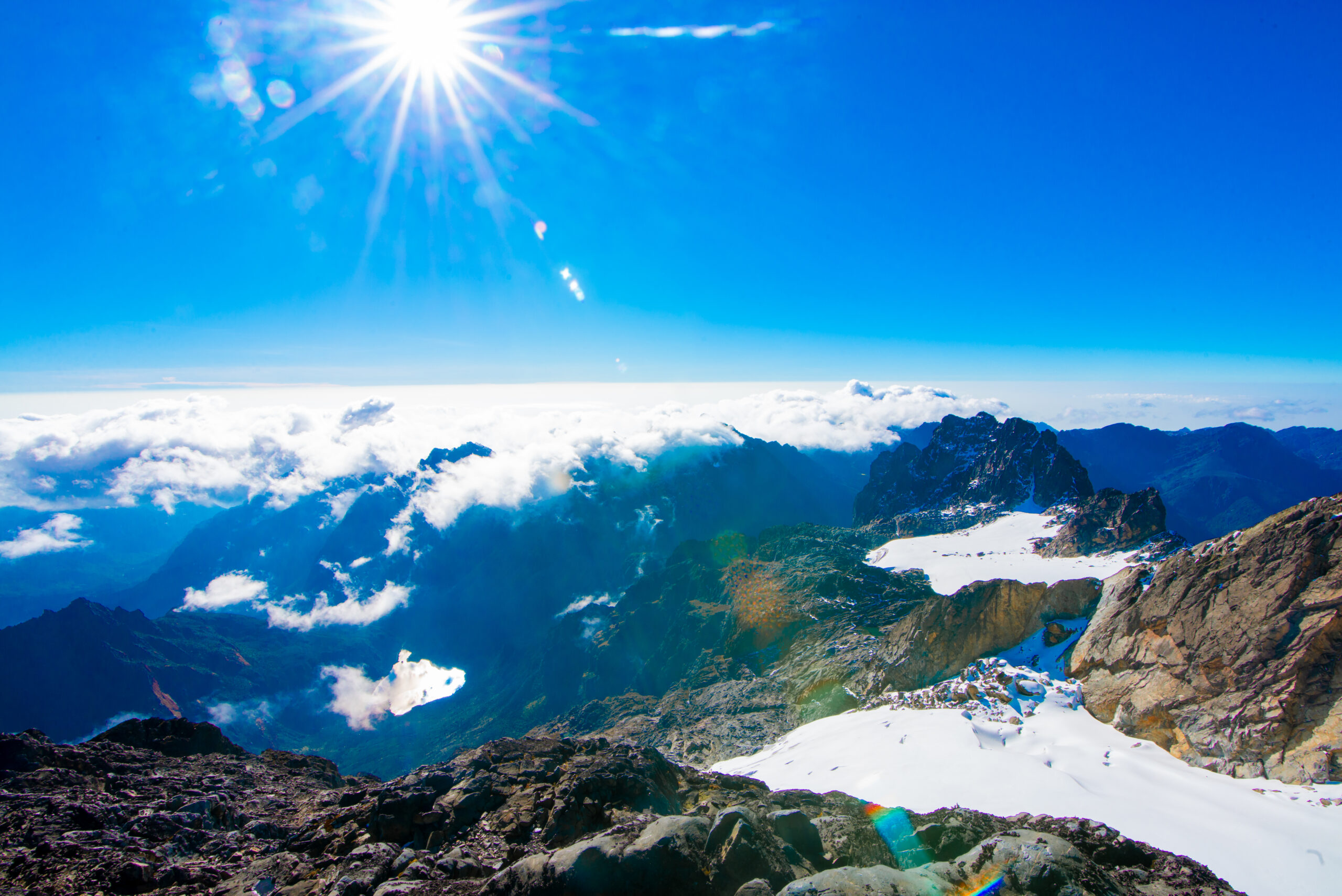
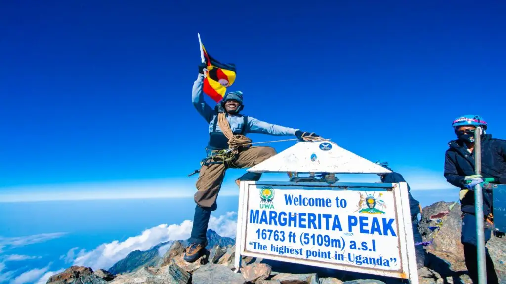
The mountain is also referred to as the Rwenzori Mountains because of the countless portal peaks and is comprised of a range of mountains like Mount Baker, Mount Stanley, and Mount Speke. Margherita, the highest peak, is 5109 m above sea level, located on Mount Stanley, with stunning views of glaciers and snowcaps that are there all year round, making it the most exciting and beautiful mountain in all of Africa. There is a lot to see in the mountains of Rwenzori, from wildlife, birding, countless species of plants, lakes, rivers, glaciers, and nature walks, among many others.
Wildlife
In the Rwenzori Mountains, you will observe a wide variety of wildlife that adapts to the different altitude zones. Some animals can’t survive in the Afro-alpine and heather zones due to high temperatures. Among the densely forested mountains, in the montane forest zone, you may spot black and white Columbus monkeys, as well as chimpanzees, elephants, and leopards.
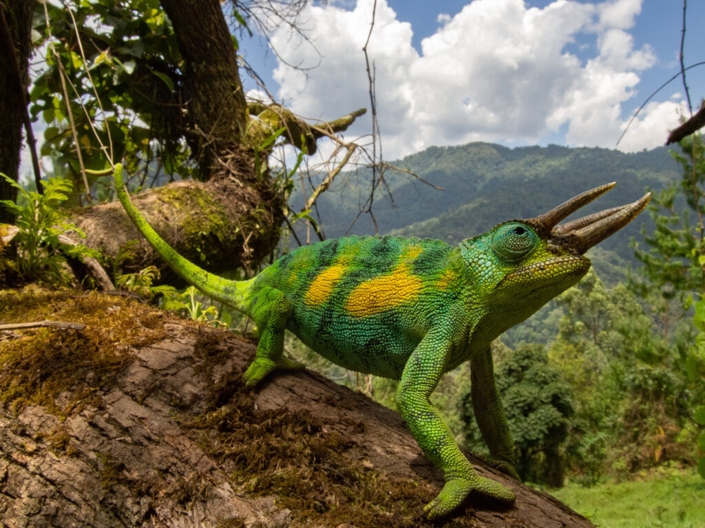
The Three-Horned Rwenzori Chameleon
In this lower section of the mountain, you can readily observe unique reptiles such as three- and one-horned chameleons. Duikers and other rodents, such as rats, are prevalent in the Afro-alpine zone, particularly around Lake Kitandara.
Birds
The Rwenzori Mountain Range is home to the Rwenzori turaco and 17 other species that are unique to that area. This makes the park the best place to see birds and rare animals. Mountain forests cover a large area and are home to many birds, such as the robin, the chestnut bee-eater, the flycatcher, and the strange weaver.
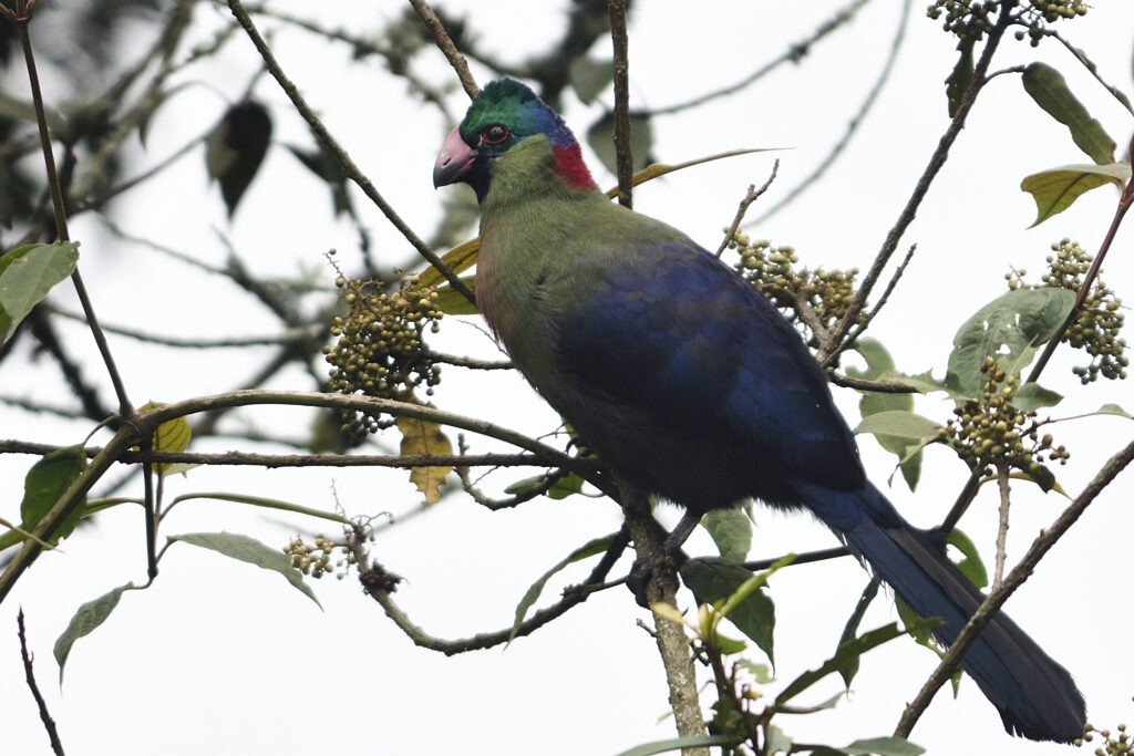
Rwenzori Turaco.
Vegetation
The Rwenzori Mountains showcase a delightful variety of plant life at different elevations, which is characteristic of equatorial alpine Africa. The Rwenzori Mountains are not only home to various fascinating wildlife but also boast some truly beautiful plants. The forest zone is filled with countless species of trees, and the indigenous Bakonzo people utilize some of these plants as medicinal herbs.
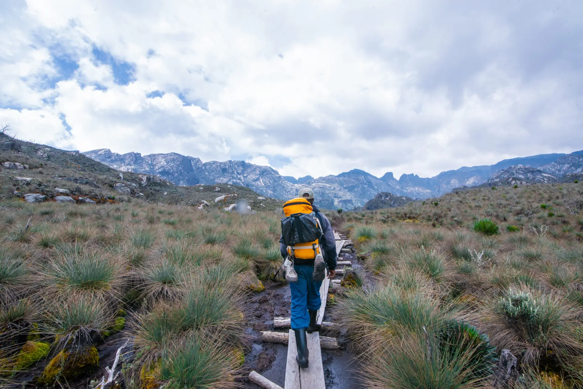
Trekkers in the Rwenzoris stroll through a range of altitude zones, each showcasing its lovely and diverse flora, featuring many native and rare species. There are many types of vegetation zones, but the montane forest zone is the most beautiful.

It rises to 2800 meters above sea level. The lush green plants and warm weather in this area make it a wonderful place for a wide variety of animals and birds.
The next stop is the bamboo zone, which is 3,300 meters above sea level. Here, you can see adorable primates like the colobus monkey and the chimpanzee.
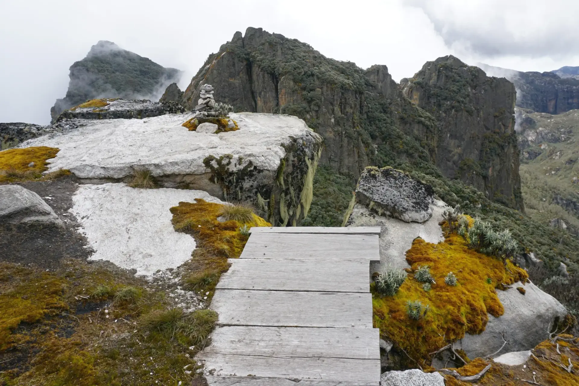
The next stop is the heather zone, famous for its giant lobelias and cool, breezy conditions at an altitude of 3,800 meters above sea level. As you move up from the heather zone into the Alpine zone, you’ll notice that the plants start to spread out and become less dense. It’s a lovely transition! At this height, the rocks are covered in moss and can be slippery in winter or rainy seasons. The landscape is filled with mountains, featuring steep, large rocks and moss that beautifully blankets the groundsel. You’ll discover some fascinating trees here, like old man’s beard, which grows in the bamboo zone.
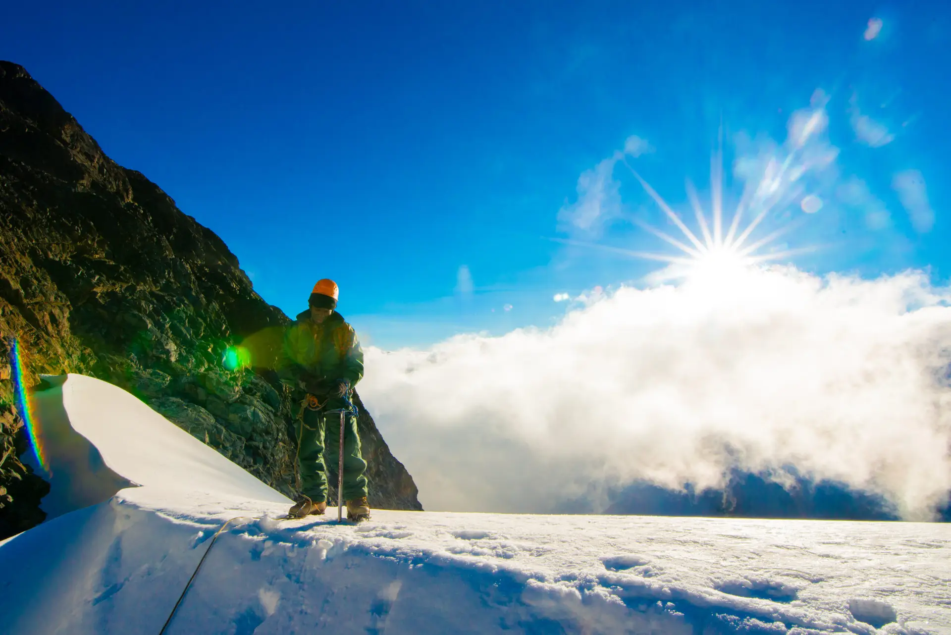
When situated at an altitude of 4,500 meters above sea level, one would certainly not want to miss the opportunity to experience the snow! Margherita sits at an impressive 5109 meters above sea level, making it even higher than the nival zone, which is the last and highest vegetation zone on the mountain, located at 5000 meters above sea level.
Visiting the Lakes and waterfalls
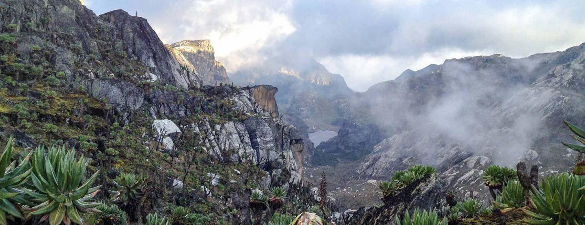
50 glacial lakes dot the Rwenzori Mountains, providing visitors with picturesque reflections and stunning panoramas. Lake Bujuku and Lake Mahoma, in the center of the central circuit trail, are the most visited lakes. Lake Bujuku offers spectacular views of Mount Stanley and Mount Speke.
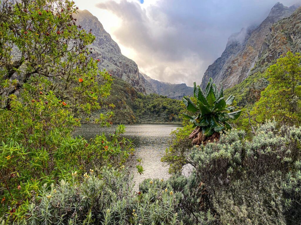
Lakes in the Rwenzori Mountains
Next, on the Ugandan–Congo border, you’ll find the twin lakes that make up Lake Kitandara: a lower lake and a higher lake. Lastly, Irene Lake, which is south of the Margherita glacier, is a must-see. Stopping by the breathtaking Kabamba waterfalls should be high on your itinerary.
Towering Rwenzori Peaks
The Rwenzori Mountains, often referred to as the “Mountains of the Moon,” are home to some of the most breathtaking peaks in Africa. These peaks are a magnet for adventure seekers and mountaineers from around the world, offering both challenge and beauty.
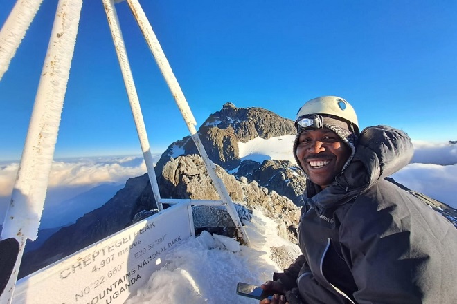
Margherita Peak: Standing at 5,109 meters, this mountain is the highest peak in the Rwenzori range and the third-highest in Africa. The summit is often snow-capped, offering a striking contrast against the tropical environment below.
Magheritah Peak
Mount Speke: With a height of 4,890 meters, Mount Speke is the second-highest peak in the range. It features sharp ridges and challenging ascents that appeal to experienced climbers.
Mount Baker: Rising to 4,844 meters, Mount Baker is known for its rugged terrain and offers climbers a less crowded route compared to the more popular Margherita Peak.
Mount Stanley: This peak is divided into several subsidiary summits, with Margherita Peak being the most prominent. The intricate glaciers and rocky outcrops make it a unique feature of the Rwenzoris.
Mount Emin and Mount Gessi: These twin peaks, each rising above 4,700 meters, are less frequented but offer stunning views and a sense of solitude for those who venture here.
The towering peaks are not only an attraction for their physical challenge but also for the panoramic views they provide. From the summits, one can see vast expanses of the African landscape, including neighboring Uganda and the Democratic Republic of Congo.
Glacial Rivers.
Glacial rivers, originating from the melting glaciers high on the peaks, crisscross the Rwenzori Mountains. These rivers are a lifeline for the surrounding communities and contribute to the Nile River system.
River Mubuku: This waterway is the most significant river in the Rwenzori Mountains, fed by the glaciers of Mount Stanley. The river flows through deep gorges and lush valleys, providing water for agriculture and domestic use in the surrounding areas.
River Nyamugasani: Originating from the western slopes of the Rwenzori Mountains, this river is known for its fast-flowing waters and scenic waterfalls. It is an essential water source for the local communities.
River Bujuku: Flowing from Lake Bujuku, this river meanders through the moorlands and forests, eventually joining the Mubuku River. It is a crucial part of the hydrological system in the Rwenzori region.
In addition to these major rivers, there are several smaller streams and rivulets that contribute to the complex water system of the Rwenzori Mountains.
Nature walks
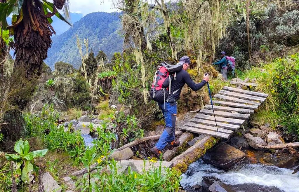
Another thrilling activity in the Rwenzori mountains is going on nature walks. You can reach Lake Mahoma in 6–8 hours each day by following the trails. Campouts are another exciting part of the trek. Alternatively, you can join guided hikes put on by the Ruboni people, who live at the mountain’s base.
These hikes go through forested areas along the River Mubuku and reach an elevation of 2300 meters, from which you can see Stanley and Mount Baker and, if you’re lucky, the glacier at Margherita Peak if the weather is clear.