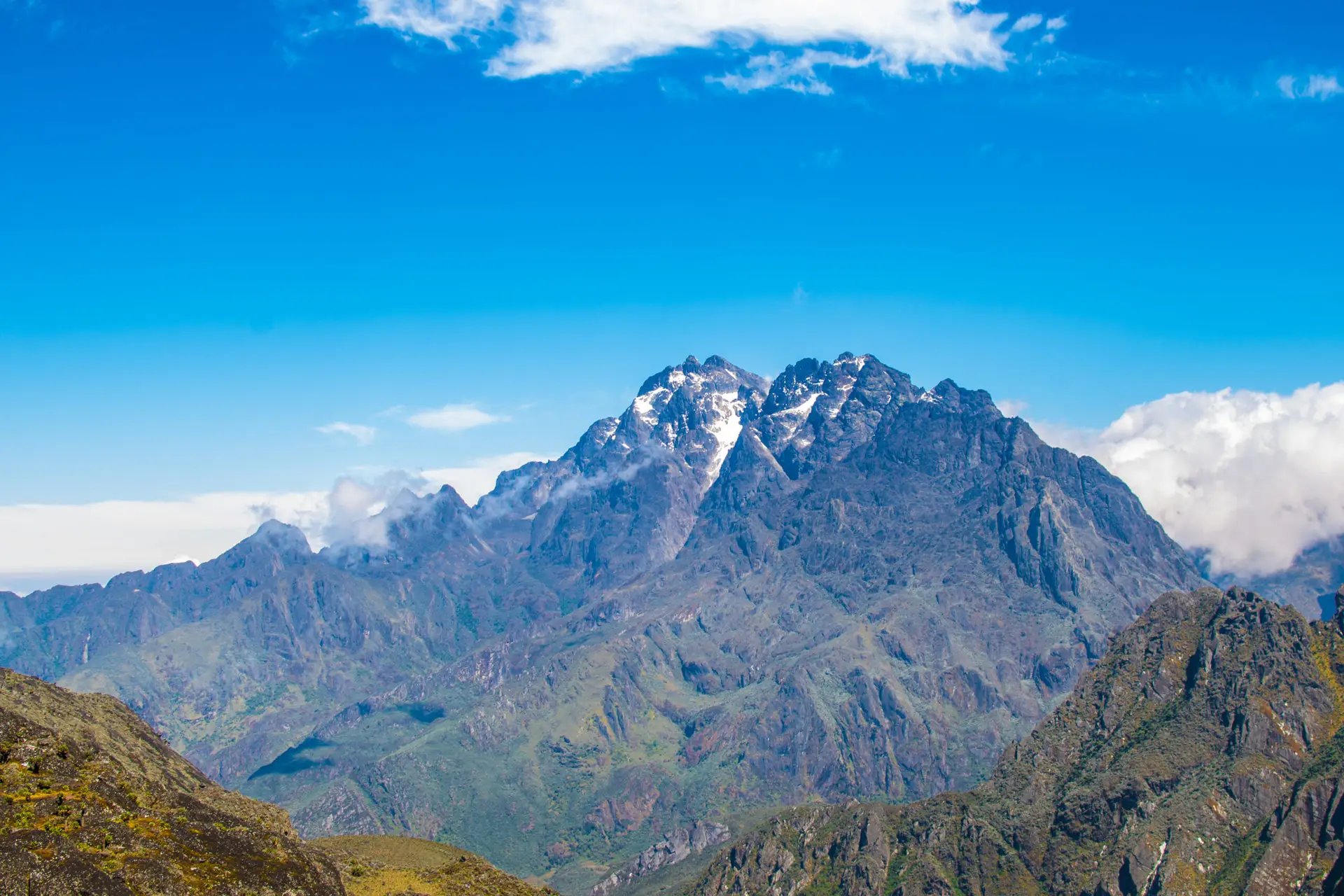
Weismann Peak is a lesser-known yet stunning mountain in the Rwenzori Mountains. It is between Mount Luigi di Savoia and Mount Baker. It is on the Central Circuit, the main hiking circle, and most visitors reach there by choosing the Kilembe Trail, a calmer and more scenic southern path operated by Rwenzori Hiking Services. Weismann Peak is not technical, so you won’t need crampons or ropes most of the year. The peak differs from Mount Stanley and Mount Baker. However, due to its elevation and rugged terrain, climbing at high altitudes demands stamina and competence.

Day 1: Trek to Sine Camp (2,596m)
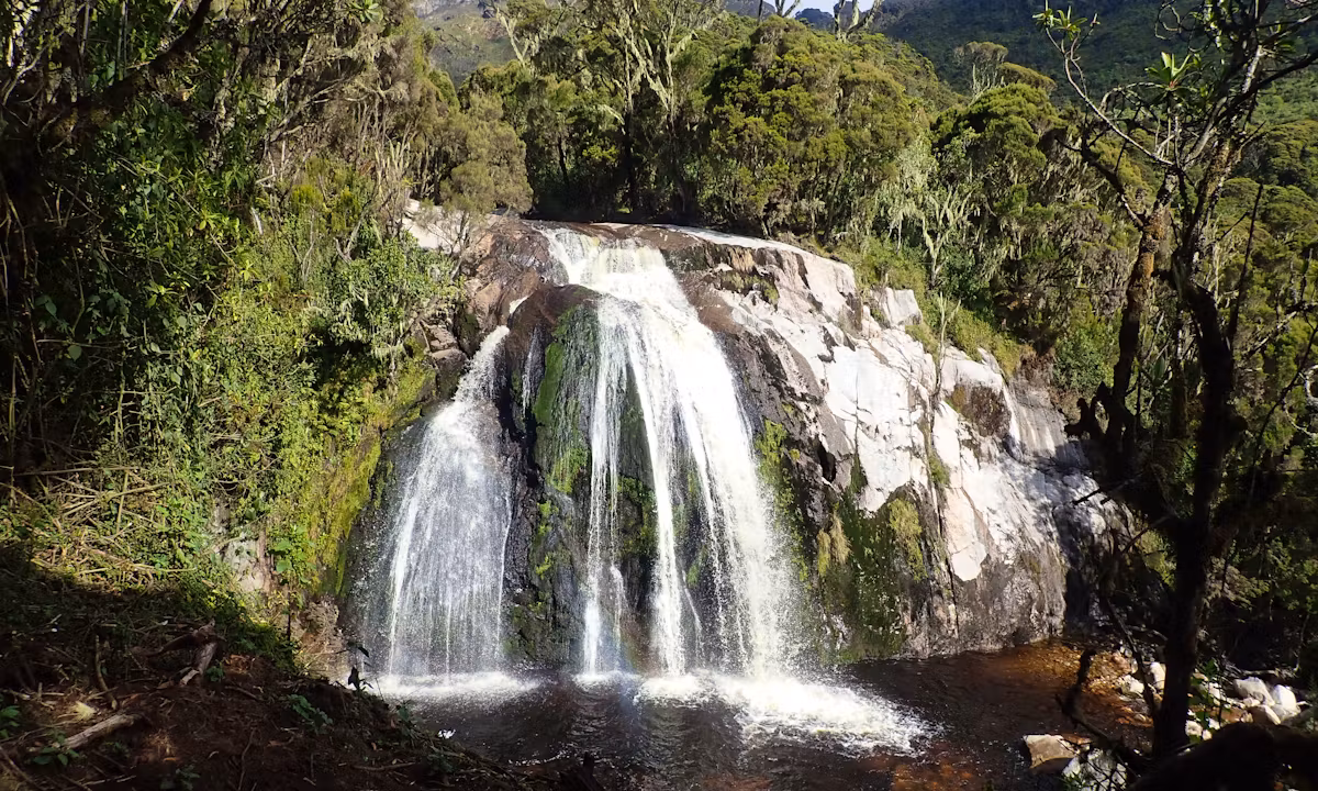
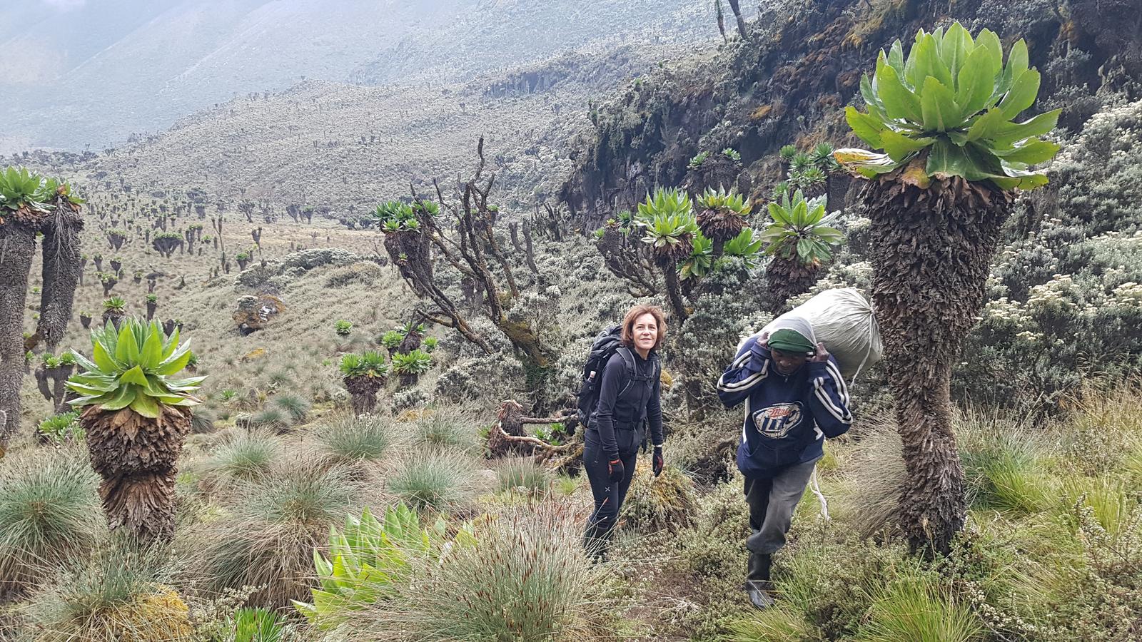
Start your journey at Trekkers Hostel in Kilembe. Ascend through the Afro-montane forest filled with monkeys, birds, and rare flora. Enjoy Enock Falls before arriving at Sine Hut.
We start by walking up the valley floor through the tall trees of the Afro-Montane Forest Zone. There are many birds along this gradual ascent, and you might even see some blue monkeys darting about in the forest.
It’s exceptional to catch a glimpse of the L’Hoest monkey, a cherished symbol for the Bakonzo people and a guardian of their traditions. You might even hear the distant calls of chimpanzees nearby! In this beautiful forest, you can discover a wonderful variety of plant life, including tall trees, bamboo clusters, low shrubs, colorful flowers, intriguing fungi, and many vines dressed with moss and lichen that bring a delightful charm. Only 200 meters from Sine Hut, Enock’s Falls offers a stunning view that looks like it belongs on a screensaver.
Distance: ~9.5 km
Duration: 5–7 hours
Overnight: Sine Camp
Day 2: Sine Camp to Mutinda Camp (3,582m)
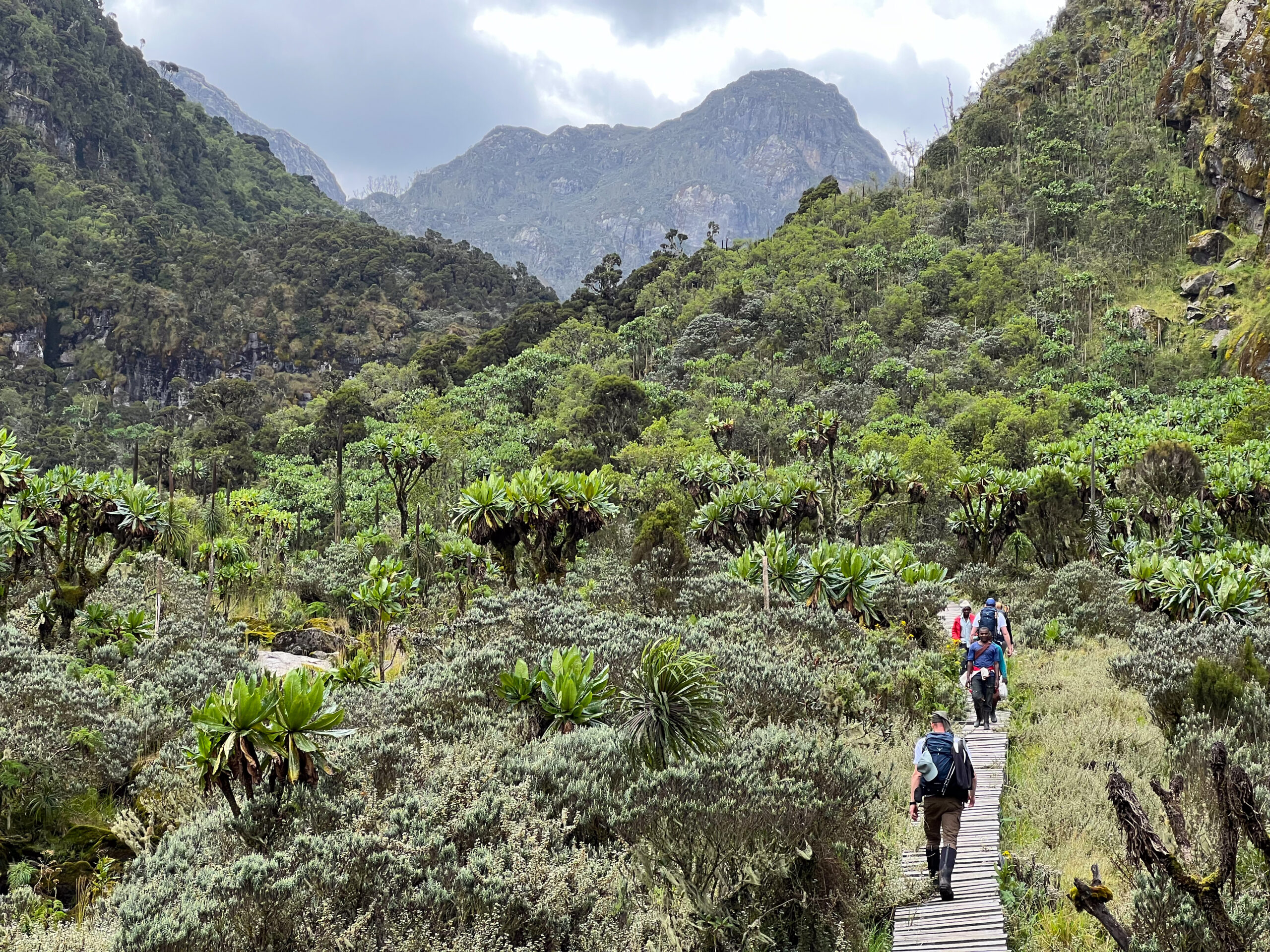
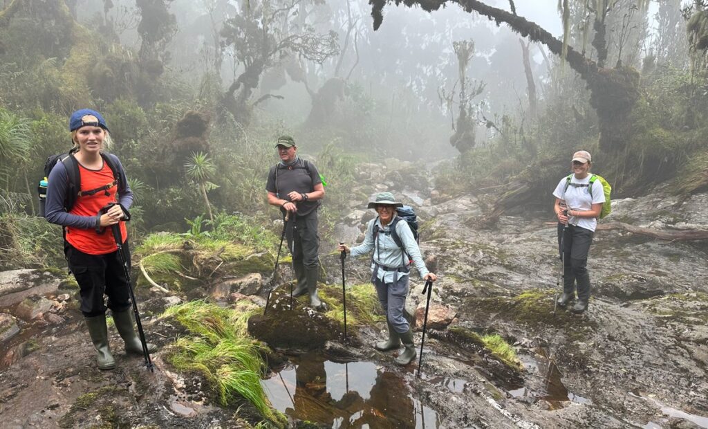
Trek through the Bamboo-Mimulopsis zone and the Heather-Rapanea forest to Kalalama, then onward to Mutinda Camp. Optional: Climb Mutinda Lookout (3,975 m) for panoramic views.
As soon as the Kilembe Trail heads into the Bamboo-Mimulopsis Zone, a strenuous ascent characterized by several high steps, the trekking begins around 8:30 in the morning. During the rainy season, the bamboo zone becomes quite slick and muddy, which slows things down. On the other hand, the Heather-Rapanea Zone’s Kalalama Camp lies at 3,147 meters, so you can stop for a break and a cup of coffee or tea before continuing on to Mutinda Camp. The atmosphere and forest are spectacular as you climb 551 meters in 1.8 km. The trail winds its way along a ridgetop, ascending and descending a few small knolls; it crosses multiple small streams and passes near moss-covered waterfalls as it descends into the valley before climbing again.
Step by step, you ascend the bank of a picturesque mossy river that cascades over boulders beneath towering giant heather trees, their trunks adorned with verdant moss and old man beards (Usnea lichen) that dangle from their limbs. Ascending the deep valley, home to an incredible array of flora, the track winds its way through a maze of twists and turns. The distinctive giant heather plants in this valley give it a picturesque, misty feel.
Distance: ~6.1 km
Duration: 6–8 hours
Overnight: Mutinda Camp
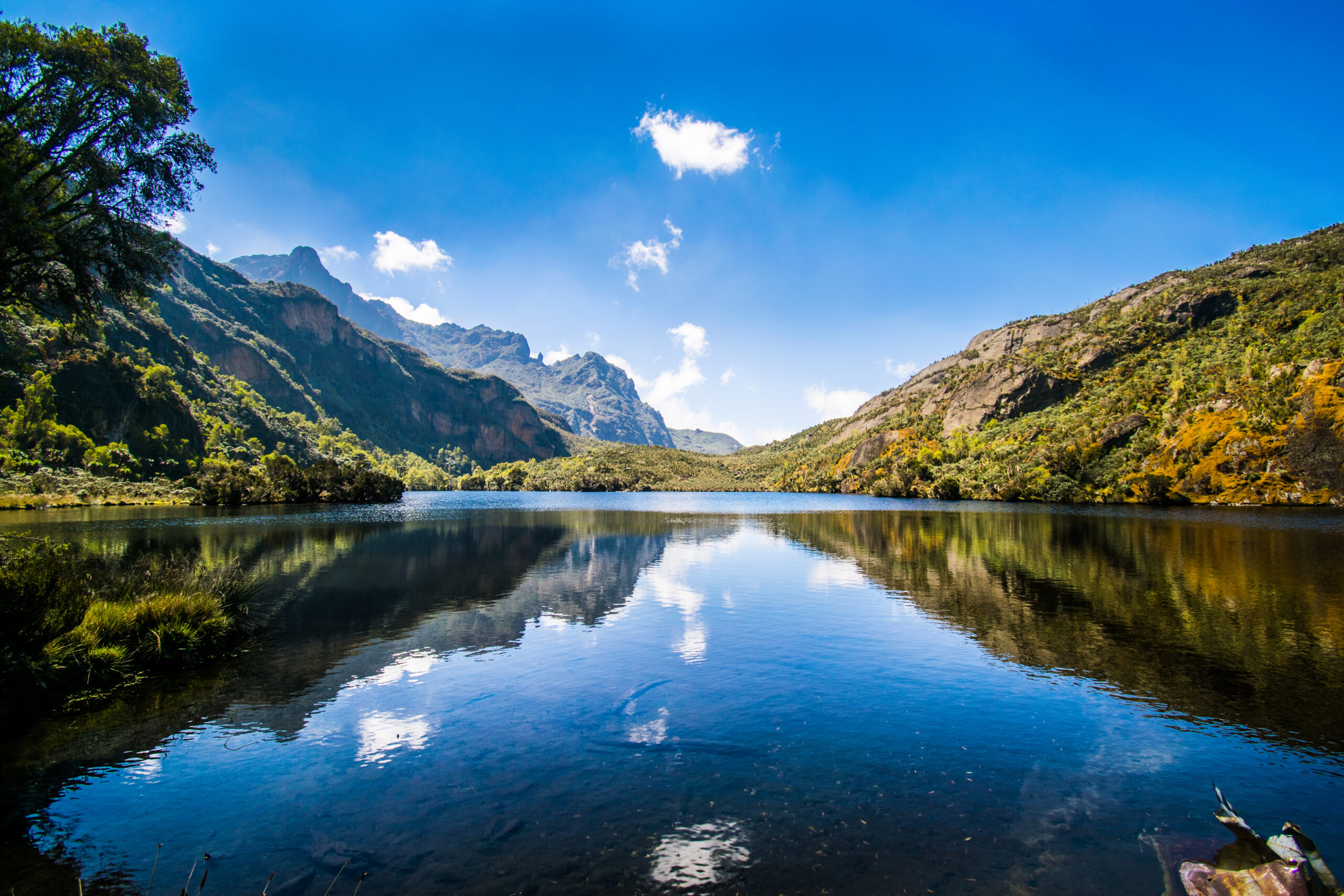
Day 3: Mutinda to Bugata Camp (4,100m)
Pass through boggy alpine moorlands filled with giant lobelias and everlasting flowers. Ascend into the wide Namusangi Valley, reaching Bugata Camp near alpine lakes.
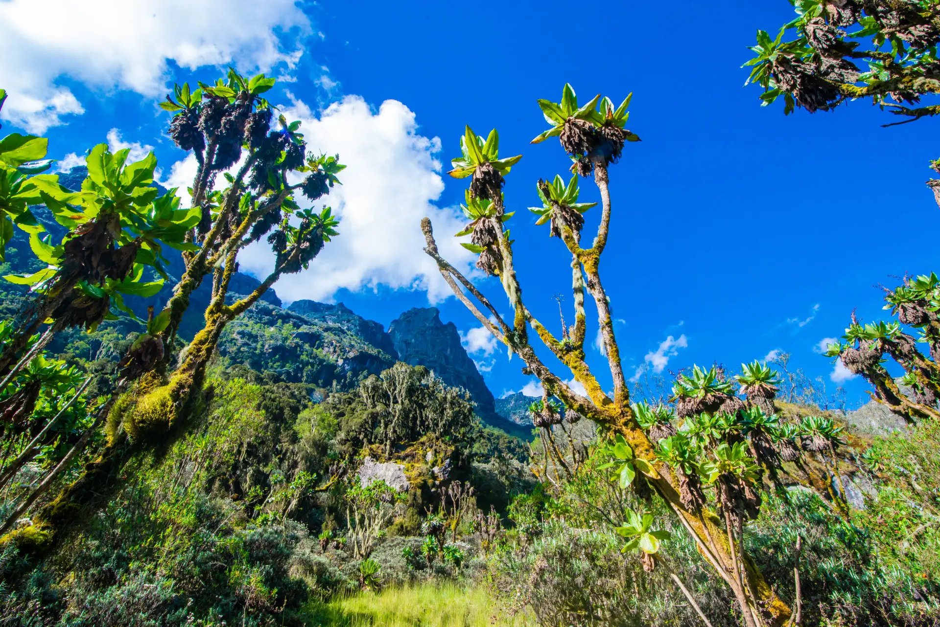
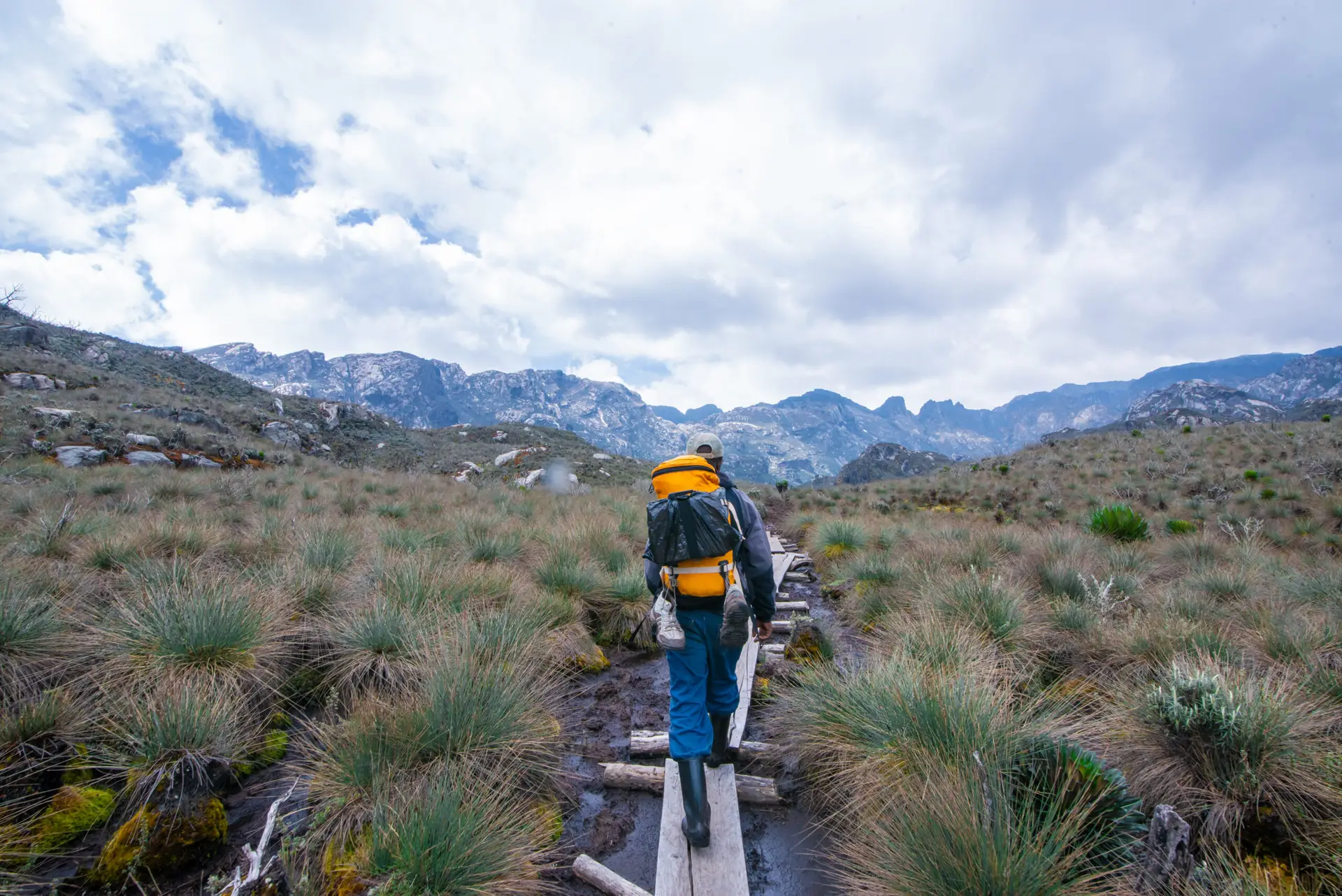
During the rainy season, the path to Bugata Camp becomes very marshy, but if you are competent enough, you can negotiate among the tussocks to make the journey simpler. Ascending a difficult part of the Namusangi Valley (3,840 m), you’ll discover vertical waterfalls and, looking back, stunning views of the Mutinda Peaks. You’ll pass through tussock grass, everlasting flowers, and a plethora of giant lobelias as you make your way over the Mutinda Valley. The trail steadily ascends to Bugata Camp at 4,100 meters across the broad Namusangi Valley, which features various inclines and declines.
Distance: ~8.6 km
Duration: 4–6 hours
Overnight: Bugata Camp
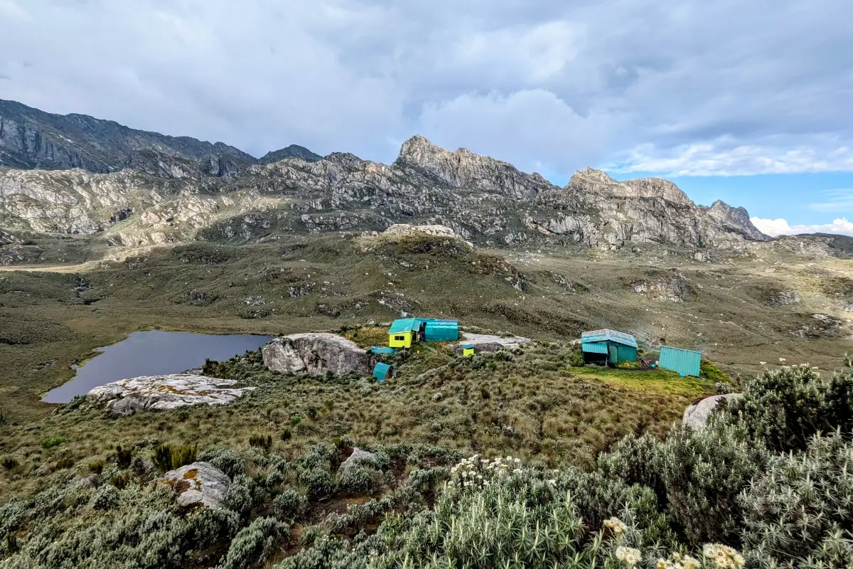
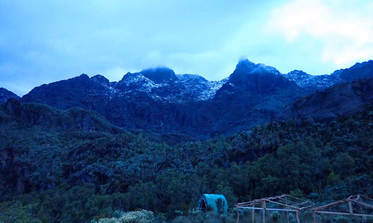
Day 4: Bugata to Hunwick’s Camp via Bamwanjara Pass
Climb to Bamwanjara Pass (4,450 m) for sweeping views of Stanley, Speke, and Baker. Continue to Hunwick’s Camp near McConnell’s Prong.
McConnell’s Prong
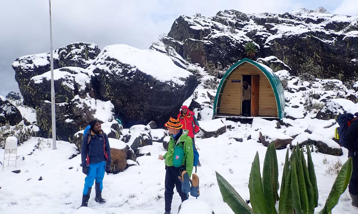
Upon leaving Bugata Camp, you will ascend a ridge, descend slightly, and then climb to the Bamwanjara Pass at 4,450 meters, where a comfortable shelter awaits to accommodate any unforeseen weather shifts. On a bright day, the pass reveals breathtaking vistas of the three prominent peaks. The trail gracefully descends into the valley, curving around the borders of wetlands and groups of conifers, lobelia, moss, and substantial groundsel. This region of the Rwenzori is an excellent location for watching the Malachite Sunbird, owing to the plentiful lobelia flowers and its designation as a known breeding ground. As you proceed, you’ll face some challenging ground before gradually ascending a ridge. At Hunwick’s Camp, perched high above a deep valley, you will enjoy breathtaking views of Mount Stanley, Mount Baker, Weismann’s Peak, and McConnell’s Prong.
Distance: ~8.3 km
Duration: 7–9 hours
Overnight: Hunwick’s Camp
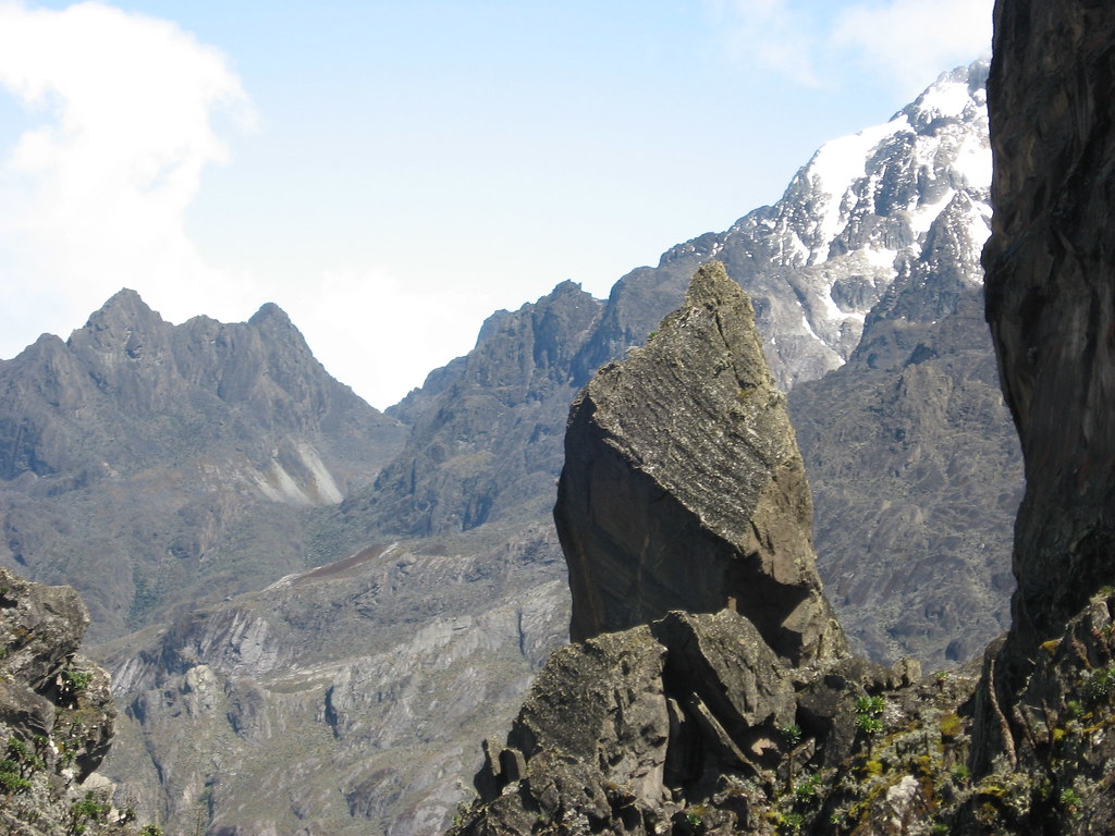
Day 5: Summit Mount Baker (4,842m)
Set off early to summit Mount Baker via a rocky and icy route. Use ropes on steep sections for safety. Marvel at the glaciated peaks of Mount Stanley before descending back to Hunwick’s Camp.
Some sections, like the crevasse that leads down to the glacier, feature a significant drop over the cliff, requiring a strong sense of height on this steep, rocky climb. We will always use safety ropes on high portions of steep Mt. Baker, even if they are not technically tough, except during the snow season (wet season) of April-May and September-October, when the ice-covered rocks are exceedingly slippery. Once at the peak, a short 300-meter trek takes you to the glacier via a cleft in the granite rock. When the weather is favorable and the clouds clear, you can see the glaciers, Margherita and Alexandria’s main peaks, and the grandeur of the snow-capped mountains.
Duration: 6–7 hours total
Overnight: Hunwick’s Camp
Day 6: Hike to Kiharo Camp (3,430 m) via Weismann Peak.
Ascend to Oliver’s Pass and optionally summit Weismann Peak (4,620 m). Continue down the Nyamwamba Valley to Kiharo Camp.
The distance between Oliver’s Pass and Hunwick’s Camp is 3 km. After a little detour around Weismann’s Peak, hikers arrive at the confluence of the Nyamwamba and Kilembe rivers; from there, the river flows via Kasese and Kilembe to Lake George in Queen Elizabeth National Park.
Here you will climb Weismann’s Peak, which is 4,620 meters from Oliver’s Pass. On a sunny day, you can see Margherita, Stanley, Speke, and Baker in their full beauty. Kiharo Camp, hidden in a deep valley surrounded by towering rocks and lush vegetation, is accessed by following the trail down the valley from the confluence.
Distance: ~15.8 km
Duration: 9–12 hours
Overnight: Kiharo Camp
Day 7: Kiharo to Kilembe Basecamp
Descend through the lush Nyamwamba Valley filled with waterfalls, mossy boulders, and wildlife like duikers and primates. Return to Trekkers Hostel in Kilembe.
Distance: ~16 km
Duration: 7–8 hours