The Rwenzori Central Circuit Trail is the longest and most famous hiking trail in the Rwenzori Mountains National Park. It takes about 5–9 days to complete and is about 58 kilometers long. Forests in the mountains, bamboo zones, heather woods, and alpine fields are just some of the ecosystems that this long route goes through. You’ll see glacial lakes, rivers, and rare animals along the way to the peak. Margherita Peak is Uganda’s highest peak.
The Central Circuit Route Trail begins at Mihunga Station and ascends through Nyabitaba and the Bujuku Valley before reaching the mountains. You’ll pass Scott Elliot Pass and then reach the Mubuku Valley via Fresh Field Pass. As a result, you’ll get to see the breathtaking Kitandara Lakes.
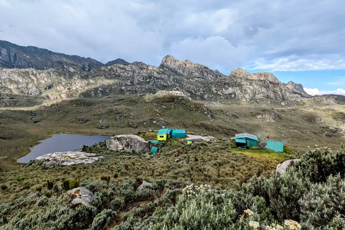
There are various huts along this route where trekkers can stay. The vast majority of them are comfortable. Although the trails are very rocky and muddy in some spots, they are generally well-kept considering the weather and conditions in the Rwenzori Mountains.
Day 1: Nyakalengija (1,600 m) → John Matte Hut (3,420 m)
Hiking time: 7–8 hours
Elevation gain: +1,820m
The trek begins at the Rwenzori Mountaineering Services (RMS) offices in Nyakalengija, where you receive a briefing, finalize permits, and organize equipment with your guides and porters.
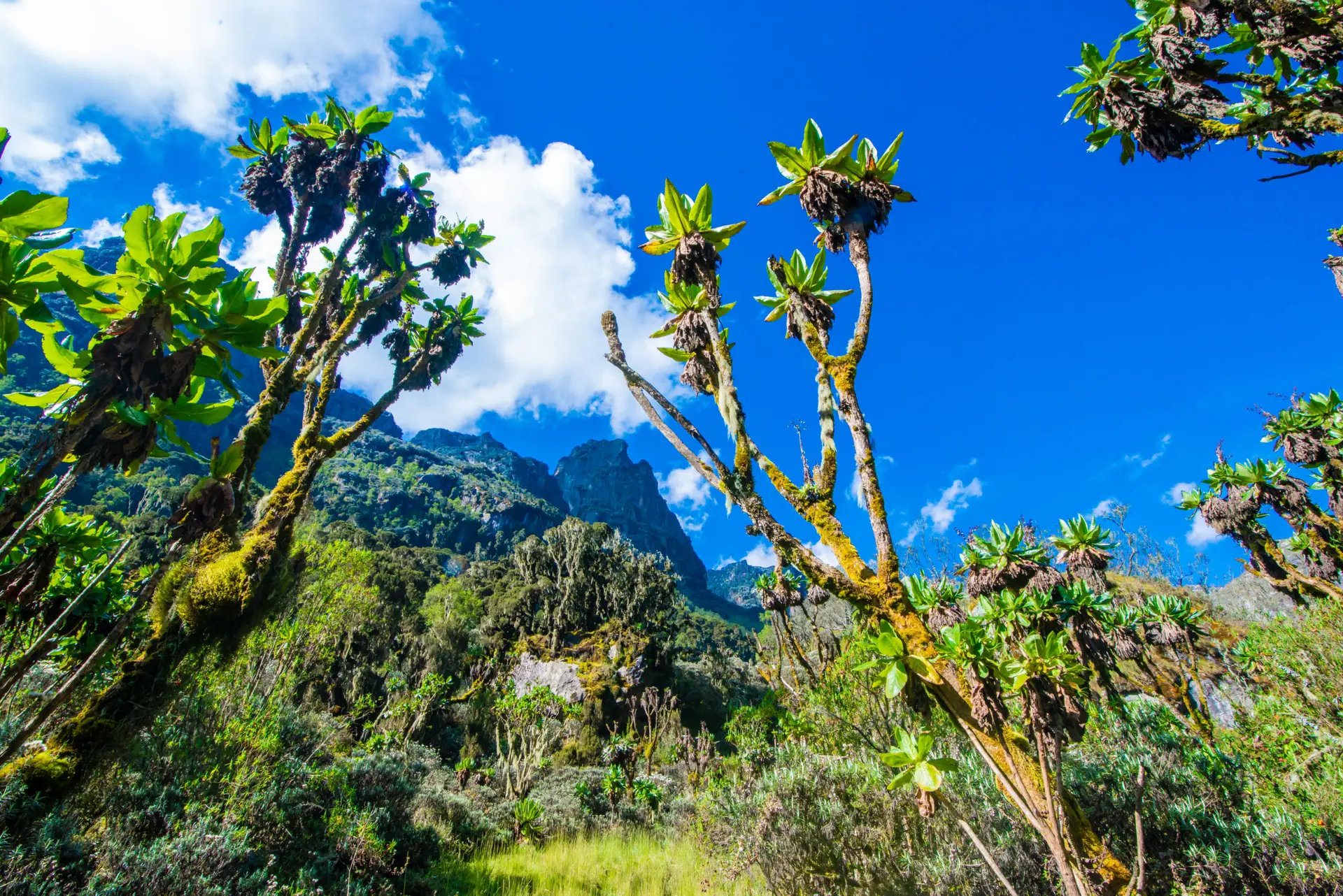
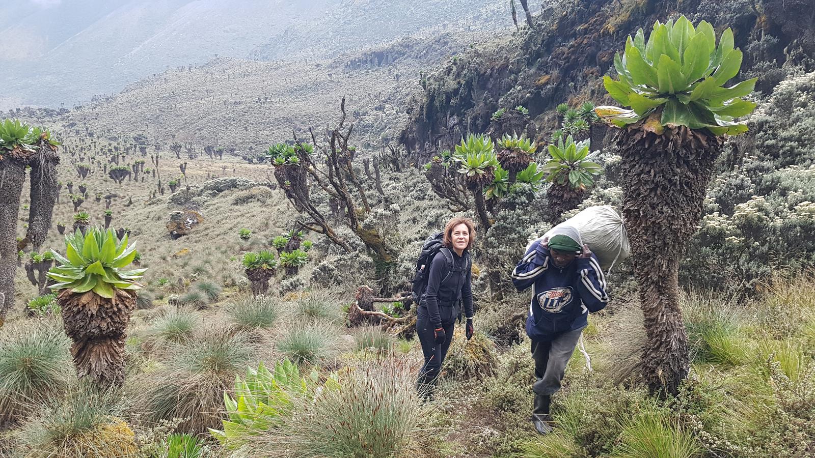
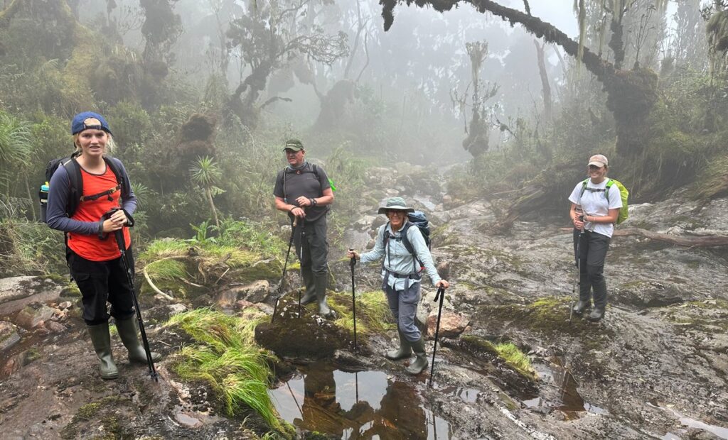
The hike starts through local Bakonzo settlements, then enters a tropical rainforest, transitioning into montane forest and bamboo zones. Wildlife sightings may include colobus monkeys and diverse birdlife.

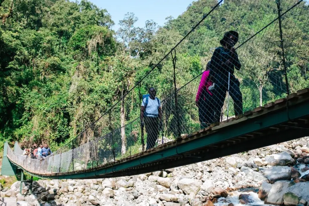
Kurt-Scharffer Bridge
A lunch stop is made at Nyabitaba Hut (2,650 m) before continuing across the Kurt Shafer Bridge, where the Mubuku and Bujuku rivers meet. From here, the trail becomes steeper and muddier as you enter the lower alpine zone, finally reaching John Matte Hut for dinner and overnight.
Day 2: John Matte Hut (3,420 m) → Elena Hut (4,563 m)
Hiking time: 8–9 hours
Elevation gain: +1,143m
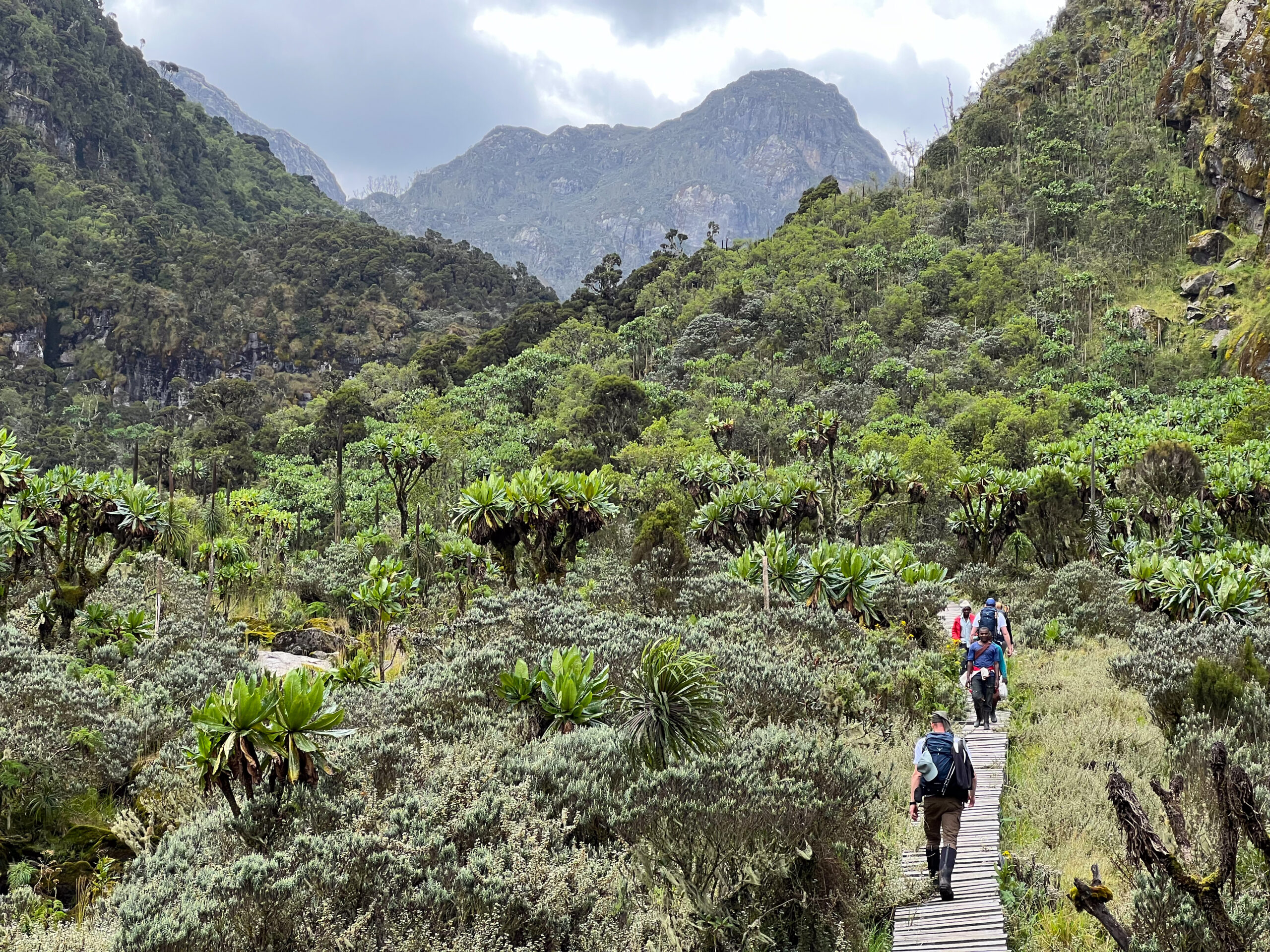
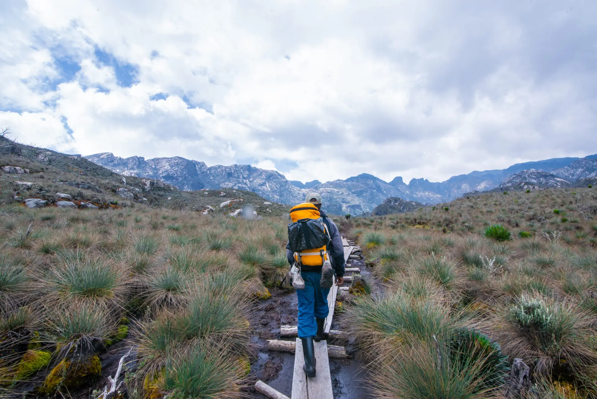
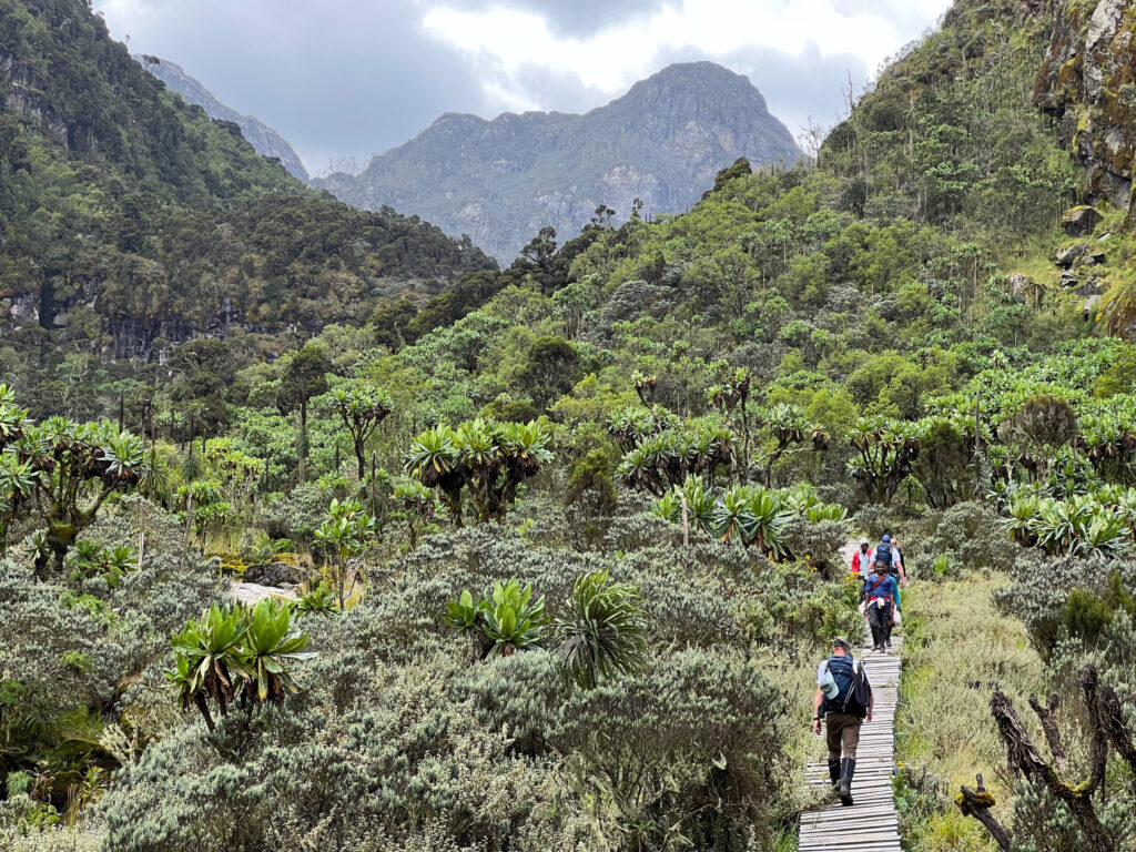
After an early breakfast, the trail leads through rocky, slippery terrain, crossing several streams fed by glacial meltwater. You pass through the Lower and Upper Bigo Bog, navigating long wooden boardwalks laid across the swampy valley floor.
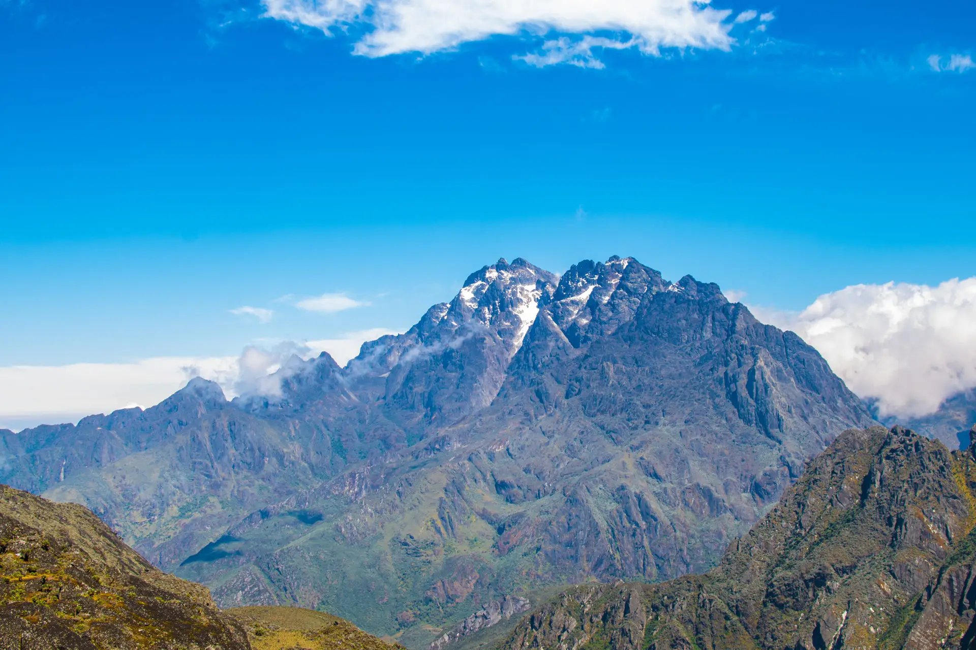
This zone showcases iconic Rwenzori vegetation, including giant lobelias, groundsels, and everlasting flowers. As you gain altitude, views of Mount Stanley, Mount Speke, and the distant Margherita and Alexandra Peaks begin to emerge.

The final ascent climbs steeply over rocky terrain to Elena Hut, perched just below the Stanley Glacier. Early dinner and rest are essential in preparation for the summit push.
Day 3: Elena Hut (4,563 m) → Margherita Peak (5,109 m) → Bujuku Hut (3,960 m)
Hiking time: 10–12 hours
Summit attempt begins: ~2:00 AM
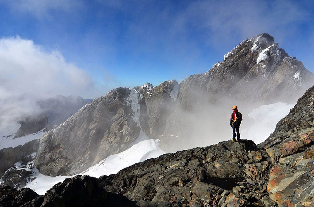
Summit day starts very early. Equipped with headlamps, crampons, harnesses, and ropes, you ascend onto the Stanley Glacier, where a technical glacier hike is required.
After crossing the glacier, you transition to rocky scrambling before entering the Margherita Glacier, the final approach to the summit. Fixed ropes assist in exposed sections.
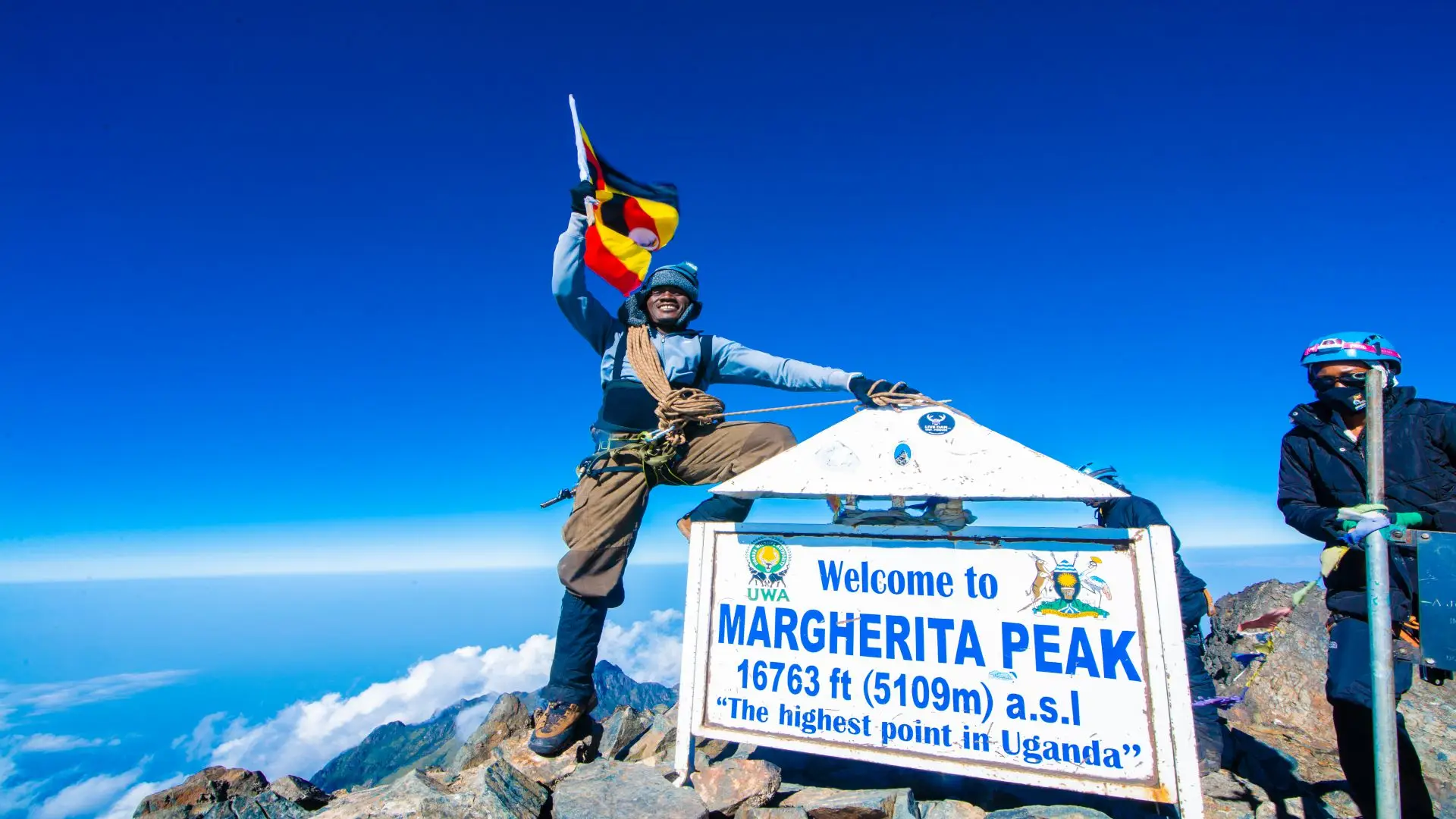
Reaching Margherita Peak, the highest point in Uganda and the third-highest in Africa, rewards you with dramatic views across the Rwenzori range, weather permitting.
Margherita Peak
After photos and a short rest, you descend carefully back to Elena Hut for lunch, then continue downhill to Bujuku Hut, passing alpine lakes and steep rocky sections. Overnight at Bujuku.
Day 4: Bujuku Hut (3,960 m) → Nyakalengija (1,600 m)
Hiking time: 8–9 hours
Elevation loss: –2,360m
After breakfast, descend through the Upper and Lower Bigo Bog, retracing the Central Circuit route. The long descent continues past John Matte Hut and Nyabitaba Hut, where you stop briefly for rest and refreshments.
From Nyabitaba, the trail drops steeply through forest zones back to Nyakalengija, marking the end of the trek. Overnight at a lodge near the park gate or onward transfer.